About Cemeteries
Australian soldiers buried their dead as best they could, they raised makeshift crosses over the graves of their mates, scavenged floral tributes and prayed on behalf of distant families who would never visit.
These private acts turned into the official fabric of commemoration that we have today – the Commonwealth War Graves Commission.
List of Cemeteries
| Cemetery Name | Description |
|---|---|
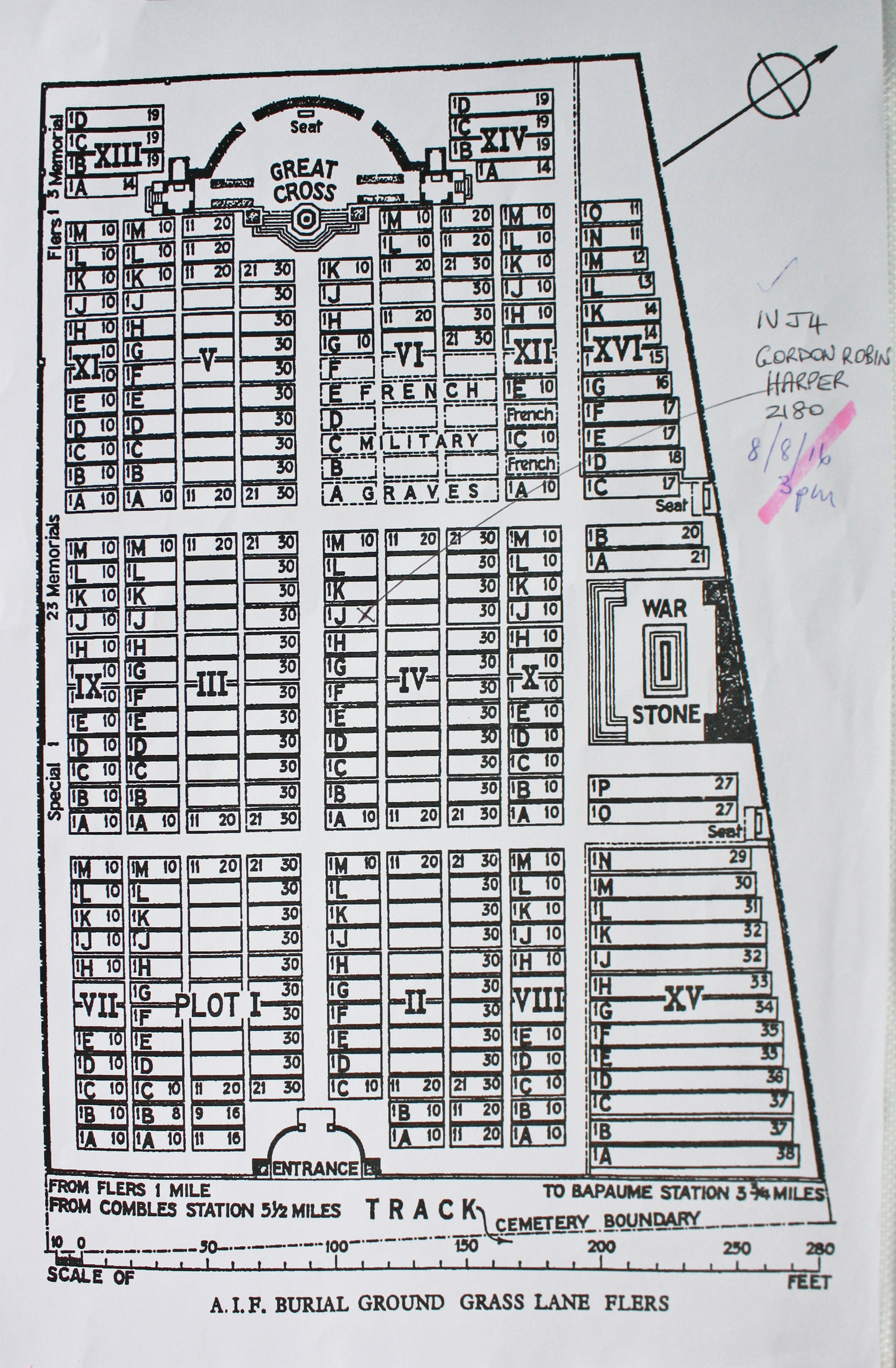
| A.I.F. BURIAL GROUND, FLERS Annotated plan | 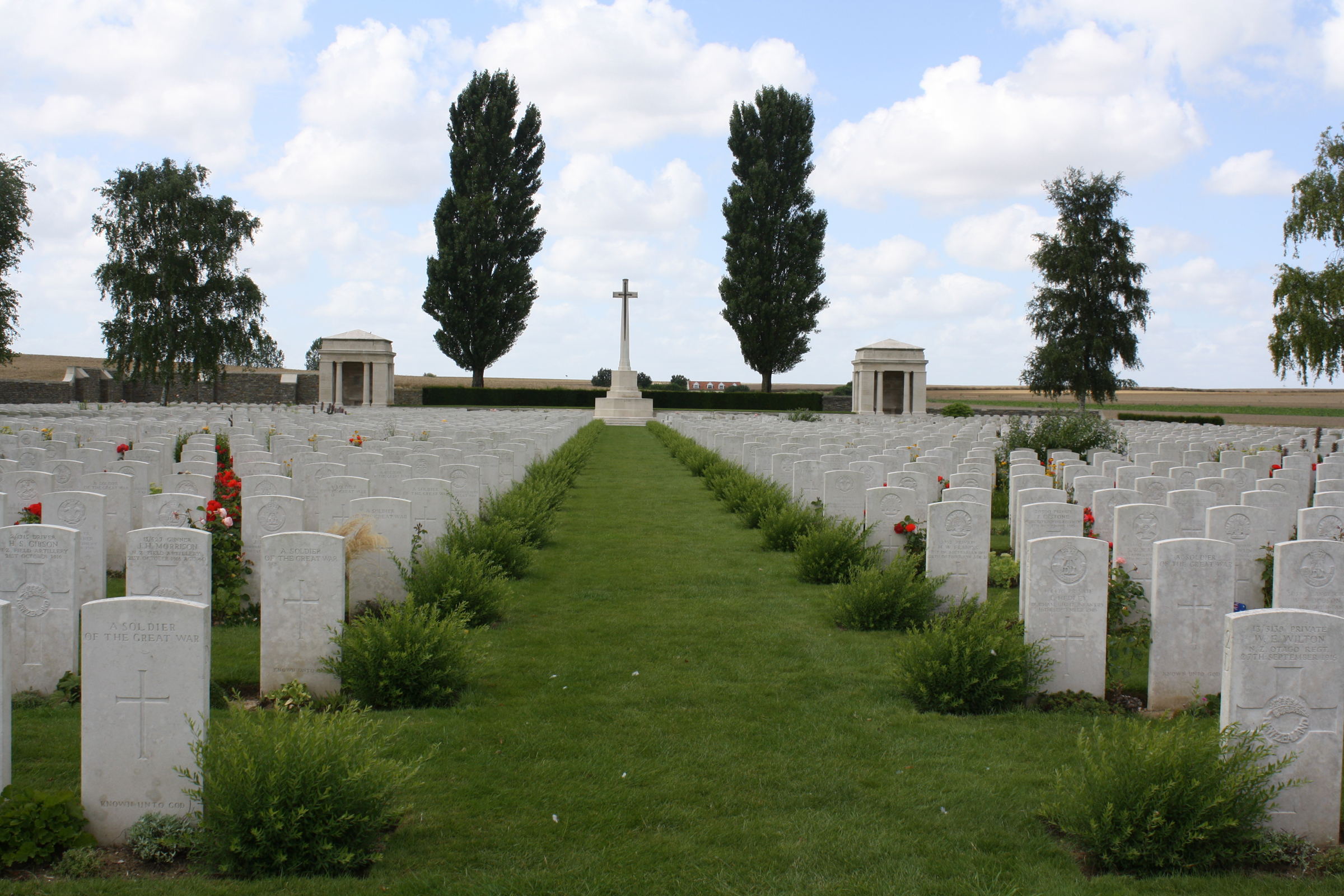 This began as a Casualty Clearing Cemetery for Australian medical units, later becoming a consolidation cemetery. Most of the graves date from the autumn of 1916, but one is from 1914, and there are others from the spring of 1917 and the spring and summer of 1918.There are now 3,475 Commonwealth servicemen of the First World War buried or commemorated in this cemetery. 2,263 of the burials are unidentified and there are special memorials to 23 casualties known or believed to be buried among them. Other special memorials record the names of three casualties buried in a cemetery at Flers, whose graves could not be found. The cemetery also contains 170 French and 3 German war graves. Commonwealth War Graves site for A.I.F. BURIAL GROUND, FLERSGo there on Google maps |
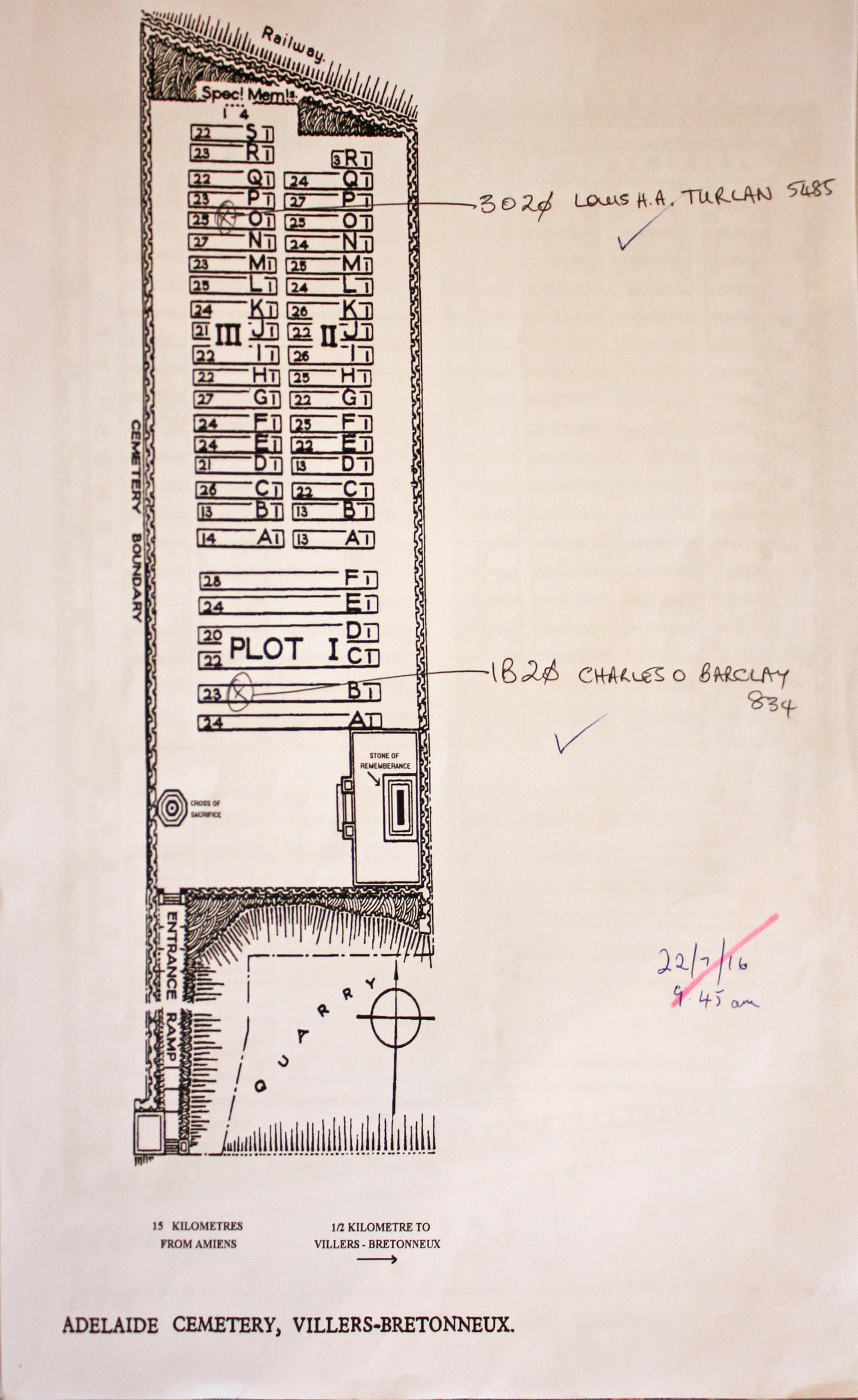
| ADELAIDE CEMETERY, VILLERS-BRETONNEUX Annotated plan | 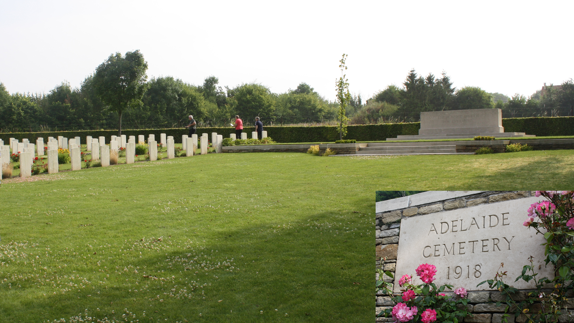 Adelaide Cemetery began early in June 1918 and was used by the 2nd and 3rd Australian Divisions. It continued in use until the Allies began their advance in mid August, by which time it contained 90 graves (the greater part of the present Plot I, Rows A to E). After the Armistice a large number of graves were brought into the cemetery from small graveyards and isolated positions on the north, west and south of Villers-Bretonneux and they were, without exception, those of men who died in the months from March to September 1918. Commonwealth War Graves site for ADELAIDE CEMETERY, VILLERS-BRETONNEUXGo there on Google maps |
| ADELAIDE WEST TERRACE CEMETERY Annotated plan |  Adelaide West Terrace Cemetery is one of Australia’s oldest capital city cemeteries. The cemetery has been a major feature of Adelaide since Colonel William Light laid out the city in 1837. Go there on Google maps |
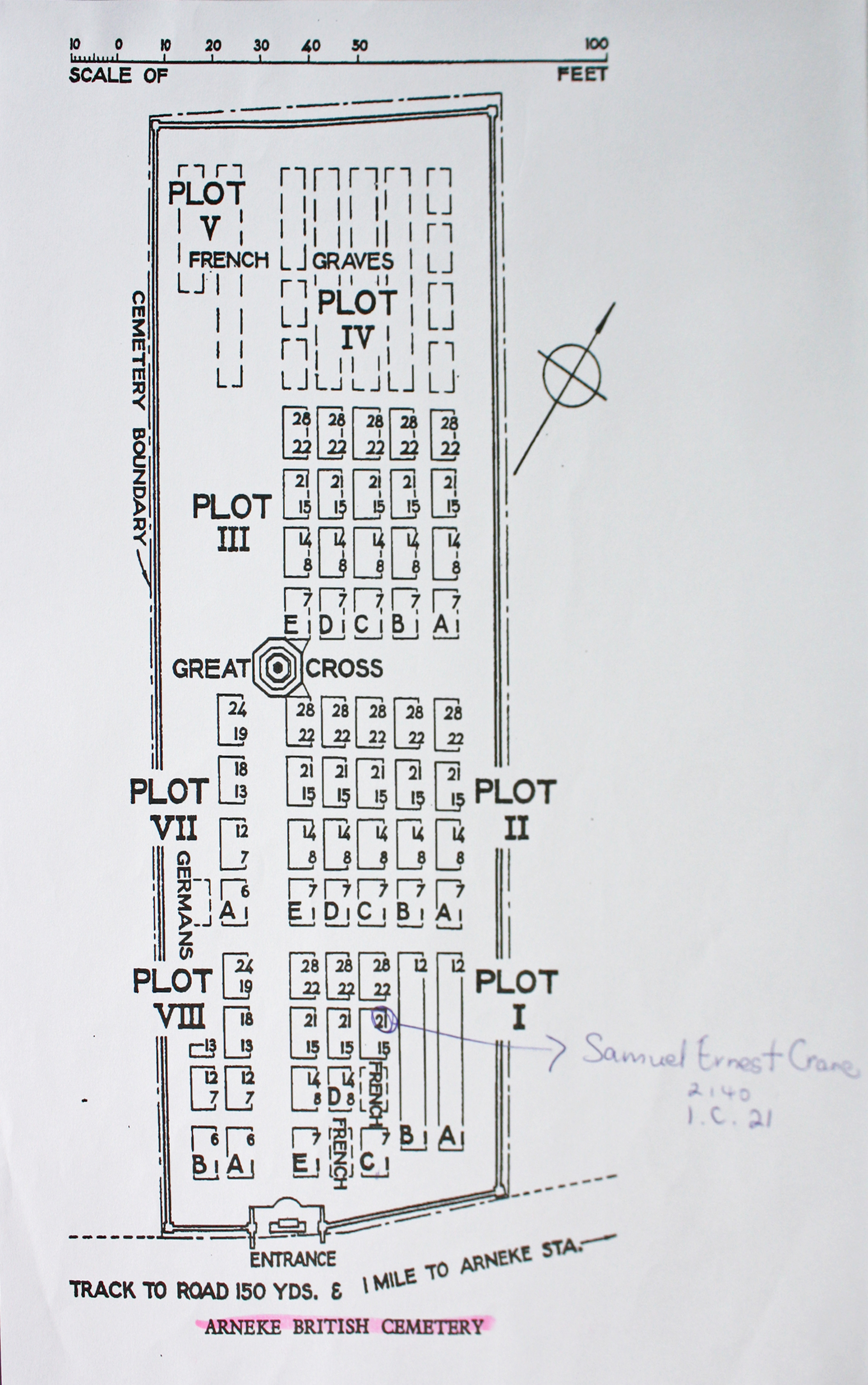
| ARNEKE BRITISH CEMETERY Annotated plan |  This was started as 13th Casualty Clearing Station Cemetery which moved to Arneke from the Proven area in October 1917. It was joined by the 10th and 44th Clearing Stations in April 1918. The cemetery was used by these hospitals until the end of May, and again from July to September 1918 by the 62nd (1/2nd London) Clearing Station. In November it was used for a short time by the 4th and 10th Stationary Hospitals. A few French soldiers were buried from clearing stations in April 1918 and French units buried in Plots IV and V at the north-west end of the cemetery, mainly in May and June 1918. Commonwealth War Graves site for ARNEKE BRITISH CEMETERYGo there on Google maps |
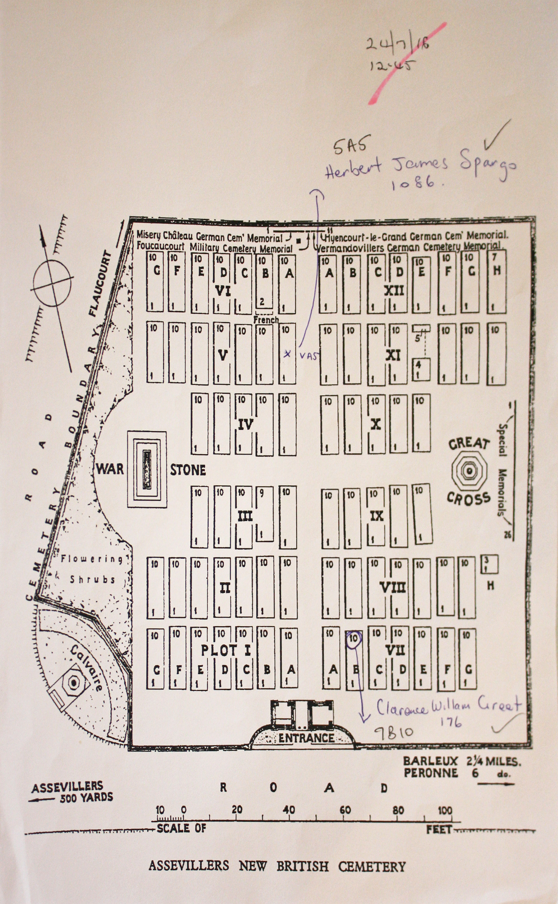
| ASSEVILLERS NEW BRITISH CEMETERY Annotated plan | 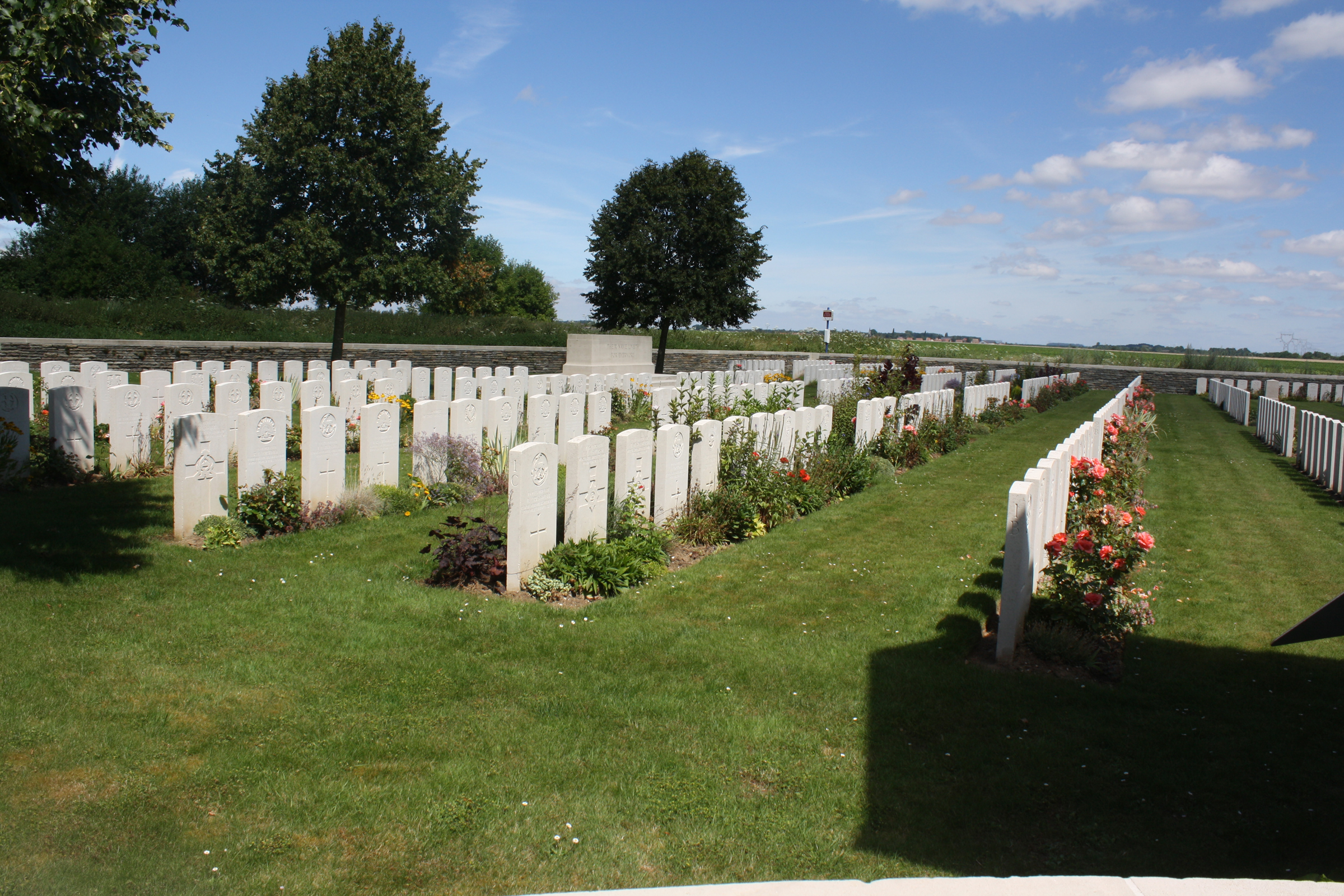 A number of cemeteries were made by the French troops at Assevillers, and in one ("E"), at the West end of the village, 13 soldiers from the United Kingdom were buried by Field Ambulances in February and March, 1917; they are now reburied in Fouquescourt British Cemetery. Assevillers New British Cemetery was made after the Armistice by the concentration of graves from the battlefields of the Somme and from other burial grounds. Commonwealth War Graves site for ASSEVILLERS NEW BRITISH CEMETERYGo there on Google maps |
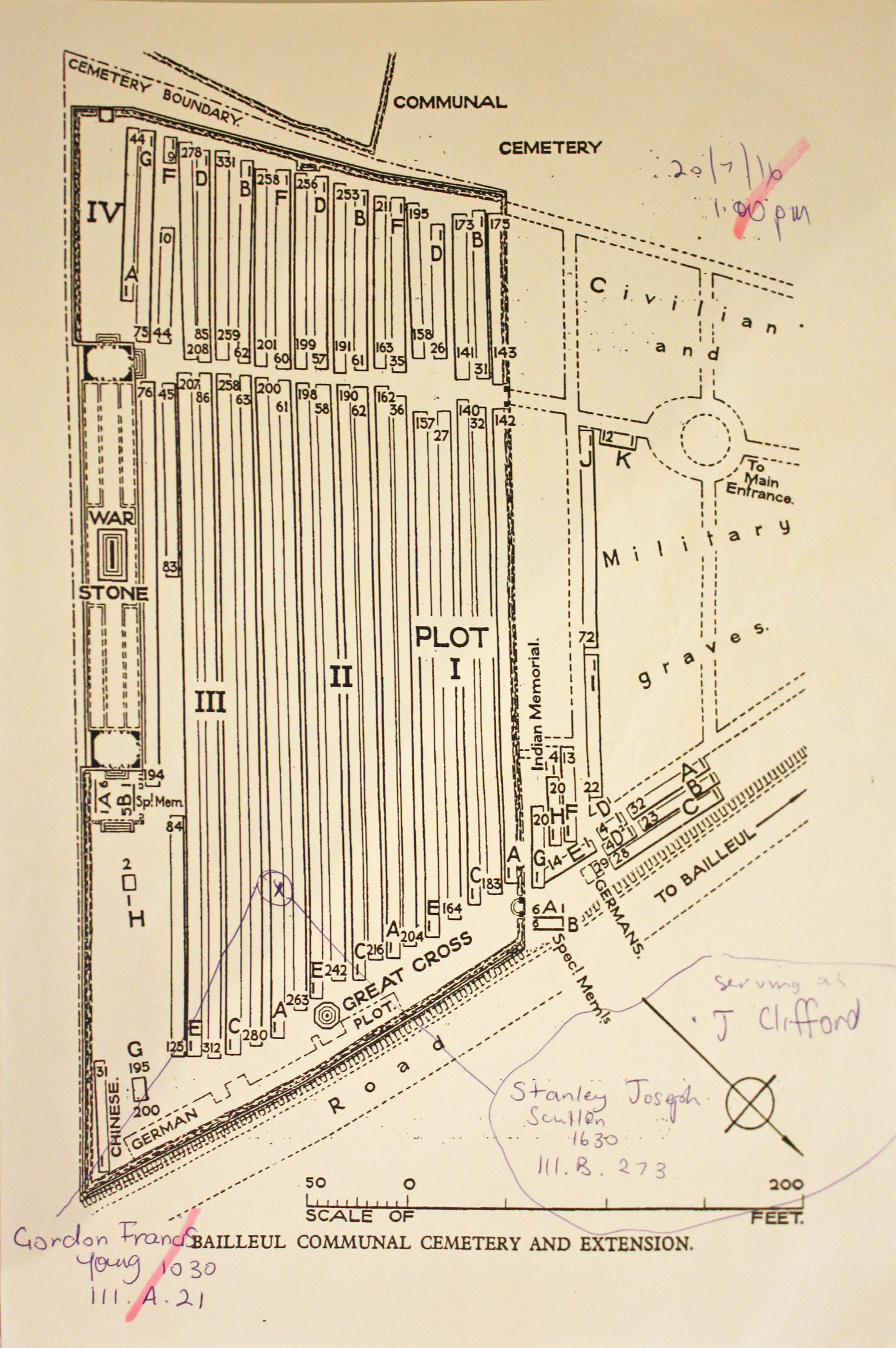
| BAILLEUL COMMUNAL CEMETERY EXTENSION, NORD Annotated plan |  The earliest Commonwealth burials at Bailleul were made at the east end of the communal cemetery and in April 1915, when the space available had been filled, the extension was opened on the east side of the cemetery. The extension was used until April 1918, and again in September, and after the Armistice graves were brought in from the neighbouring battlefields and burial grounds. Commonwealth War Graves site for BAILLEUL COMMUNAL CEMETERY EXTENSION, NORDGo there on Google maps |
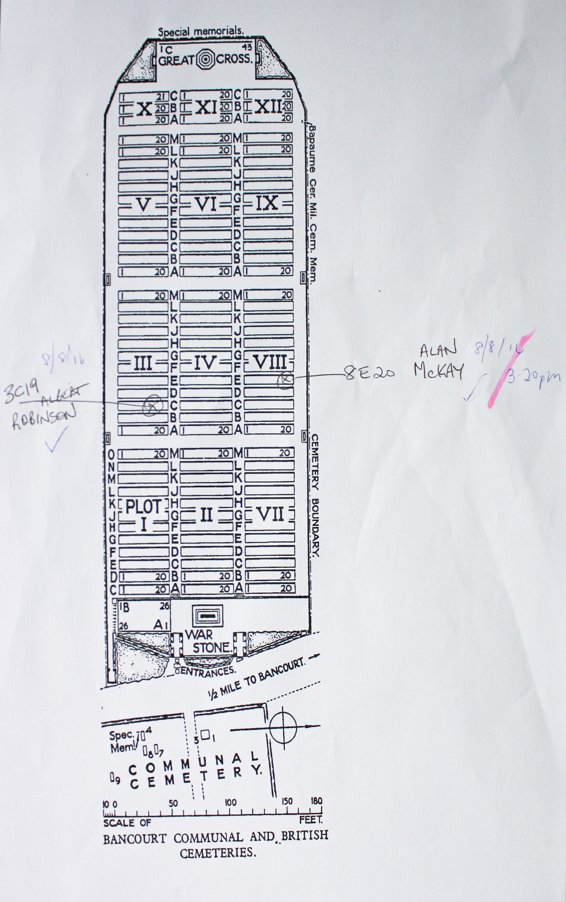
| BANCOURT BRITISH CEMETERY Annotated plan |  The cemetery was begun by the New Zealand Division in September 1918; the original cemetery is now Plot I, Rows A and B. The remainder of the cemetery was made after the Armistice when graves were brought in from the battlefields east and south of Bancourt and from certain Allied and German cemeteries. Commonwealth War Graves site for BANCOURT BRITISH CEMETERYGo there on Google maps |
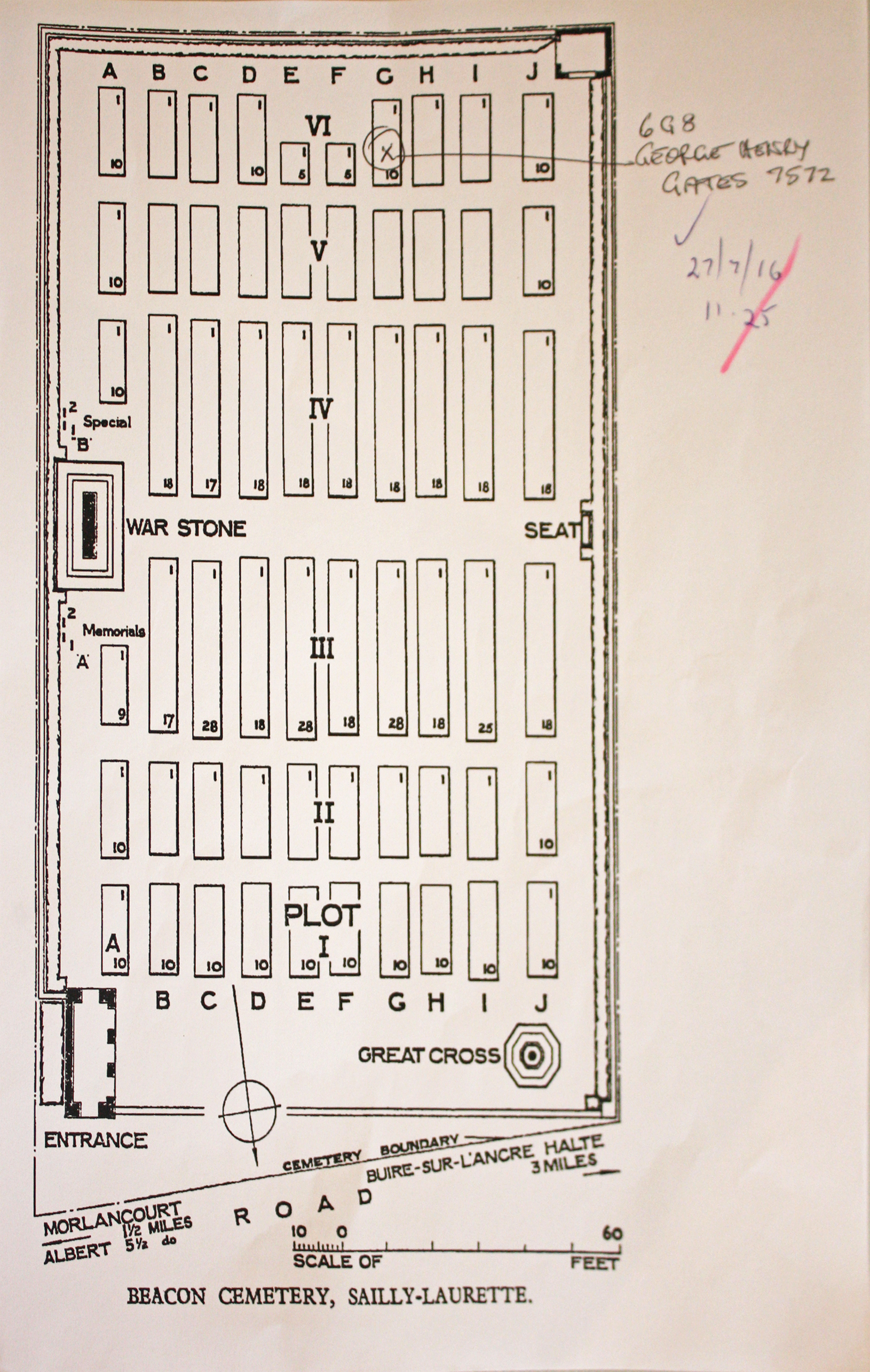
| BEACON CEMETERY, SAILLY-LAURETTE Annotated plan | The cemetery (named from a brick beacon on the summit of the ridge a little south-east of the village) was made by the 18th Division Burial Officer on 15 August when the 12th (Eastern), 18th and 58th (London) Divisions attacked from the Ancre to the Somme and the Australian Corps beyond the Somme. At the Armistice, the original burials numbered 109 (now Plot III, Rows C, E, G and I), chiefly from the 12th Division, but it was then greatly increased when graves were brought in from the surrounding battlefields and some smaller burial grounds. Commonwealth War Graves site for BEACON CEMETERY, SAILLY-LAURETTEGo there on Google maps |
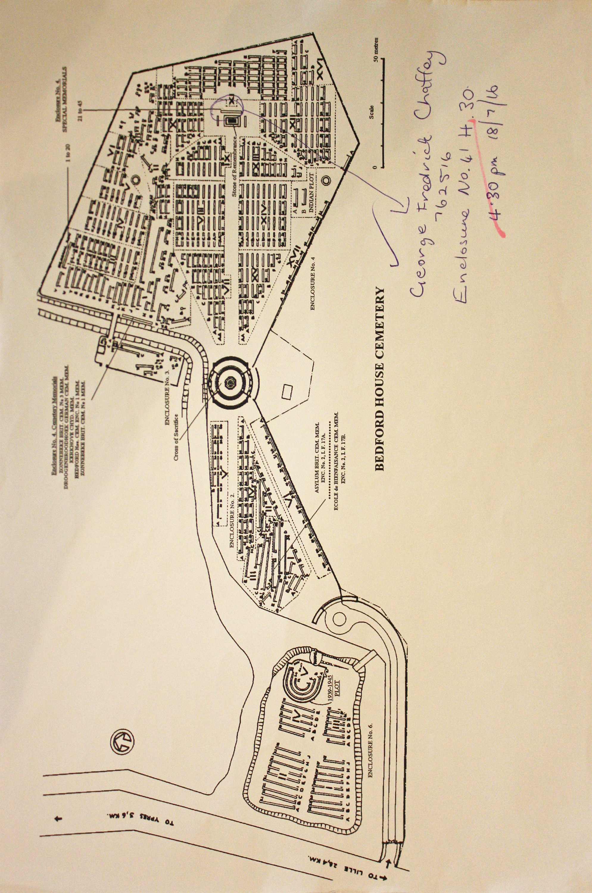
| BEDFORD HOUSE CEMETERY Annotated plan |  Bedford House, sometimes known as Woodcote House, were the names given by the Army to the Chateau Rosendal, a country house in a small wooded park with moats. Although it never fell into German hands, the house and the trees were gradually destroyed by shell fire. It was used by field ambulances and as the headquarters of brigades and other fighting units, and charcoal pits were dug there from October 1917. In time, the property became largely covered by small cemeteries; five enclosures existed at the date of the Armistice, but the graves from No.1 were then removed to White House Cemetery, St. Jean, and those from No.5 to Aeroplane Cemetery, Ypres. Commonwealth War Graves site for BEDFORD HOUSE CEMETERYGo there on Google maps |
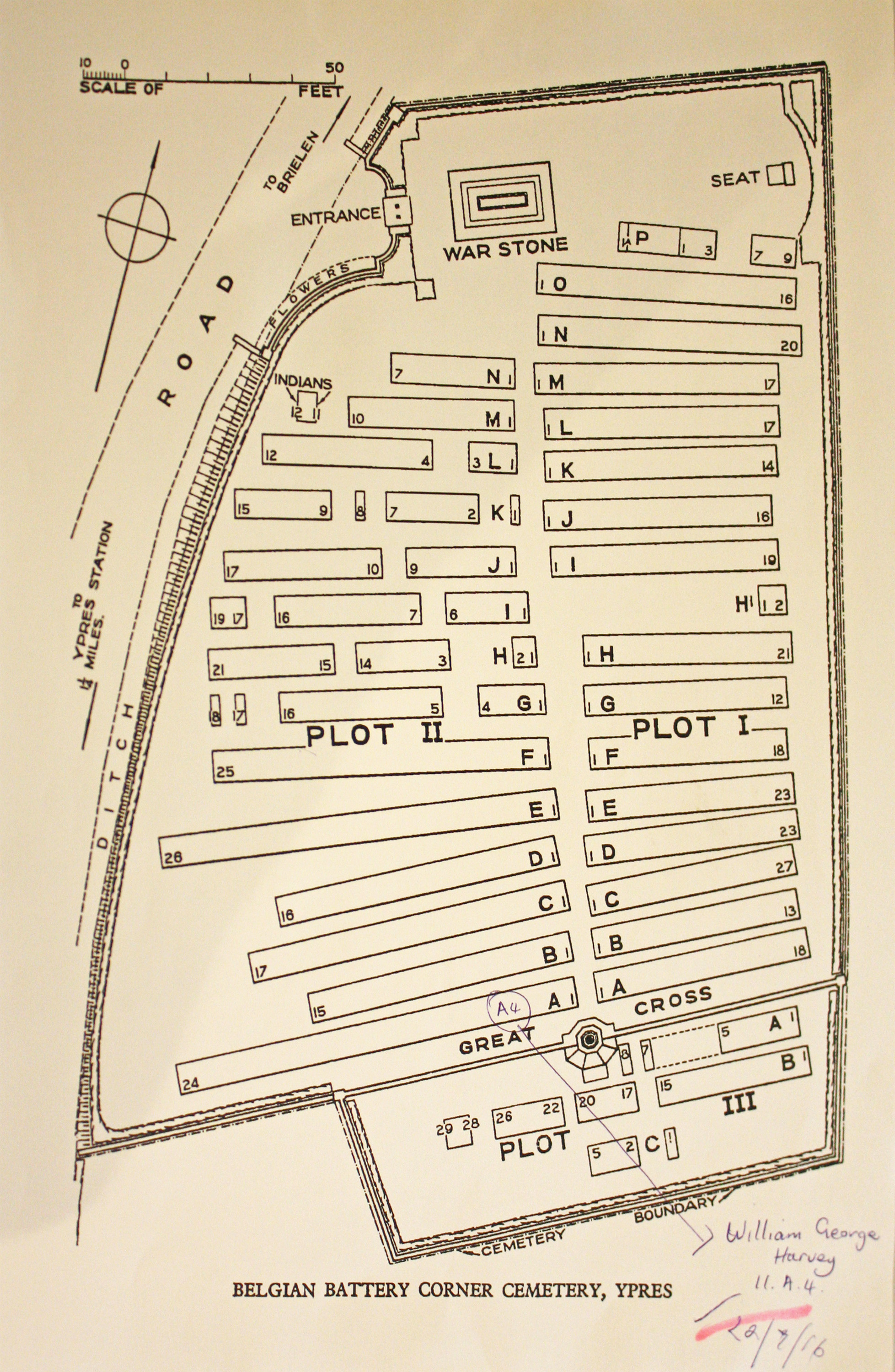
| BELGIAN BATTERY CORNER CEMETERY Annotated plan | 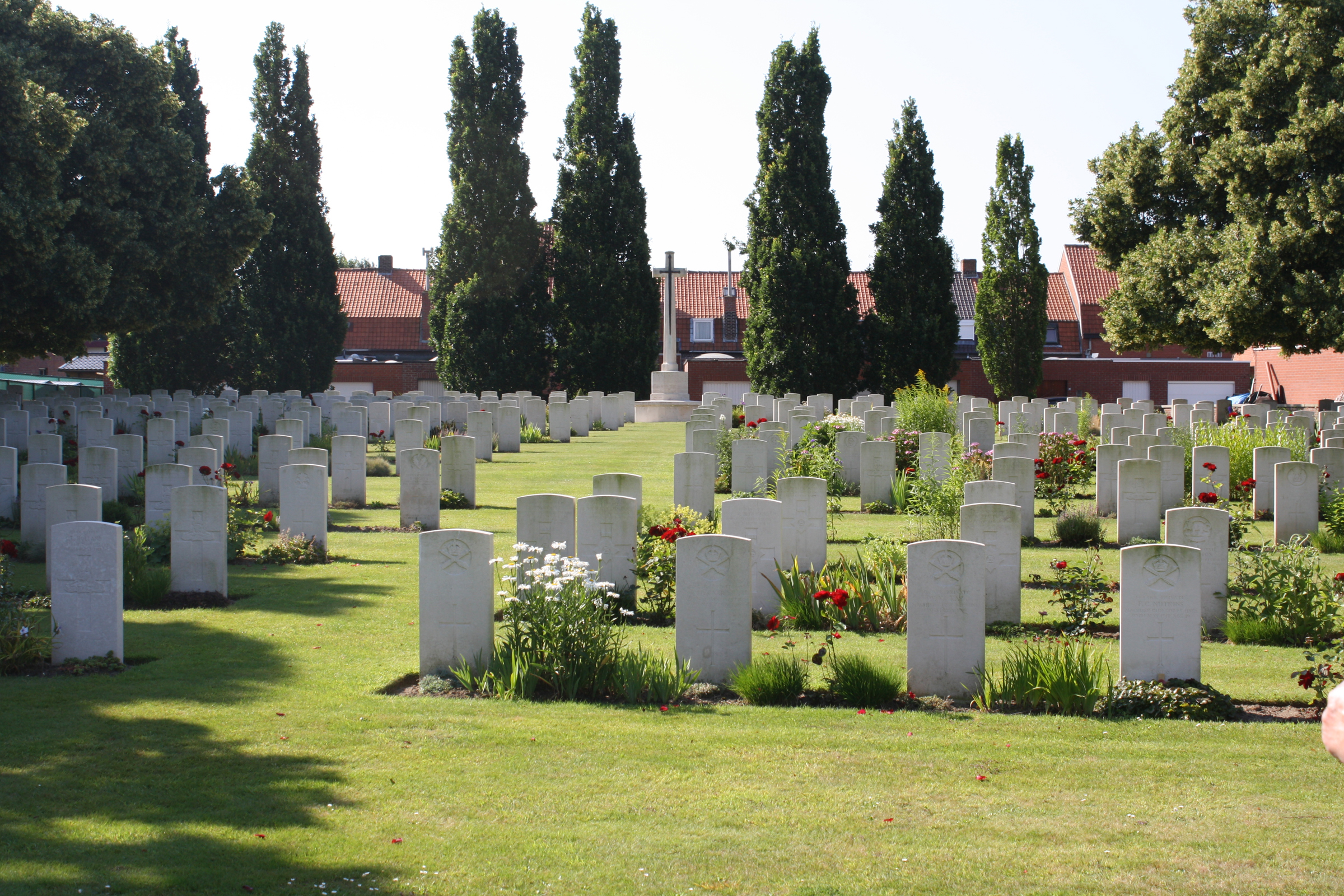 It started as a Casualty Clearing Station cemetery in June 1917 after the Battle of Messines and it was used until October 1918. Almost half of the graves are of casualties who belonged, or were attached, to artillery units.There are now 573 First World War casualties buried or commemorated in this cemetery. Seven of the burials are unidentified and special memorials commemorate three casualties known to have been buried in the cemetery, but whose graves could not be located. Commonwealth War Graves site for BELGIAN BATTERY CORNER CEMETERYGo there on Google maps |
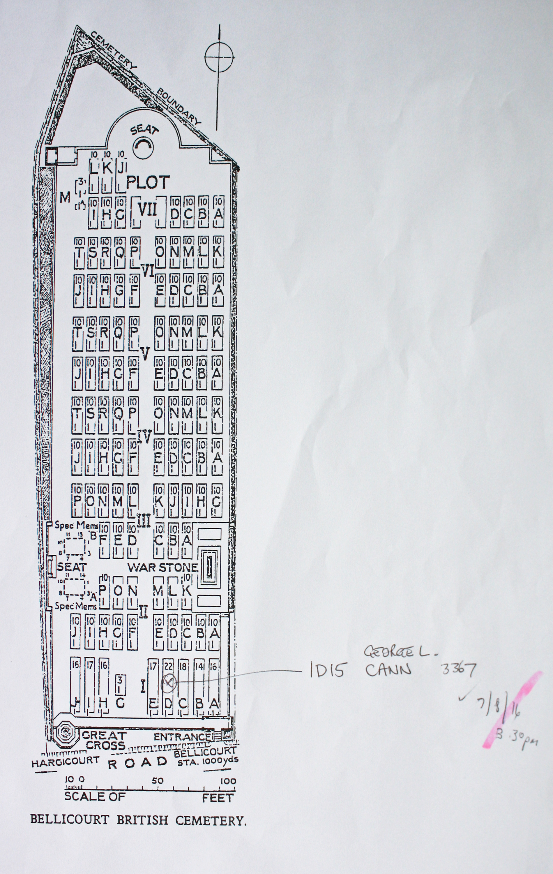
| BELLICOURT BRITISH CEMETERY Annotated plan | 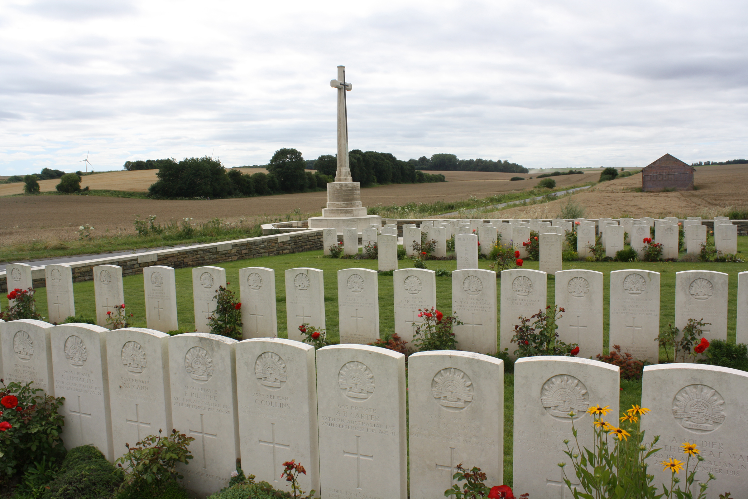 This cemetery started after the Battle of the St. Quentin Canal, when 73 dead were buried in what is now Plot I. It was greatly enlarged after the Armistice, when graves were brought in from the surrounding battlefields and smaller cemeteries. Commonwealth War Graves site for BELLICOURT BRITISH CEMETERYGo there on Google maps |
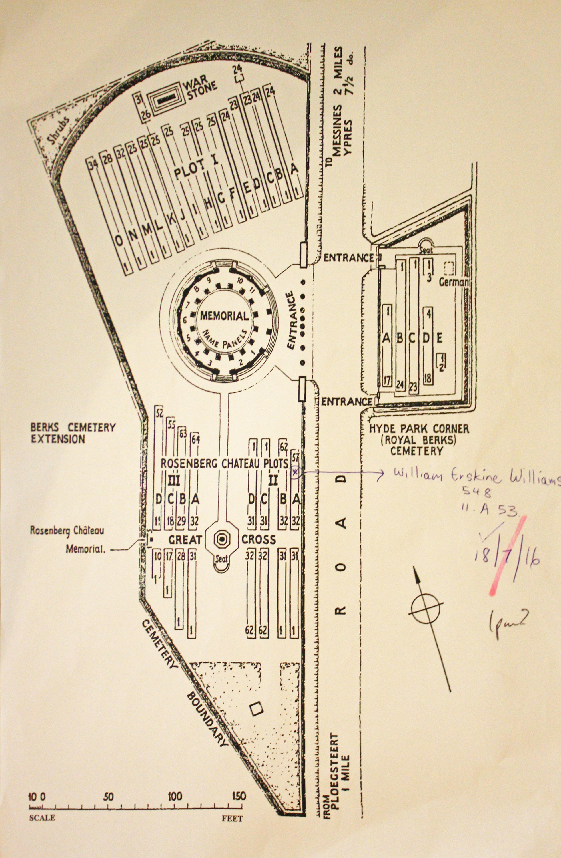
| BERKS CEMETERY EXTENSION Annotated plan | 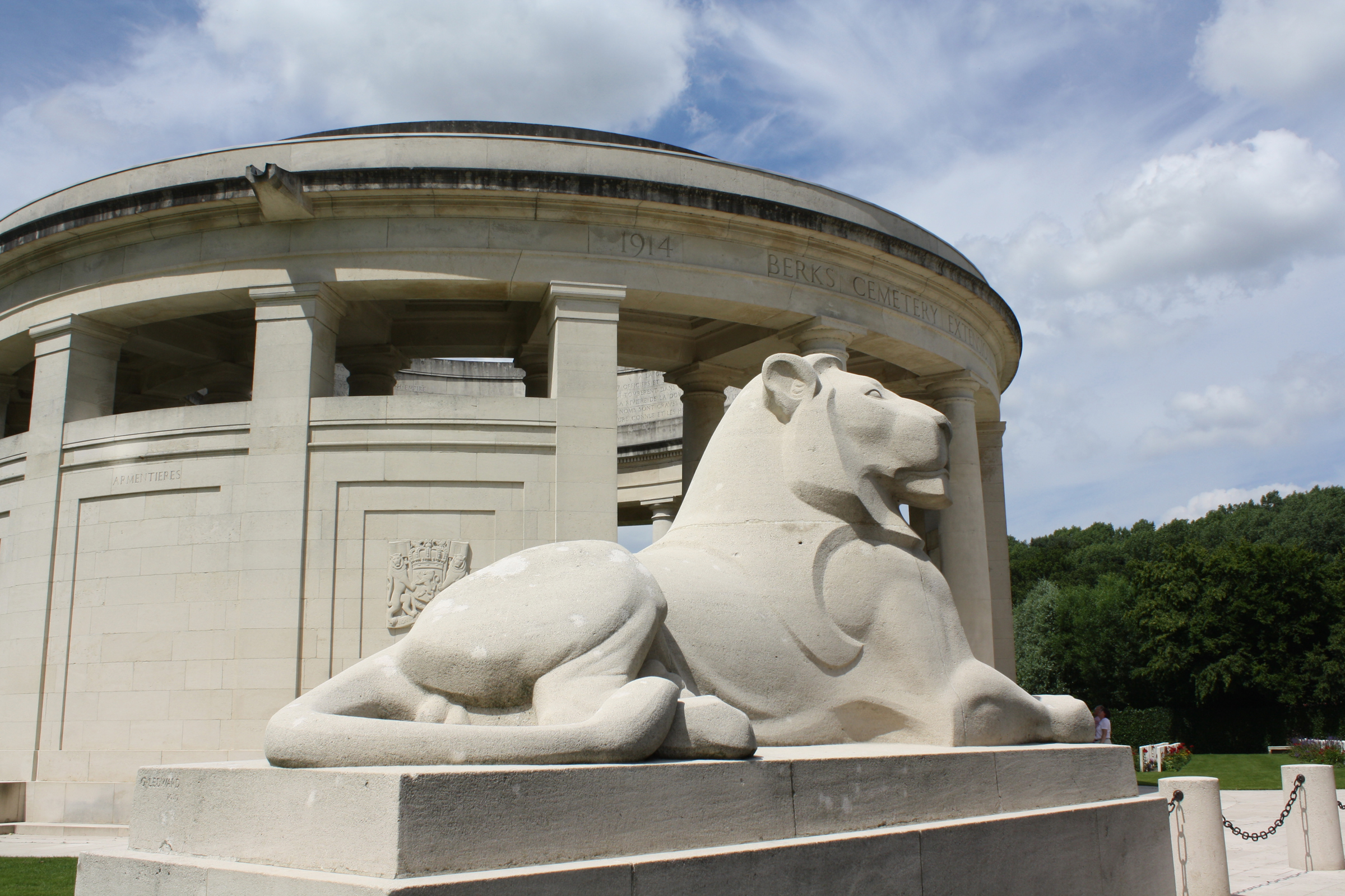 HYDE PARK CORNER (ROYAL BERKS) CEMETERY was begun in April 1915 by the 1st/4th Royal Berkshire Regiment and was used at intervals until November 1917. The cemetery contains 83 Commonwealth burials of the First World War and four German war graves. BERKS CEMETERY EXTENSION is separated from Hyde Park Corner Cemetery by a road. The extension was begun in June 1916 and used continuously until September 1917. At the Armistice, the extension comprised Plot I only, but Plots II and III were added in 1930 when graves were brought in from Rosenberg Chateau Military Cemetery and Extension, about 1 kilometre to the north-west, when it was established that these sites could not be acquired in perpetuity. Rosenberg Chateau Military Cemetery was used by fighting units from November 1914 to August 1916. The extension was begun in May 1916 and used until March 1918. Together, the cemetery and extension were sometimes referred to as 'Red Lodge'. Berks Cemetery Extension now contains 876 First World War burials. Commonwealth War Graves site for BERKS CEMETERY EXTENSIONGo there on Google maps |
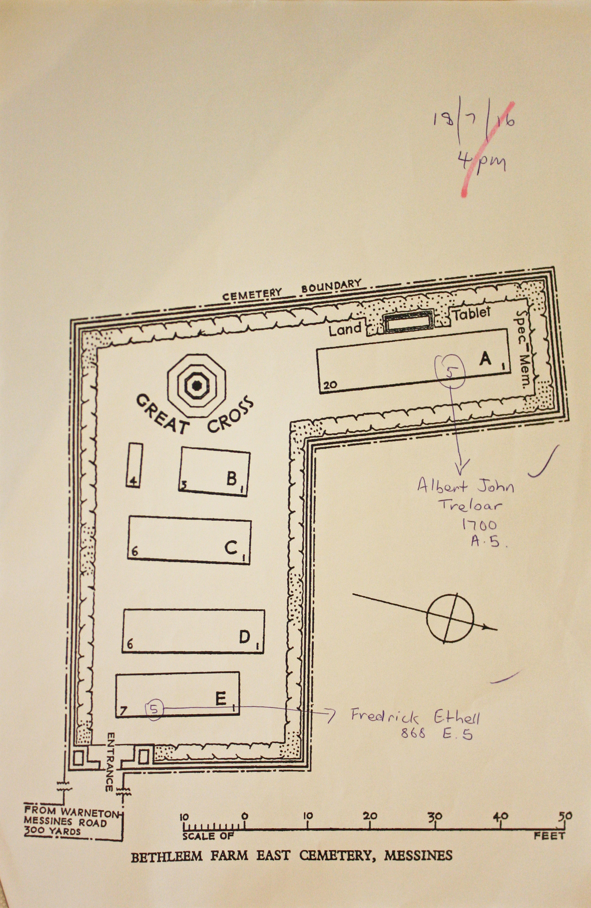
| BETHLEEM FARM EAST CEMETERY Annotated plan |  Bethleem Farm East Cemetery was made by Australian units when the nearby Bethleem Farm was captured by the 3rd Australian Division on 7 June 1917, in the Battle of Messines. The majority of the burials are those of officers and men killed in action on 8 or 10 June, though the cemetery continued to be used until the following September. There are 44 servicemen of the First World War buried or commemorated in the cemetery. Eight of the burials are unidentified but a special memorial commemorates one casualty know to be buried among them. Commonwealth War Graves site for BETHLEEM FARM EAST CEMETERYGo there on Google maps |
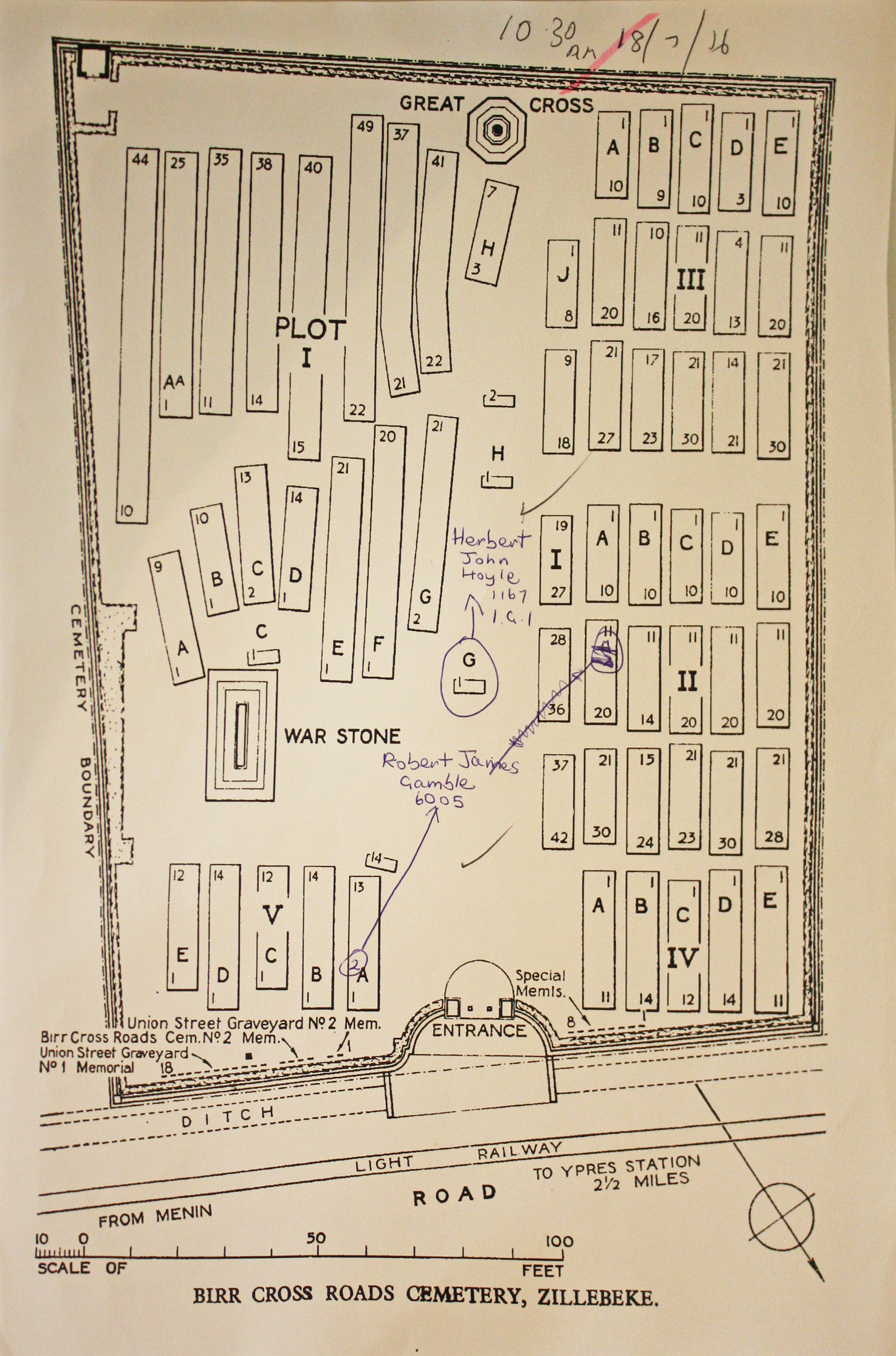
| BIRR CROSS ROADS CEMETERY Annotated plan | 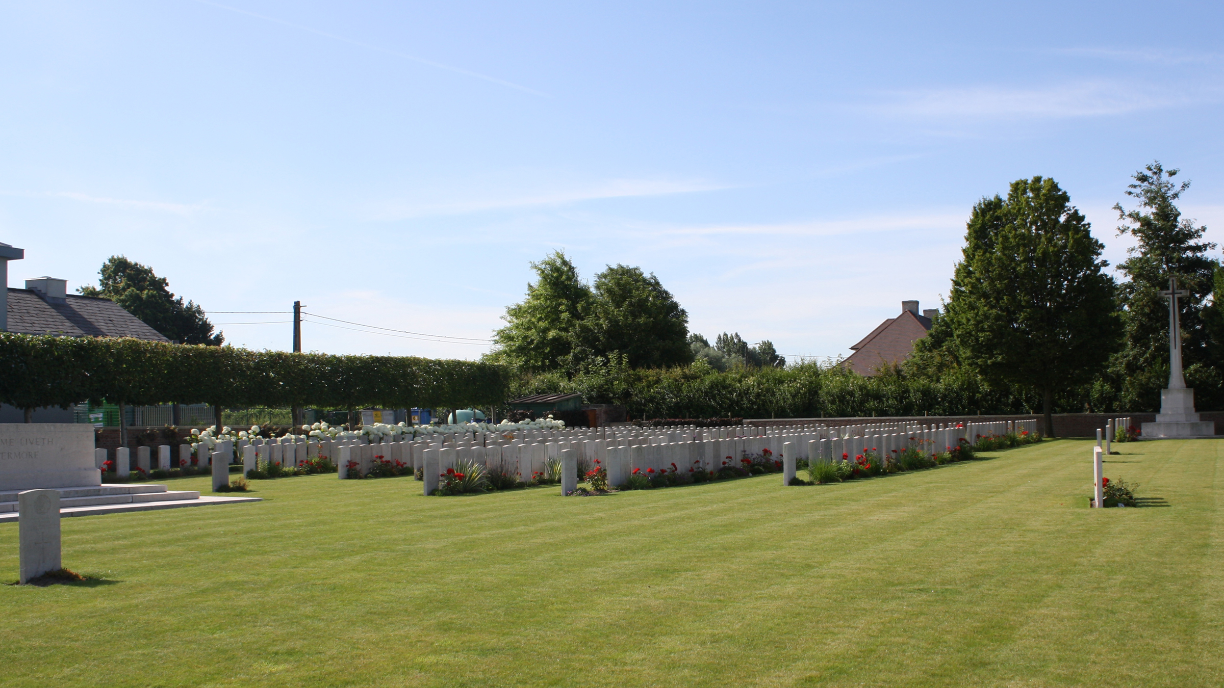 This cemetery contains graves in which more than one soldier is buried and on which more than one headstone is erected. As each of these graves has a single grave number it follows that the numbering of a grave given in the register will in some cases not correspond with the number of the headstone as determined by counting from the beginning of the Row. Birr Cross Roads was named by the 1st Leinsters from their depot. The cemetery was begun in August 1917 and used as a Dressing Station cemetery until, and after, the German advance in 1918. At the Armistice, it contained nine irregular rows of graves, now part of Plot I, but was greatly enlarged when graves were brought in from the surrounding battlefields and from certain smaller cemeteries. Commonwealth War Graves site for BIRR CROSS ROADS CEMETERYGo there on Google maps |
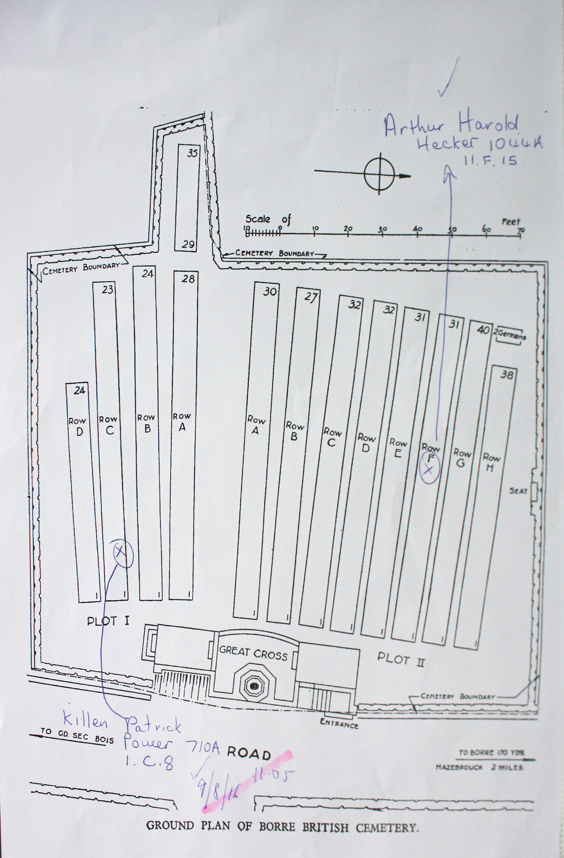
| BORRE BRITISH CEMETERY Annotated plan | 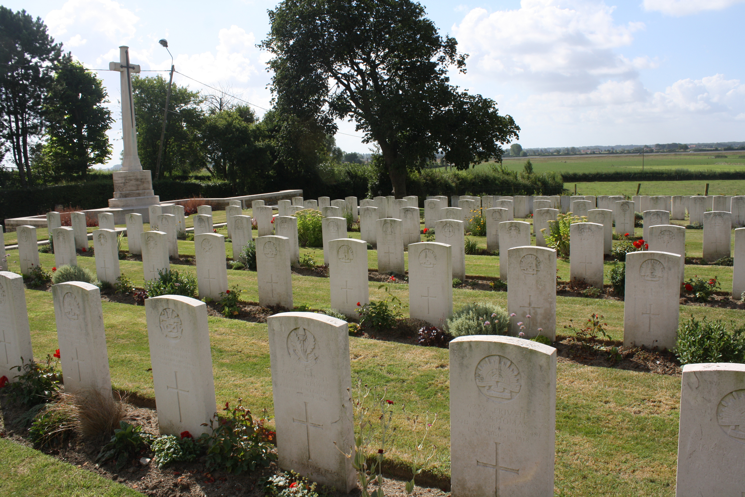 The cemetery was used from May to September 1918 by field ambulances and fighting Units, particularly those of the 1st Australian Division, during the interval between the German and Allied offensives of that year. The cemetery now contains 367 Commonwealth burials of the First World War and three German war graves. There are also five burials of the Second World War. Commonwealth War Graves site for BORRE BRITISH CEMETERYGo there on Google maps |
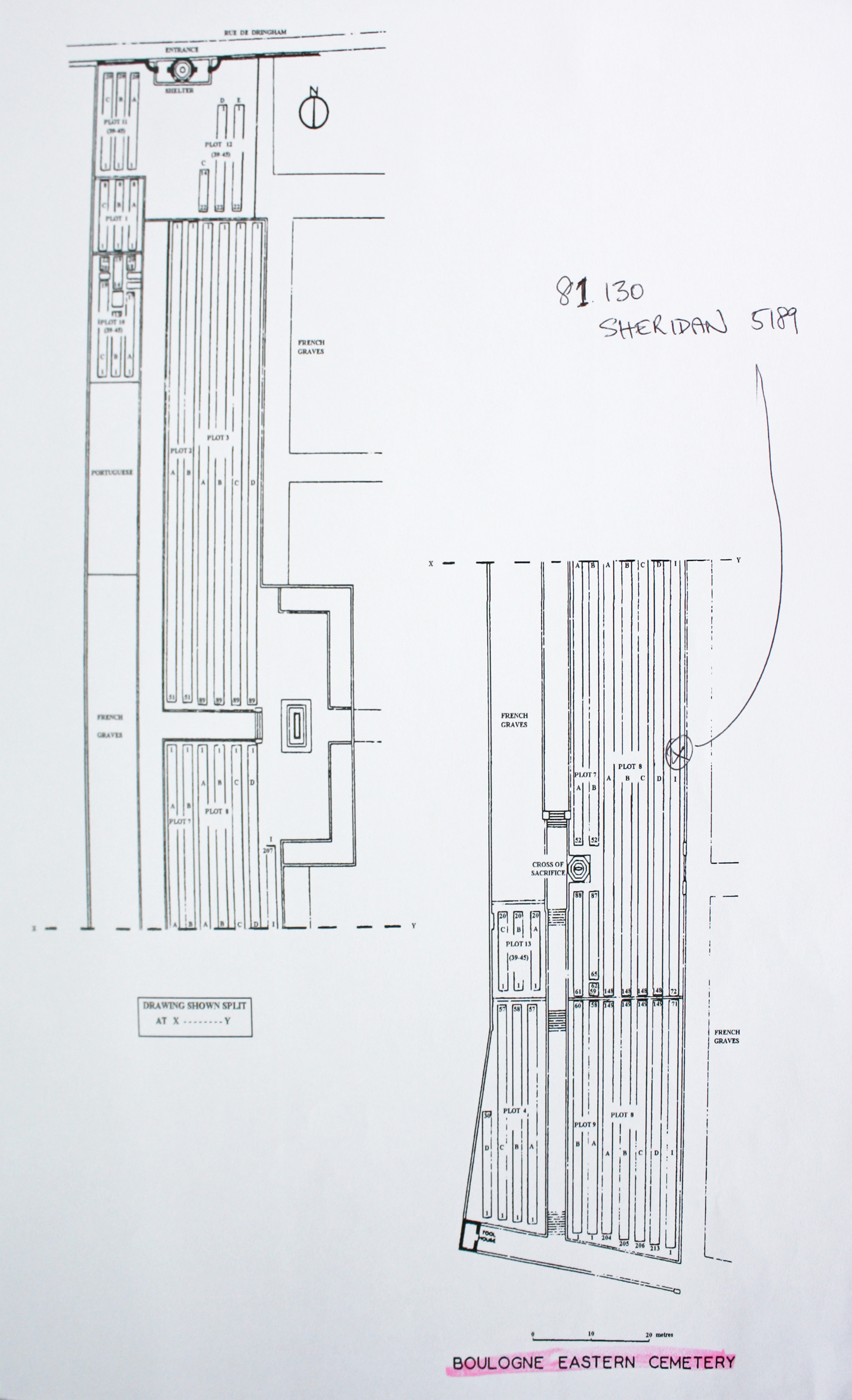
| BOULOGNE EASTERN CEMETERY Annotated plan |  Until June 1918, the dead from the hospitals at Boulogne itself were buried in the Cimetiere de L'Est, one of the town cemeteries, the Commonwealth graves forming a long, narrow strip along the right hand edge of the cemetery. In the spring of 1918, it was found that space was running short in the Eastern Cemetery in spite of repeated extensions to the south, and the site of the new cemetery at Terlincthun was chosen. During the Second World War, hospitals were again posted to Boulogne for a short time in May 1940. The town was taken by the Germans at the end of that month and remained in their hands until recaptured by the Canadians on 22 September 1944.Boulogne Eastern Cemetery contains 5,577 Commonwealth burials of the First World War and 224 from the Second World War. Commonwealth War Graves site for BOULOGNE EASTERN CEMETERYGo there on Google maps |
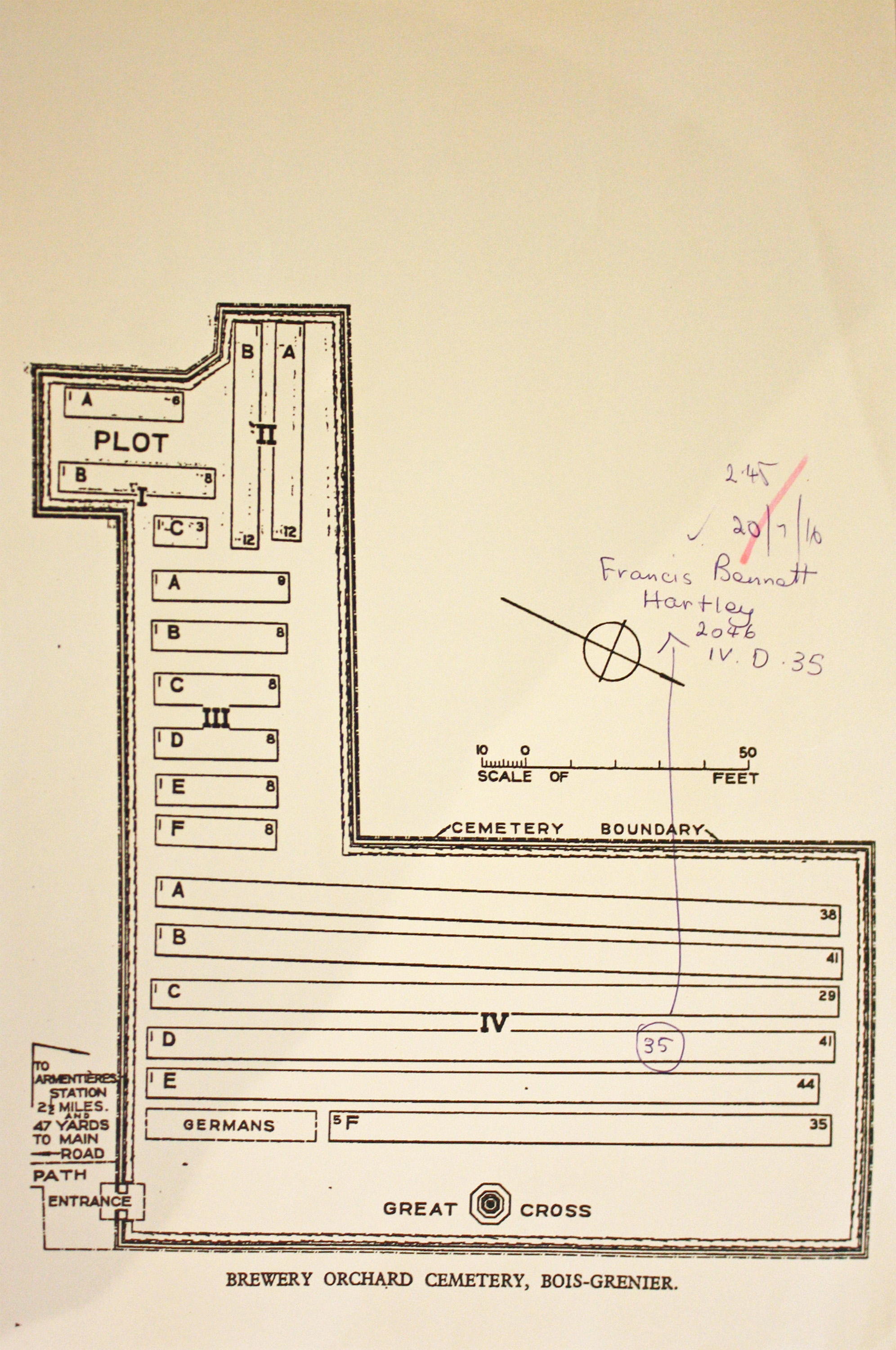
| BREWERY ORCHARD CEMETERY, BOIS-GRENIER Annotated plan |  The cellar of the brewery was used as a dressing station and the cemetery was started in the orchard nearby in November 1914. It was sheltered from enemy observation by ruined houses and continued in use until January 1918. Brewery Orchard Cemetery contains 339 Commonwealth burials of the First World War. There are also four Second World War burials and five German war graves. Commonwealth War Graves site for BREWERY ORCHARD CEMETERY, BOIS-GRENIERGo there on Google maps |
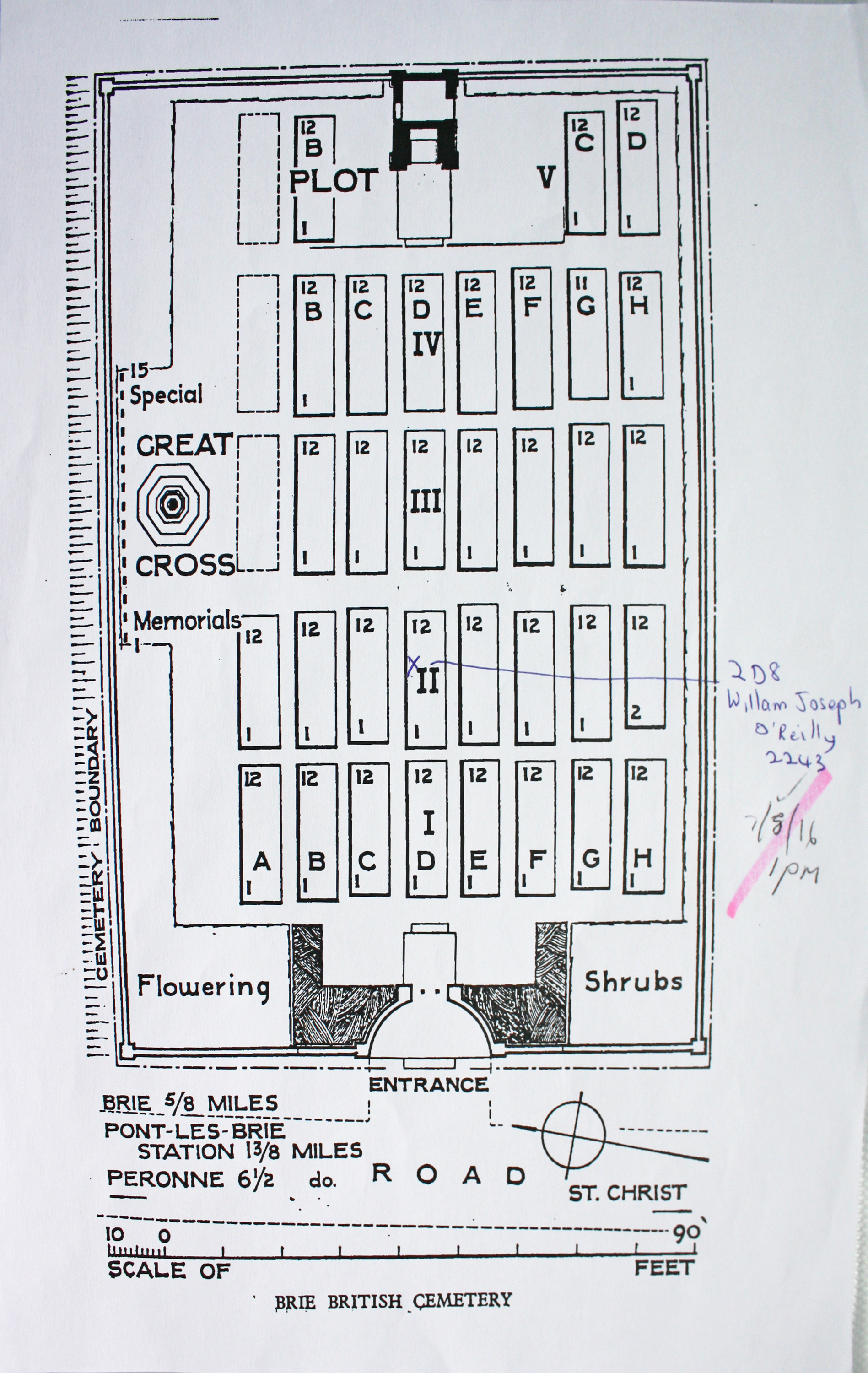
| BRIE BRITISH CEMETERY Annotated plan | 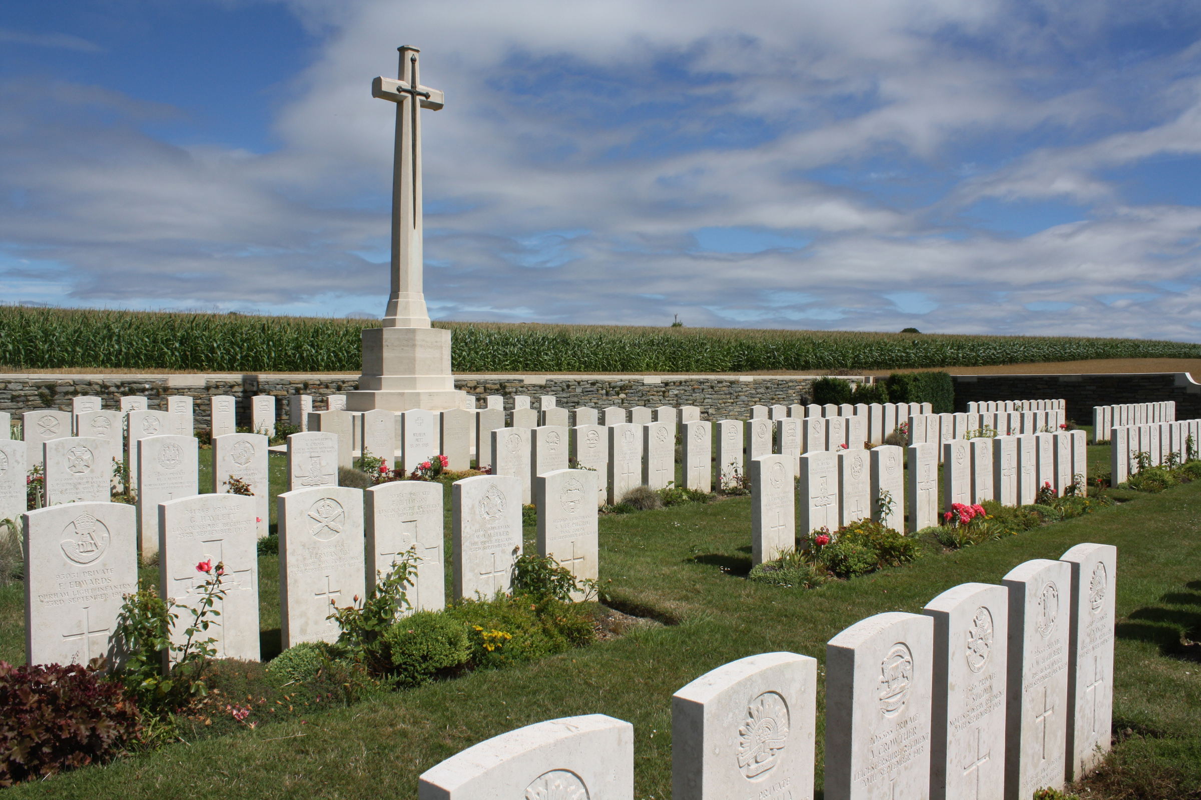 The cemetery was started by Commonwealth units after the second occupation of the village and taken over by the 5th, 47th and 48th Casualty Clearing Stations, which were posted at Brie in September and October before being moved on along the St. Quentin road to Bihecourt, near Vermand. It was enlarged after the Armistice when graves were brought in from the battlefields east and south of Brie and the following cemeteries. Brie British Cemetery contains 409 Commonwealth burials and commemorations of the First World War. 49 of the burials are unidentified but there are special memorials to 15 casualties known or believed to be buried among them. There are also 36 German war graves in the cemetery. Commonwealth War Graves site for BRIE BRITISH CEMETERYGo there on Google maps |
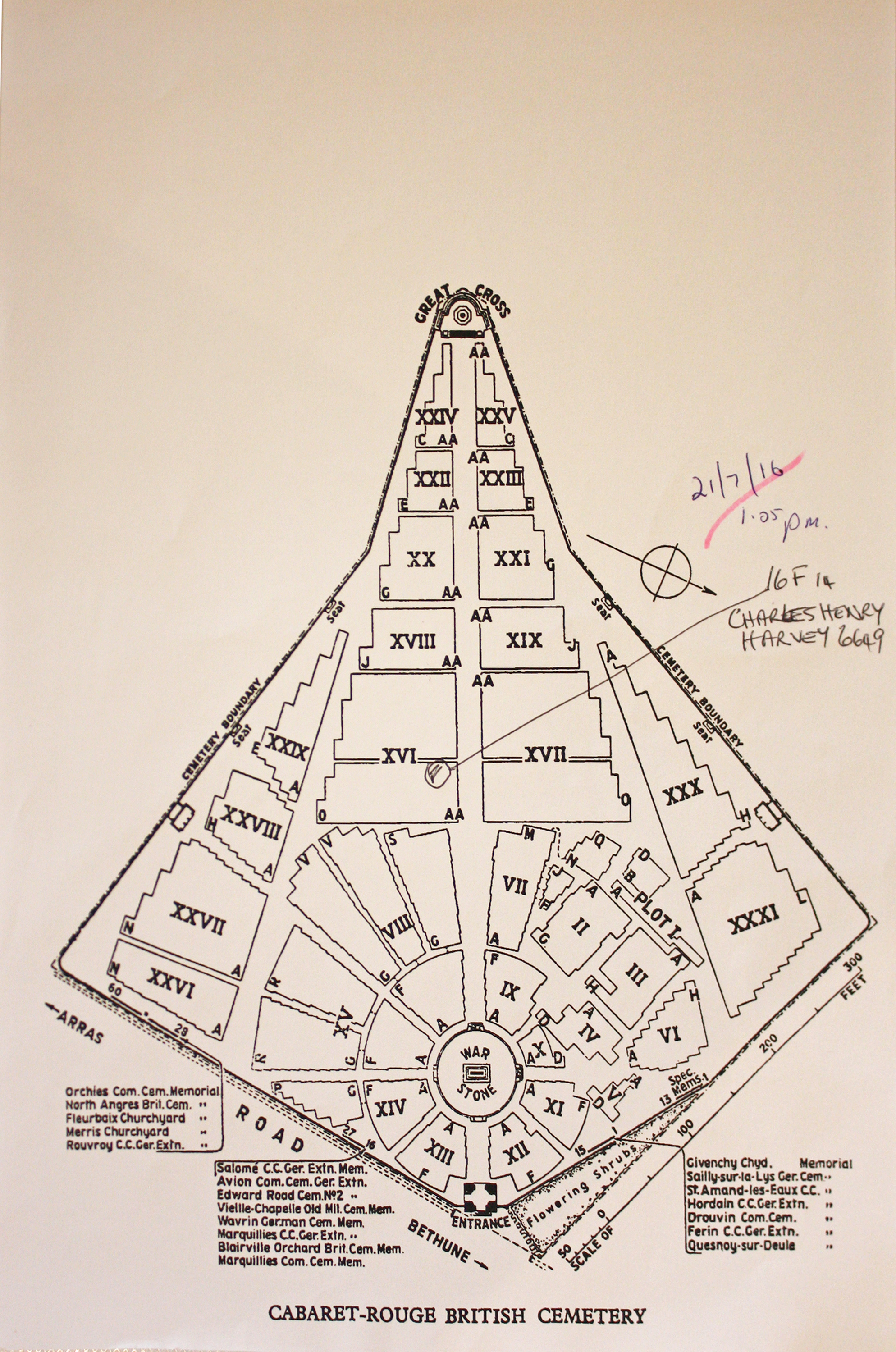
| CABARET-ROUGE BRITISH CEMETERY, SOUCHEZ Annotated plan |  This cemetery was used mostly by the 47th (London) Division and the Canadian Corps until August 1917 and by different fighting units until September 1918. It was greatly enlarged in the years after the war when as many as 7,000 graves were concentrated here from over 100 other cemeteries in the area. For much of the twentieth century, Cabaret Rouge served as one of a small number of 'open cemeteries' at which the remains of fallen servicemen newly discovered in the region were buried. Today the cemetery contains over 7,650 burials of the First World War, over half of which remain unidentified. Commonwealth War Graves site for CABARET-ROUGE BRITISH CEMETERY, SOUCHEZGo there on Google maps |
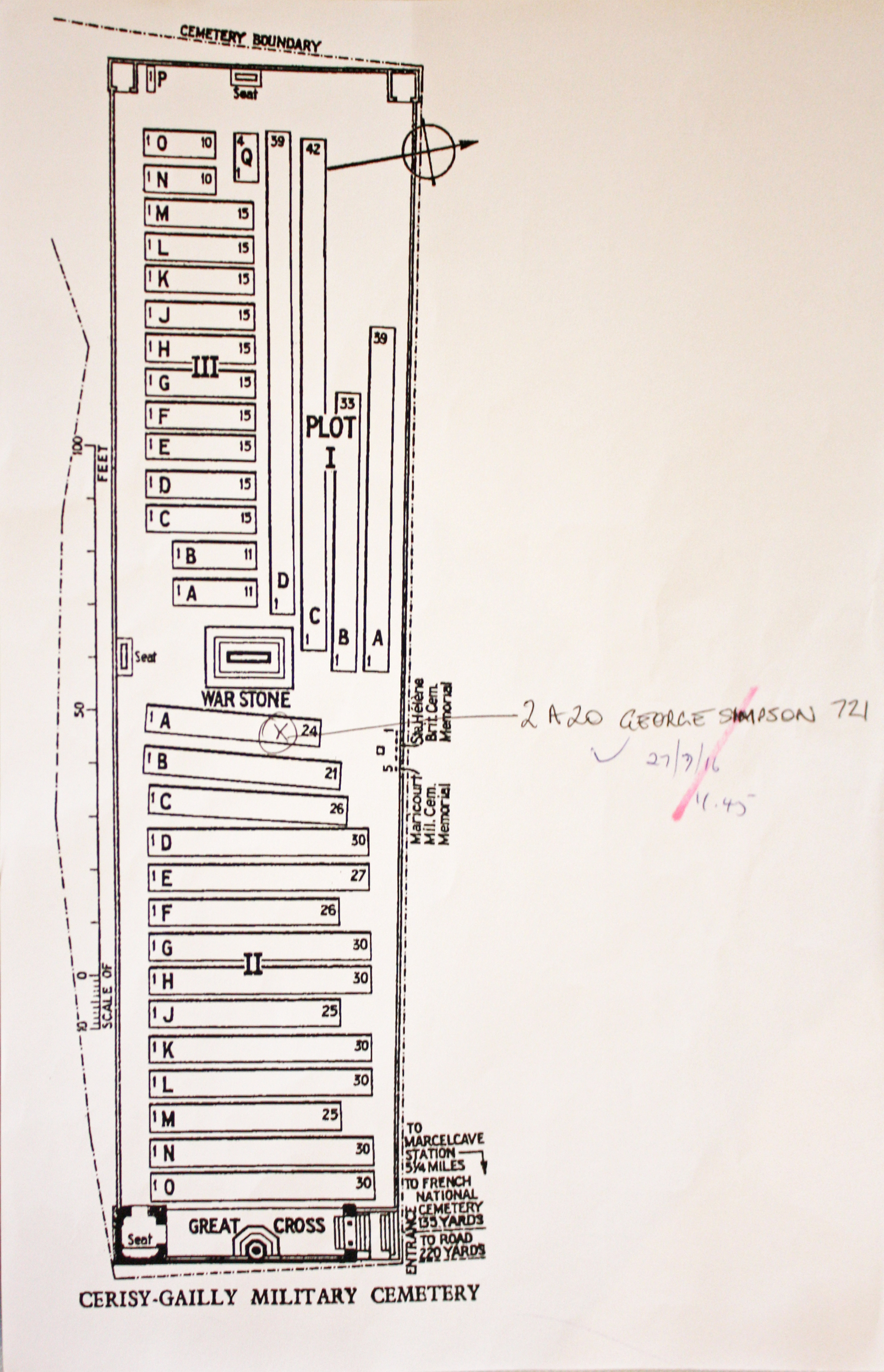
| CERISY-GAILLY MILITARY CEMETERY Annotated plan |  Gailly was the site of the 39th and 13th Casualty Clearing Stations during the early part of 1917, and of the 41st Stationary Hospital from May 1917 to March 1918. The villages were then captured by the Germans, but were retaken by the Australian Corps in August 1918. Cerisy-Gailly Military Cemetery (originally called the New French Military Cemetery) was begun in February 1917 and used by medical units until March 1918. After the recapture of the village it was used by Australian units. The cemetery was increased after the Armistice when graves were brought in from the battlefields of the Somme. Commonwealth War Graves site for CERISY-GAILLY MILITARY CEMETERYGo there on Google maps |
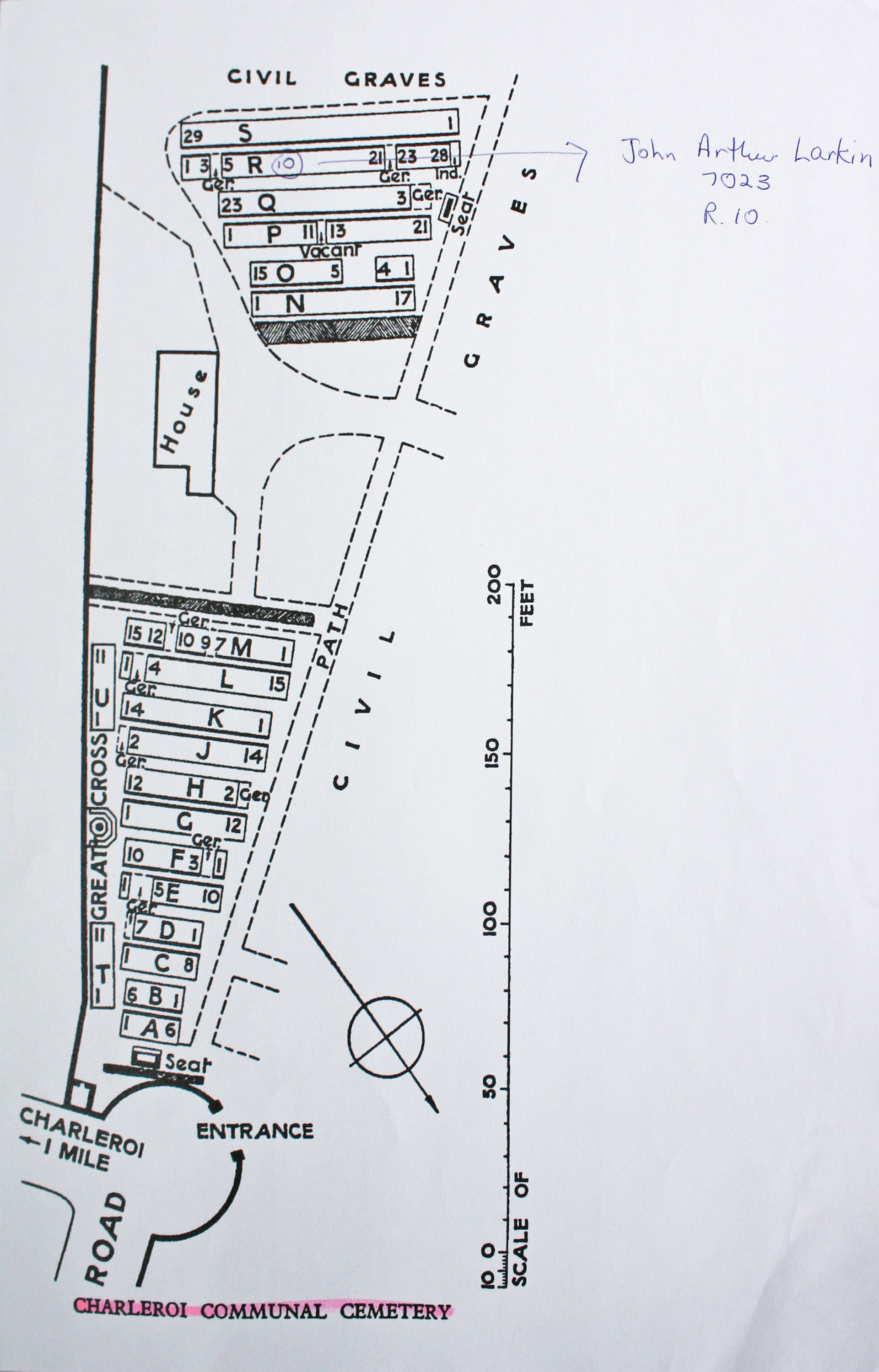
| CHARLEROI COMMUNAL CEMETERY Annotated plan |  Charleroi was the scene of fighting between 21 and 24 August 1914 and for the rest of the First World War it was a German military and administrative centre.The 270 Commonwealth servicemen of the First World War buried in the communal cemetery either died as prisoners of war, or after the Armistice. The cemetery also contains 38 Second World War burials, most of them airmen, and 23 war graves of other nationalities. Commonwealth War Graves site for CHARLEROI COMMUNAL CEMETERYGo there on Google maps |
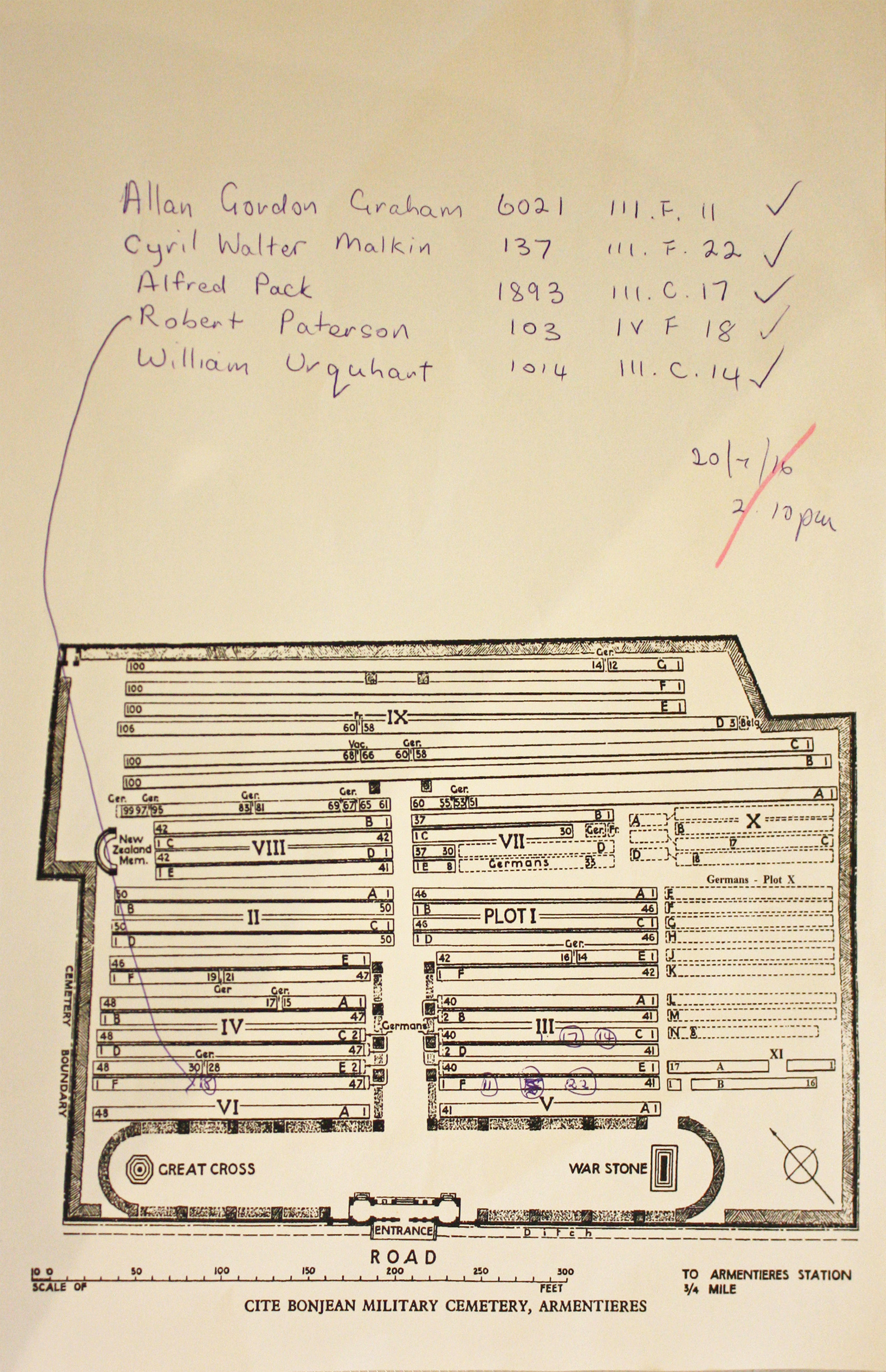
| CITE BONJEAN MILITARY CEMETERY, ARMENTIERES Annotated plan | 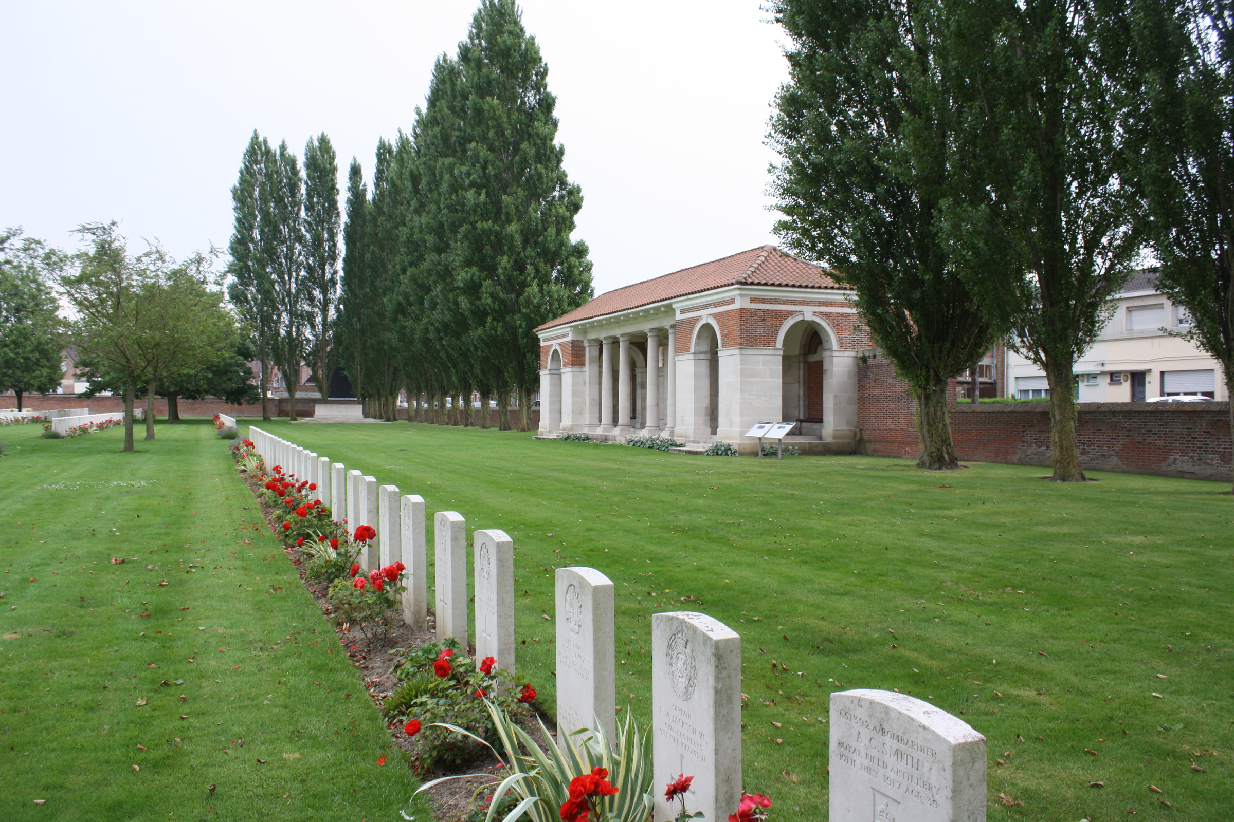 CITE BONJEAN MILITARY CEMETERY began as (Plot IX) in October 1914 and during the winter of 1914-15 it was used for civilian burials (later removed), the town cemetery at Le Bizet being too greatly exposed. The cemetery continued to be used by field ambulances and fighting units (particularly the 4th, 6th, 21st, New Zealand, 17th and 57th (West Lancashire) Divisions and the Australian Corps) until April 1918. Plots V, VI, VII and X were then used by the Germans. The cemetery now contains 2,132 Commonwealth burials of the First World War. In 1925, 455 German graves were removed from Plots V and VI, but more than 500 remain in the cemetery. Commonwealth War Graves site for CITE BONJEAN MILITARY CEMETERY, ARMENTIERESGo there on Google maps |
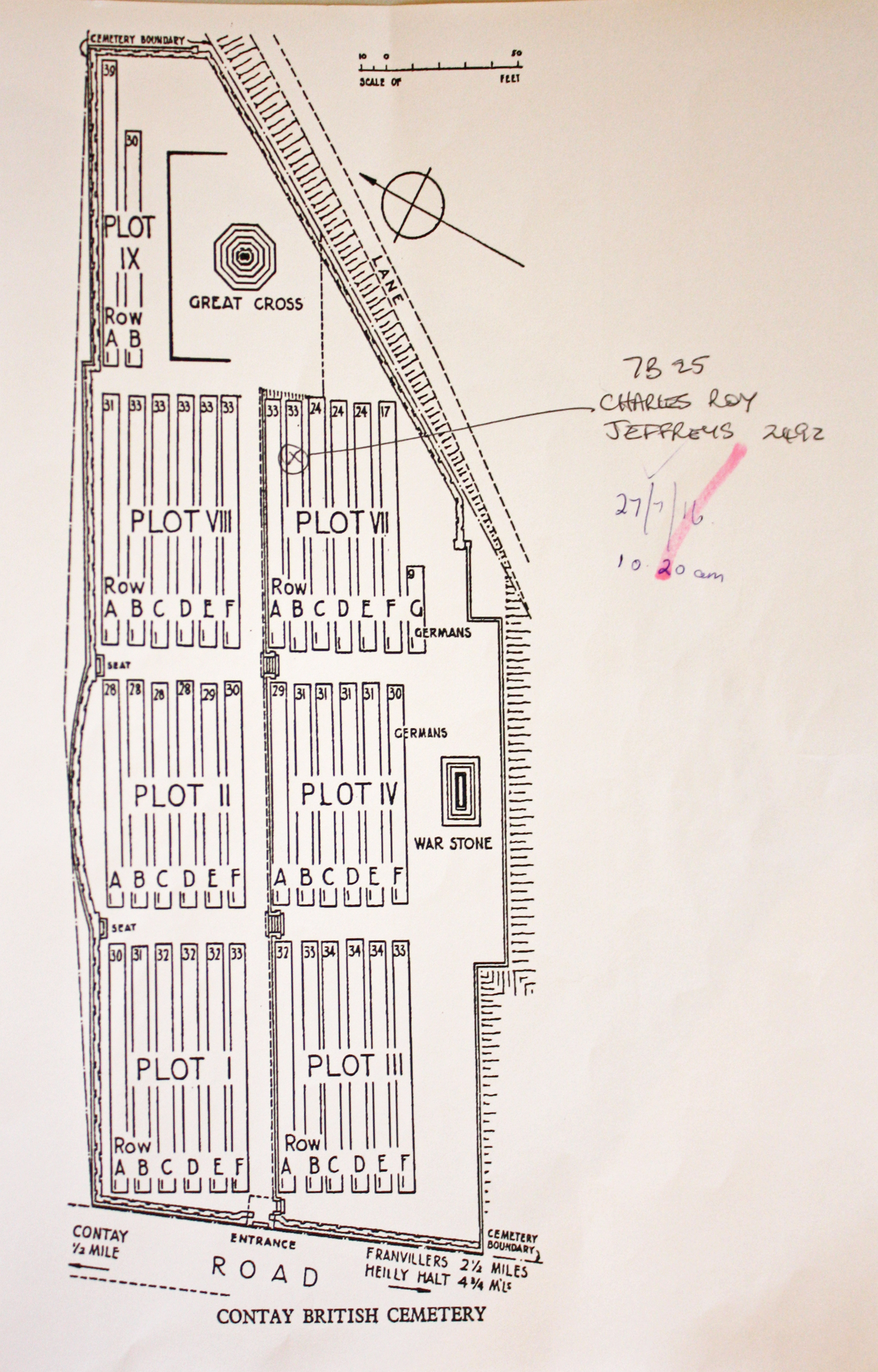
| CONTAY BRITISH CEMETERY, CONTAY Annotated plan |  The site was chosen in August 1916 for burials from the 49th Casualty Clearing Station, which arrived at Contay at the end of August. It was joined by the 9th Casualty Clearing Station in September. It was used until March 1917. Commonwealth War Graves site for CONTAY BRITISH CEMETERY, CONTAYGo there on Google maps |
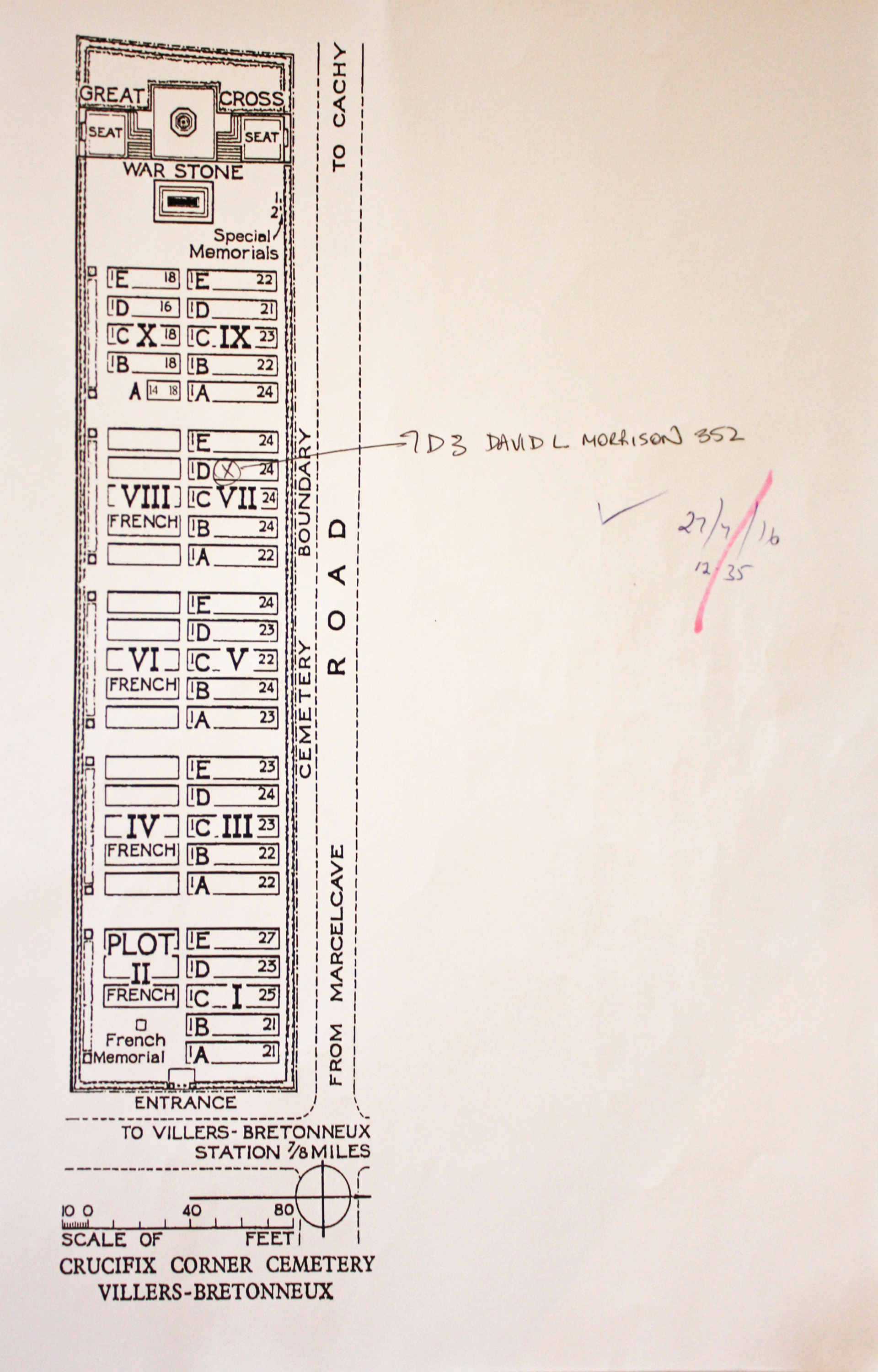
| CRUCIFIX CORNER CEMETERY, VILLERS-BRETONNEUX Annotated plan |  The cemetery was begun by the Canadian Corps in August 1918 and closed in the same month. The original British Cemetery (now Plot I, Rows A to D) contained 90 burials, and French troops buried in Plot II at the same time. The cemetery was greatly enlarged after the Armistice when graves were brought in from the battlefields between the Somme and the Luce. Commonwealth War Graves site for CRUCIFIX CORNER CEMETERY, VILLERS-BRETONNEUXGo there on Google maps |
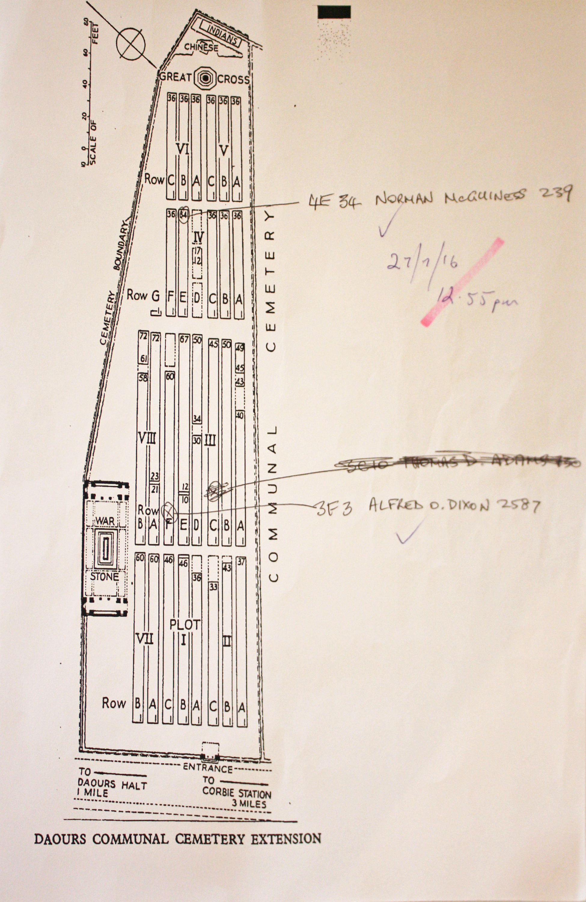
| DAOURS COMMUNAL CEMETERY EXTENSION Annotated plan |  The preparations for the Somme offensive of July 1916 brought a group of casualty clearing stations (the 1st/1st South Midland, 21st, 34th, 45th and Lucknow, section "B") to Daours. The extension to the communal cemetery was opened and the first burials made in Plots I, II, Row A of Plot III and the Indian plot, between June and November 1916. Commonwealth War Graves site for DAOURS COMMUNAL CEMETERY EXTENSIONGo there on Google maps |
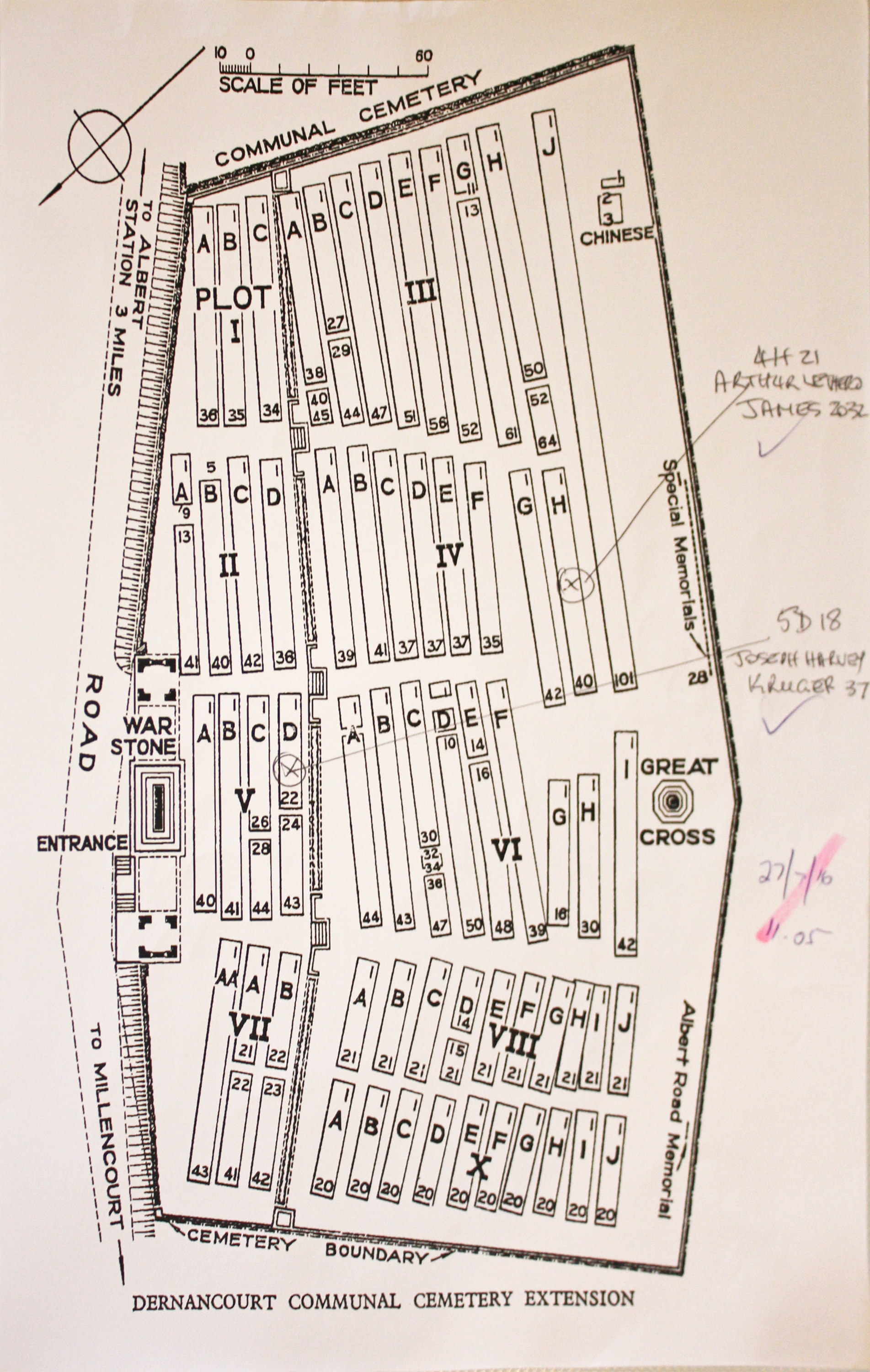
| DERNANCOURT COMMUNAL CEMETERY EXTENSION Annotated plan | 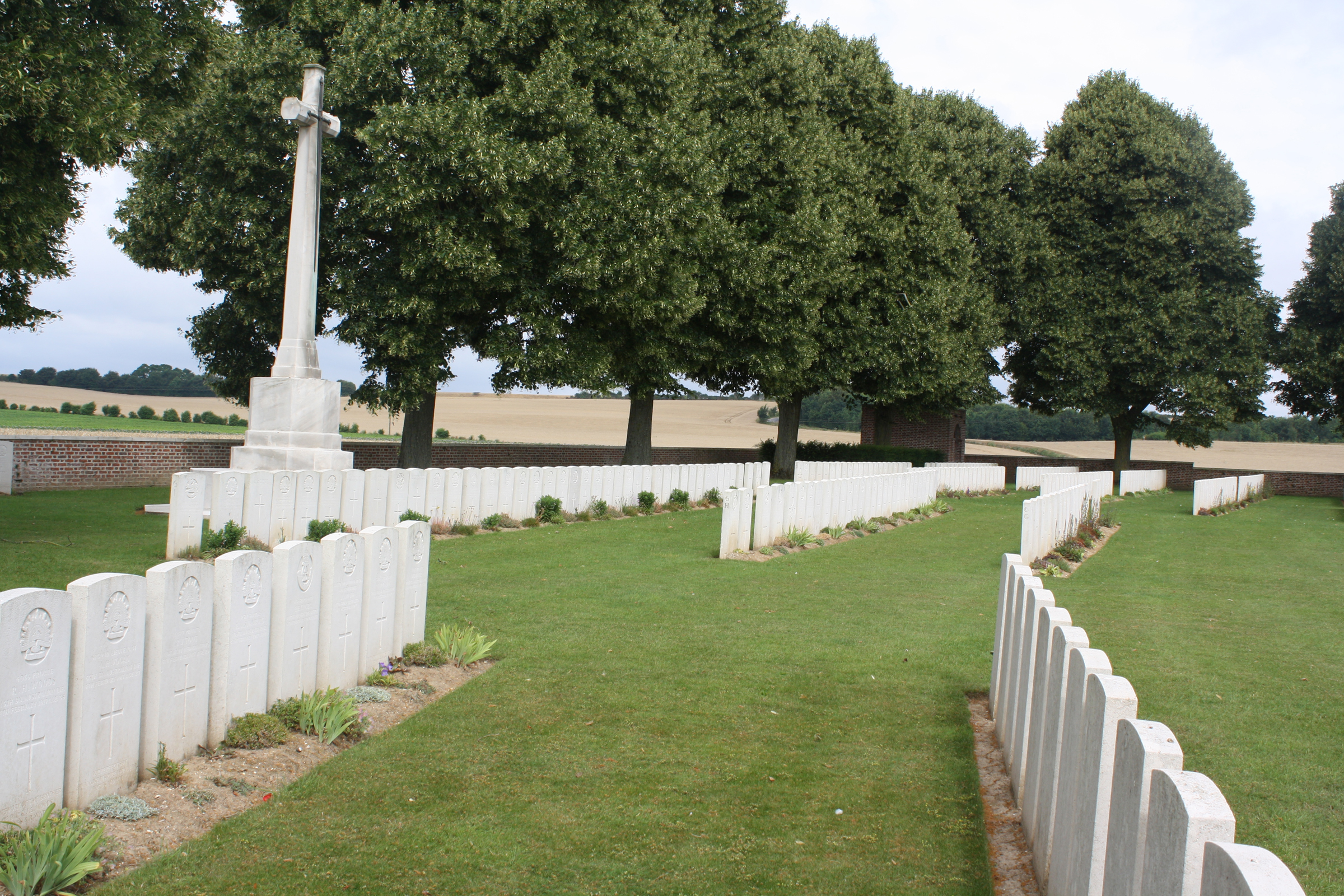 Field ambulances used the Communal Cemetery for Commonwealth burials from September 1915 to August 1916, and again during the German advance of March 1918. It contains 127 Commonwealth burials of the First World War. Commonwealth War Graves site for DERNANCOURT COMMUNAL CEMETERY EXTENSIONGo there on Google maps |
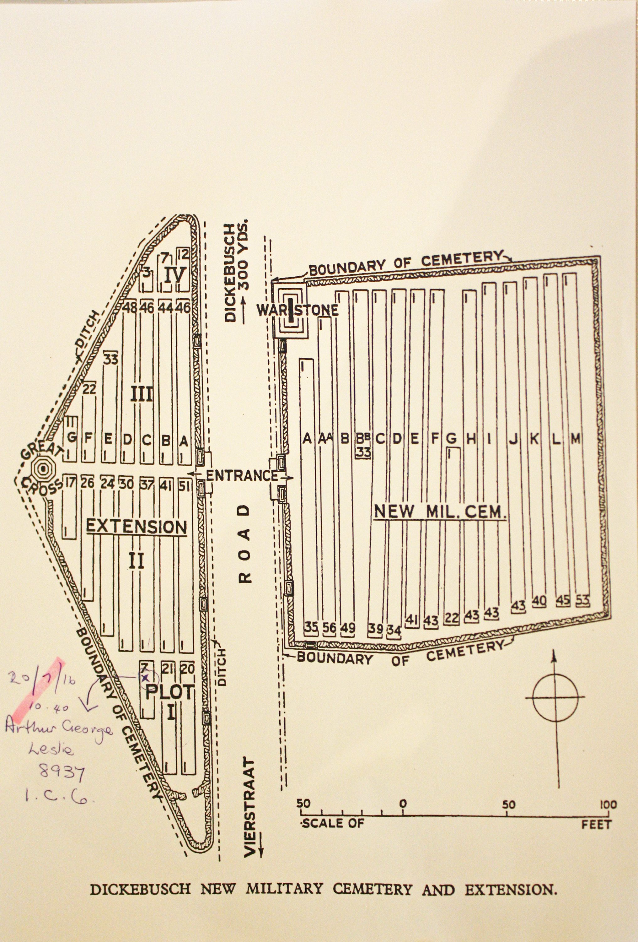
| DICKEBUSCH NEW MILITARY CEMETERY EXTENSION Annotated plan | 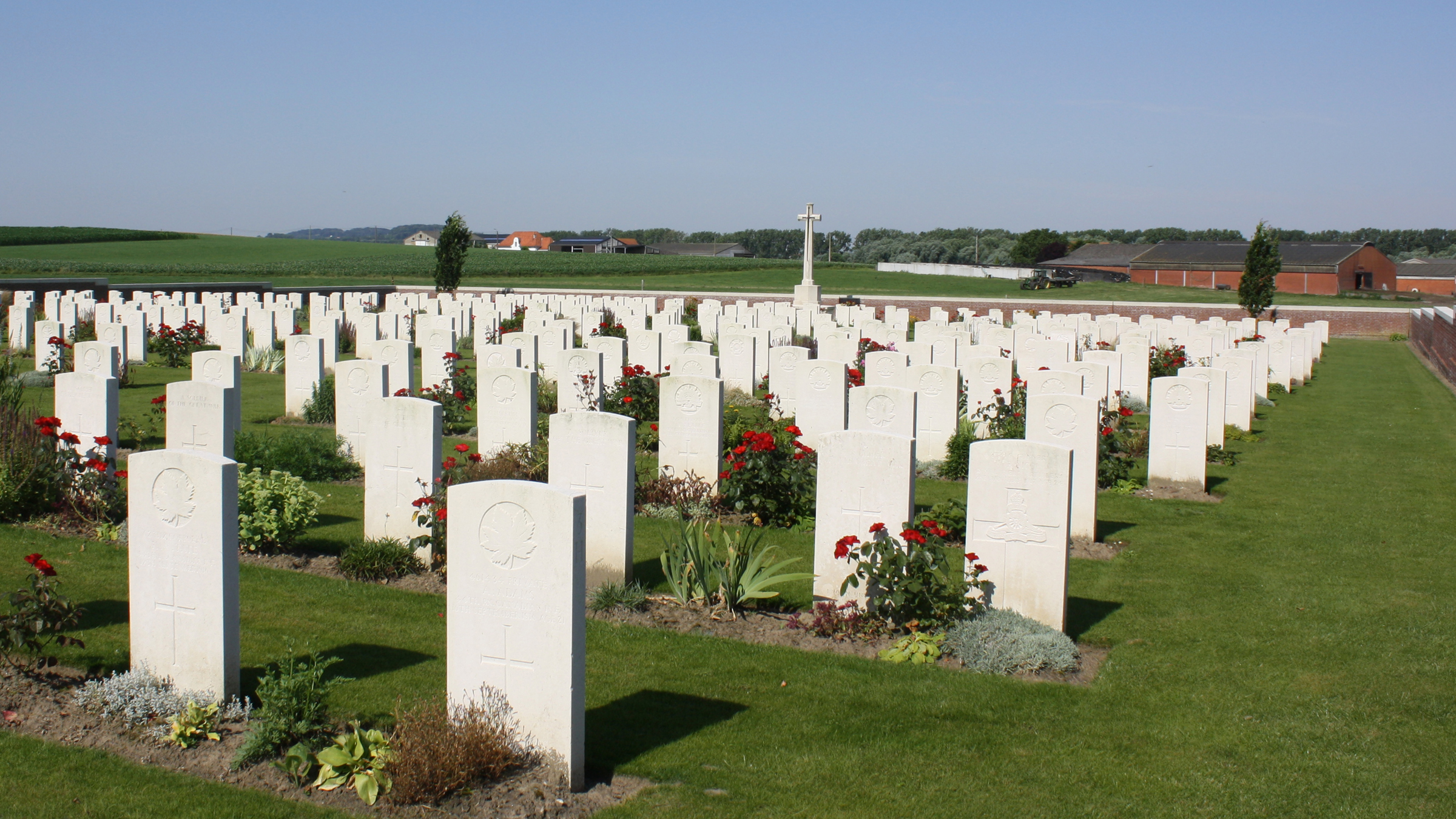 The New Military Cemetery was begun in February 1915 and was used until May 1917 by fighting units and field ambulances, with a few further burials taking place in March and April 1918. The Extension was used from May 1917 to January 1918. Commonwealth War Graves site for DICKEBUSCH NEW MILITARY CEMETERY EXTENSIONGo there on Google maps |
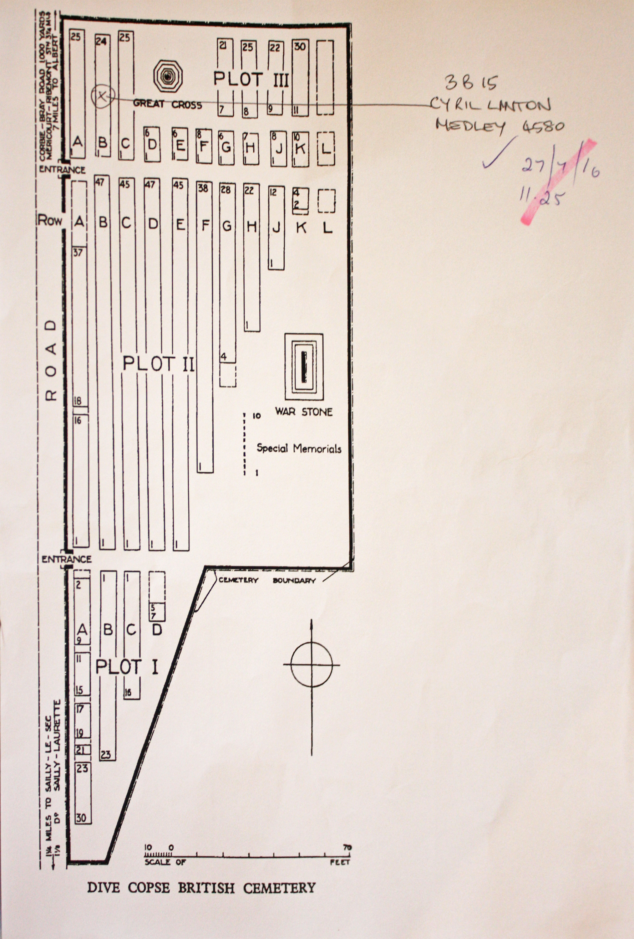
| DIVE COPSE BRITISH CEMETERY, SAILLY-LE-SEC Annotated plan | 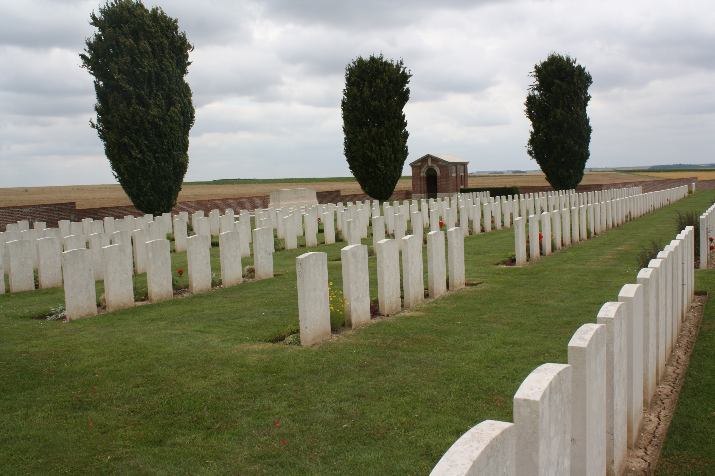 In June 1916, before the Somme offensive, the ground north of the cemetery was chosen for a concentration of field ambulances, which became the XIV Corps Main Dressing Station. Dive Copse was a small wood close by, under the Bray-Corbie road, named after the officer commanding this station. Plots I and II were filled with burials from these medical units between July and September 1916. In the spring of 1918, the cemetery was lost during the German advance; Plot III contains the graves of 77 men who died in August 1918 when it was retaken. This plot also contains graves brought in from scattered sites and small cemeteries in the neighbourhood Commonwealth War Graves site for DIVE COPSE BRITISH CEMETERY, SAILLY-LE-SECGo there on Google maps |
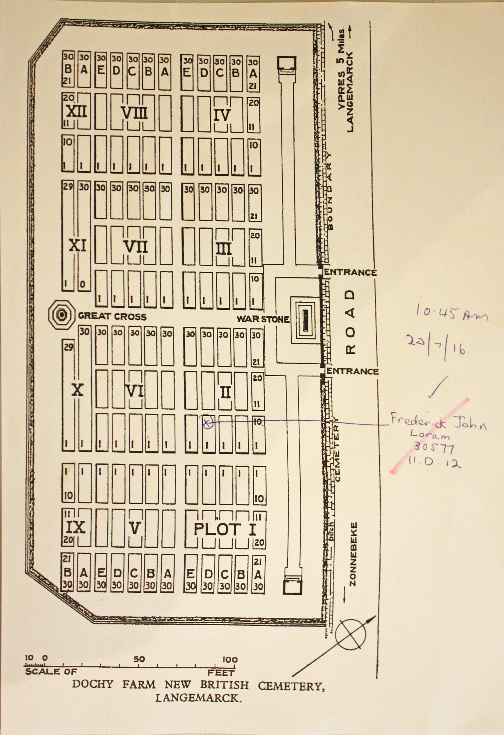
| DOCHY FARM NEW BRITISH CEMETERY Annotated plan | 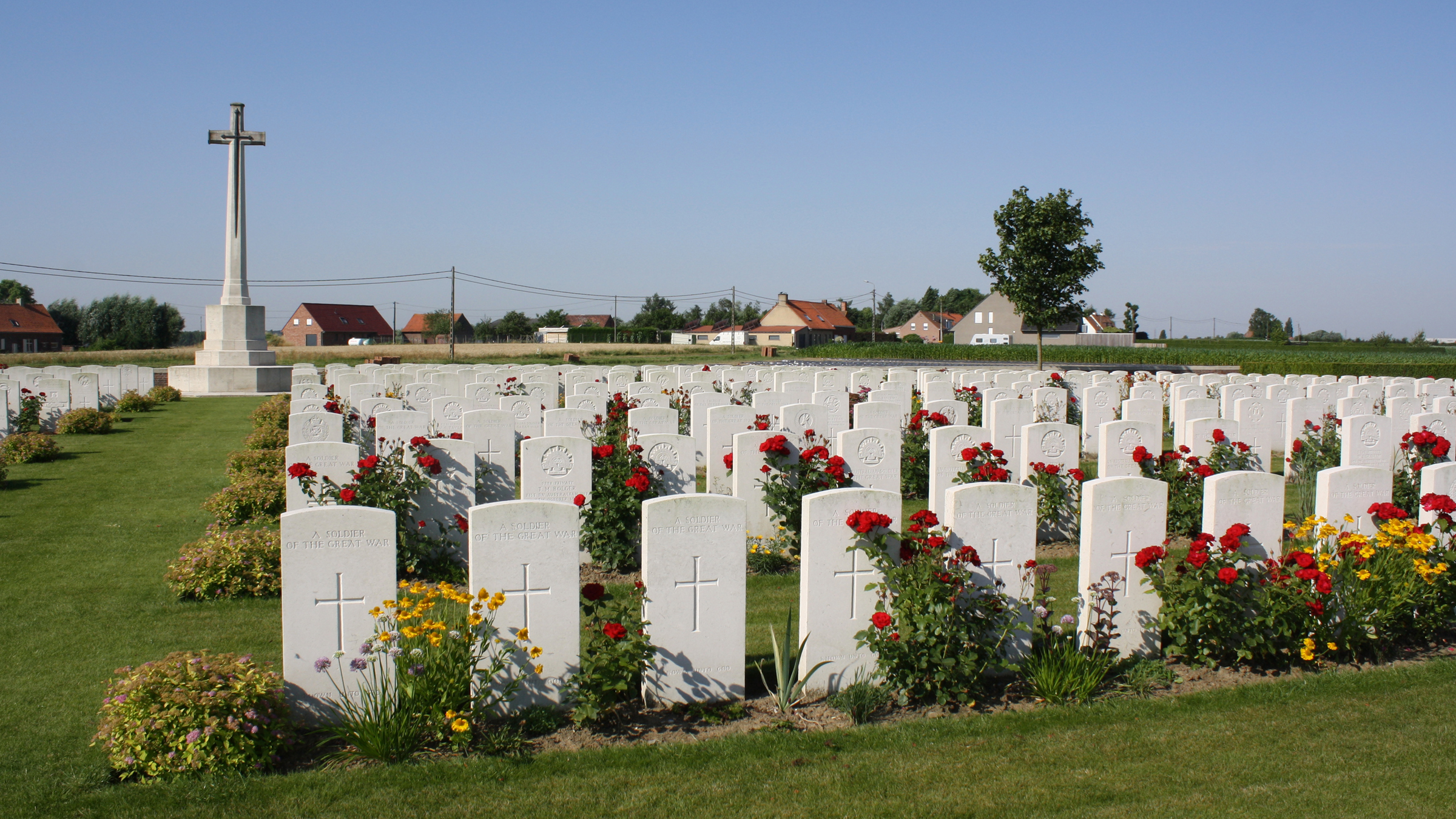 Dochy Farm, which had become a German strong point, was taken by the 4th New Zealand Brigade on 4 October 1917, in the Battle of Broodseinde. The cemetery was made after the Armistice when isolated graves were brought in from the battlefields of Boesinghe, St. Julien, Frezenberg and Passchendaele. Commonwealth War Graves site for DOCHY FARM NEW BRITISH CEMETERYGo there on Google maps |
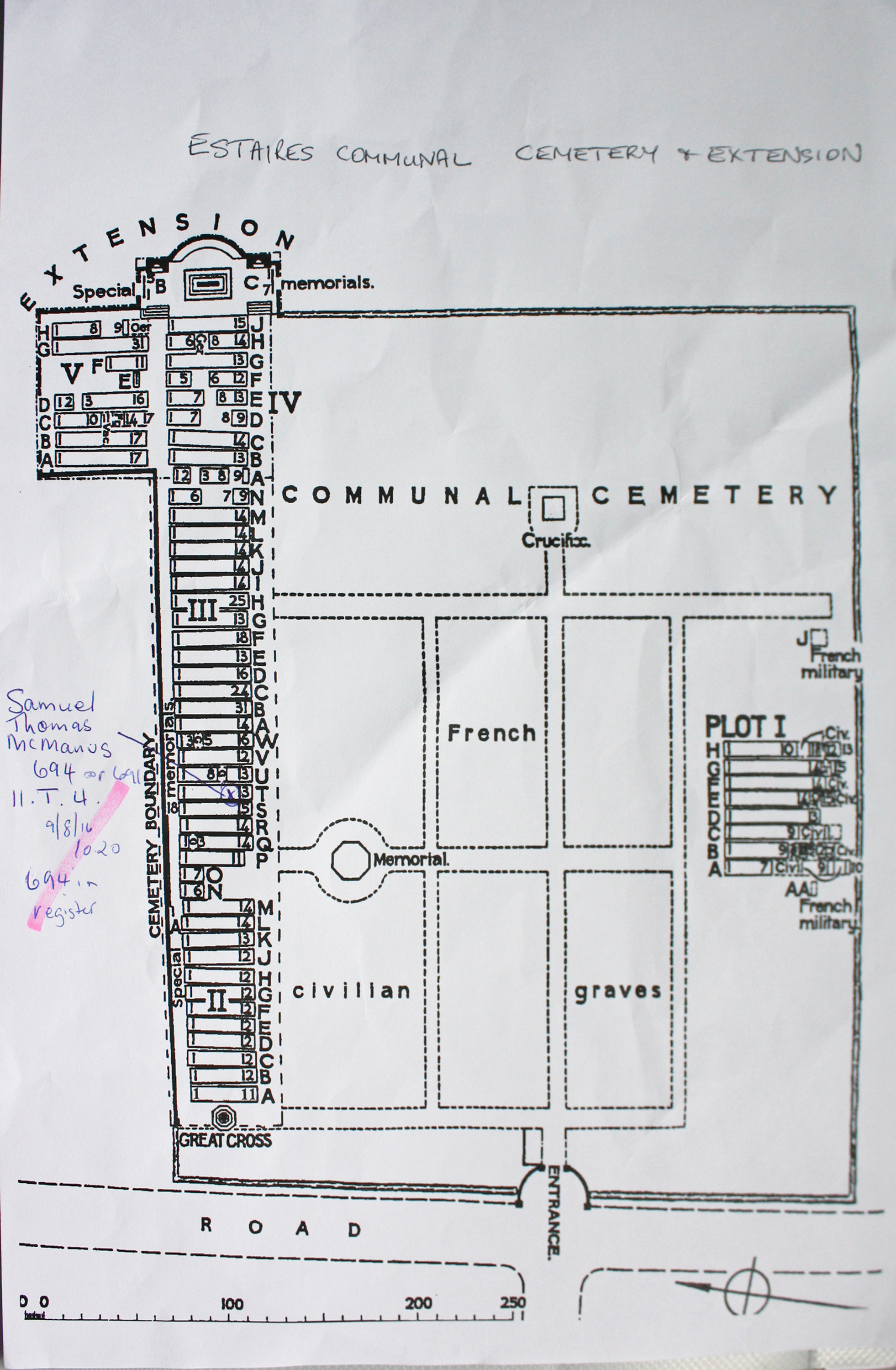
| ESTAIRES COMMUNAL CEMETERY AND EXTENSION Annotated plan | 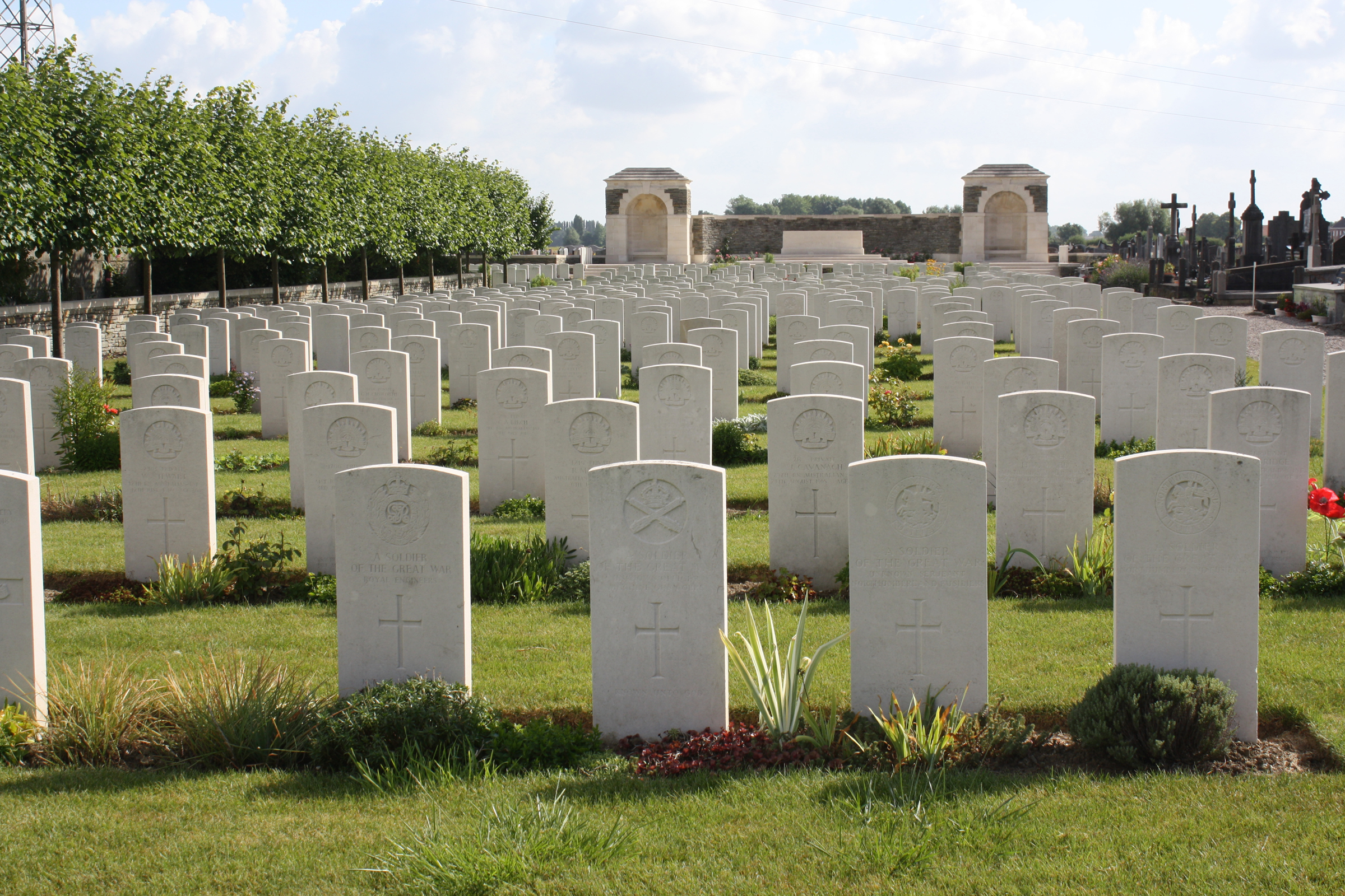 Estaires town was a Field Ambulance centre as early as November 1914, and later the 1st Australian Casualty Clearing Station was posted in it. It was later "adopted" by the County Borough of Plymouth. Commonwealth War Graves site for ESTAIRES COMMUNAL CEMETERY AND EXTENSIONGo there on Google maps |
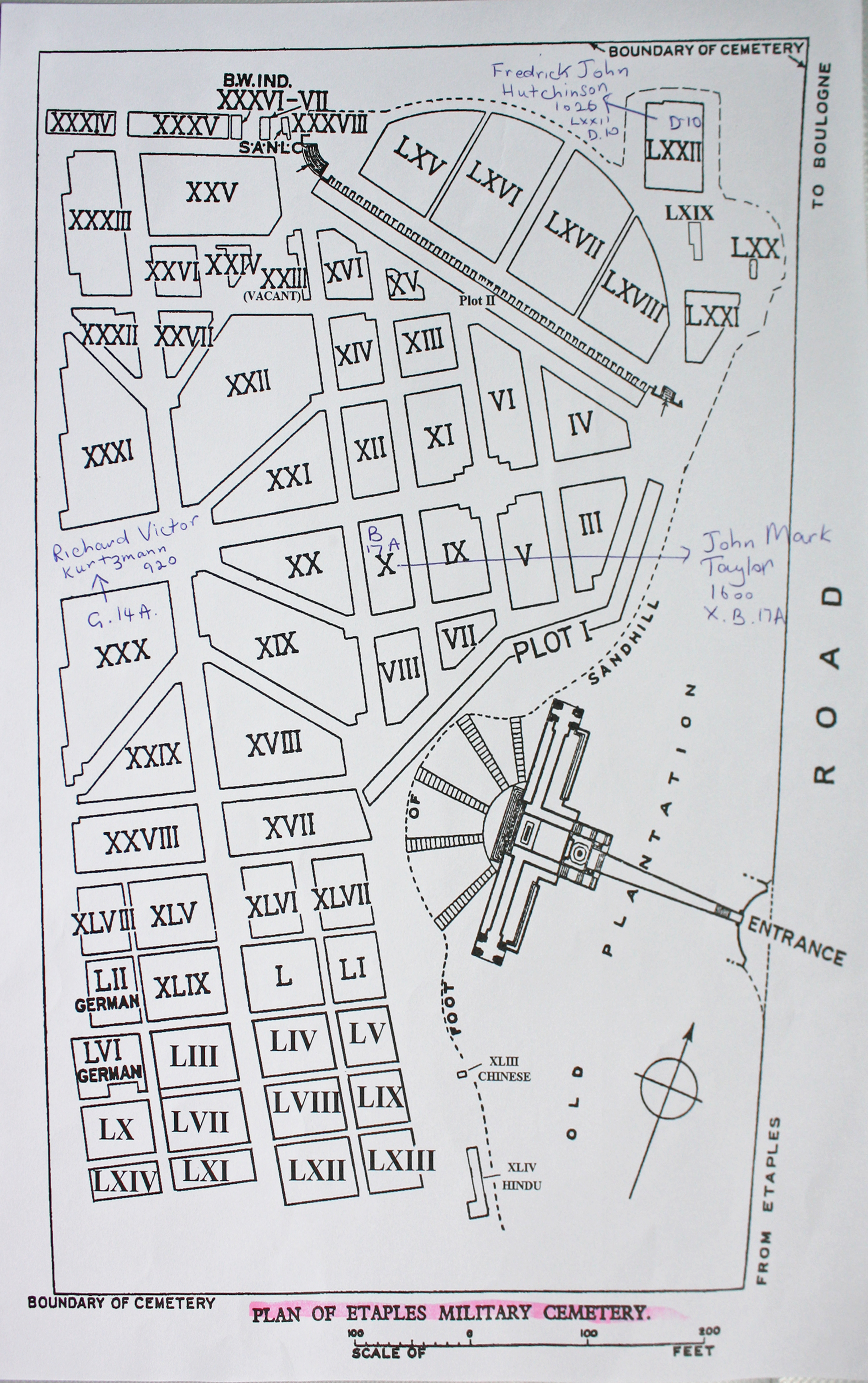
| ETAPLES MILITARY CEMETERY Annotated plan |  During the First World War, the area around Etaples was the scene of immense concentrations of Commonwealth reinforcement camps and hospitals. It was remote from attack, except from aircraft, and accessible by railway from both the northern or the southern battlefields. In 1917, 100,000 troops were camped among the sand dunes and the hospitals, which included eleven general, one stationary, four Red Cross hospitals and a convalescent depot, could deal with 22,000 wounded or sick. In September 1919, ten months after the Armistice, three hospitals and the Q.M.A.A.C. convalescent depot remained. Commonwealth War Graves site for ETAPLES MILITARY CEMETERYGo there on Google maps |
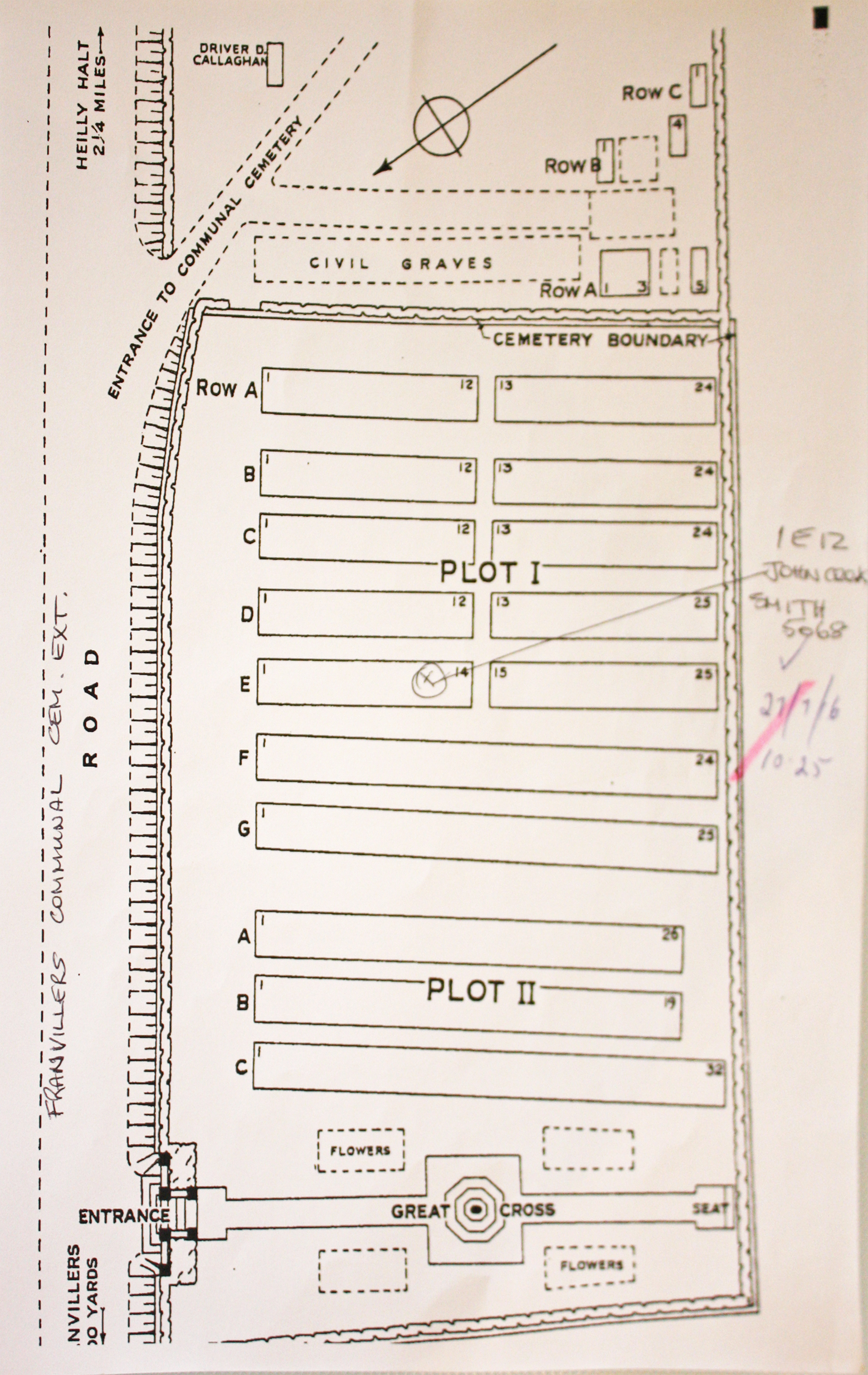
| FRANVILLERS COMMUNAL CEMETERY EXTENSION Annotated plan |  Franvillers is a village and district in the Department of the Somme, and stands on high ground above the River Ancre. The COMMUNAL CEMETERY at Franvillers was used at intervals from May 1916 to May 1918. It contains eight Commonwealth burials of the First World War. The adjoining EXTENSION was used from April to August 1918 by units and field ambulances engaged in the defence of Amiens. It contains 248 Commonwealth burials of the First World War and five German graves. Commonwealth War Graves site for FRANVILLERS COMMUNAL CEMETERY EXTENSIONGo there on Google maps |
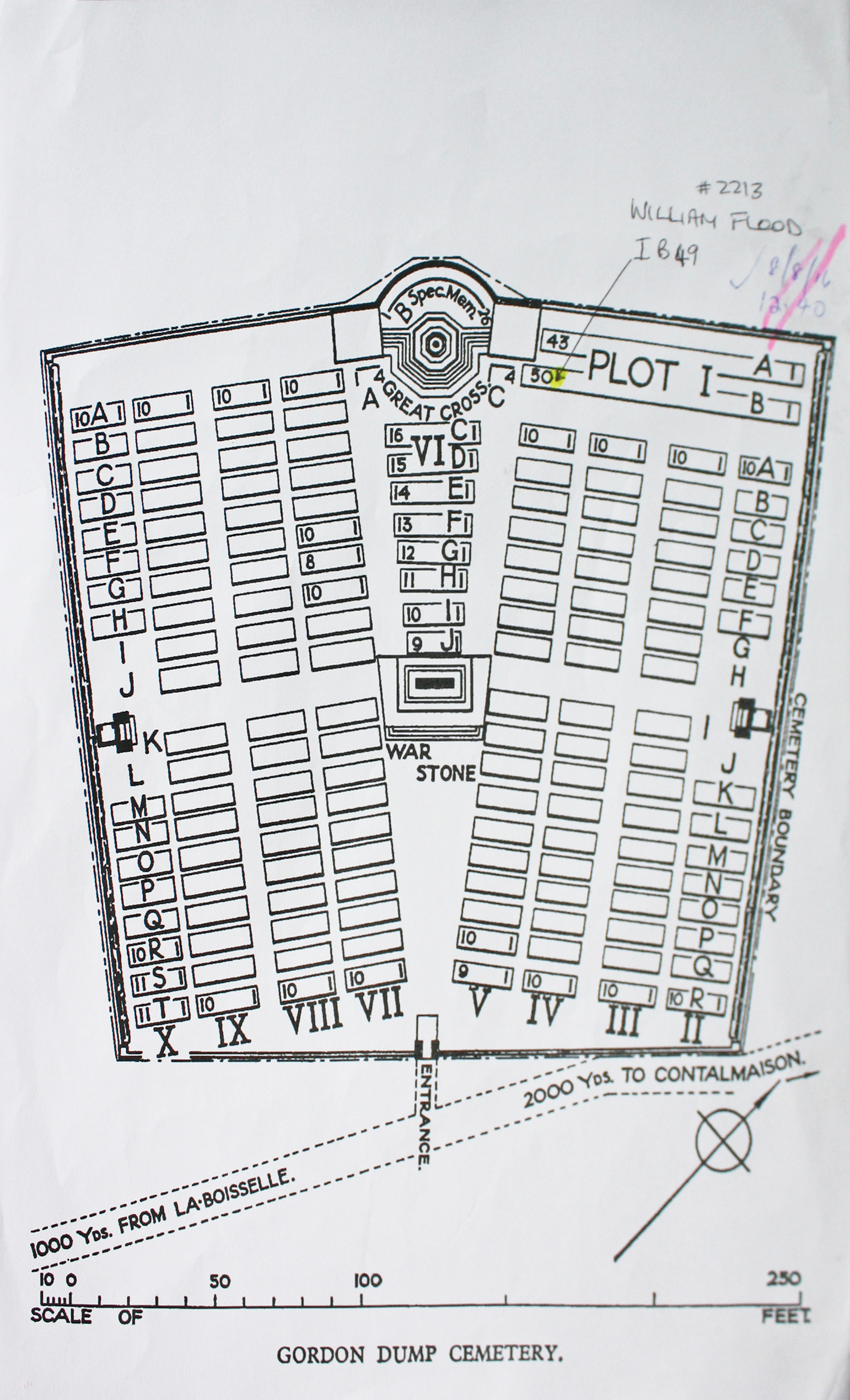
| GORDON DUMP CEMETERY, OVILLERS-LA BOISSELLE Annotated plan |  Plot I of the Cemetery was made by fighting units after 10 July 1916 and closed in September when it contained the graves of 95 soldiers, mainly Australian. It was called variously Gordon (or Gordon's) Dump Cemetery or Sausage Valley Cemetery, from the name given to the broad, shallow valley that runs down from it to Becourt. The remainder of the cemetery was formed after the Armistice when graves were brought in from the 1916 battlefields immediately surrounding the cemetery. Commonwealth War Graves site for GORDON DUMP CEMETERY, OVILLERS-LA BOISSELLEGo there on Google maps |
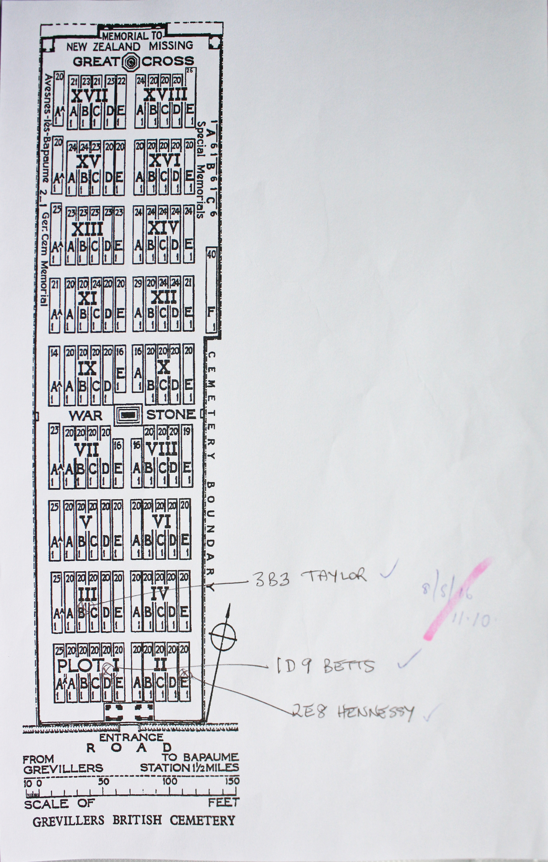
| GREVILLERS BRITISH CEMETERY Annotated plan | 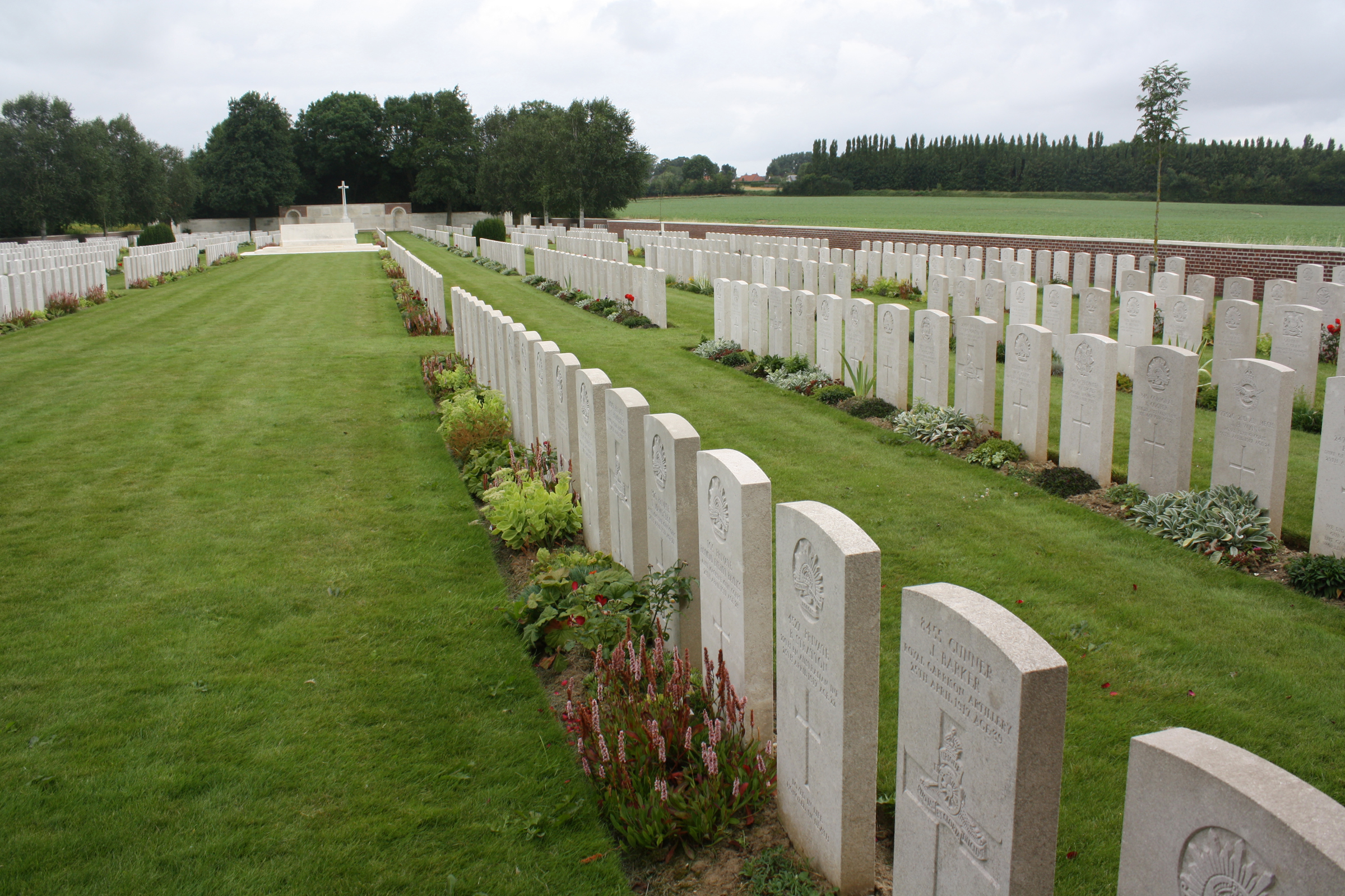 The village of Grevillers was occupied by Commonwealth troops on 14 March 1917 and in April and May, the 3rd, 29th and 3rd Australian Casualty Clearing Stations were posted nearby. They began the cemetery and continued to use it until March 1918, when Grevillers was lost to the German during their great advance. On the following 24 August, the New Zealand Division recaptured Grevillers and in September, the 34th, 49th and 56th Casualty Clearing Stations came to the village and used the cemetery again. After the Armistice, 200 graves were brought in from the battlefields to the south of the village, 40 from an adjoining cemetery made during the German occupation Commonwealth War Graves site for GREVILLERS BRITISH CEMETERYGo there on Google maps |
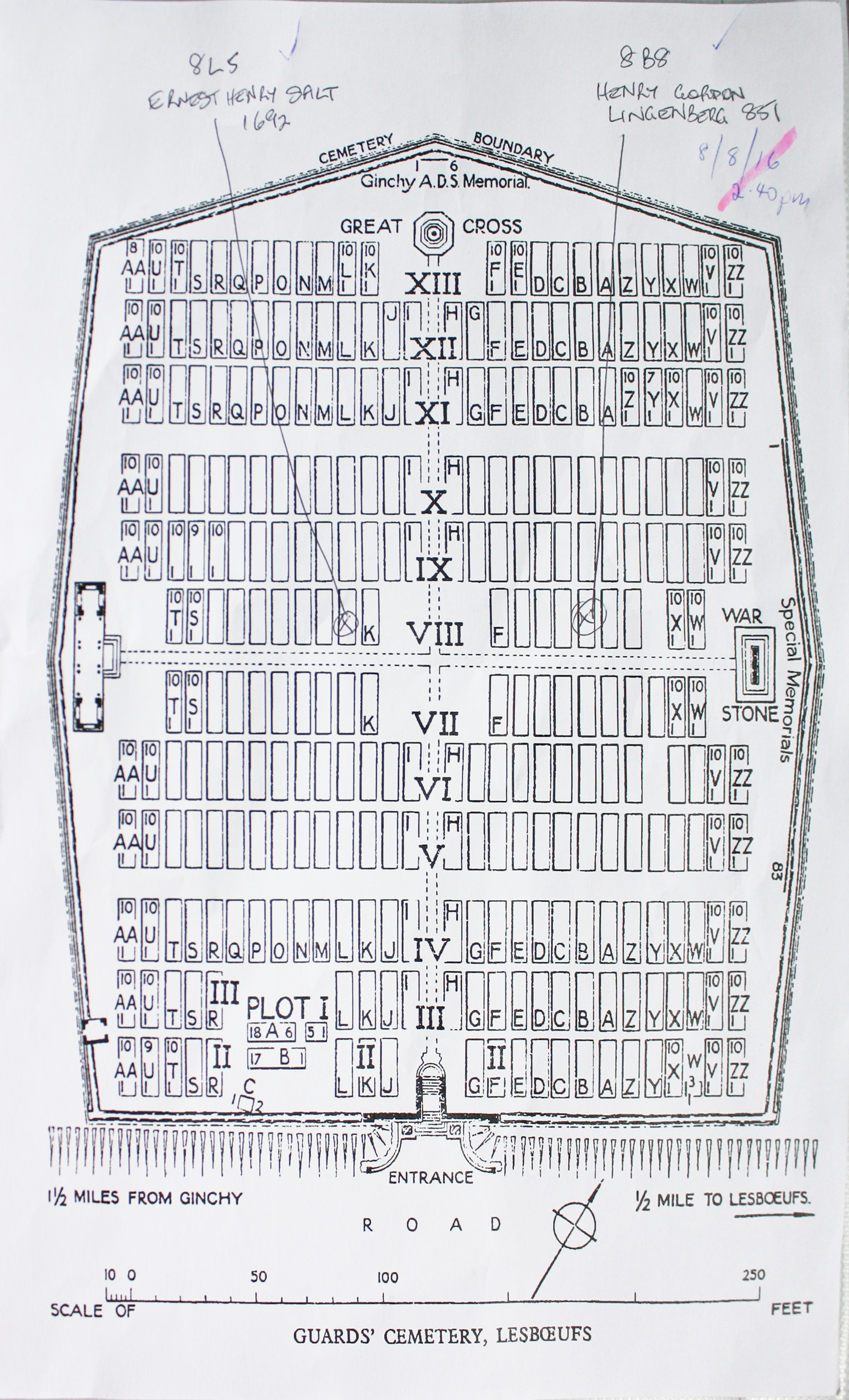
| GUARDS' CEMETERY, LESBOEUFS Annotated plan | 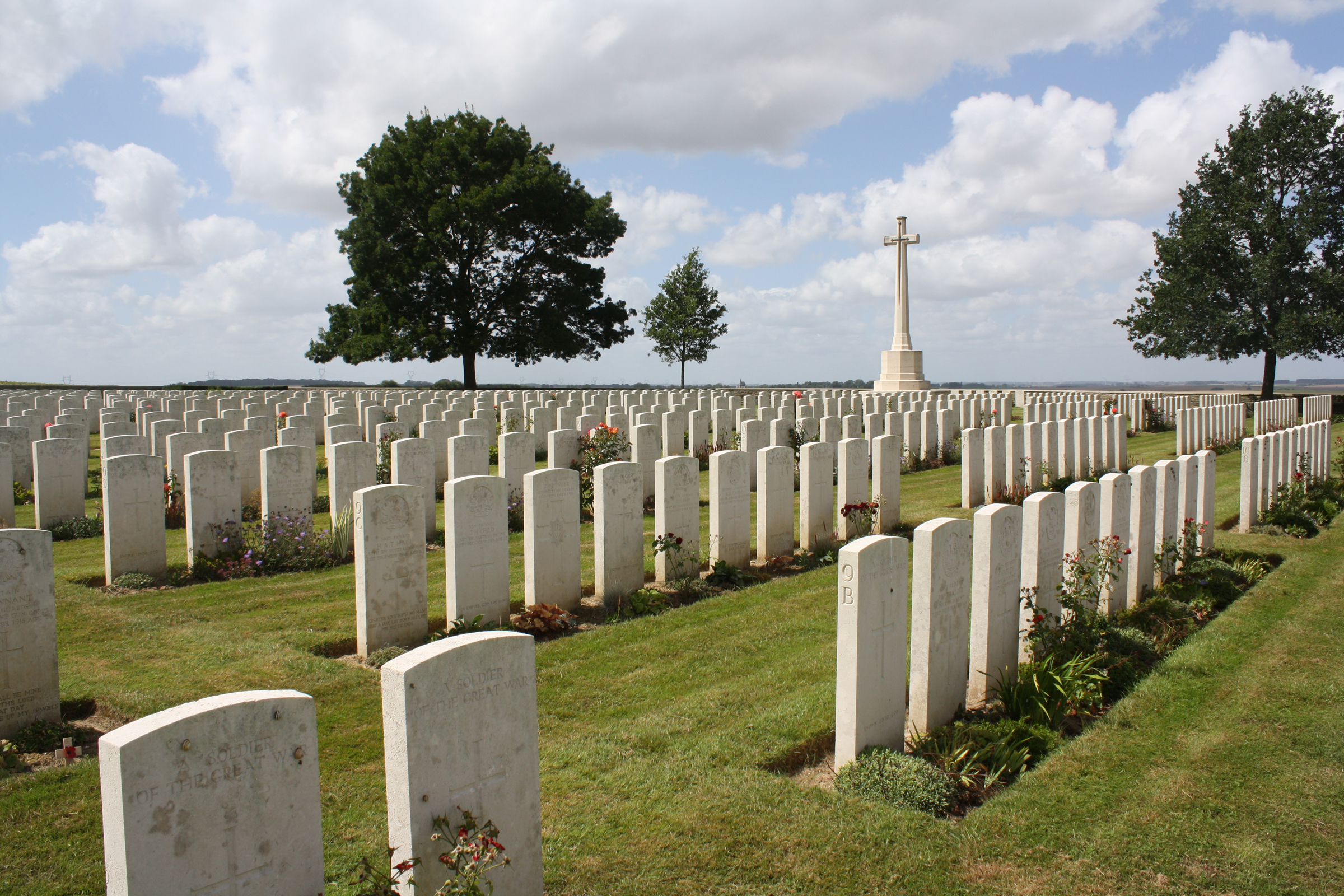 At the time of the Armistice, the cemetery consisted of only 40 graves (now Plot I), mainly those of officers and men of the 2nd Grenadier Guards who died on 25 September 1916, but it was very greatly increased when graves were brought in from the battlefields and small cemeteries round Lesboeufs. Commonwealth War Graves site for GUARDS' CEMETERY, LESBOEUFSGo there on Google maps |
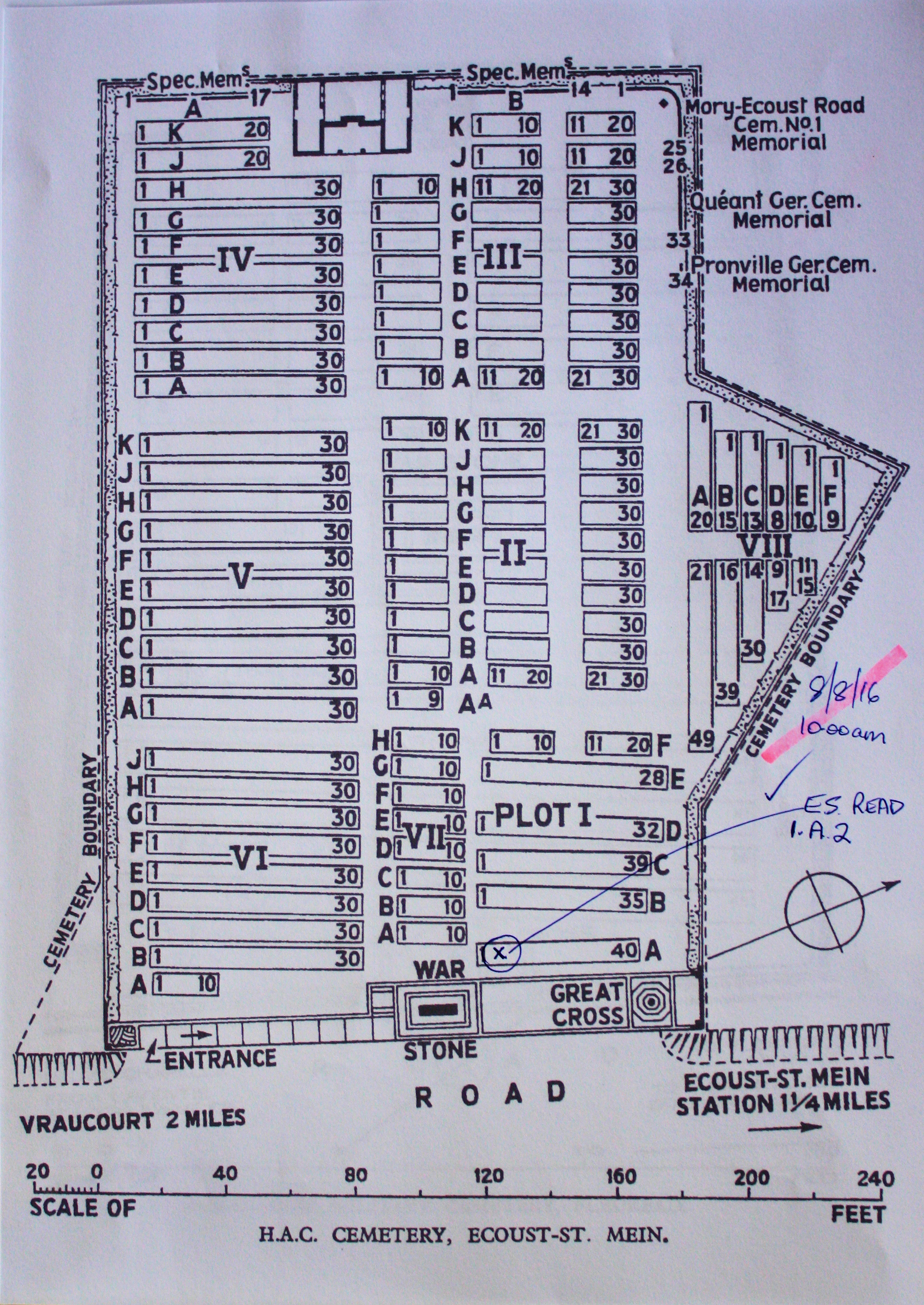
| H.A.C. CEMETERY, ECOUST-ST. MEIN Annotated plan | 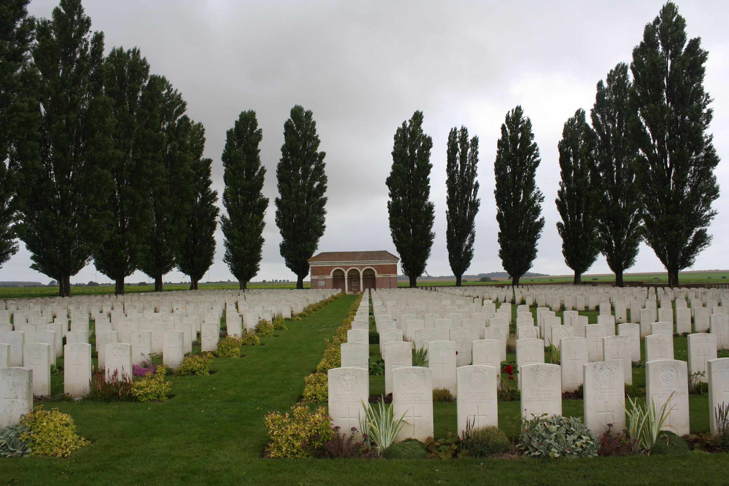 The enemy positions from Doignies to Henin-sur-Cojeul, including the village of Ecoust, were captured on 2 April 1917, by the 4th Australian and 7th Divisions. This cemetery was begun by the 7th Division after the battle, when 27 of the 2nd H.A.C., who fell (with one exception) on the 31st March or the 1st April, were buried in what is now Plot I, Row A. After the German counter-attack near Lagnicourt on the 15th April, twelve Australian gunners were buried in the same row. Rows B, C and part of D were made in August and September 1918, when the ground had been recaptured by the 3rd Division after five months enemy occupation. The 120 graves thus made were the original H.A.C. Cemetery; but after the Armistice graves were added from the battlefields of Bullecourt and Ecoust and from a number of smaller burial grounds Commonwealth War Graves site for H.A.C. CEMETERY, ECOUST-ST. MEINGo there on Google maps |
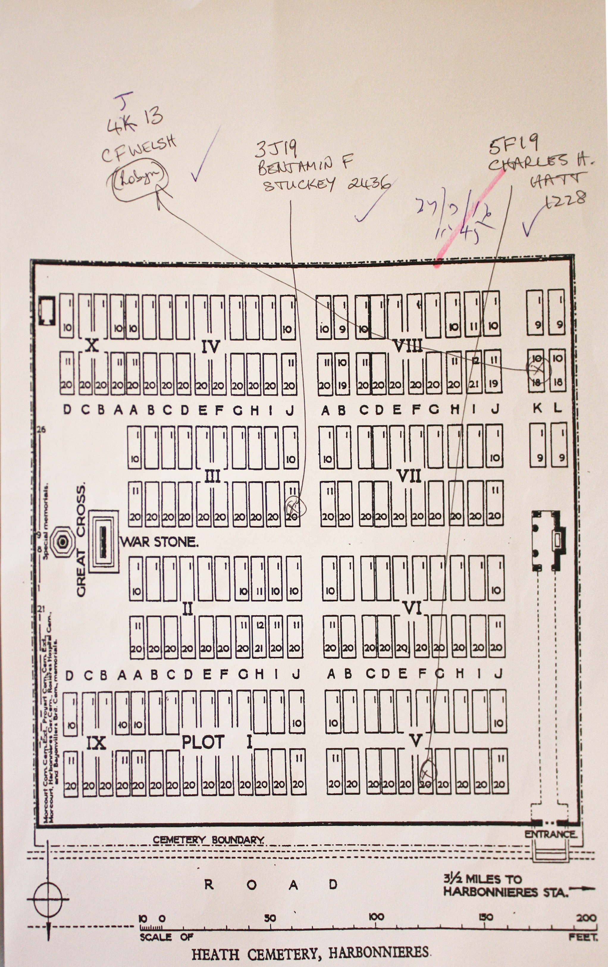
| HEATH CEMETERY, HARBONNIERES Annotated plan | 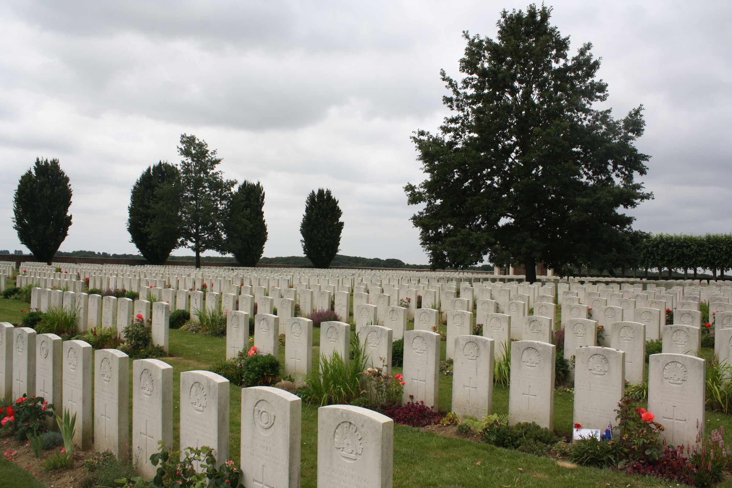 Heath Cemetery, so called from the wide expanse of open country on which it stands, was made after the Armistice, next to a French Military Cemetery, now removed. Graves were brought into it from the battlefields between Bray and Harbonnieres and from other burial grounds in the area Commonwealth War Graves site for HEATH CEMETERY, HARBONNIERESGo there on Google maps |
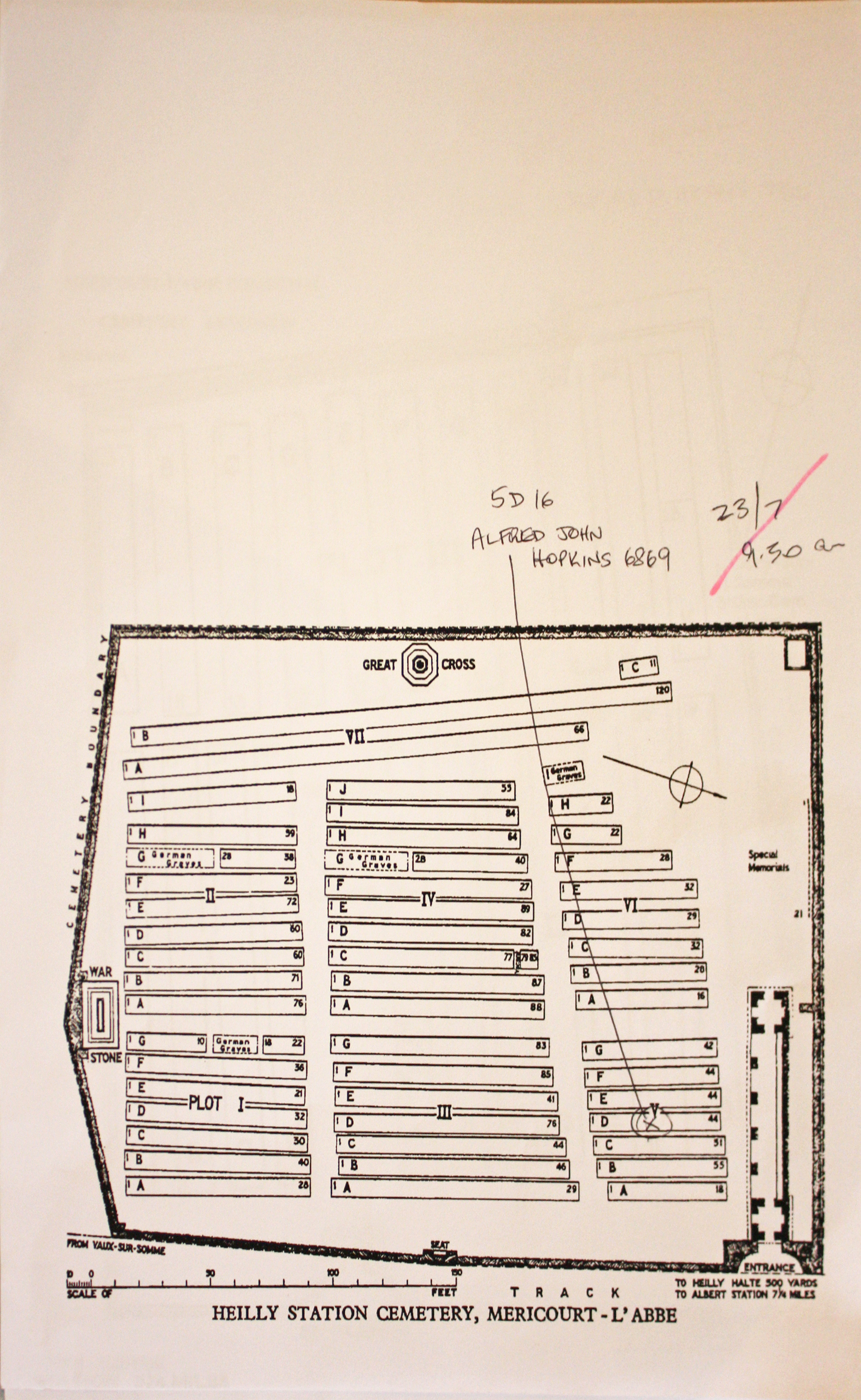
| HEILLY STATION CEMETERY, MERICOURT-L'ABBE Annotated plan | 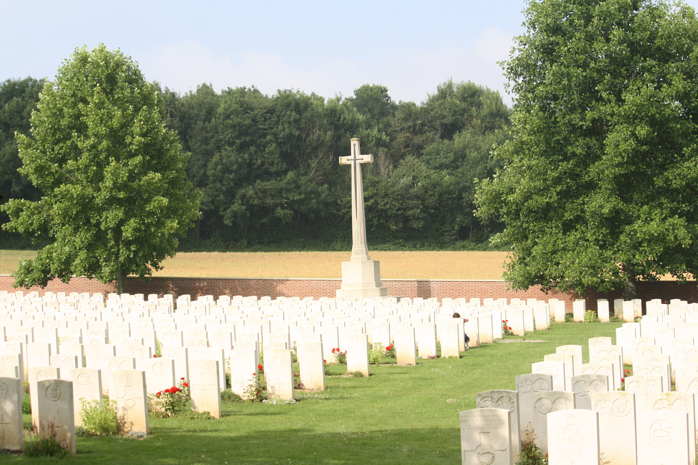 The 36th Casualty Clearing Station was at Heilly from April 1916. It was joined in May by the 38th, and in July by the 2/2nd London, but these hospitals had all moved on by early June 1917. The cemetery was begun in May 1916 and was used by the three medical units until April 1917. From March to May 1918, it was used by Australian units, and in the early autumn for further hospital burials when the 20th Casualty Clearing Station was there briefly in August and September 1918. The last burial was made in May 1919. Commonwealth War Graves site for HEILLY STATION CEMETERY, MERICOURT-L'ABBEGo there on Google maps |
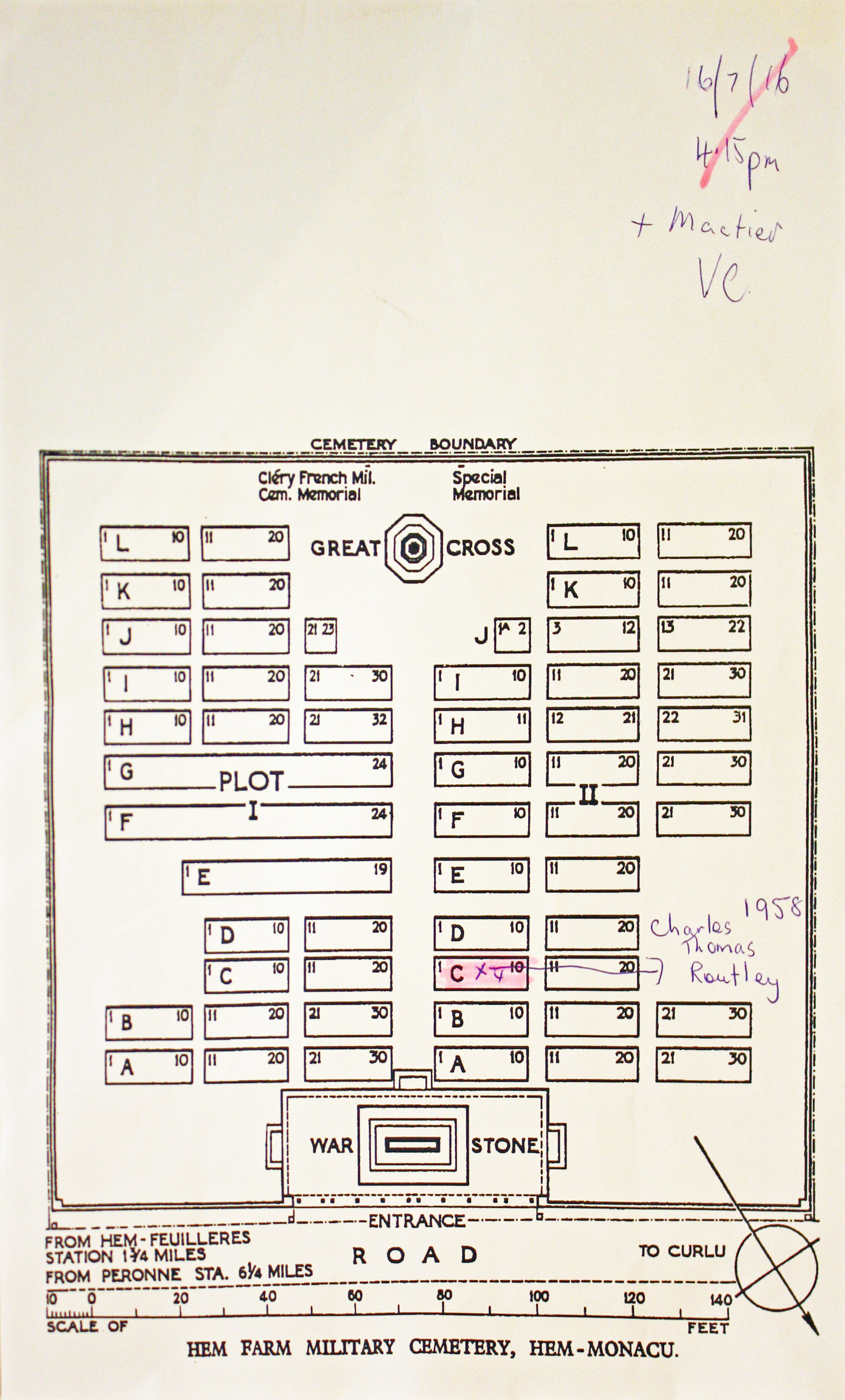
| HEM FARM MILITARY CEMETERY, HEM-MONACU Annotated plan | 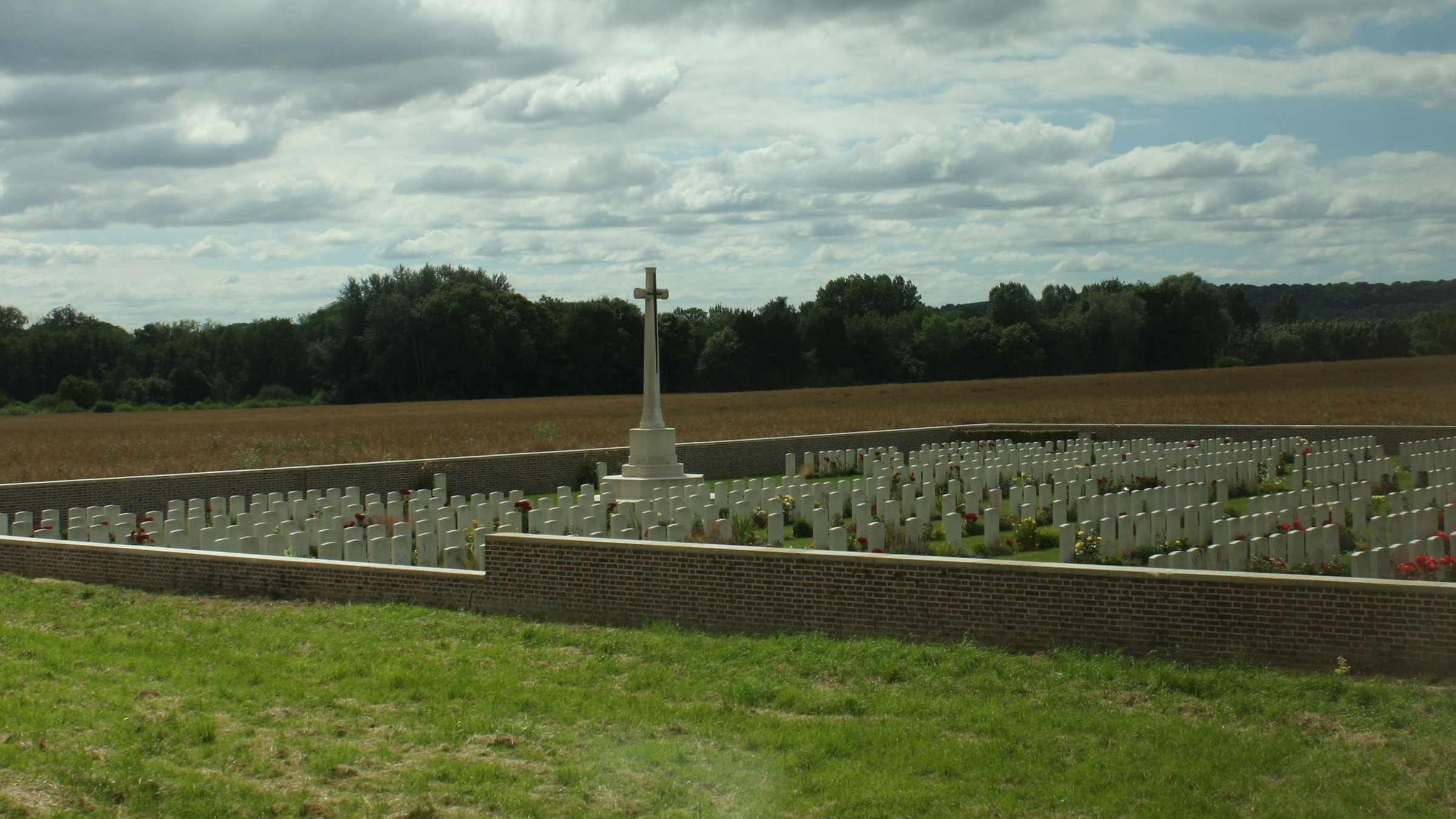 Hem Farm Military Cemetery was begun by British troops in January 1917, and used until the following March, and again in September 1918; and these graves now form part of Plot I, Rows E, F and G. It was greatly enlarged after the Armistice by the addition of graves from the battlefields on both sides of the Somme. Commonwealth War Graves site for HEM FARM MILITARY CEMETERY, HEM-MONACUGo there on Google maps |
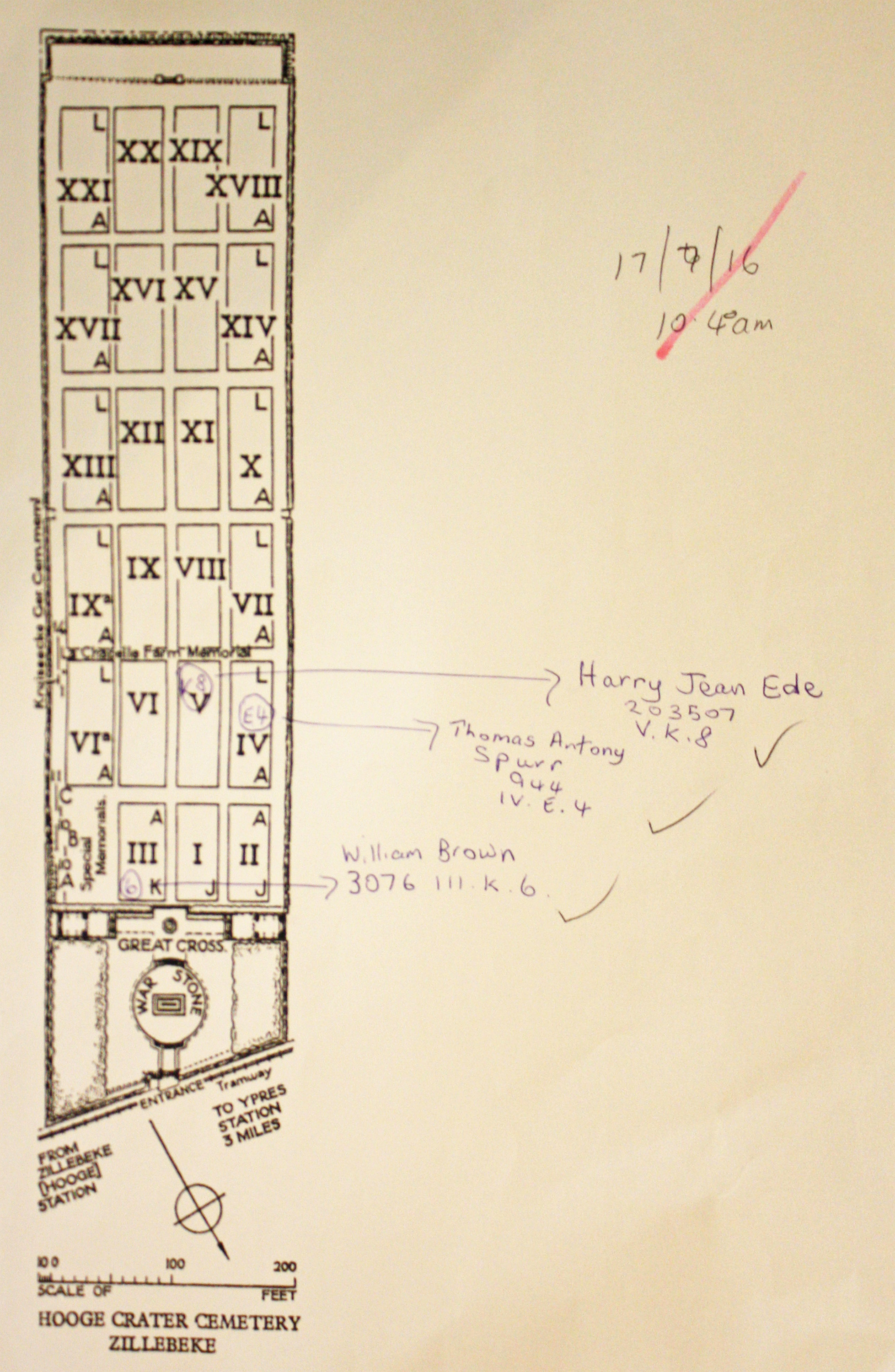
| HOOGE CRATER CEMETERY Annotated plan | 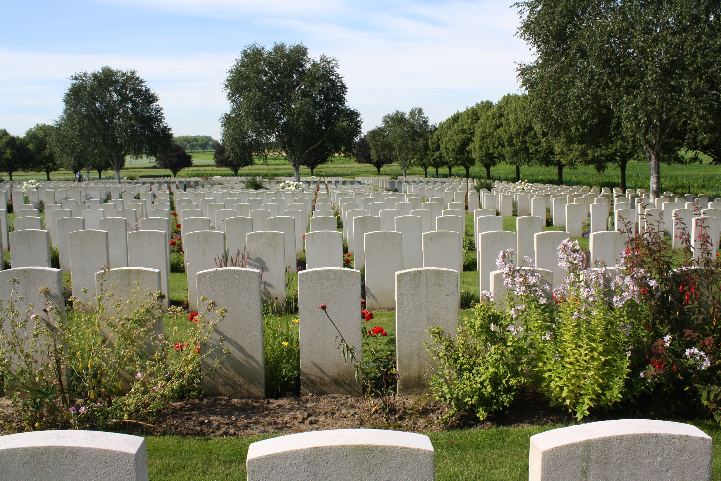 Hooge Crater Cemetery was begun by the 7th Division Burial Officer early in October 1917. It contained originally 76 graves, in Rows A to D of Plot I, but was greatly increased after the Armistice when graves were brought in from the battlefields of Zillebeke, Zantvoorde and Gheluvelt. Commonwealth War Graves site for HOOGE CRATER CEMETERYGo there on Google maps |
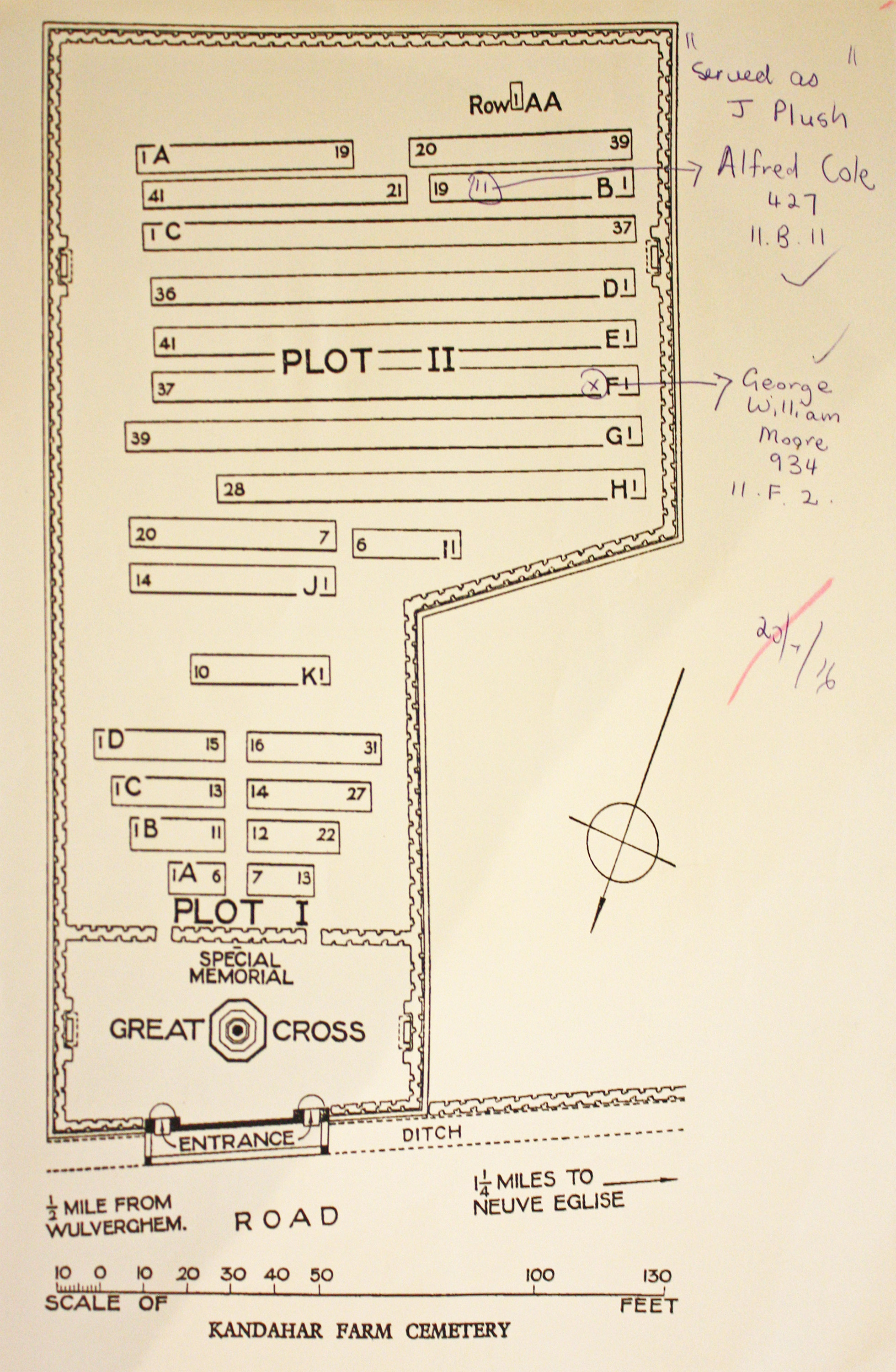
| KANDAHAR FARM CEMETERY Annotated plan | 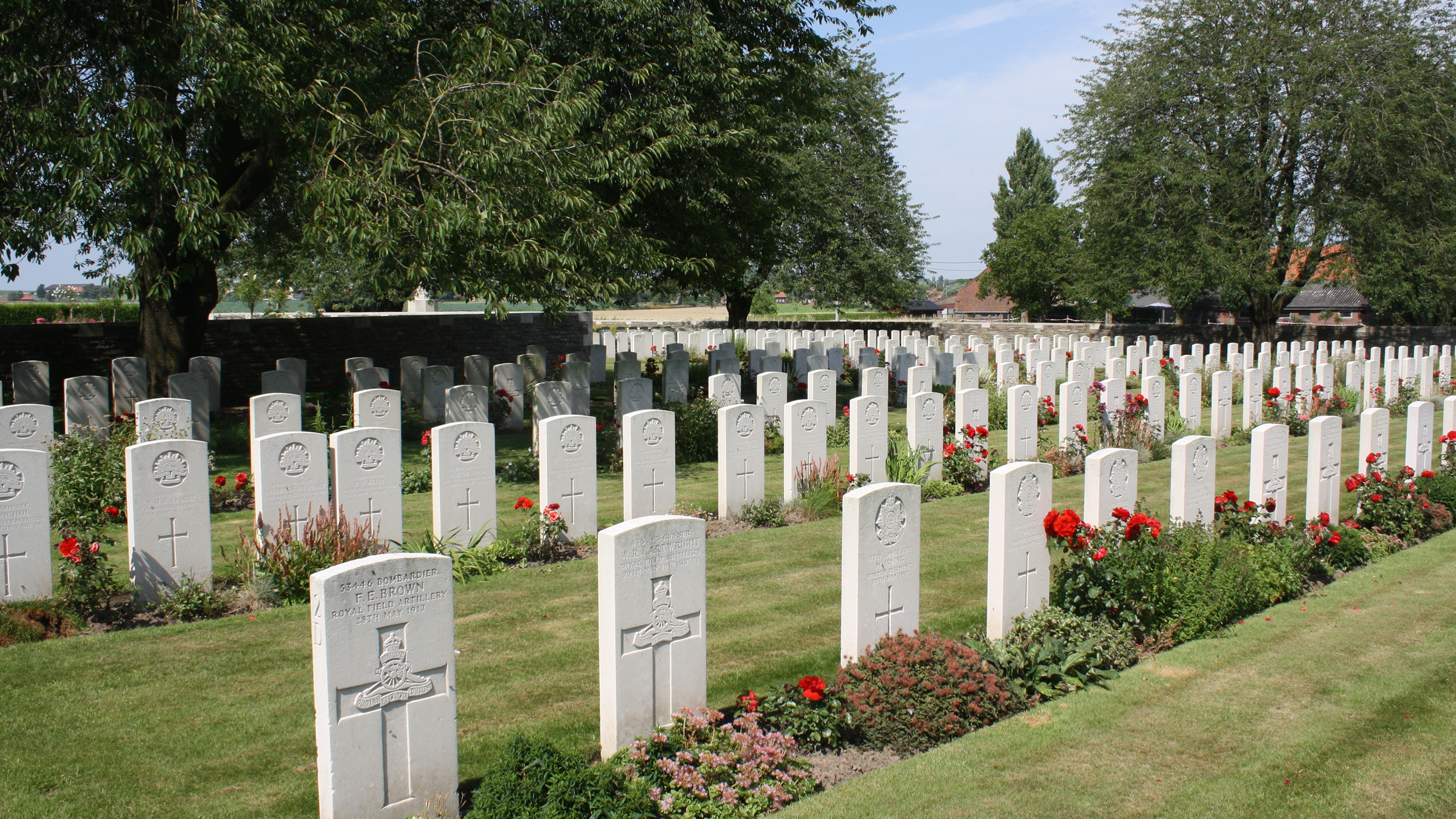 The cemetery was used by Commonwealth divisions holding this sector from November 1914 to April 1918, when it fell into German hands with the capture of Wulverghem and Neuve-Eglise (now Nieuwkerke). The two villages were recovered in early September and the cemetery was used again. Commonwealth War Graves site for KANDAHAR FARM CEMETERYGo there on Google maps |
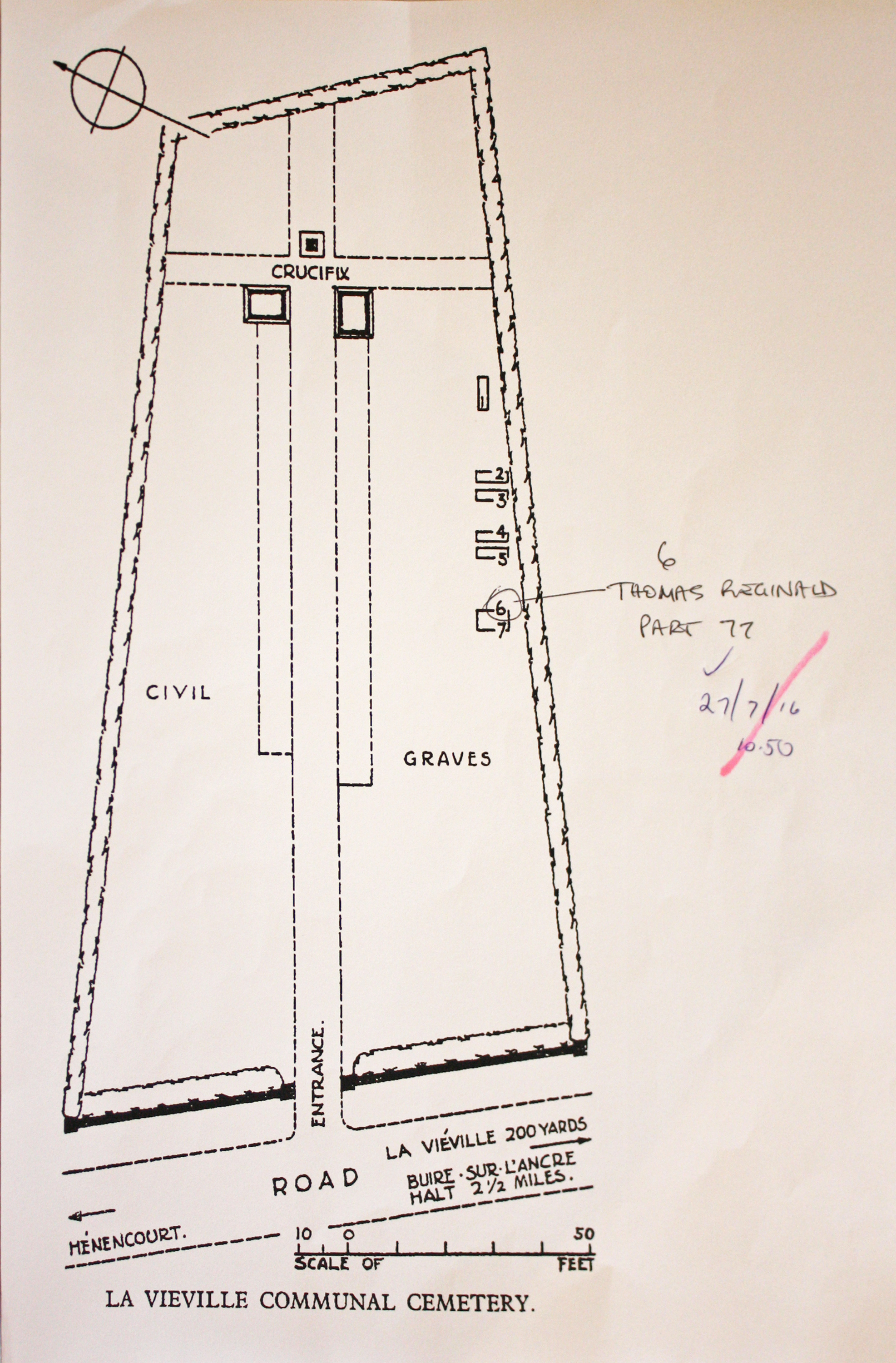
| LAVIEVILLE COMMUNAL CEMETERY Annotated plan | 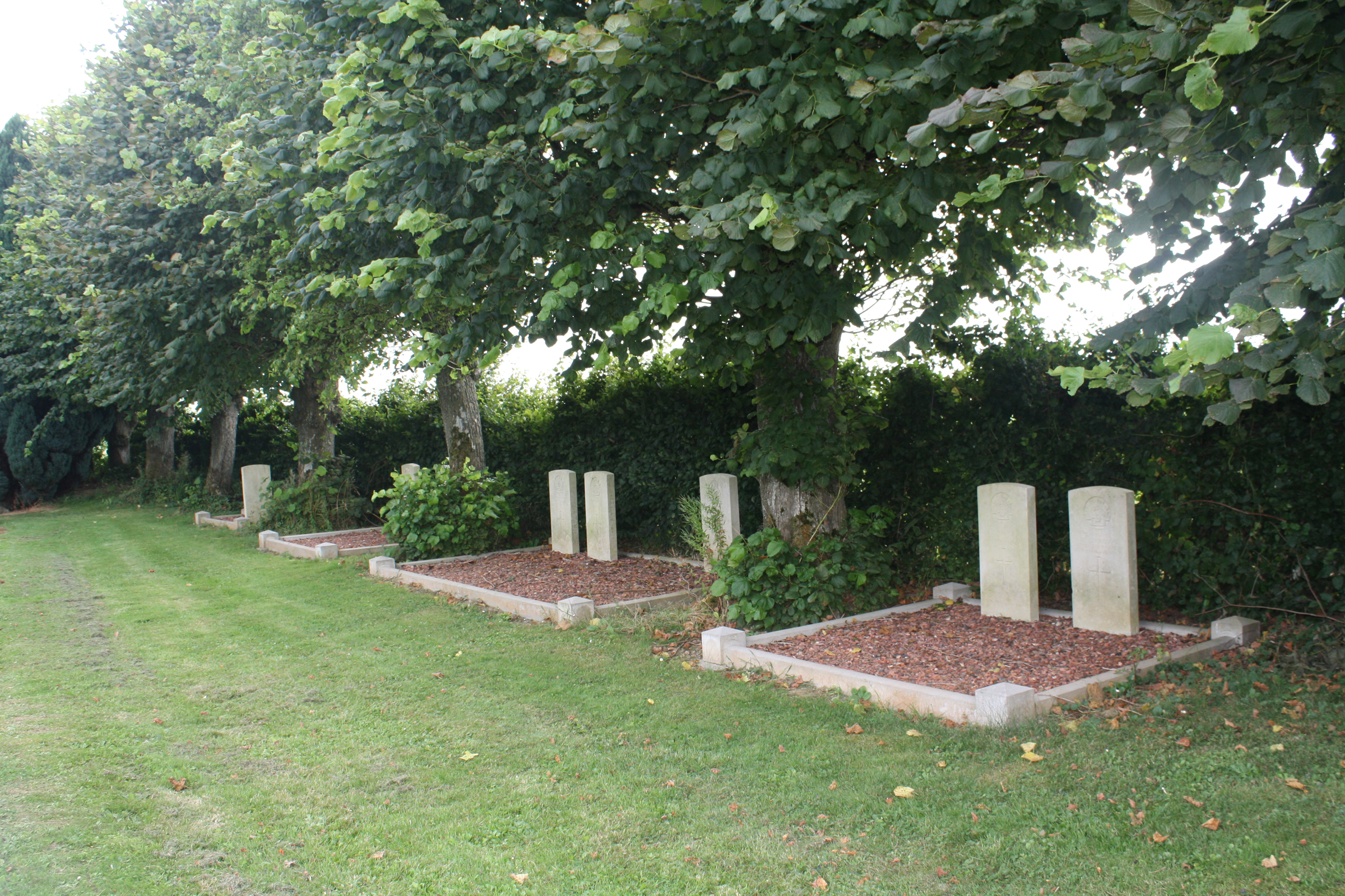 Lavieville Communal Cemetery contains seven Commonwealth burials of the First World War and one from the Second World War. Commonwealth War Graves site for LAVIEVILLE COMMUNAL CEMETERYGo there on Google maps |
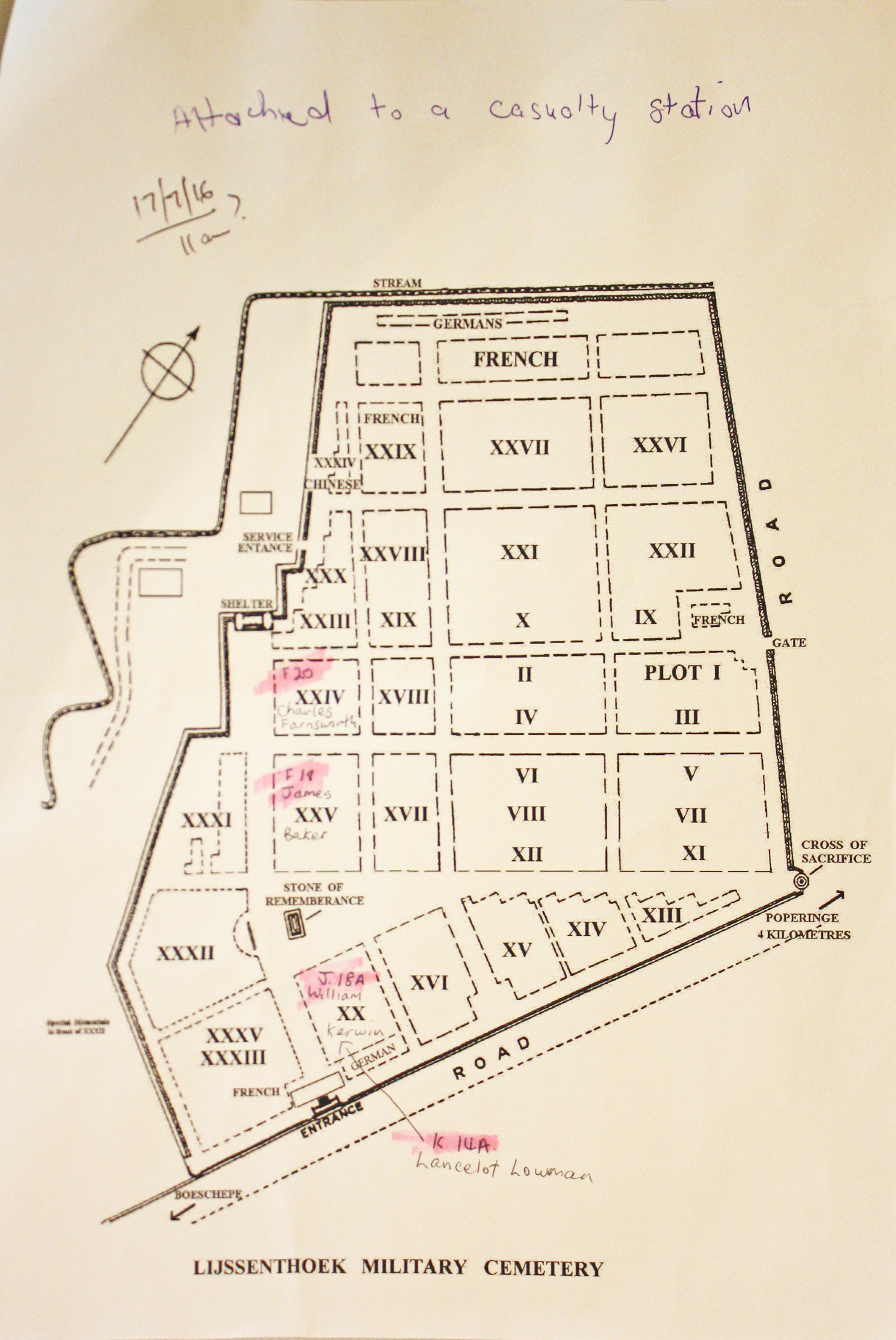
| LIJSSENTHOEK MILITARY CEMETERY Annotated plan | 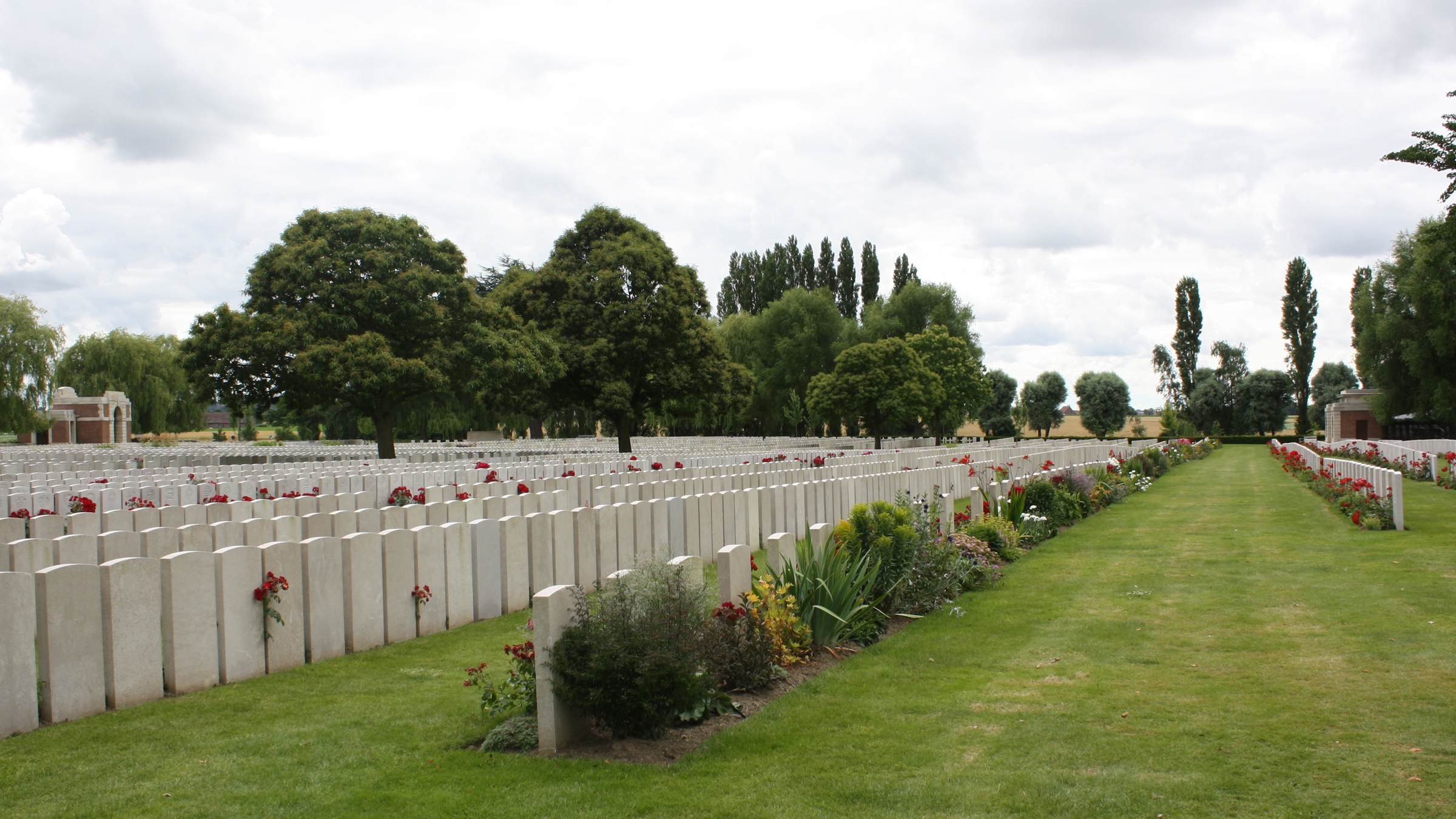 During the First World War, the village of Lijssenthoek was situated on the main communication line between the Allied military bases in the rear and the Ypres battlefields. Close to the Front, but out of the extreme range of most German field artillery, it became a natural place to establish casualty clearing stations. The cemetery was first used by the French 15th Hopital D'Evacuation and in June 1915, it began to be used by casualty clearing stations of the Commonwealth forces. From April to August 1918, the casualty clearing stations fell back before the German advance and field ambulances (including a French ambulance) took their places. Commonwealth War Graves site for LIJSSENTHOEK MILITARY CEMETERYGo there on Google maps |
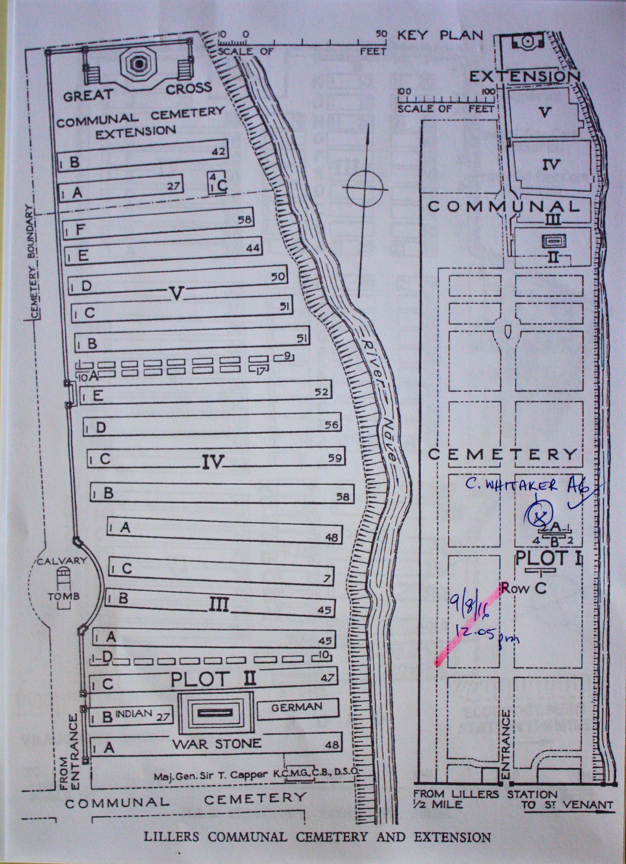
| LILLERS COMMUNAL CEMETERY EXTENSION Annotated plan | 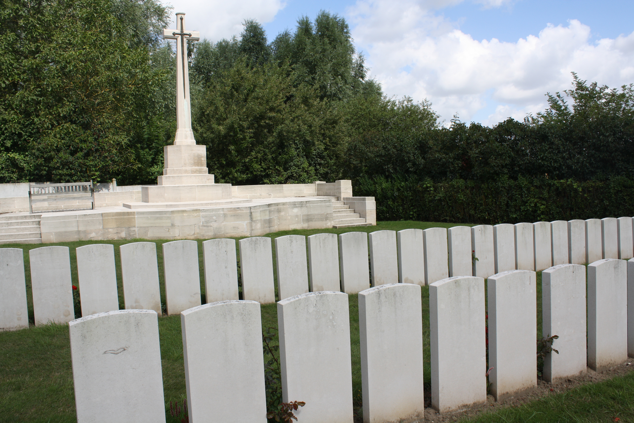 Lillers was used for billets and headquarter offices from the autumn of 1914 to April 1918. At that time it was a hospital centre with the 6th, 9th, 18th, 32nd, 49th and 58th Casualty Clearing Stations in the town at one time or another. These units buried their dead on the right of the central path of the communal cemetery, working back from Plot I. In April 1918, the Germans advanced as far as Robecq; Lillers came under shell-fire, and the units holding this front continued to bury beyond the cemetery boundary, in the extension. Commonwealth War Graves site for LILLERS COMMUNAL CEMETERY EXTENSIONGo there on Google maps |
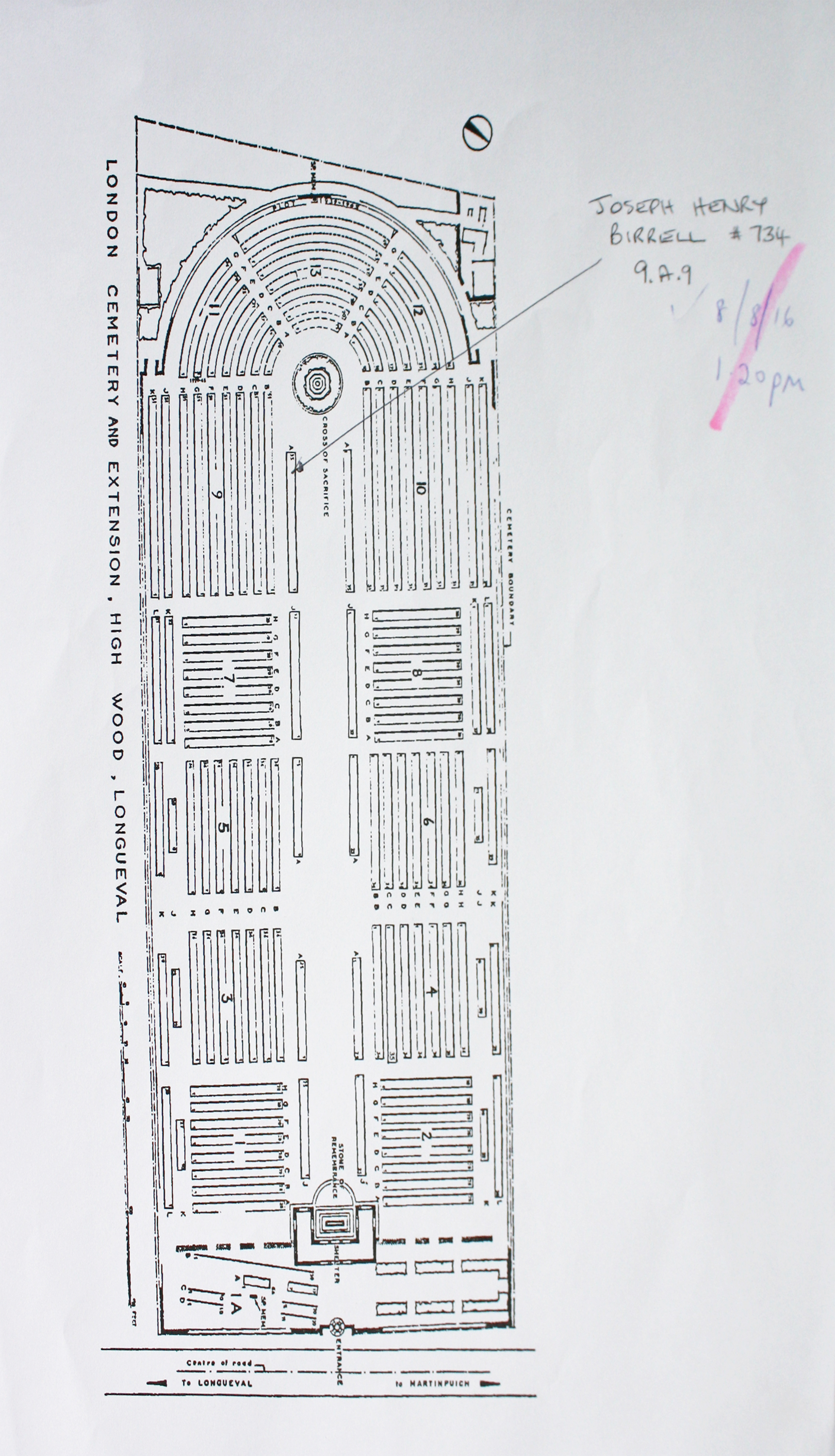
| LONDON CEMETERY AND EXTENSION, LONGUEVAL Annotated plan | 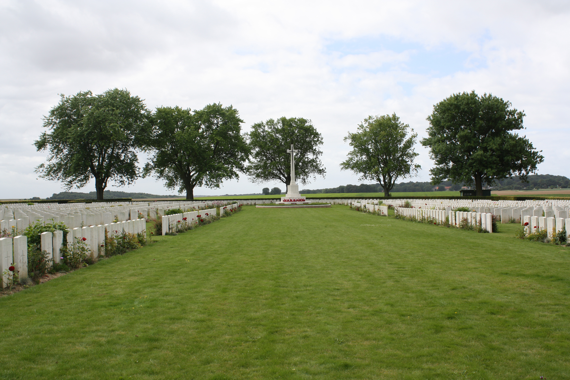 The original London Cemetery at High Wood was begun when 47 men of the 47th Division were buried in a large shell hole on 18 and 21 September 1916. Other burials were added later, mainly of officers and men of the 47th Division who died on 15 September 1916, and at the Armistice the cemetery contained 101 graves. The cemetery was then greatly enlarged when remains were brought in from the surrounding battlefields, but the original battlefield cemetery is preserved intact within the larger cemetery, now known as the London Cemetery and Extension. The cemetery, one of five in the immediate vicinity of Longueval which together contain more than 15,000 graves, is the third largest cemetery on the Somme with 3,873 First World War burials, 3,114 of them unidentified. Commonwealth War Graves site for LONDON CEMETERY AND EXTENSION, LONGUEVALGo there on Google maps |
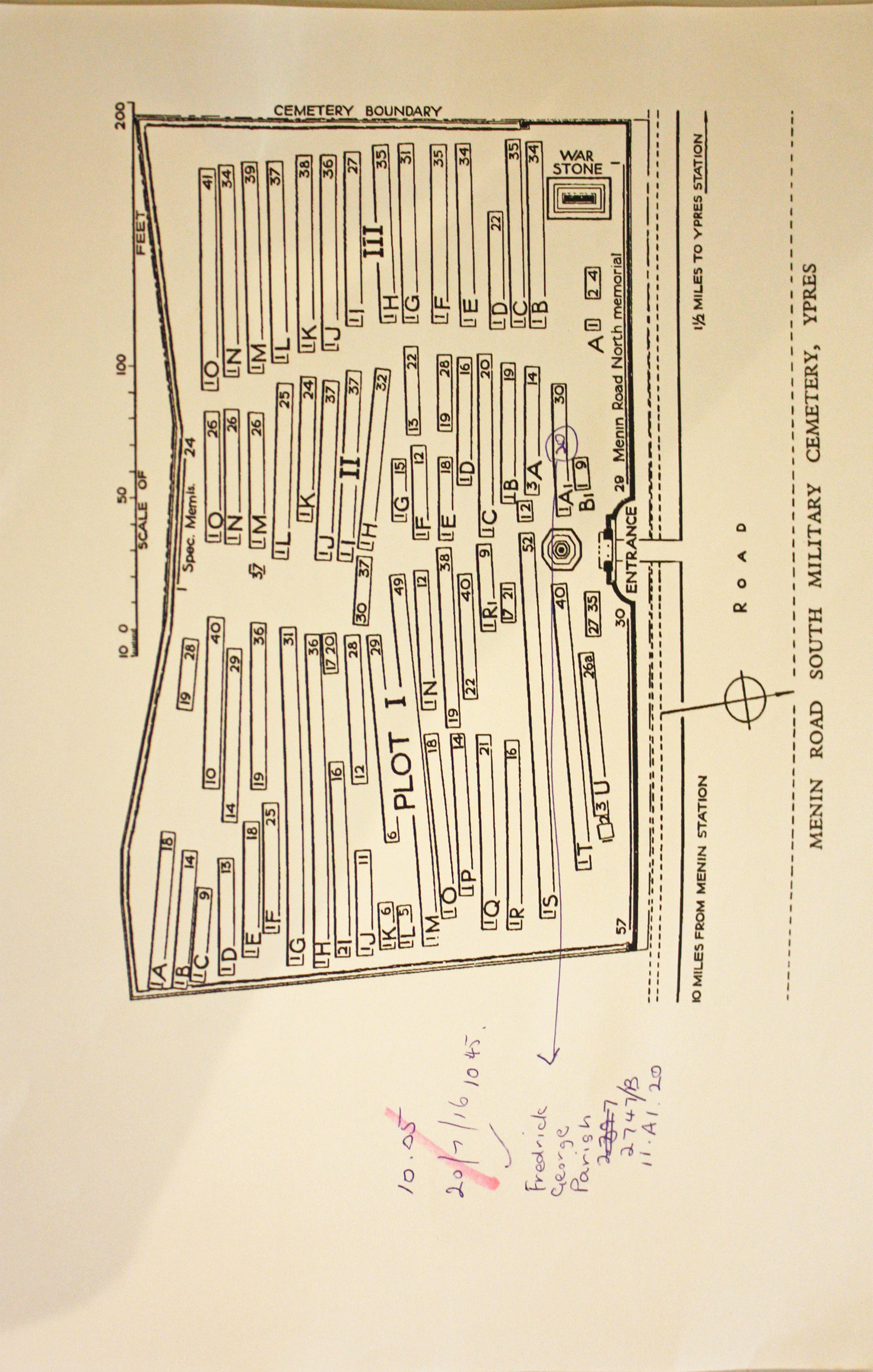
| MENIN ROAD SOUTH MILITARY CEMETERY Annotated plan | 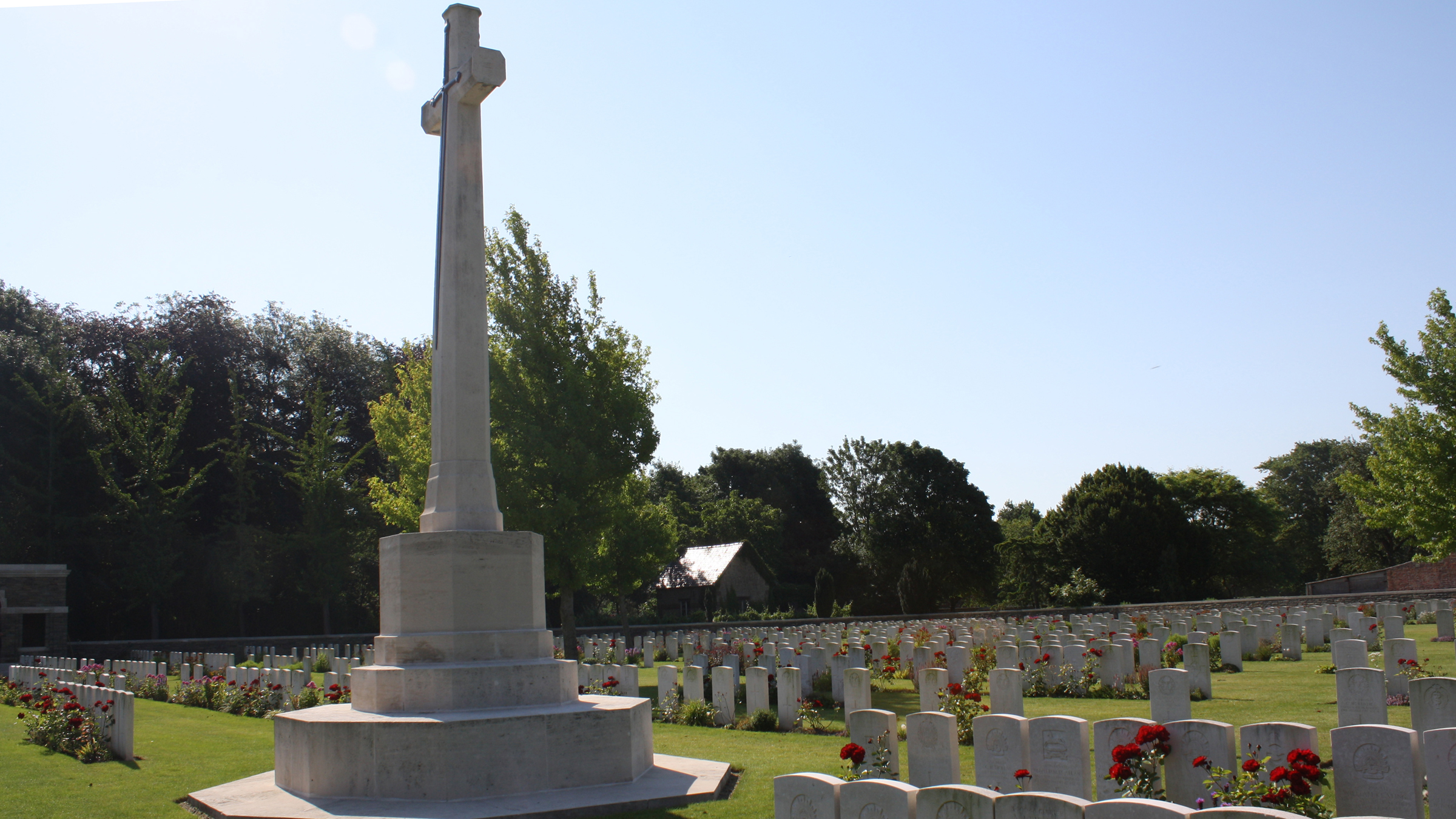 The Menin Road ran east and a little south from Ypres (now Ieper) to a front line which varied only a few kilometres during the greater part of the war. The position of this cemetery was always within the Allied lines. It was first used in January 1916 by the 8th South Staffords and the 9th East Surreys, and it continued to be used by units and Field Ambulances until the summer of 1918. The cemetery was increased after the Armistice when graves were brought in from isolated positions on the battlefields to the east . Commonwealth War Graves site for MENIN ROAD SOUTH MILITARY CEMETERYGo there on Google maps |
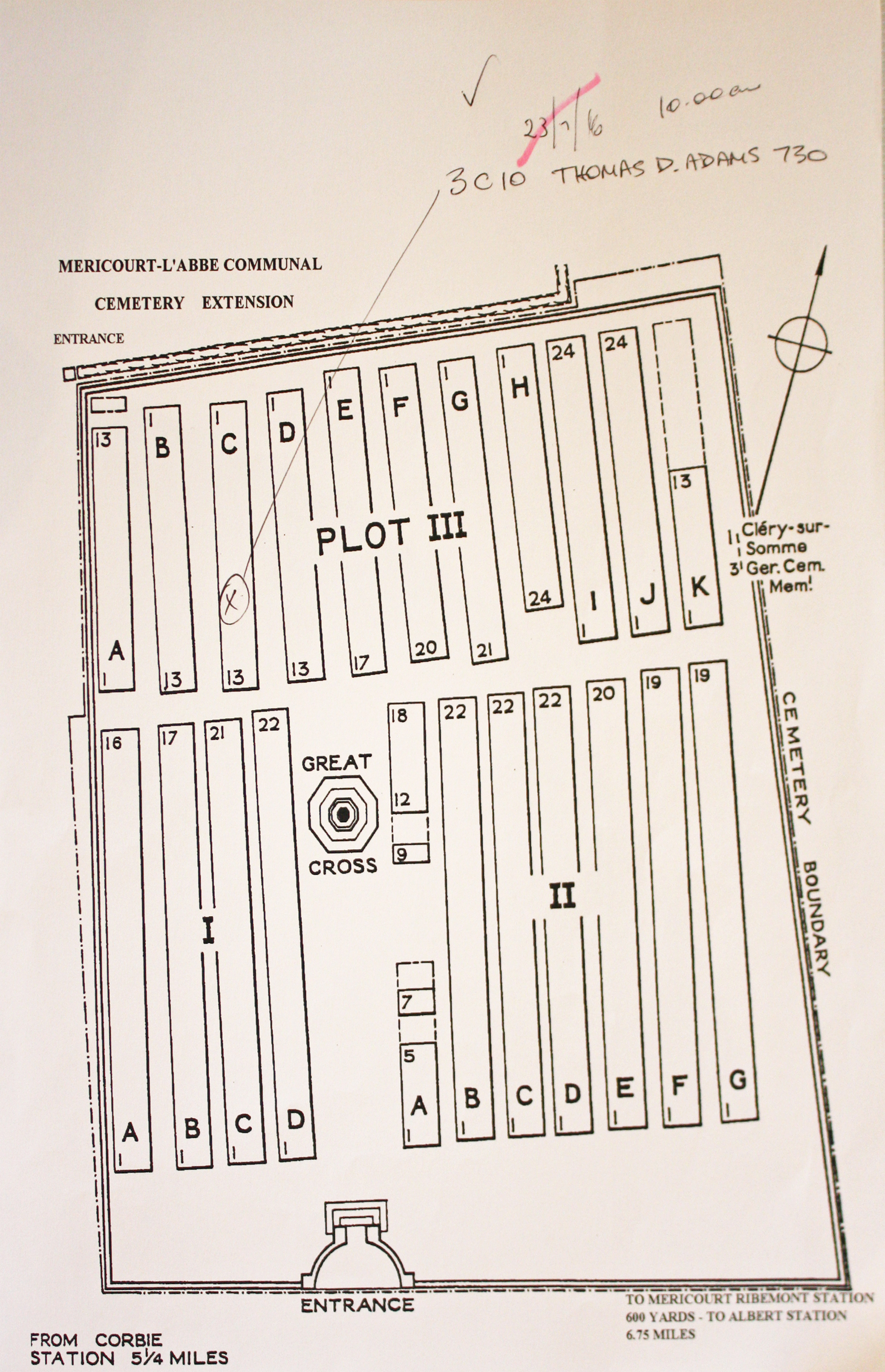
| MERICOURT-L'ABBE COMMUNAL CEMETERY EXTENSION Annotated plan | 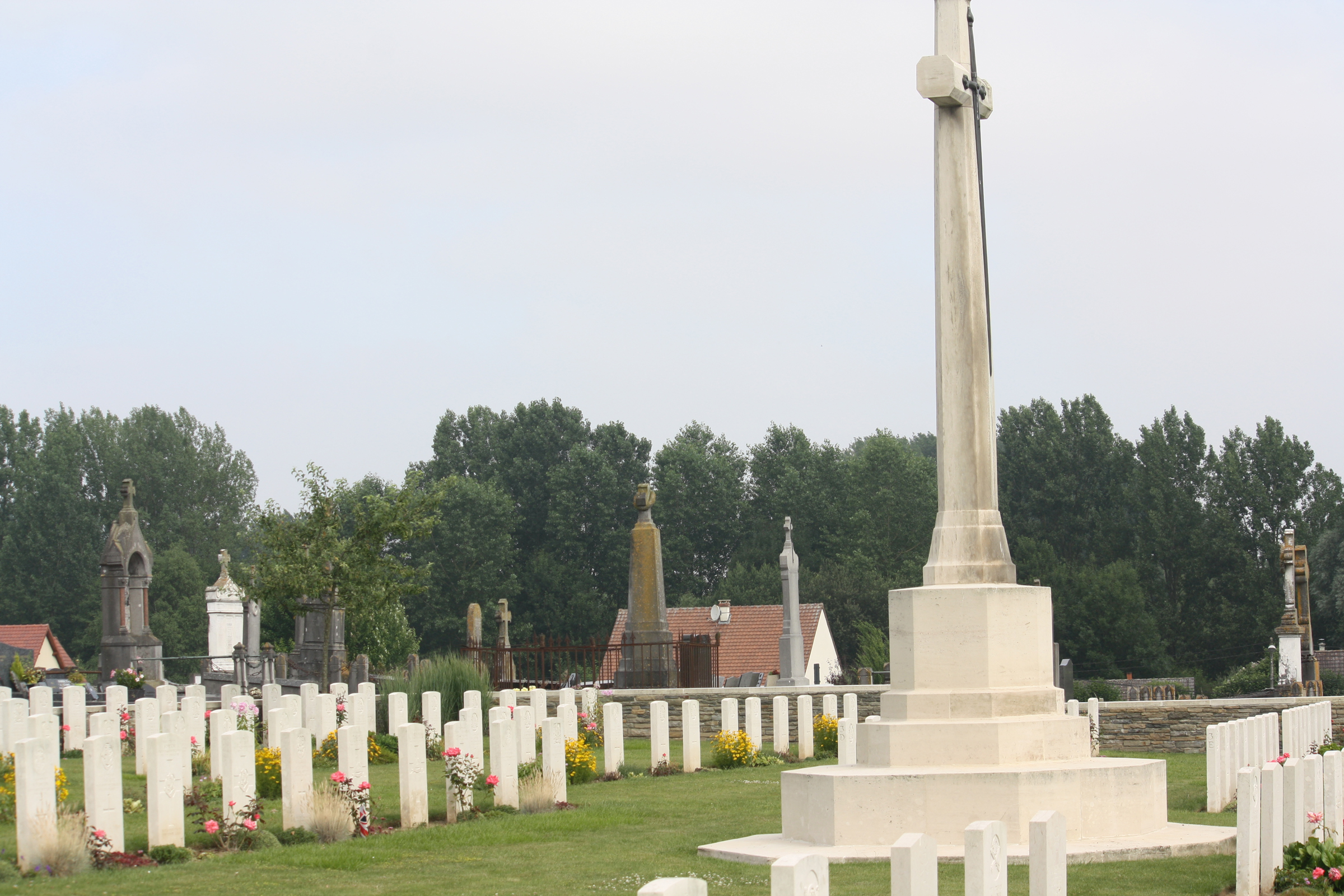 In the early summer of 1915, Commonwealth forces relieved French troops on this part of the front and Mericourt-Ribemont Station became a railhead. The extension to the communal cemetery at Mericourt was begun in August 1915 and was used chiefly by field ambulances until July 1916, when it was closed until the German advance of March 1918. From March 1918 to August 1918 it was used by units engaged in the defence of Amiens. After the Armistice, Rows G and K of Plot III were added when isolated graves (only one of which could be identified) were brought in from the battlefields north-east of Mericourt. Commonwealth War Graves site for MERICOURT-L'ABBE COMMUNAL CEMETERY EXTENSIONGo there on Google maps |
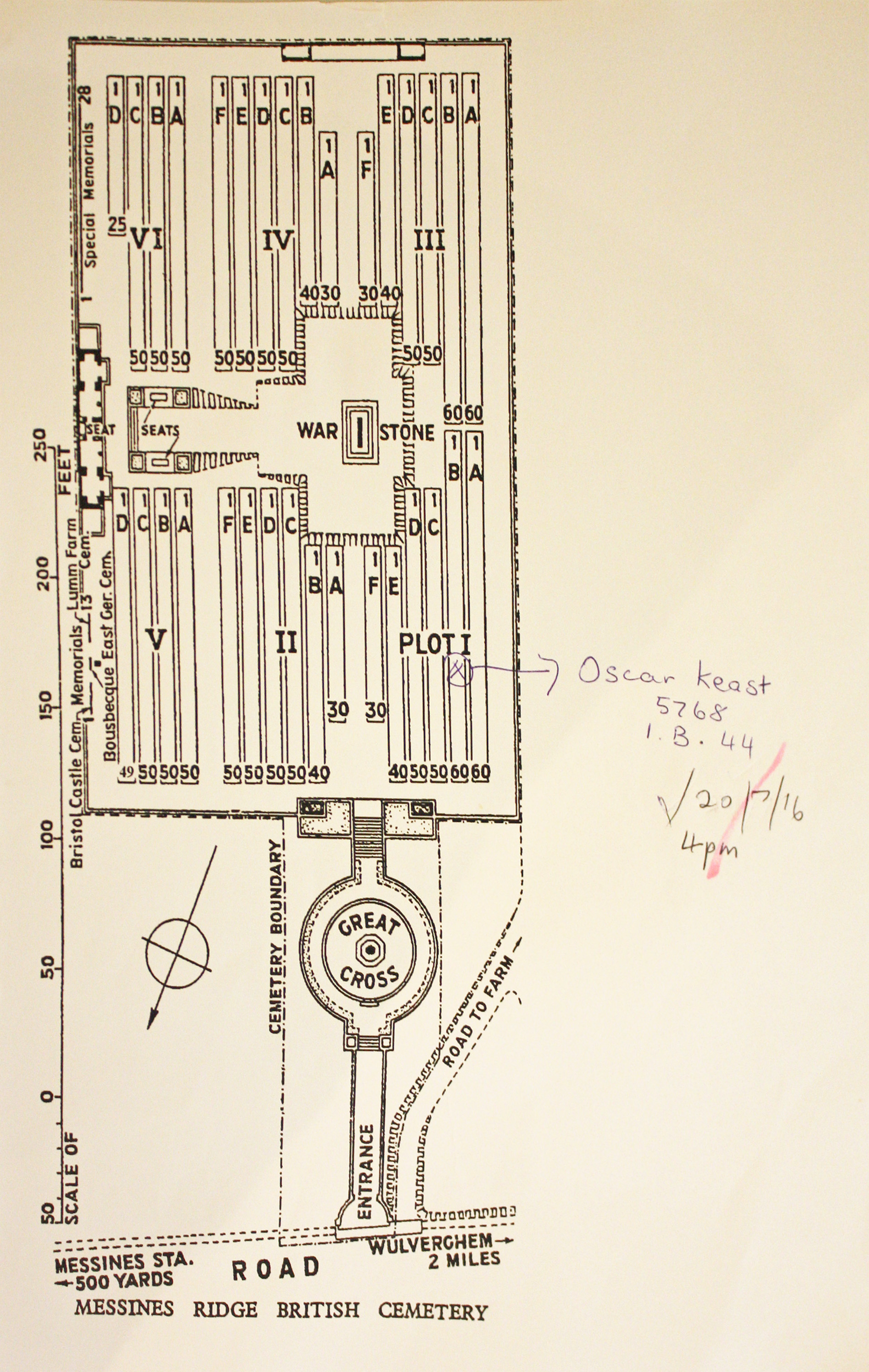
| MESSINES RIDGE BRITISH CEMETERY Annotated plan | 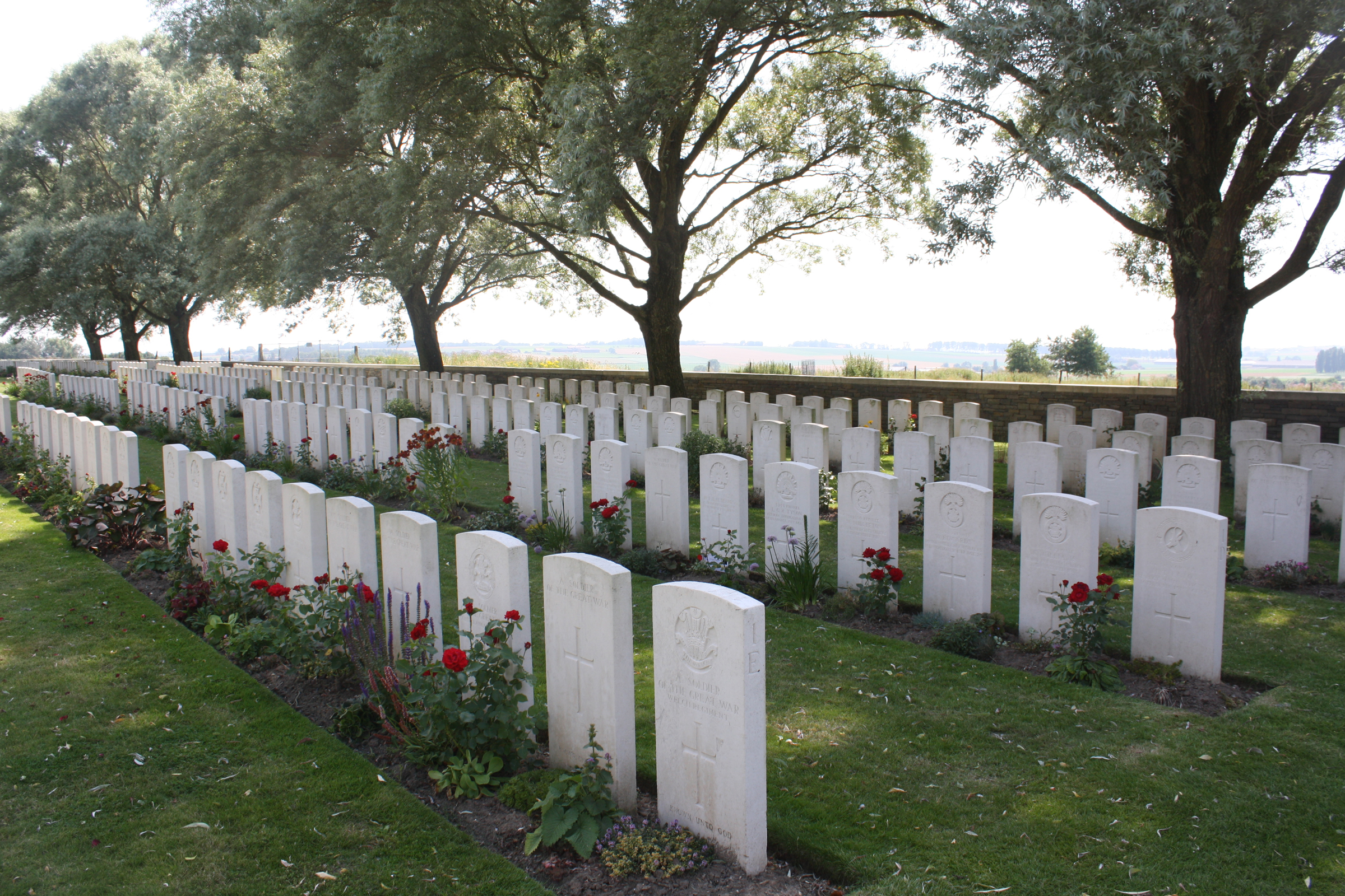 MESSINES RIDGE BRITISH CEMETERY, which stands on ground that belonged to the 'Institution Royale' (the Cross of Sacrifice is on the site of the Institution's windmill), was made after the Armistice when graves were brought in from the battlefield around Messines and from the following small burial grounds Commonwealth War Graves site for MESSINES RIDGE BRITISH CEMETERYGo there on Google maps |
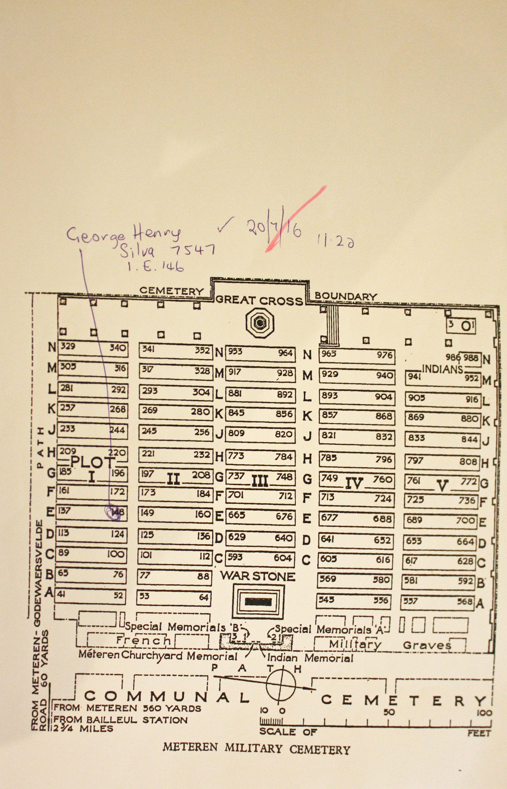
| METEREN MILITARY CEMETERY Annotated plan | 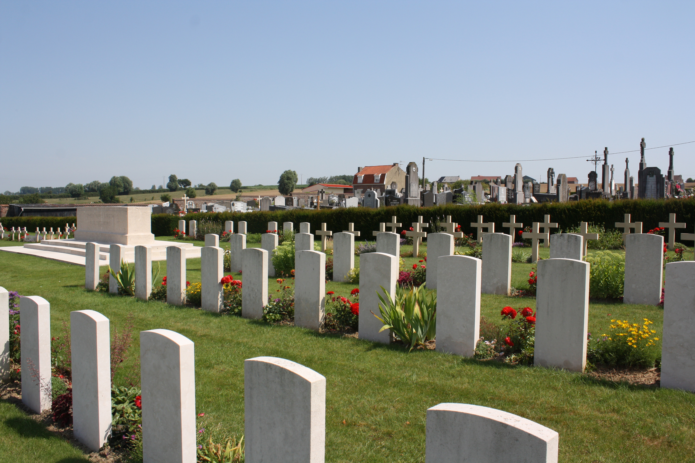 The cemetery was made in 1919 by the French authorities, who brought in Commonwealth, French and German graves from the neighbouring battlefields and from other cemeteries. Commonwealth War Graves site for METEREN MILITARY CEMETERYGo there on Google maps |
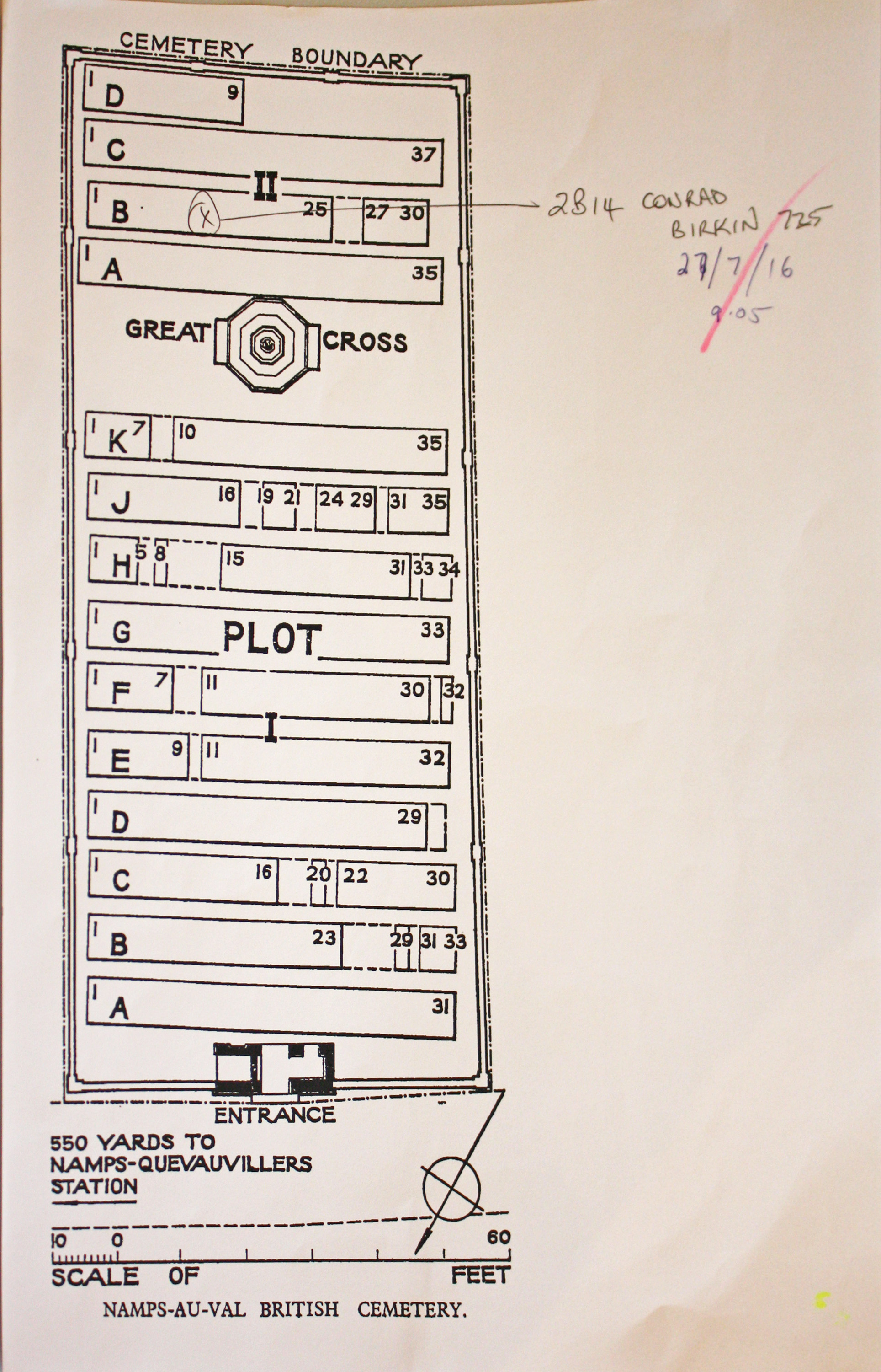
| NAMPS-AU-VAL BRITISH CEMETERY Annotated plan | 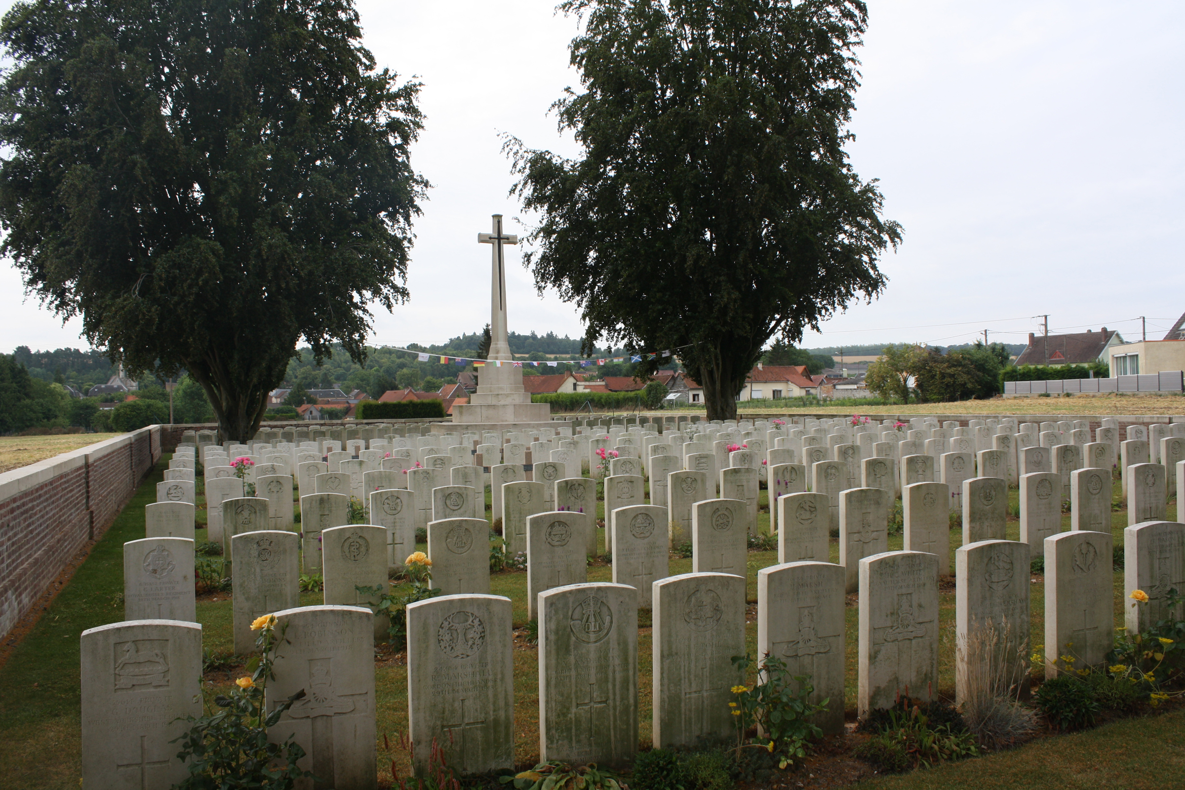 At the end of March 1918, when the German offensive in Picardy began, the 41st, 50th and 55th Casualty Clearing Stations came to Namps-au-Val, remaining until the middle of April. Almost all the burials in the cemetery were carried out by them, but nine graves in Plot II, Row D, were brought after the Armistice from CONTY FRENCH MILITARY CEMETERY. Commonwealth War Graves site for NAMPS-AU-VAL BRITISH CEMETERYGo there on Google maps |
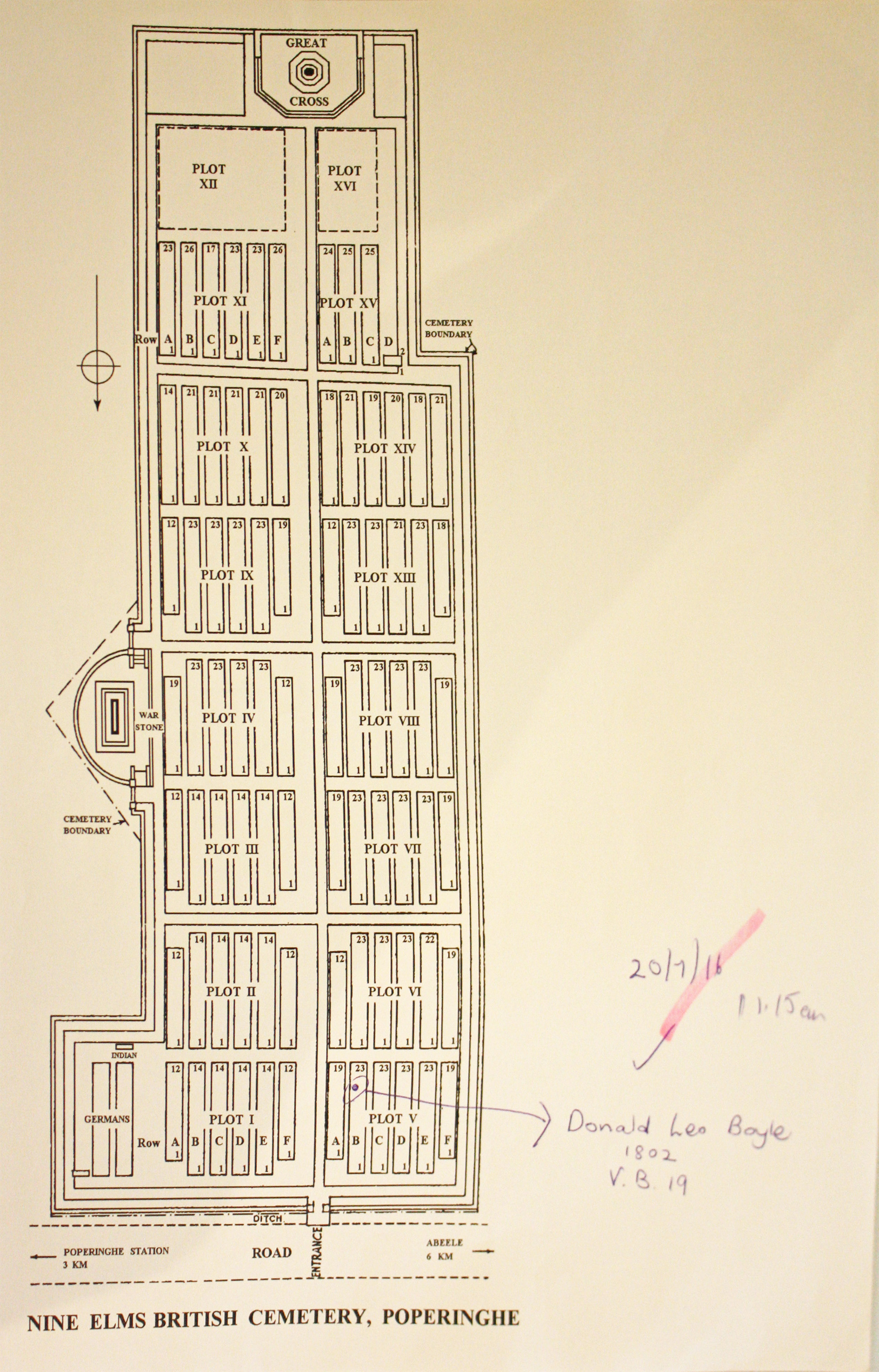
| NINE ELMS BRITISH CEMETERY Annotated plan |  The cemetery was begun and used by the 3rd Australian and 44th Casualty Clearing Stations when they moved to Poperinghe (now Poperinge), from Brandhoek and Lijssenthoek respectively, in September 1917. Nearly all the burials in Plots I to IX came from these Casualty Clearing Stations, whilst they operated in this area during the 1917 Battle of Ypres, up until December 1917. Plots X, XI, XIII, XIV and XV cover the dates between the beginning of March, 1918 and the 12th October, 1918, the period of the German offensive in Flanders, the British counter attacks and the final advance of August-September. The burials in these cases were carried out almost entirely by fighting units. Commonwealth War Graves site for NINE ELMS BRITISH CEMETERYGo there on Google maps |
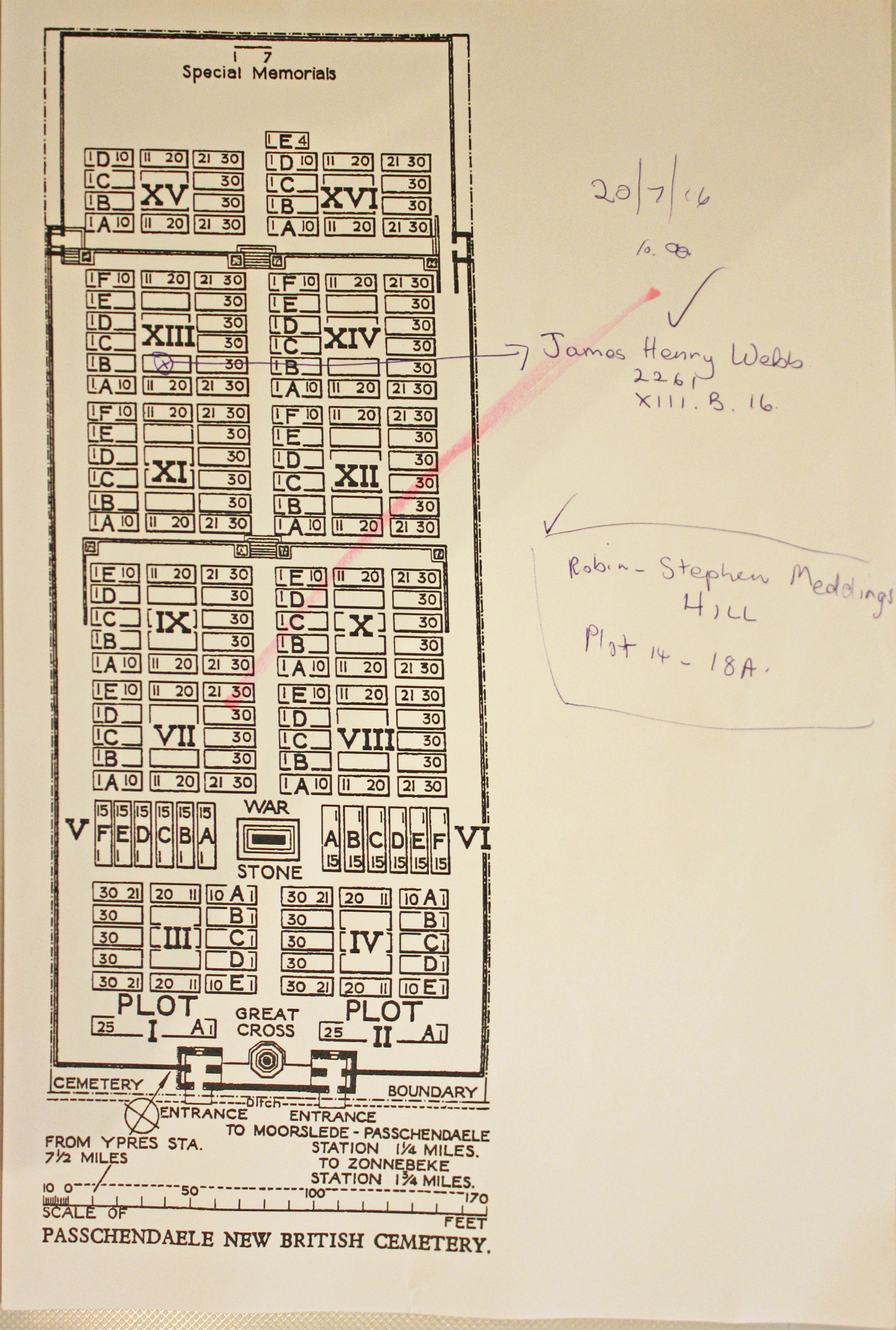
| PASSCHENDAELE NEW BRITISH CEMETERY Annotated plan |  The New British Cemetery was made after the Armistice when graves were brought in from the battlefields of Passchendaele and Langemarck. Almost all of the burials are from the autumn of 1917. The cemetery now contains 2,101 burials and commemorations of the First World War. 1,600 of the graves are unidentified but there are special memorials to seven casualties believed to be buried among them. Commonwealth War Graves site for PASSCHENDAELE NEW BRITISH CEMETERYGo there on Google maps |
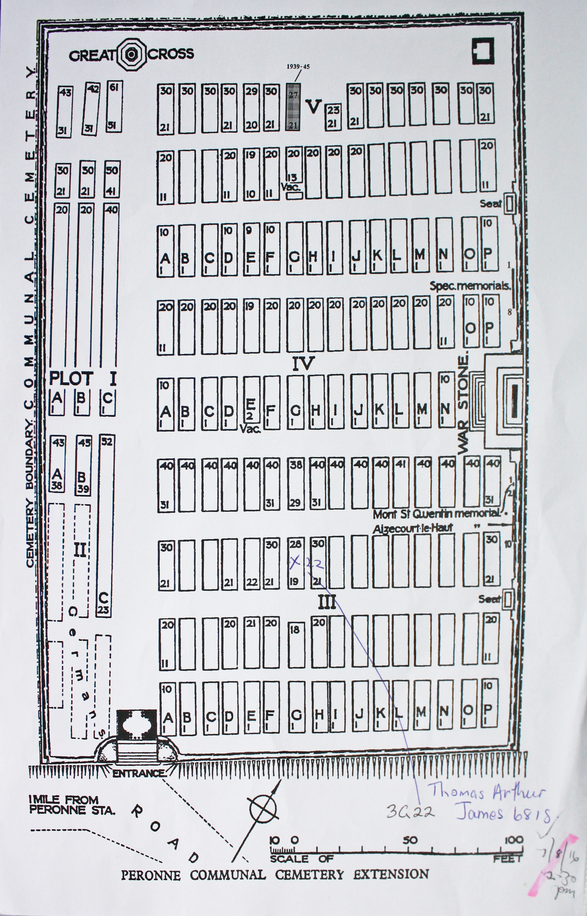
| PERONNE COMMUNAL CEMETERY EXTENSION Annotated plan |  The cemetery extension was begun by the 48th (South Midland) Division in March 1917, used by the Germans in 1918, and resumed by Australian units in September 1918. At the Armistice it contained 177 graves, now in Plots I and II. It was then enlarged when graves were brought in from the battlefields north and east of Peronne. Commonwealth War Graves site for PERONNE COMMUNAL CEMETERY EXTENSIONGo there on Google maps |
| PERTH CEMETERY (CHINA WALL) Annotated plan | 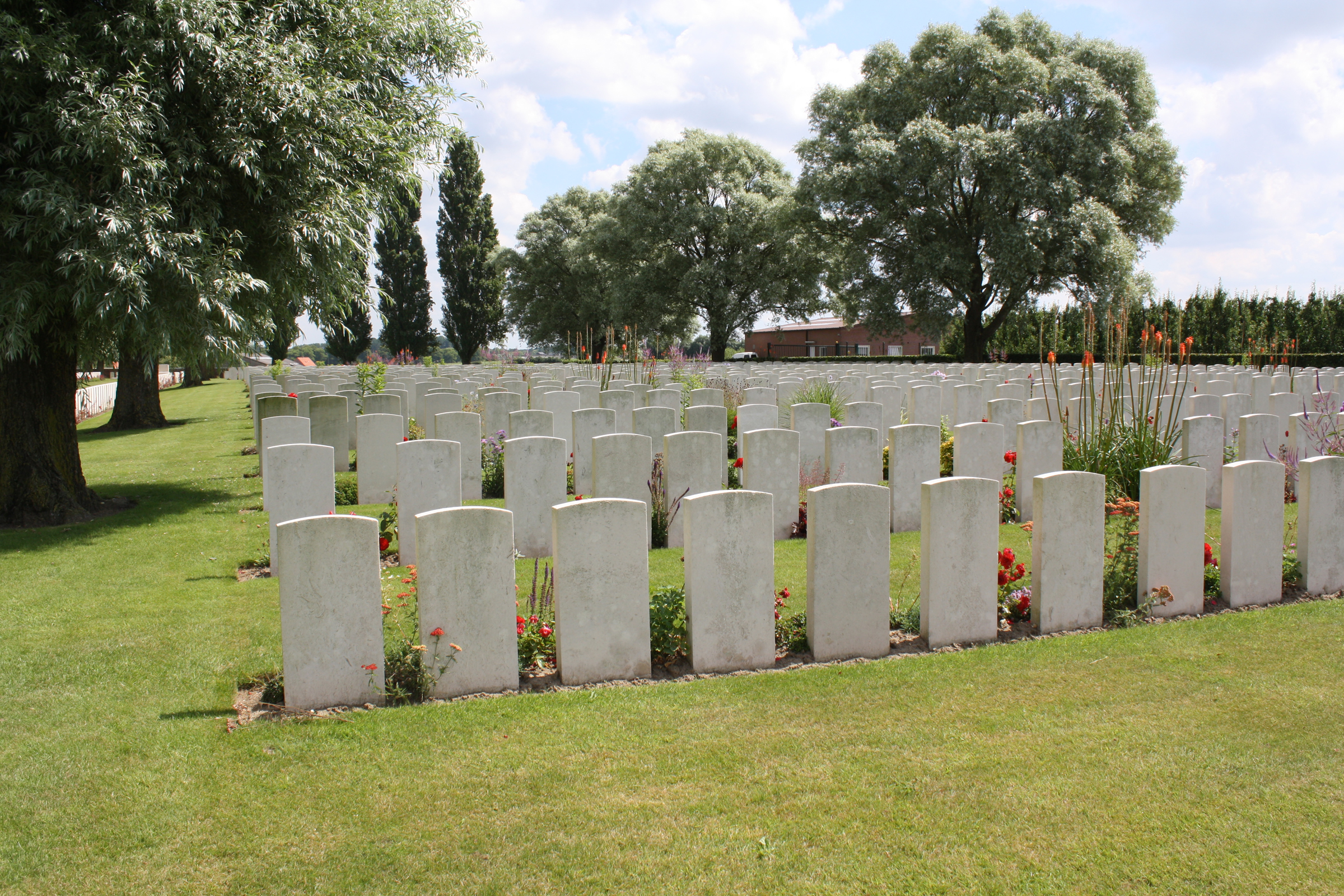 The cemetery was begun by French troops in November 1914 (the French graves were removed after the Armistice) and adopted by the 2nd Scottish Rifles in June 1917. It was called Perth (as the predecessors of the 2nd Scottish Rifles were raised in Perth), China Wall (from the communication trench known as the Great Wall of China), or Halfway House Cemetery. The cemetery was used for front line burials until October 1917 when it occupied about half of the present Plot I and contained 130 graves. It was not used again until after the Armistice, when graves were brought in from the battlefields around Ypres and from smaller cemeteries. Commonwealth War Graves site for PERTH CEMETERY (CHINA WALL)Go there on Google maps |
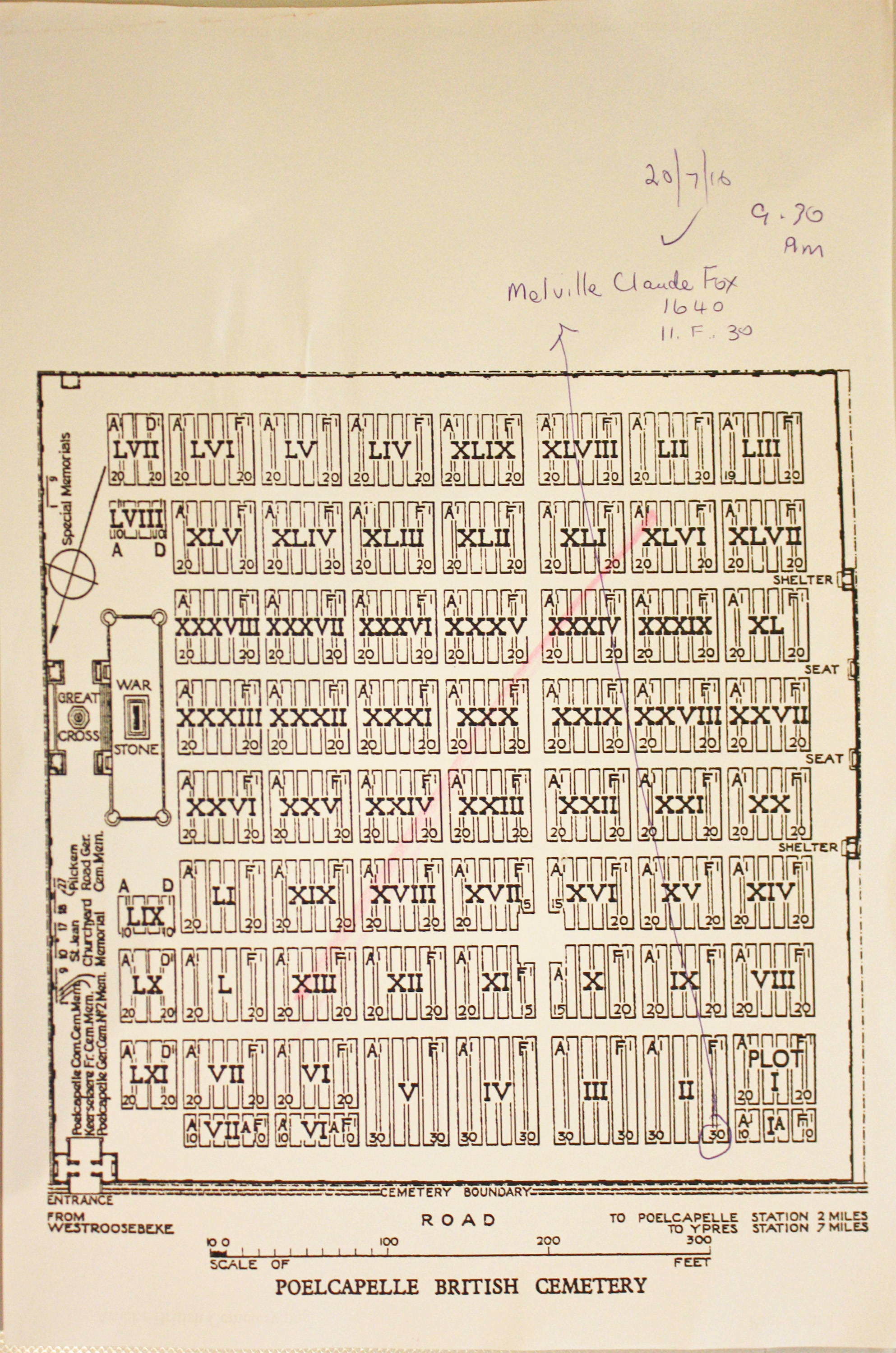
| POELCAPELLE BRITISH CEMETERY Annotated plan | 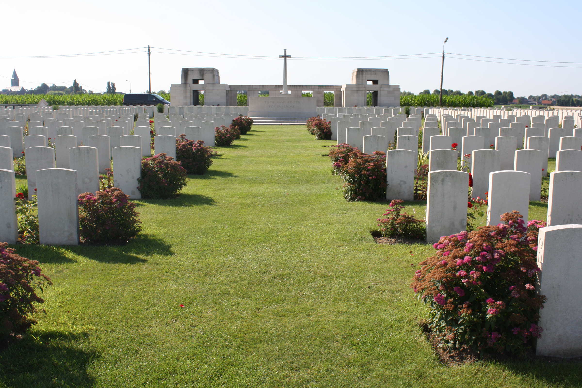 Poelcapelle British Cemetery was made after the Armistice when graves were brought in from the surrounding battlefields .Among those buried in the cemetery is Private John Condon of the Royal Irish Regiment, who at 14 is thought to be the youngest battle casualty of the First World War commemorated by the Commission. Commonwealth War Graves site for POELCAPELLE BRITISH CEMETERYGo there on Google maps |
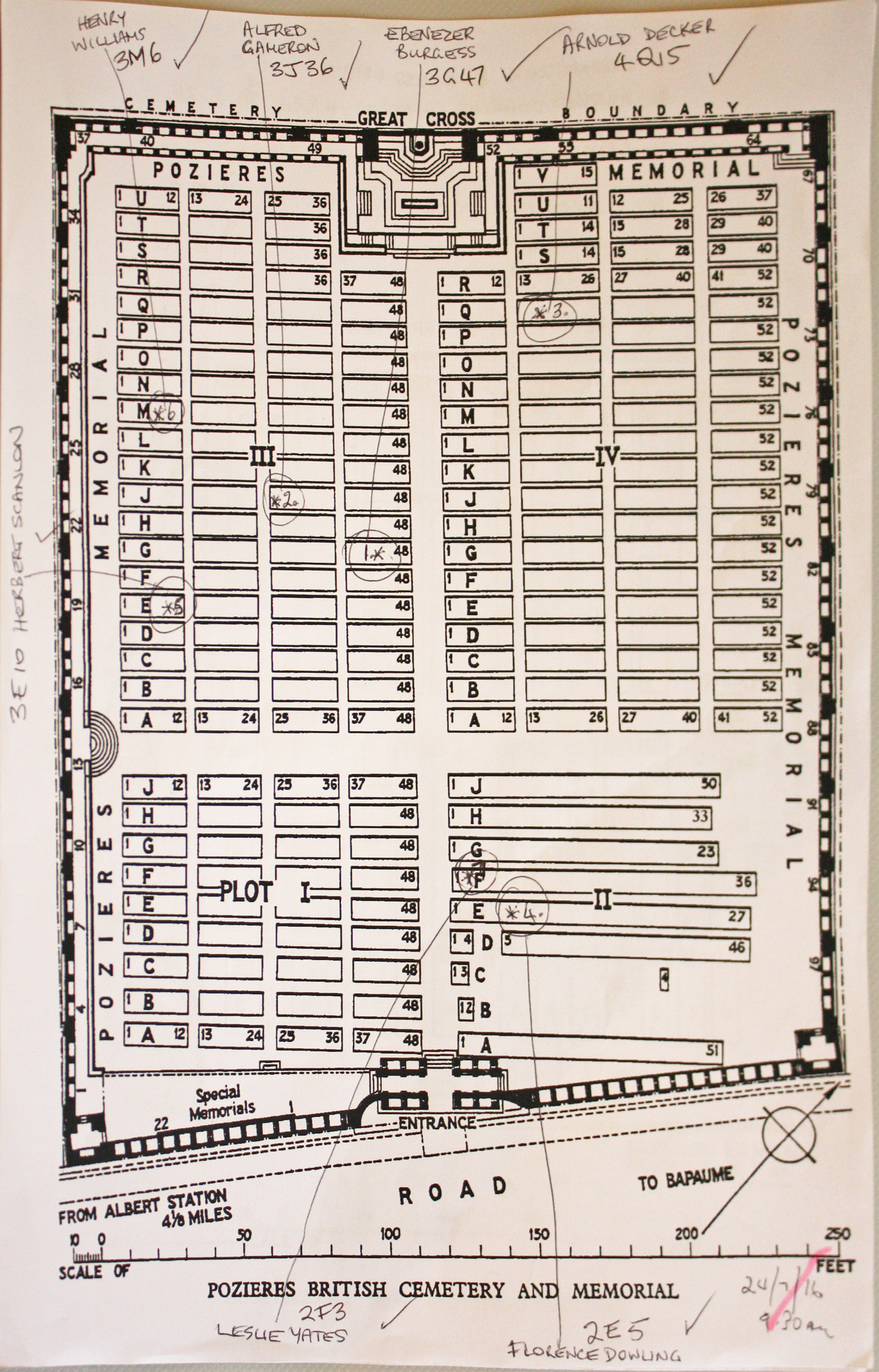
| POZIERES BRITISH CEMETERY, OVILLERS-LA BOISSELLE Annotated plan | 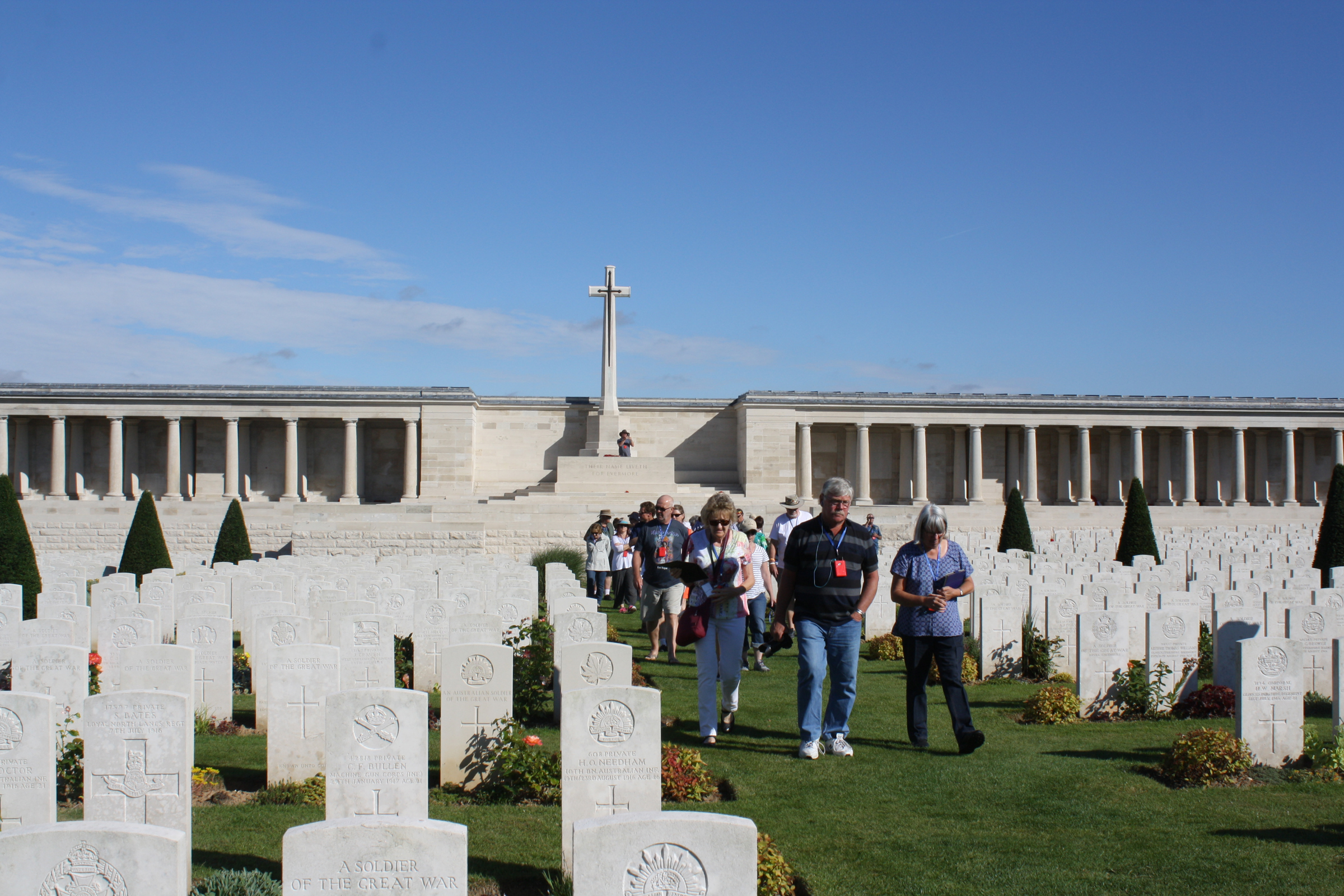 Plot II of POZIERES BRITISH CEMETERY contains the original burials of 1916, 1917 and 1918, carried out by fighting units and field ambulances. The remaining plots were made after the Armistice when graves were brought in from the battlefields immediately surrounding the cemetery, the majority of them of soldiers who died in the Autumn of 1916, but a few represent the fighting in August 1918.The cemetery is enclosed by the POZIERES MEMORIAL, which relates to the period of crisis in March and April 1918 when the Allied Fifth Army was driven back by overwhelming numbers across the former Somme battlefields, and the months that followed before the Advance to Victory, which began on 8 August 1918. Commonwealth War Graves site for POZIERES BRITISH CEMETERY, OVILLERS-LA BOISSELLEGo there on Google maps |
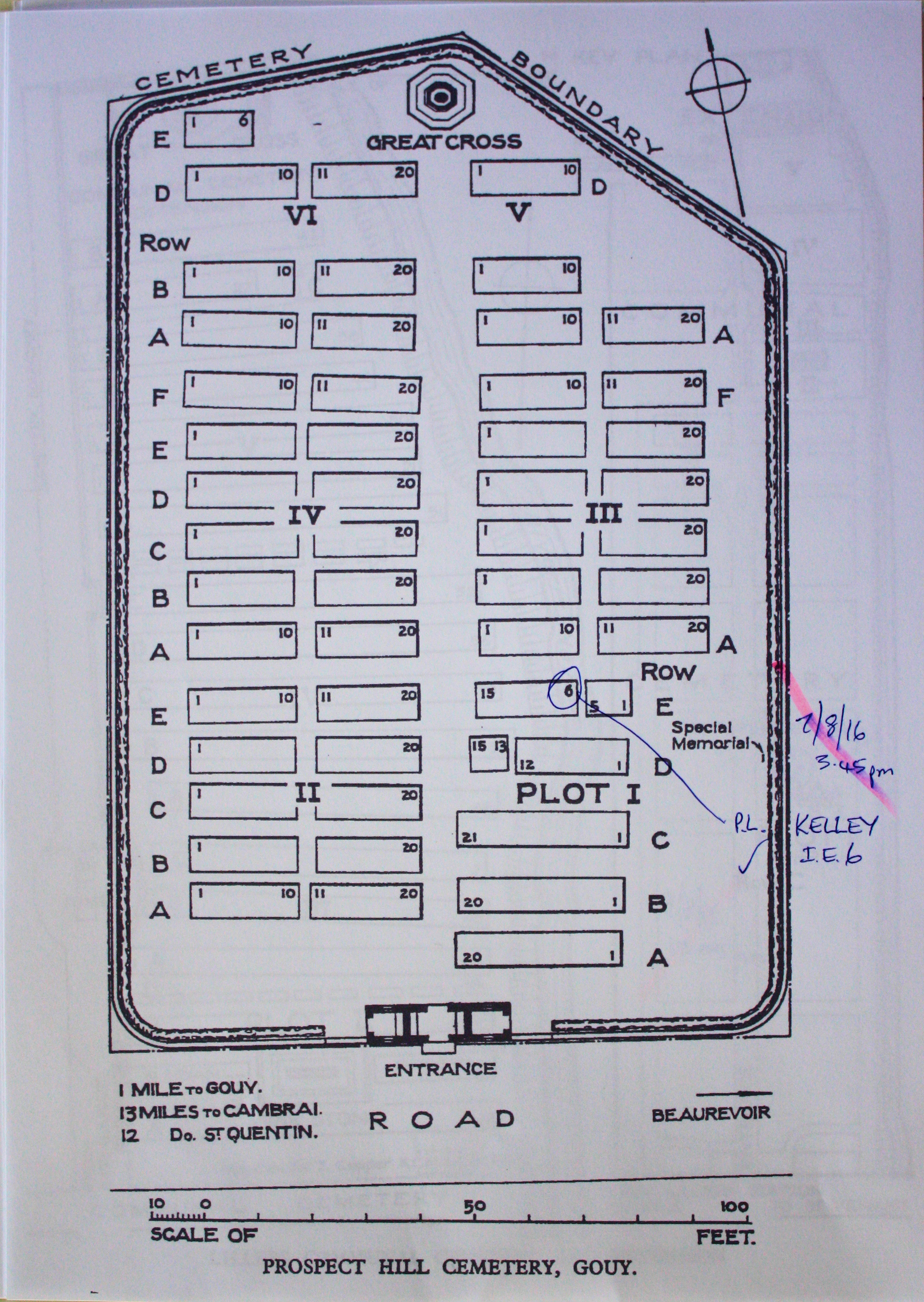
| PROSPECT HILL CEMETERY, GOUY Annotated plan | 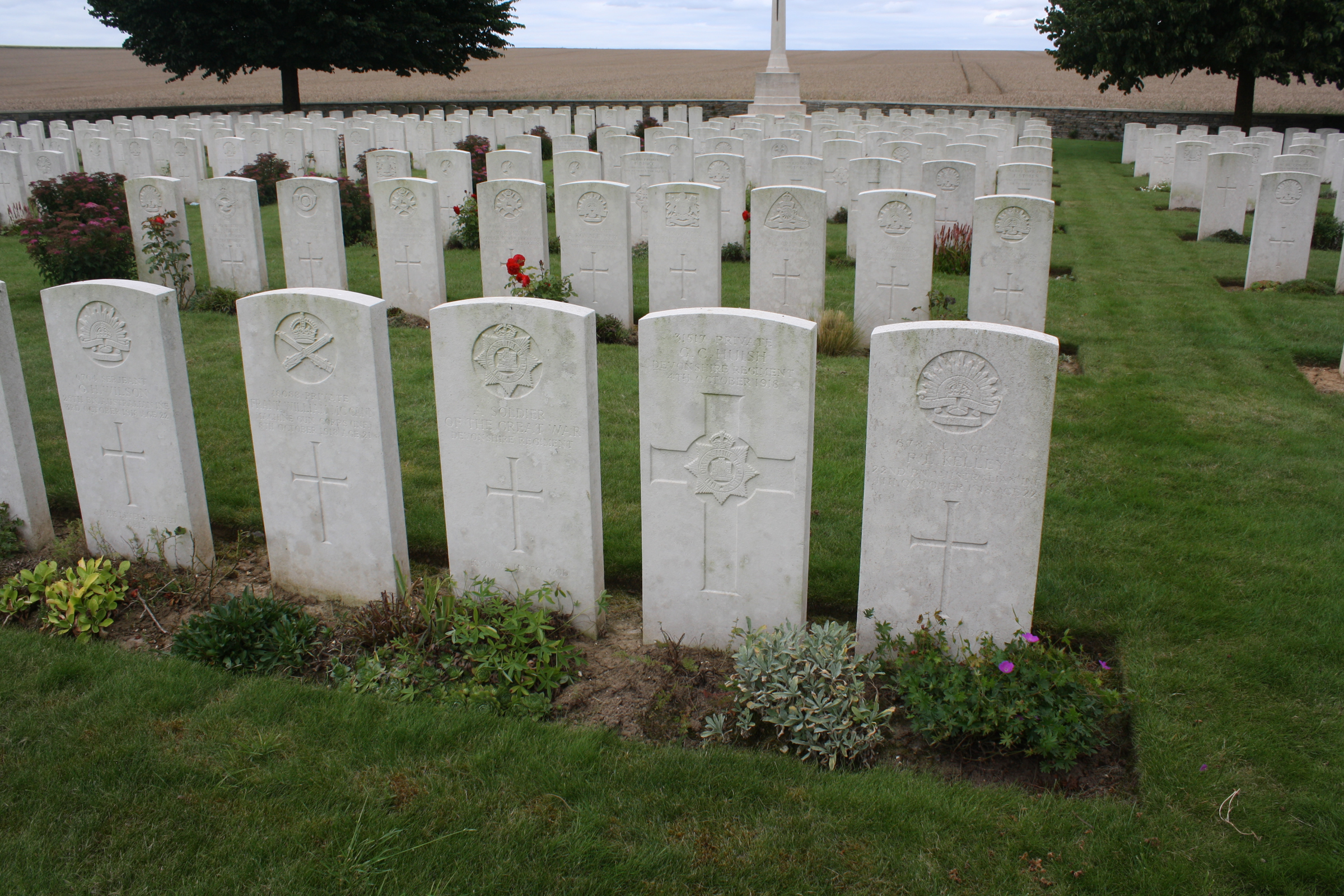 On 3 October 1918, the 1st King's Own Yorkshire Light Infantry captured Prospect Hill, after Le Catelet and Gouy had been taken by the 50th (Northumbrian) Division, the 6th Royal Inniskilling Fusiliers and the 4th King's Royal Rifle Corps. The cemetery was made by the 50th Division and the 18th Field Ambulance immediately after. Plot I formed the original cemetery but this was increased after the Armistice when graves were brought in, mainly from the battlefields north of Gouy, and almost exclusively of men who died in October 1918. Commonwealth War Graves site for PROSPECT HILL CEMETERY, GOUYGo there on Google maps |
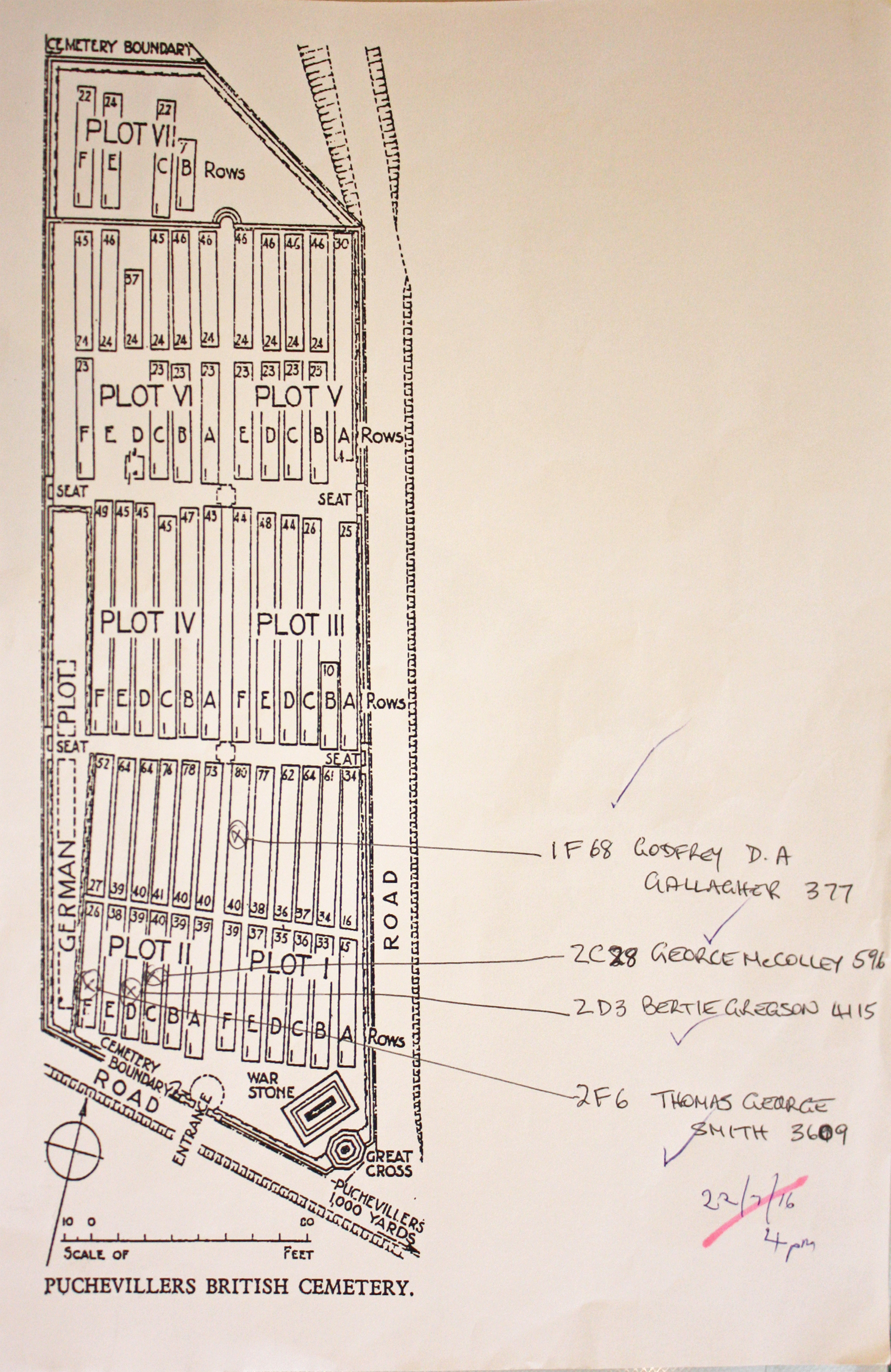
| PUCHEVILLERS BRITISH CEMETERY Annotated plan | 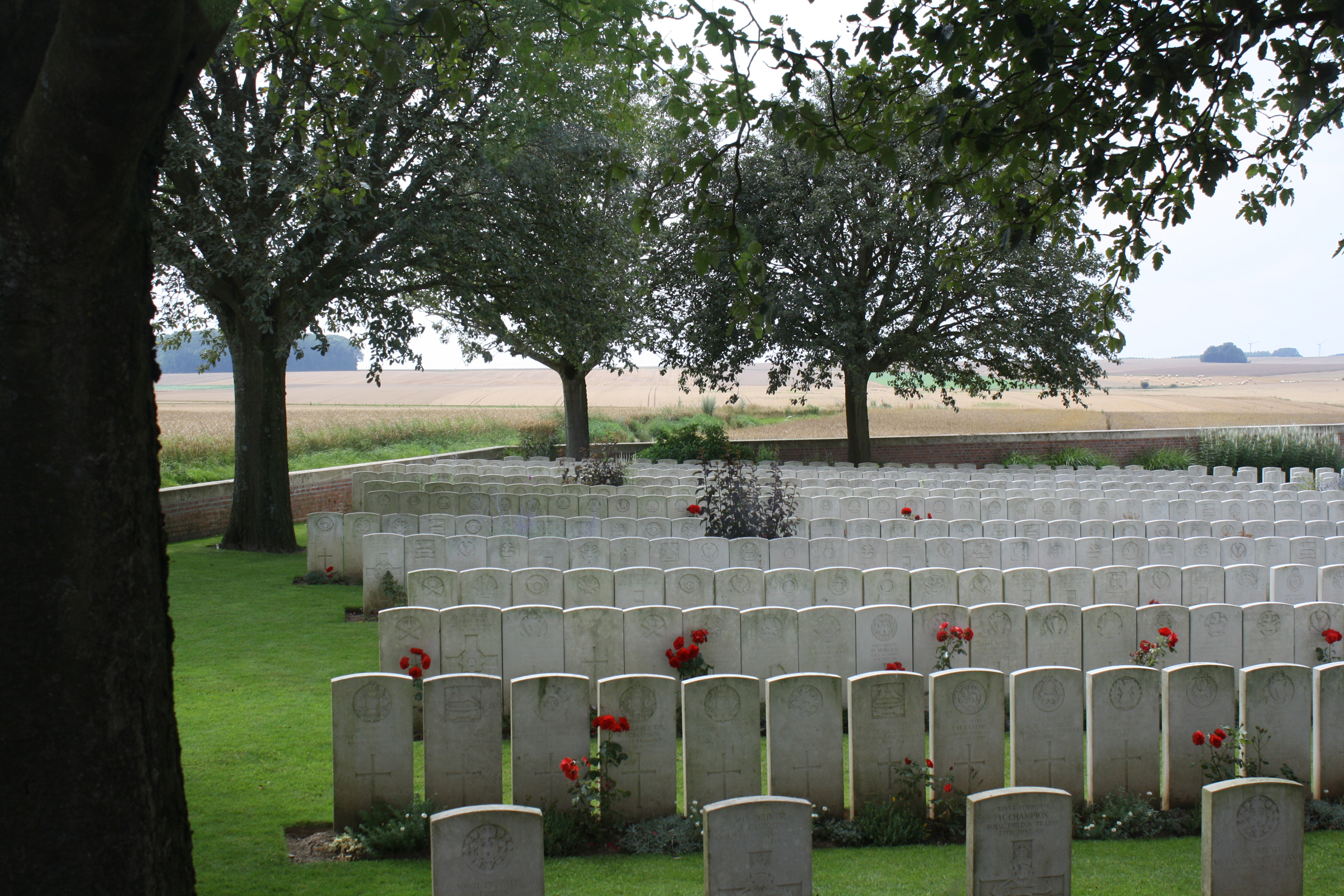 In June 1916, just before the opening of the Battles of the Somme, the 3rd and 44th Casualty Clearing Stations came to Puchevillers. Plots I to V, and almost the whole of Plot VI were made by those hospitals before the end of March 1917. For the next two months the 2nd/1st South Midland Casualty Clearing Station used the cemetery.Plot VII contains for the most part the graves of men who died in the German advance in 1918, many of whom were buried by the 49th Clearing Station in March 1918, or by the 48th Labour Group in August. Commonwealth War Graves site for PUCHEVILLERS BRITISH CEMETERYGo there on Google maps |
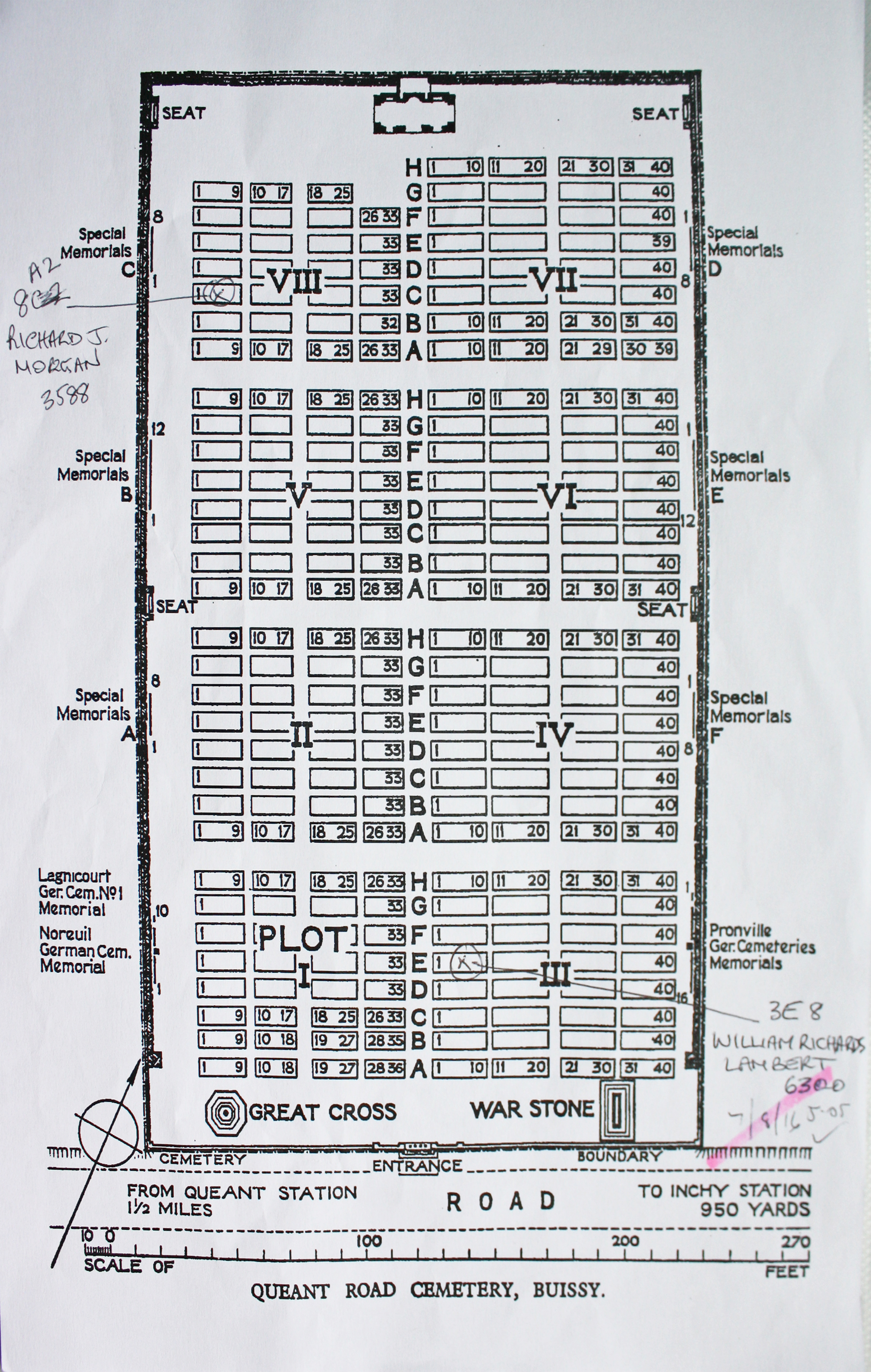
| QUEANT ROAD CEMETERY, BUISSY Annotated plan |  Queant Cemetery was made by the 2nd and 57th Casualty Clearing Stations in October and November 1918. It then consisted of 71 graves (now Plot I, Rows A and B), but was greatly enlarged after the Armistice when 2200 graves were brought in from the battlefields of 1917-1918 between Arras and Bapaume. Commonwealth War Graves site for QUEANT ROAD CEMETERY, BUISSYGo there on Google maps |
| RED CROSS CORNER CEMETERY, BEUGNY Annotated plan |  Plot I of the cemetery (except Row K) was made between April 1917 and March 1918 by field ambulances and fighting units. When the cemetery fell into German hands in March 1918, they added the 25 Commonwealth burials that make up Row K (all from 21 March 1918) and began another cemetery alongside (Beugny Military Cemetery No.3). Commonwealth forces retook the cemetery in September 1918 and added Plot II to the original burials. The German graves were removed after the Armistice, and the Commonwealth burials among them were transferred partly to Delsaux Farm Cemetery and partly to Favreuil British Cemetery. Commonwealth War Graves site for RED CROSS CORNER CEMETERY, BEUGNYGo there on Google maps |
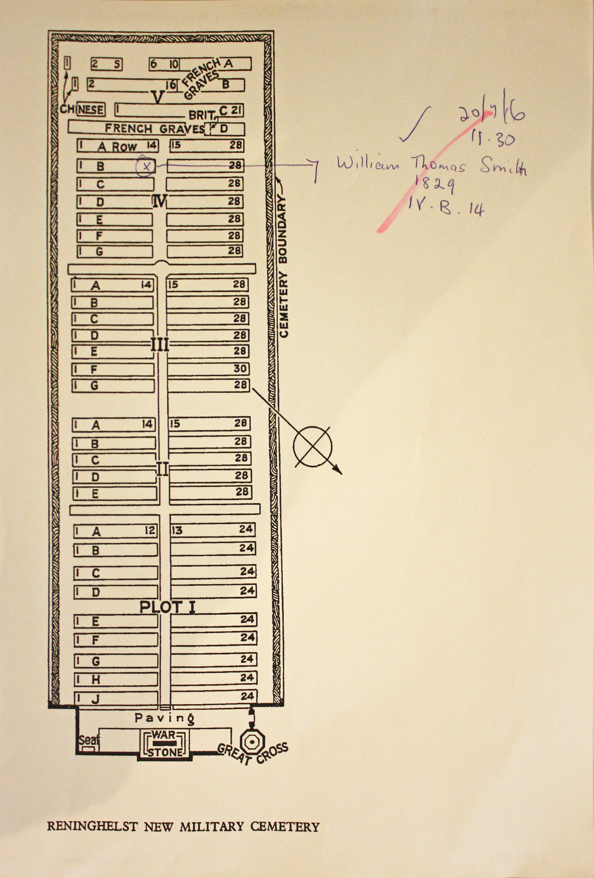
| RENINGHELST NEW MILITARY CEMETERY Annotated plan |  The village of Reninghelst (now Reningelst) was occupied by Commonwealth forces from the late autumn of 1914 to the end of the war and was sufficiently far from the front line to provide a suitable station for field ambulances. The earliest burials took place in the Churchyard, but in November 1915, the New Military Cemetery was opened. It remained in use until September 1918. Commonwealth War Graves site for RENINGHELST NEW MILITARY CEMETERYGo there on Google maps |
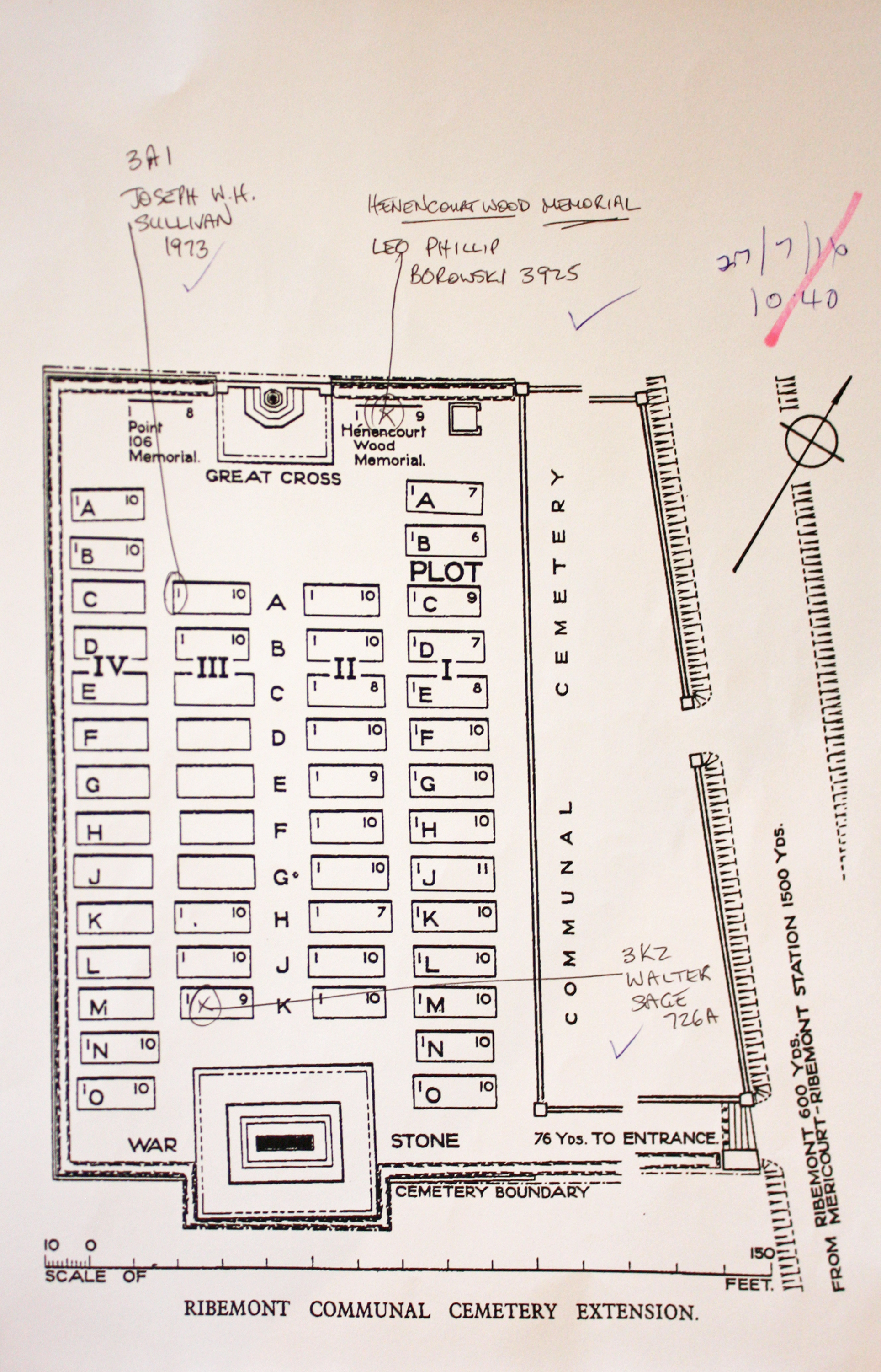
| RIBEMONT COMMUNAL CEMETERY EXTENSION, SOMME Annotated plan | 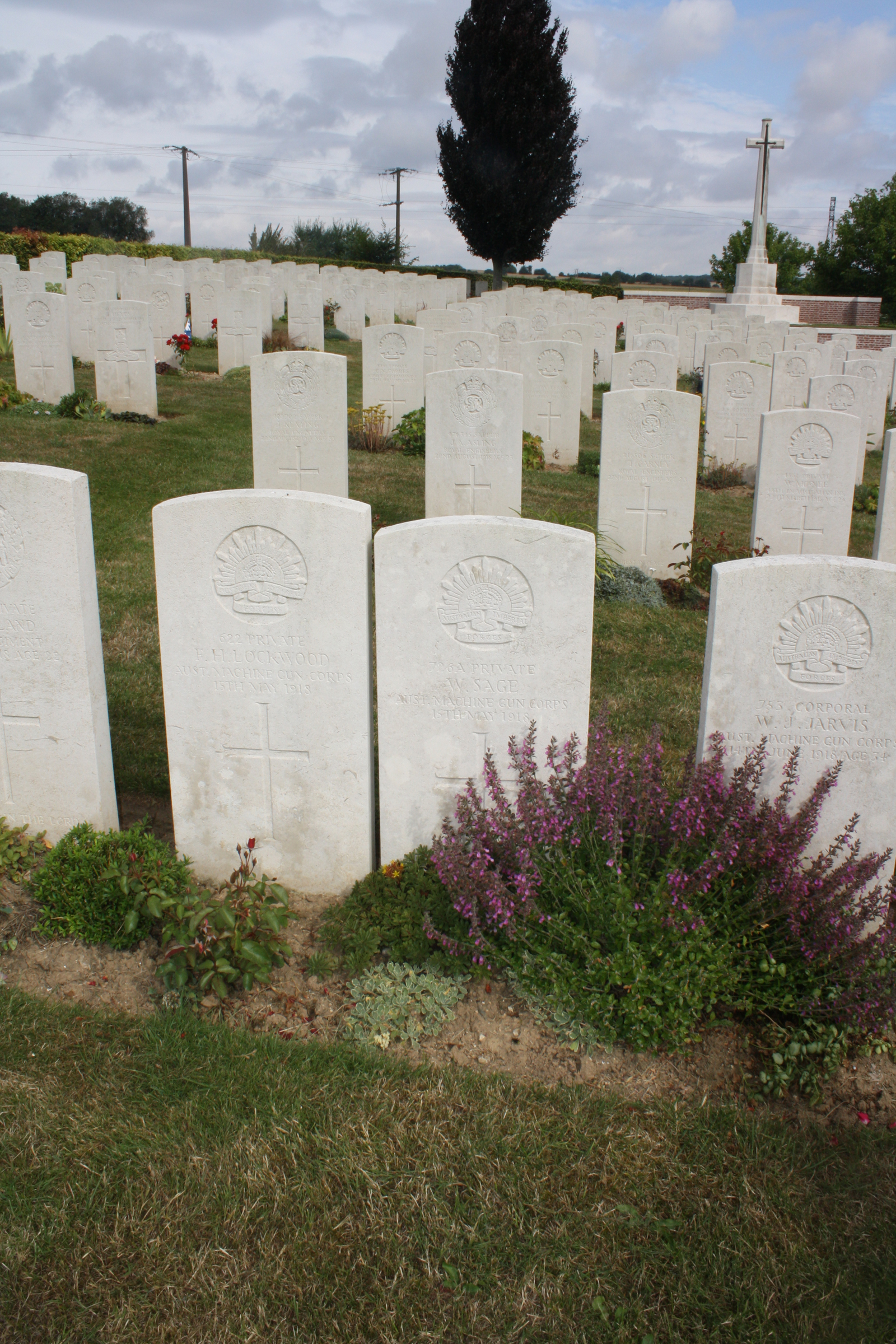 This sector of the front was taken over by the Commonwealth forces in the early summer of 1915, when Mericourt-Ribemont Station, on the railway line from Amiens to Albert, became a railhead. However, it was not until the German advance at the end of March 1918 that the first burials were made at Ribemont, initially in the communal cemetery itself. The extension was begun in May and used until August 1918, when 68 burials were carried out by units engaged in the defence of Amiens. It was greatly enlarged after the Armistice when graves were brought in from the battlefields of 1918 east of Ribemont and from other cemeteries. Commonwealth War Graves site for RIBEMONT COMMUNAL CEMETERY EXTENSION, SOMMEGo there on Google maps |
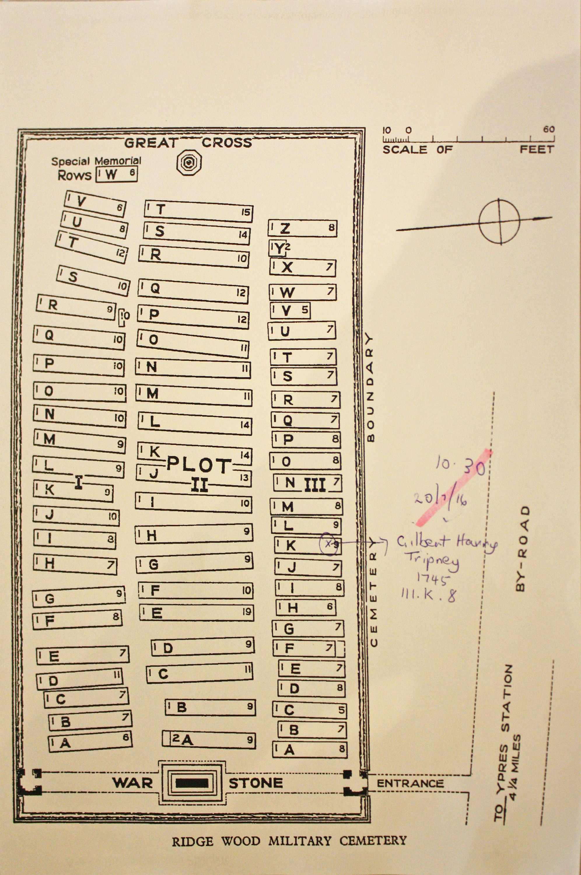
| RIDGE WOOD MILITARY CEMETERY Annotated plan | 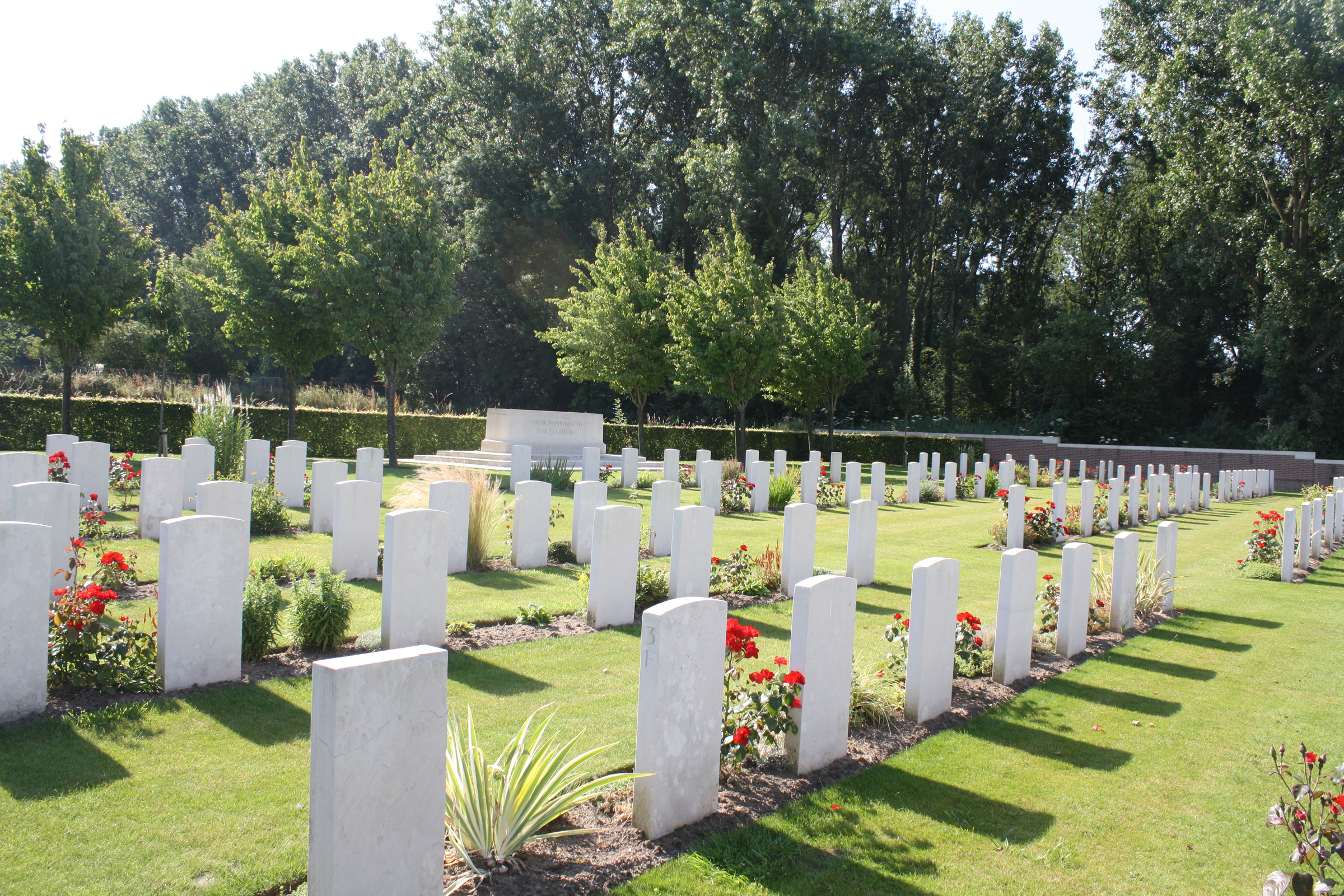 Ridge Wood was the name given to a wood standing on high ground between the Kemmel road and Dickebusch Lake.The cemetery lies in a hollow on the western side of the ridge and the position was chosen for a front line cemetery as early as May 1915. The first graves were from the 2nd Royal Irish Rifles and similar groups were made by the 18th, 19th, 20th and 21st Canadian Battalions and the 9th Durham Light Infantry at the times when they occupied this sector. The German advance in the spring of 1918 pushed the front line back on to the ridge, and it was not till July that the wood was finally cleared by the 6th and 33rd Divisions. There are few burials from these last battles in the cemetery and the graves of some French divisions, which fought alongside Commonwealth forces in April and May, were removed to other burial grounds. Commonwealth War Graves site for RIDGE WOOD MILITARY CEMETERYGo there on Google maps |
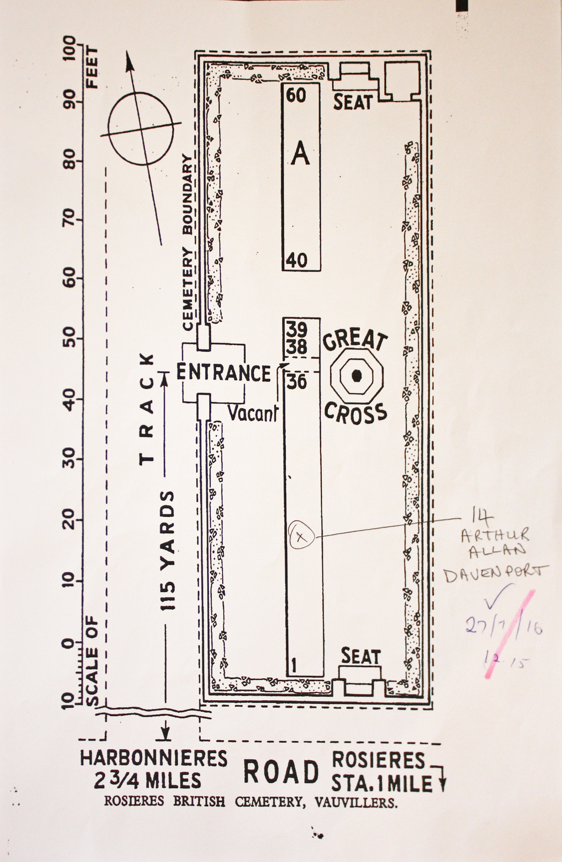
| ROSIERES BRITISH CEMETERY Annotated plan | 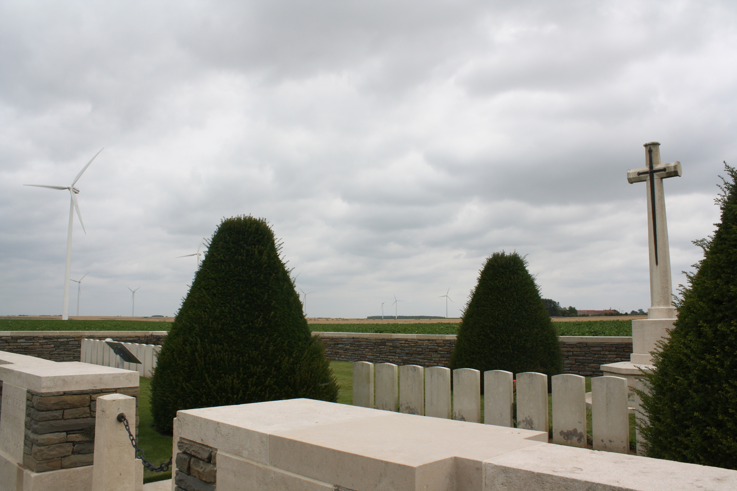 There are now 60, 1914-18 war casualties commemorated in this site. Of these, a small number are unidentified. The body of one American airman has been removed. The cemetery covers an area of 436 square metres and is enclosed by a rubble wall. Commonwealth War Graves site for ROSIERES BRITISH CEMETERYGo there on Google maps |
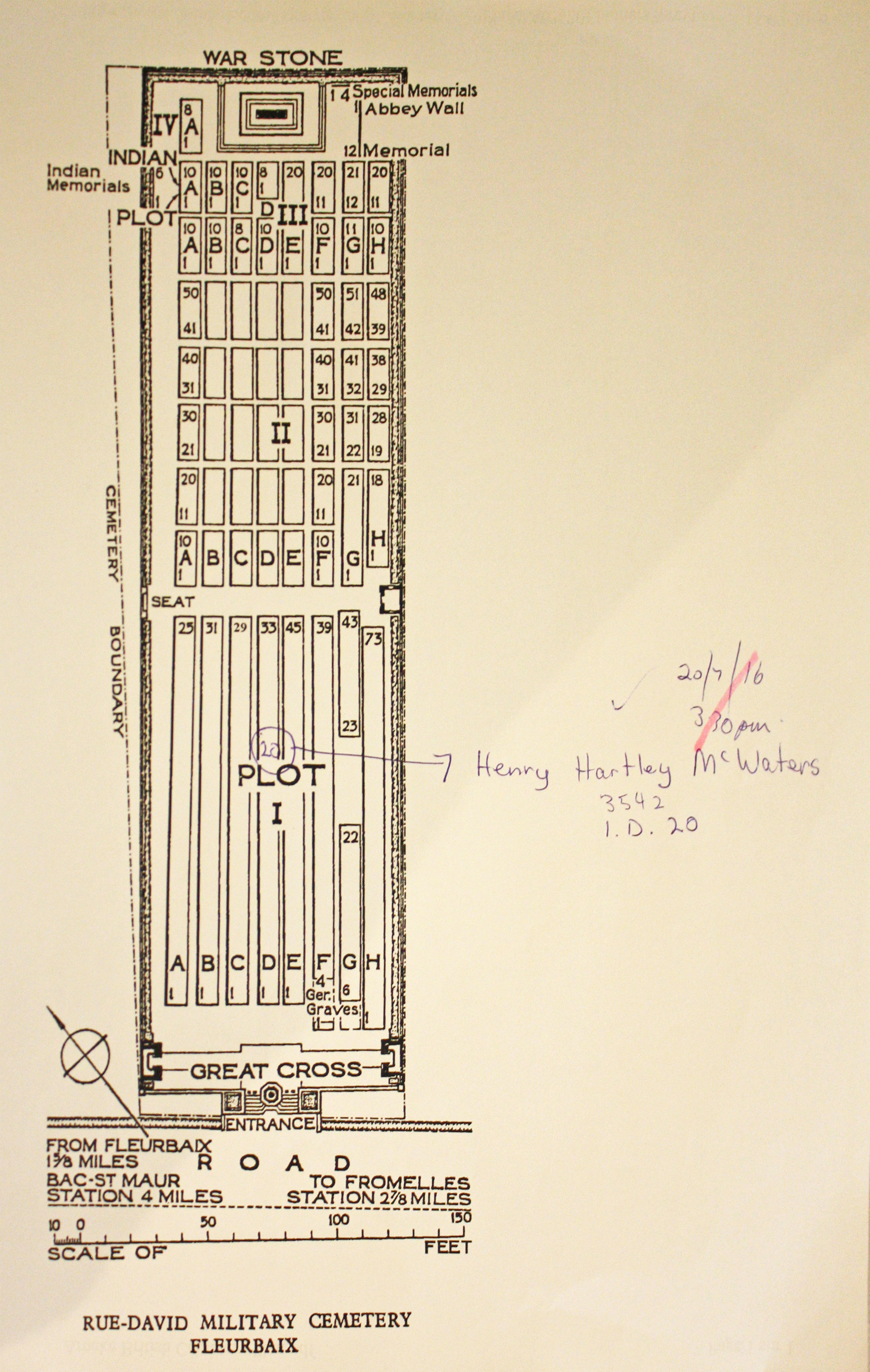
| RUE-DAVID MILITARY CEMETERY, FLEURBAIX Annotated plan | 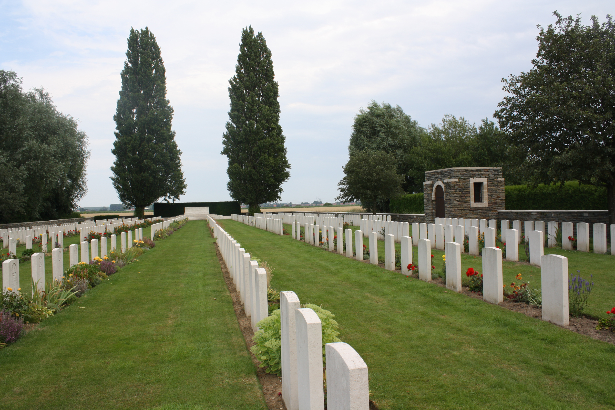 "Rue-David" (or "Rue-des-Davids") is the local name of the road running between La Croix-Marechal and La Boutillerie. The cemetery was begun by the 2nd Royal Scots Fusiliers in December 1914 and closed to Commonwealth burials in December 1917. At the Armistice it comprised Rows A to F and part of G of the present Plot I and contained 220 graves. The cemetery was greatly enlarged after the Armistice when graves were brought in mainly from the neighbourhood of Aubers and Fromelles, including those of many of the 1st Middlesex who died at the end of October 1914, and of the 5th Australian and 61st (South Midland) Divisions who died in July 1916. Commonwealth War Graves site for RUE-DAVID MILITARY CEMETERY, FLEURBAIXGo there on Google maps |
| RUE-DU-BOIS MILITARY CEMETERY, FLEURBAIX Annotated plan | 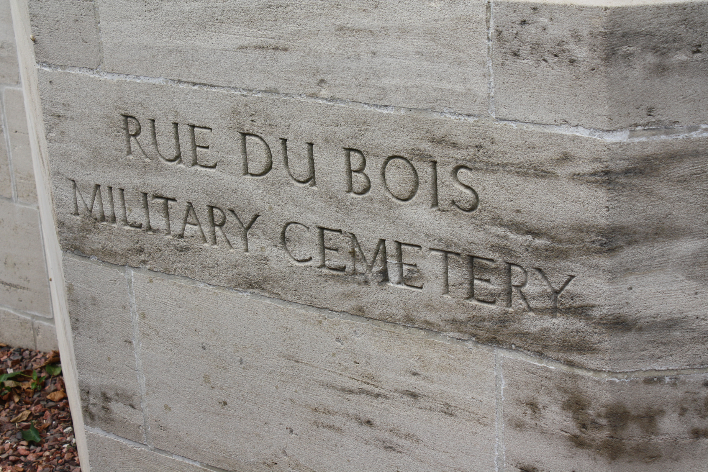 The original Rue-du-Bois Cemetery, now comprising Plot I and Rows A and B of Plot II, was begun in November 1914 and used until December 1916. It was reopened in January 1918, and again in October. The majority of the graves were Australian, with Plot I, Row B, containing the graves of 27 soldiers of the 5th Australian Division who died in the Attack at Fromelles (19-20 July 1916).Plot II, Row A contains two big graves into which, about the time of the Armistice, the remains of soldiers of the 5th Australian Division and the 2nd/1st Bucks Battalion were brought from the battlefield of Fromelles. The number of the dead in these graves is not certain, but it is believed that the Australian grave contains 22 bodies and the Bucks grave 52. The cemetery was enlarged after the Armistice when 423 graves were brought in from the surrounding battlefields and from certain small cemeteries. Commonwealth War Graves site for RUE-DU-BOIS MILITARY CEMETERY, FLEURBAIXGo there on Google maps |
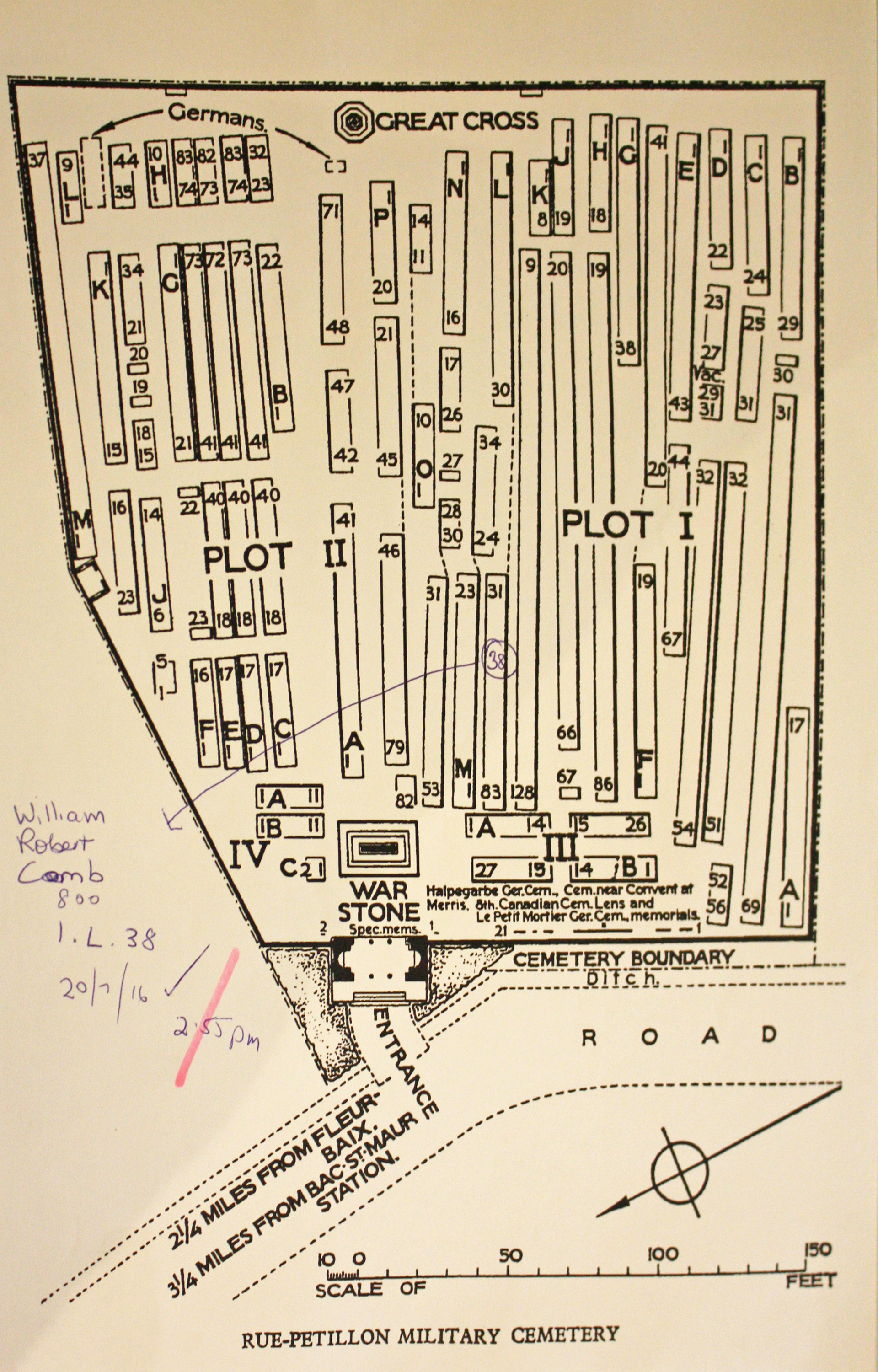
| RUE-PETILLON MILITARY CEMETERY, FLEURBAIX Annotated plan |  British soldiers began burying their fallen comrades at Rue Pétillon in December 1914 and the cemetery was used by fighting units until it fell into German hands during the Spring Offensive of 1918. The Allies recaptured this sector of the front in September 1918 and when the war ended in November the cemetery was the site of twelve Battalion burial grounds. Many of those laid to rest here had died of wounds in a dressing station that was located in the buildings adjoining the cemetery, which were known as 'Eaton Hall' during the war. The cemetery was enlarged in the years after the Armistice when graves were concentrated here from the battlefields around Fleurbaix and a number of smaller burial grounds. A whole range of different Commonwealth units served in this sector during the war and the cemetery contains the graves of British, Irish, Canadian, New Zealand, and Indian soldiers, as well as over 260 men who were killed while serving with the Australian Imperial Force. Today over 1,500 war dead of the First World War are buried or commemorated here. Rue Pétillon is also the final resting placing of over 100 Australian soldiers killed at the Battle of Fromelles on 19 July 1916. Commonwealth War Graves site for RUE-PETILLON MILITARY CEMETERY, FLEURBAIXGo there on Google maps |
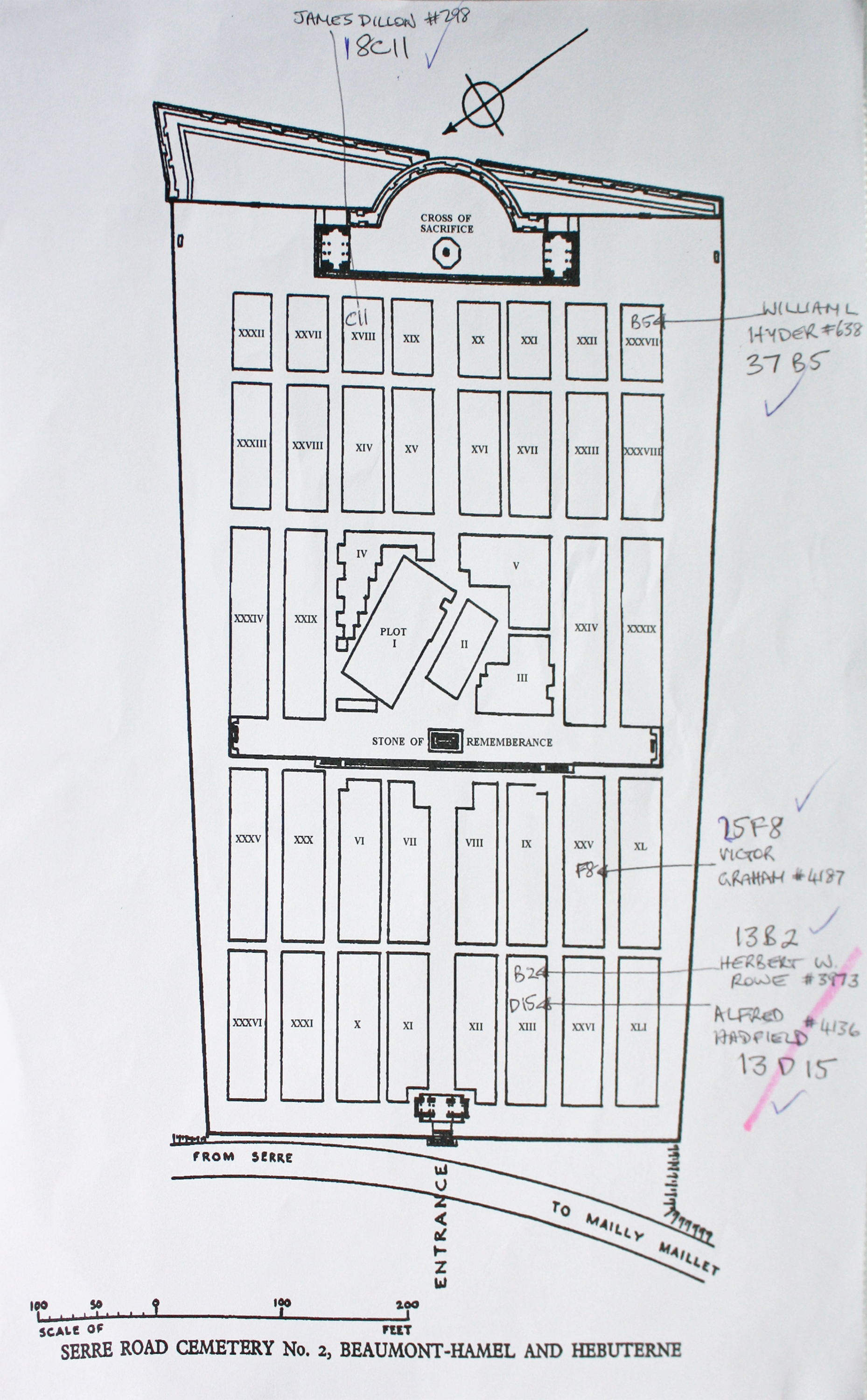
| SERRE ROAD CEMETERY No.2 Annotated plan |  In the spring of 1917, the battlefields of the Somme and Ancre were cleared and a number of new cemeteries were made, three of which are now named from the Serre Road. Serre Road Cemetery No.2 was begun in May 1917 and by the end of the war it contained approximately 475 graves (Plots I and II, except for Row E, Plot II which was added in 1922 and Row AA, Plot I which was added in 1927), but it was greatly enlarged after the Armistice by the addition of further graves from the surrounding area. Commonwealth War Graves site for SERRE ROAD CEMETERY No.2Go there on Google maps |
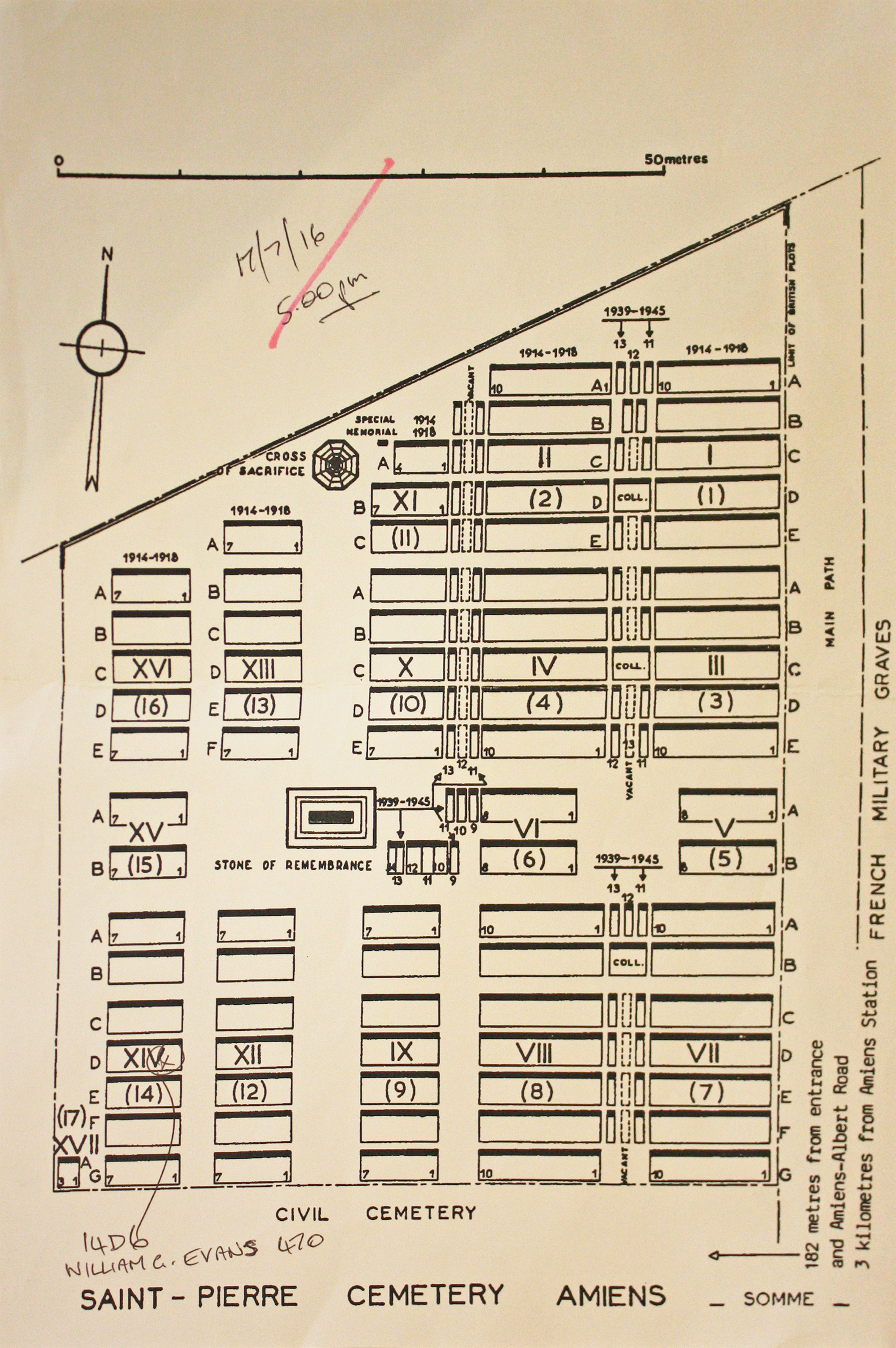
| ST. PIERRE CEMETERY, AMIENS Annotated plan |  The 7th General Hospital was at Amiens in August 1914; the 56th (South Midland) Casualty Clearing Station from April to July 1916; the New Zealand Stationary Hospital from July 1916 to May 1917; the 42nd Stationary Hospital from October 1917 to March 1919; and the 41st Stationary Hospital in March 1918, and again in December 1918 and January 1919.The Commonwealth plot in St. Pierre Cemetery was first used in September 1915 and closed in October 1919, but shortly afterwards 33 graves of 1918 were brought in from positions in or near the city. Commonwealth War Graves site for ST. PIERRE CEMETERY, AMIENSGo there on Google maps |
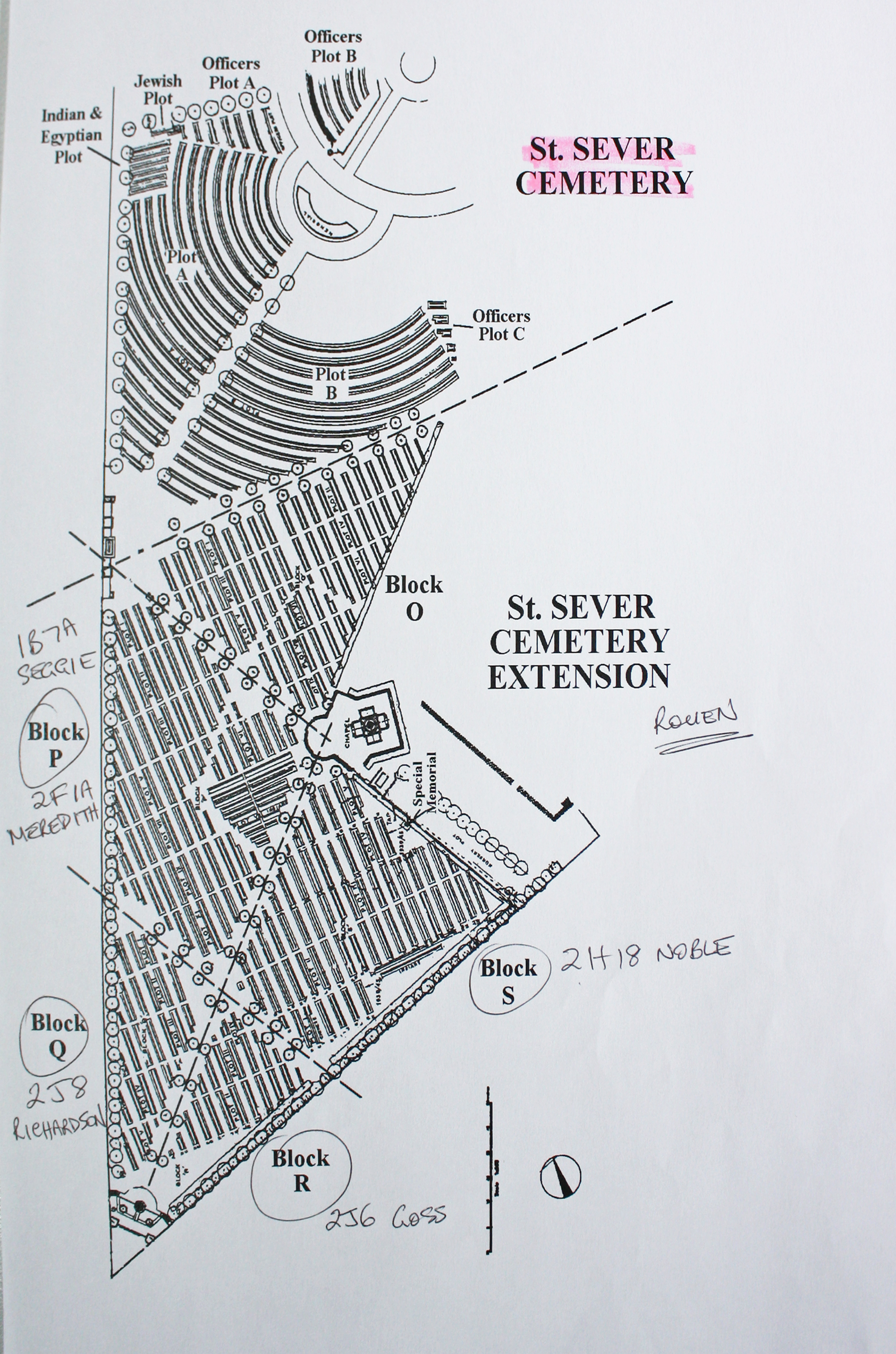
| ST. SEVER CEMETERY EXTENSION, ROUEN Annotated plan |  During the First World War, Commonwealth camps and hospitals were stationed on the southern outskirts of Rouen. A base supply depot and the 3rd Echelon of General Headquarters were also established in the city. Almost all of the hospitals at Rouen remained there for practically the whole of the war. They included eight general, five stationary, one British Red Cross and one labour hospital, and No. 2 Convalescent Depot. A number of the dead from these hospitals were buried in other cemeteries, but the great majority were taken to the city cemetery of St. Sever. In September 1916, it was found necessary to begin an extension, where the last burial took place in April 1920. Commonwealth War Graves site for ST. SEVER CEMETERY EXTENSION, ROUENGo there on Google maps |
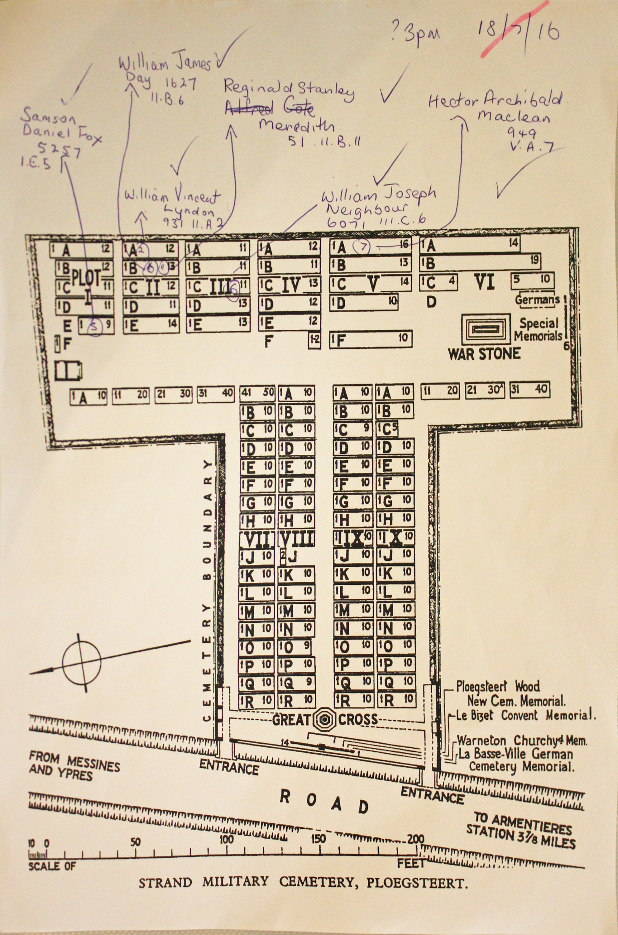
| STRAND MILITARY CEMETERY Annotated plan | 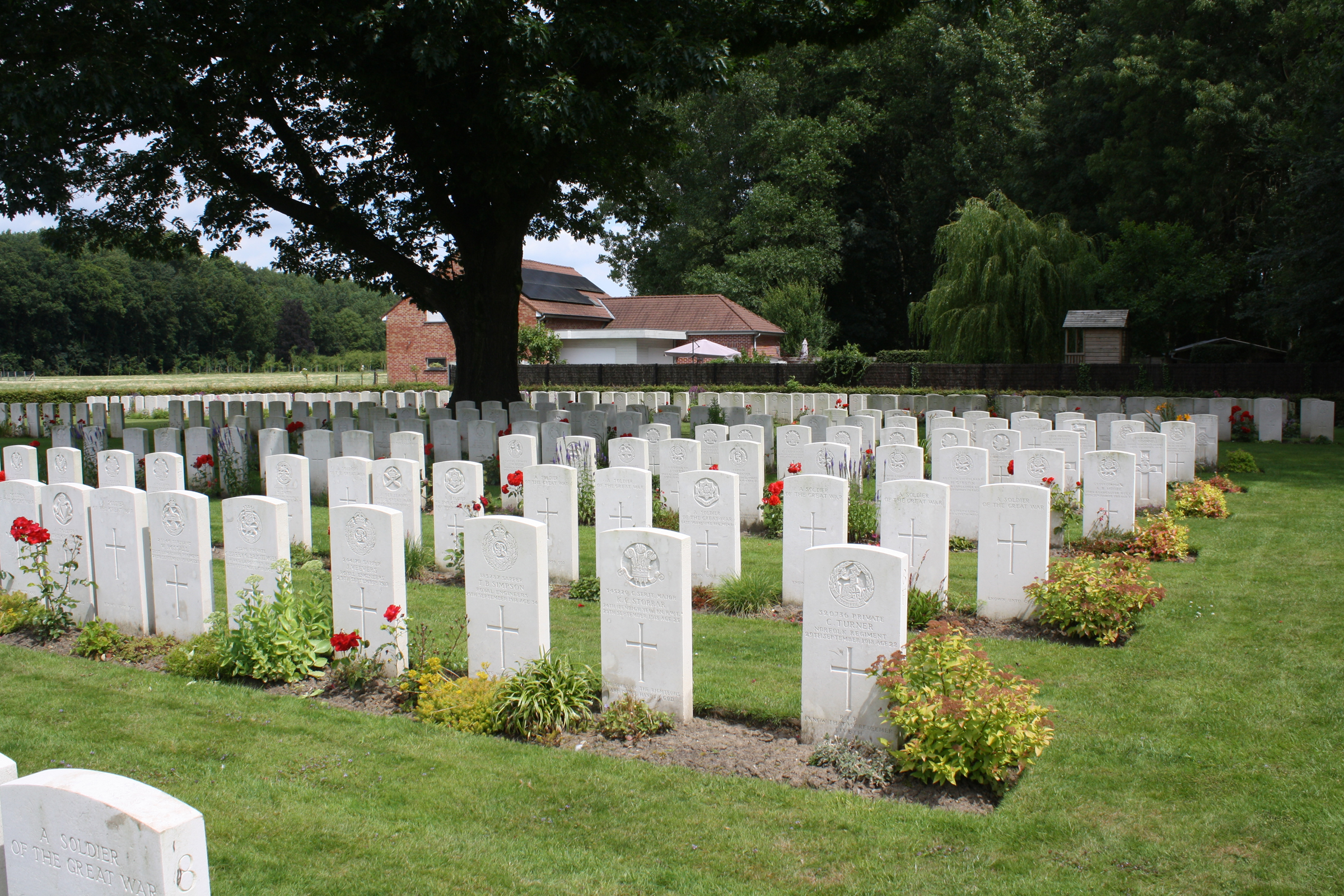 Charing Cross' was the name given by the troops to a point at the end of a trench called the Strand, which led into Ploegsteert Wood. In October 1914, two burials were made at this place, close to an Advanced Dressing Station.The cemetery was not used between October 1914 and April 1917, but in April-July 1917 Plots I to VI were completed. Plots VII to X were made after the Armistice, when graves were brought in from some small cemeteries and from the battlefields lying mainly between Wytschaete and Armentieres. The cemetery was in German hands for a few months in 1918, but was very little used by them. Commonwealth War Graves site for STRAND MILITARY CEMETERYGo there on Google maps |
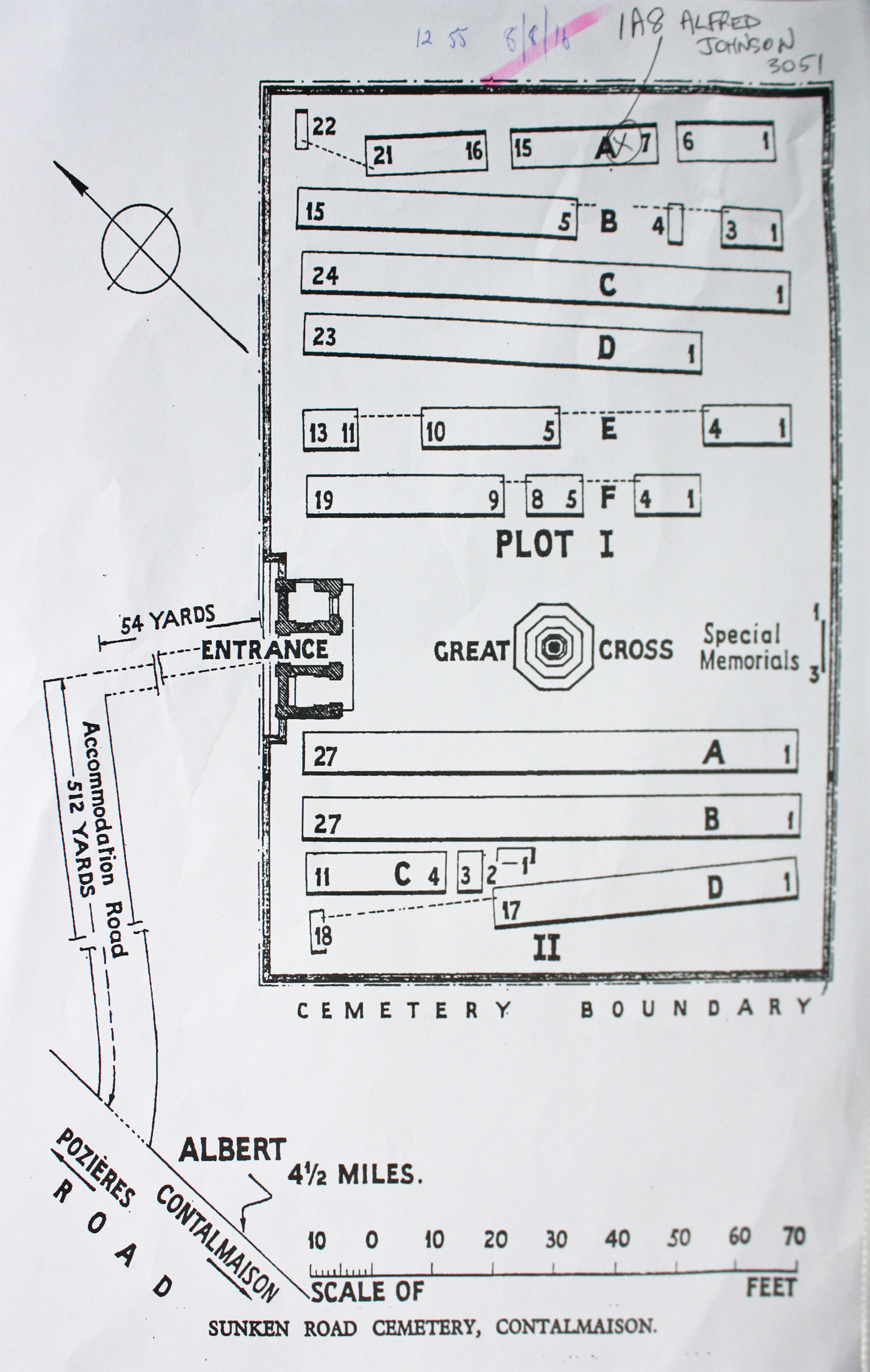
| SUNKEN ROAD CEMETERY, CONTALMAISON Annotated plan | 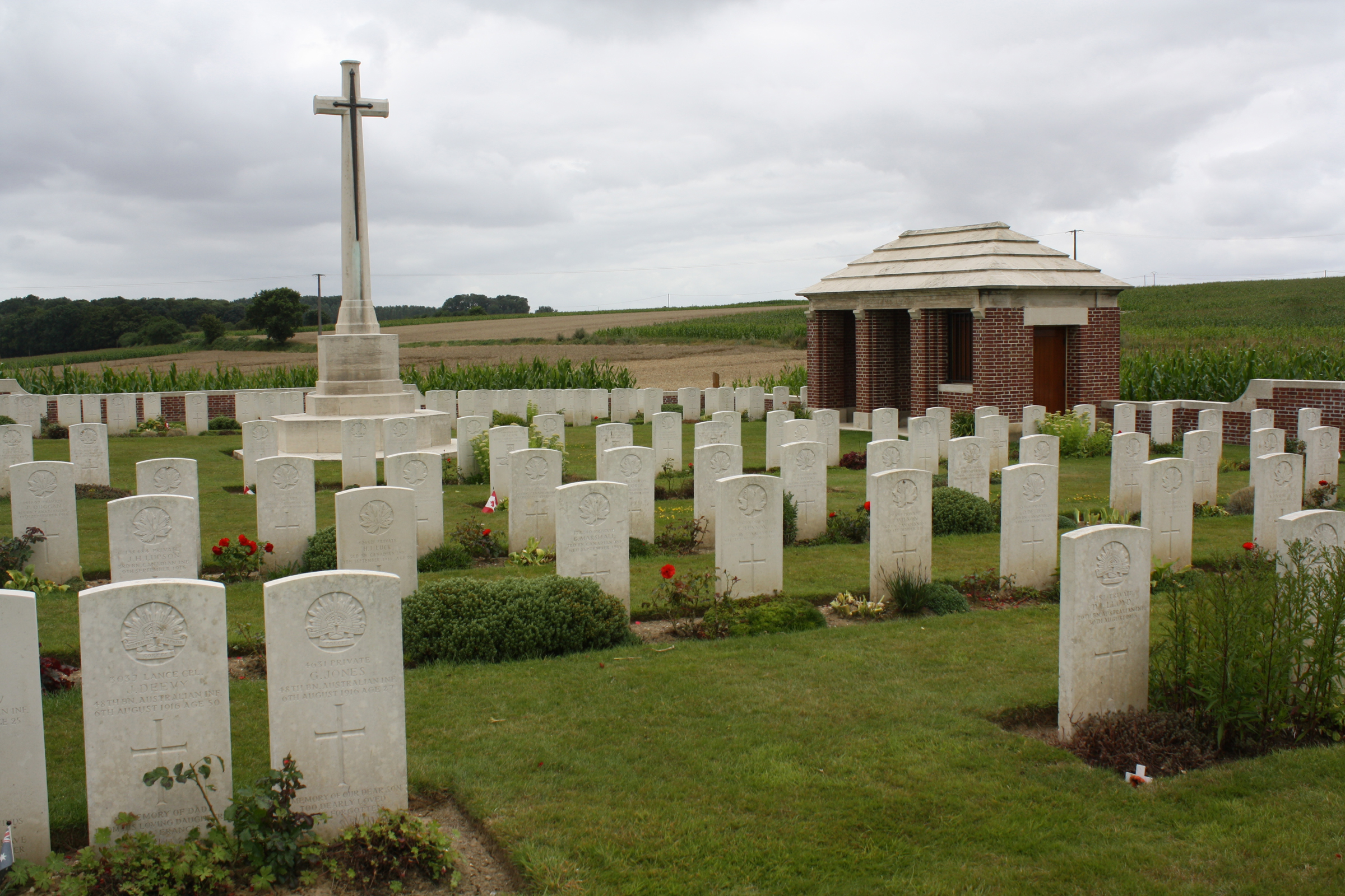 The Sunken Road Cemetery was made in July-October 1916, during the middle fighting in the Somme offensive.There are now over 200, 1914-18 war casualties commemorated in this site. Of these, a small number are unidentified and three Australian graves, which cannot be located, are represented by special memorials. The graves of two German soldiers, buried by the enemy at the end of March 1918, have been removed. Commonwealth War Graves site for SUNKEN ROAD CEMETERY, CONTALMAISONGo there on Google maps |
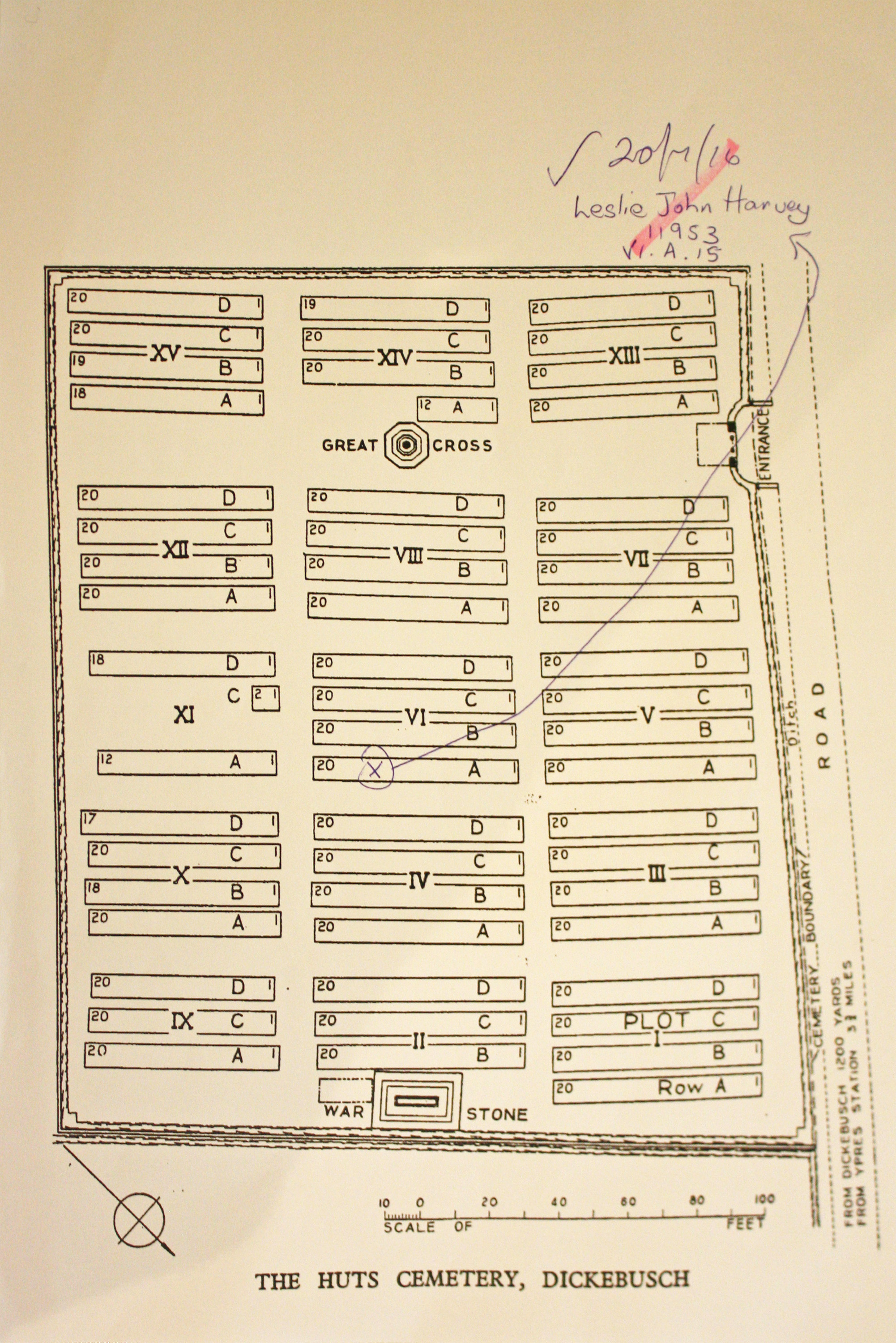
| THE HUTS CEMETERY Annotated plan | 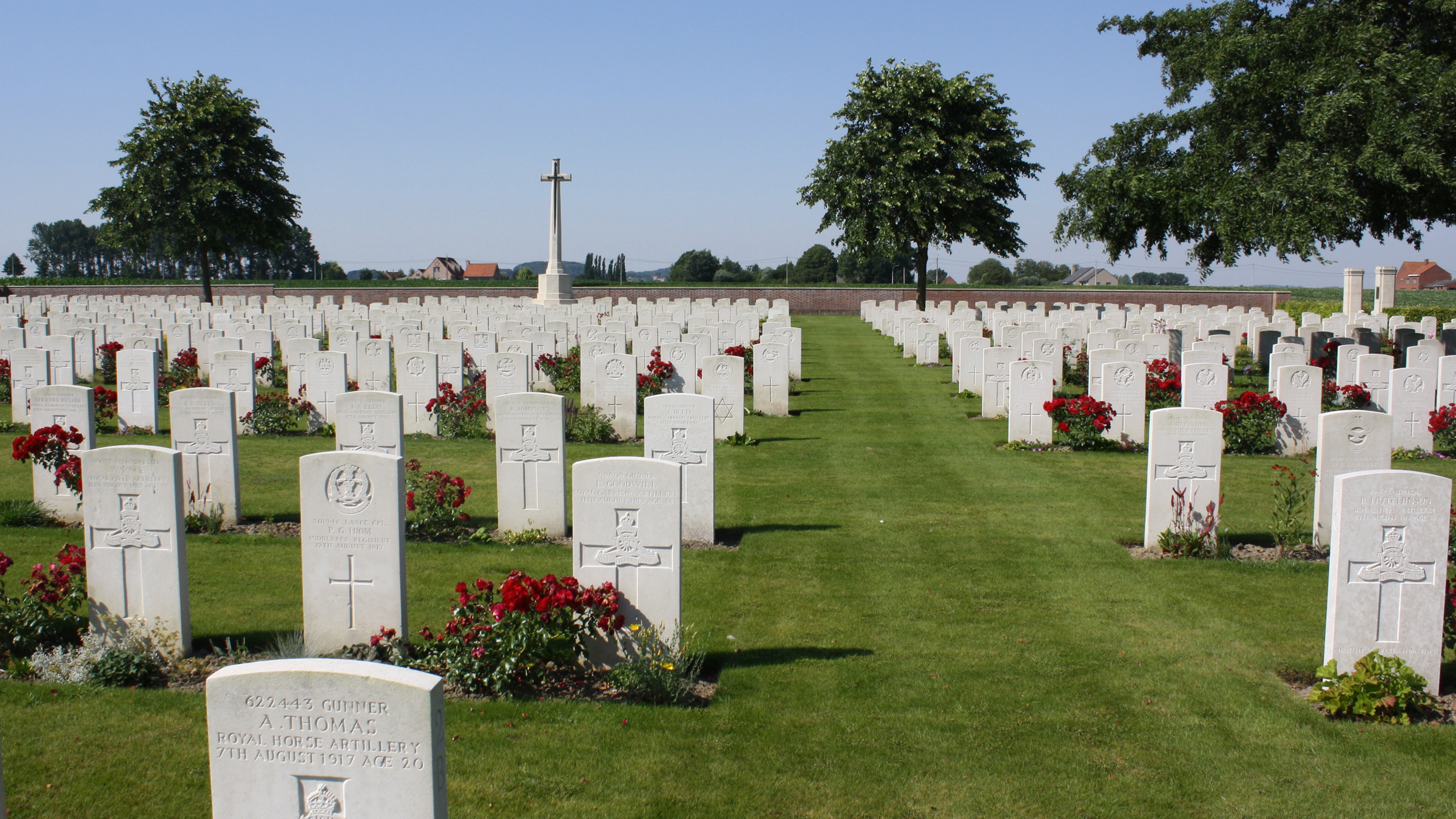 This cemetery takes its name from a line of huts strung along the road from Dickebusch (now Dikkebus) to Brandhoek, which were used by field ambulances during the 1917 Allied offensive on this front. Plots I to X and XII to XIV were filled between July and November 1917. Plots XV and XI followed. Nearly two-thirds of the burials are of gunners as many artillery positions existed nearby. Commonwealth War Graves site for THE HUTS CEMETERYGo there on Google maps |
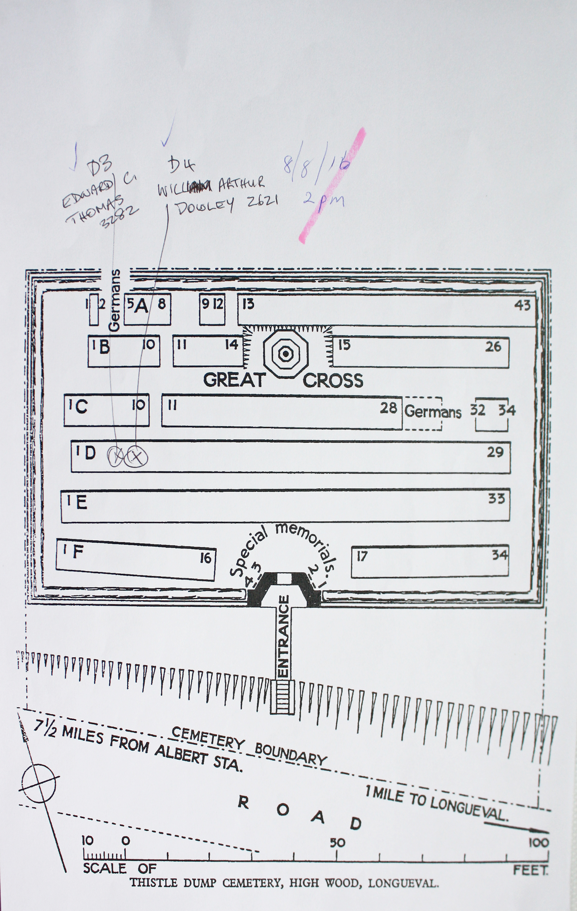
| THISTLE DUMP CEMETERY, HIGH WOOD, LONGUEVAL Annotated plan | 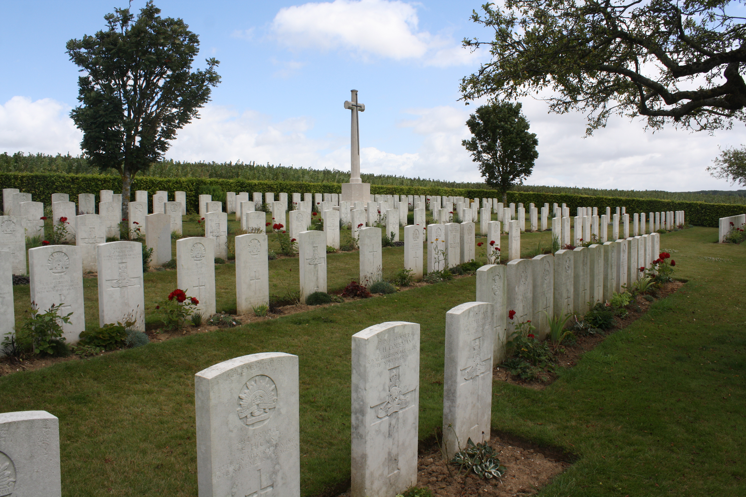 Thistle Dump Cemetery was begun in August 1916 and used as a front line cemetery until February 1917. It was later increased after the Armistice by the concentration of 56 graves from the Somme battlefields. Commonwealth War Graves site for THISTLE DUMP CEMETERY, HIGH WOOD, LONGUEVALGo there on Google maps |
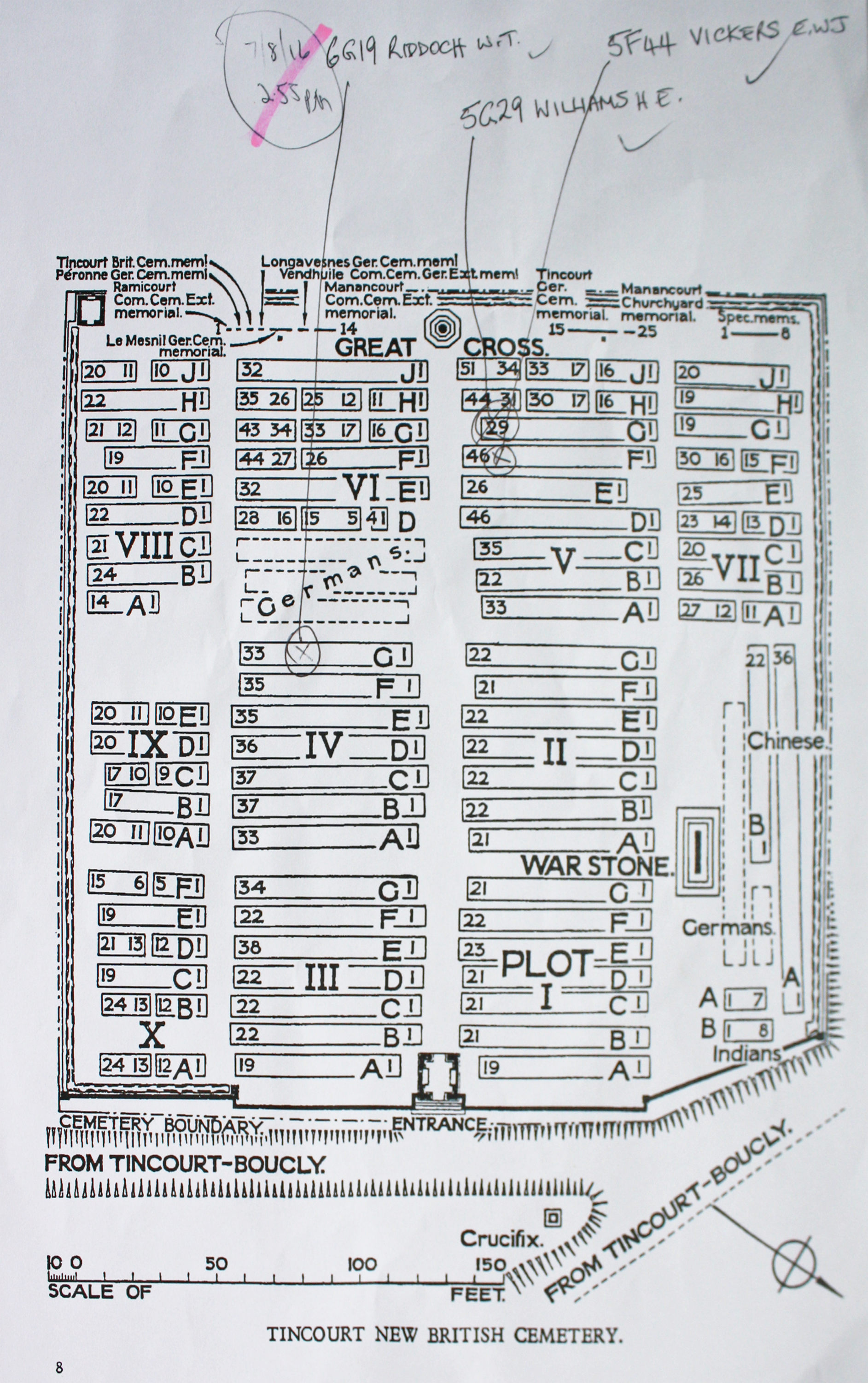
| TINCOURT NEW BRITISH CEMETERY Annotated plan | 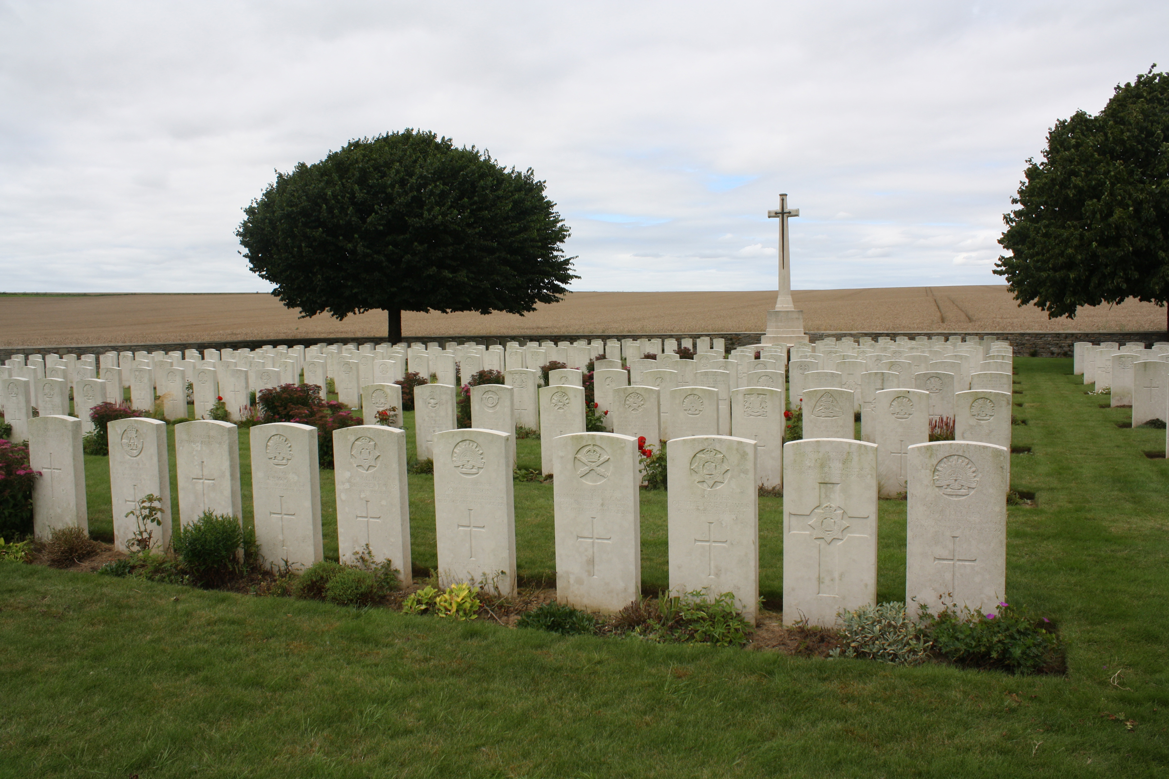 The cemetery was begun in June 1917, and used until September 1919; the few German burials, during their occupation of the village, are in Plot VI, Row A. After the Armistice it was used for the reburial of soldiers found on the battlefield, or buried in small French or German cemeteries. Commonwealth War Graves site for TINCOURT NEW BRITISH CEMETERYGo there on Google maps |
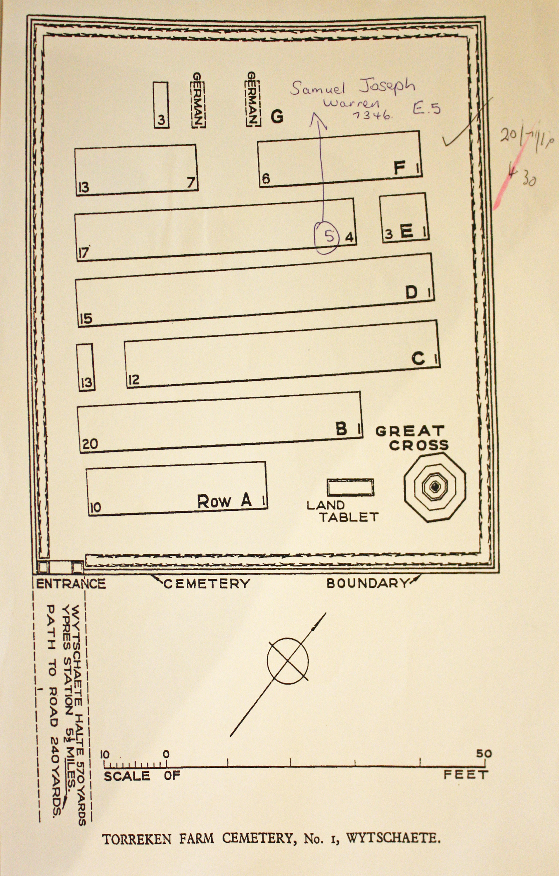
| TORREKEN FARM CEMETERY NO.1 Annotated plan |  Torreken Farm Cemetery (there is now only one) was begun by the 5th Dorset Regiment in June 1917 and used as a front line cemetery until April 1918.The cemetery contains 90 Commonwealth burials of the First World War and 14 German war graves. Commonwealth War Graves site for TORREKEN FARM CEMETERY NO.1Go there on Google maps |
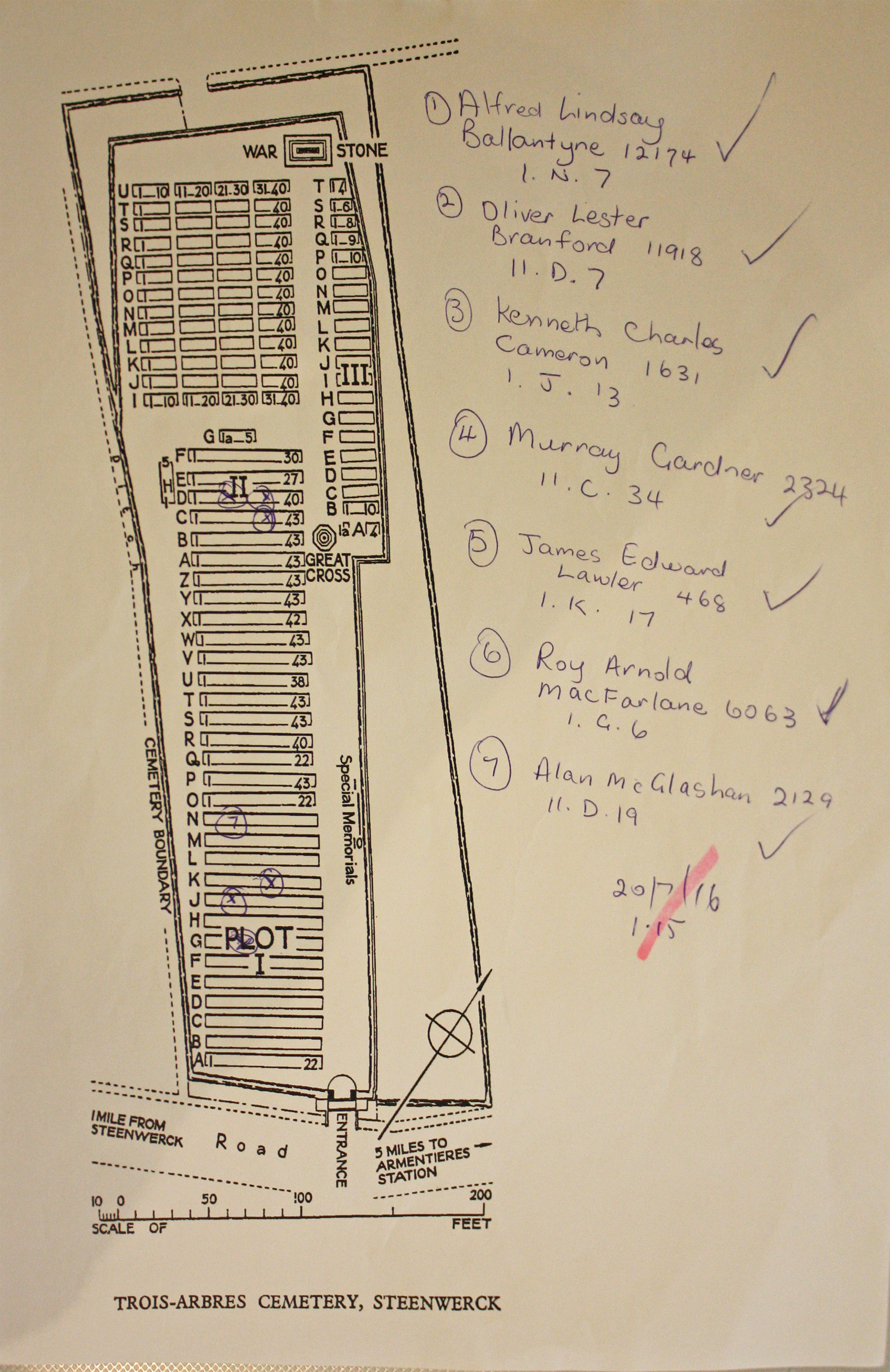
| TROIS ARBRES CEMETERY, STEENWERCK Annotated plan |  The site for Trois Arbres Cemetery was chosen for the 2nd Australian Casualty Clearing Station in July 1916, and Plot 1 and the earlier rows of Plot II, were made and used by that hospital until April 1918. A few further burials were made in the cemetery after the German withdrawal at the end of 1918 and after the Armistice, over 700 graves were brought into it from the battlefields of Steenwerck, Nieppe, Bailleul and Neuve-Eglise. Commonwealth War Graves site for TROIS ARBRES CEMETERY, STEENWERCKGo there on Google maps |
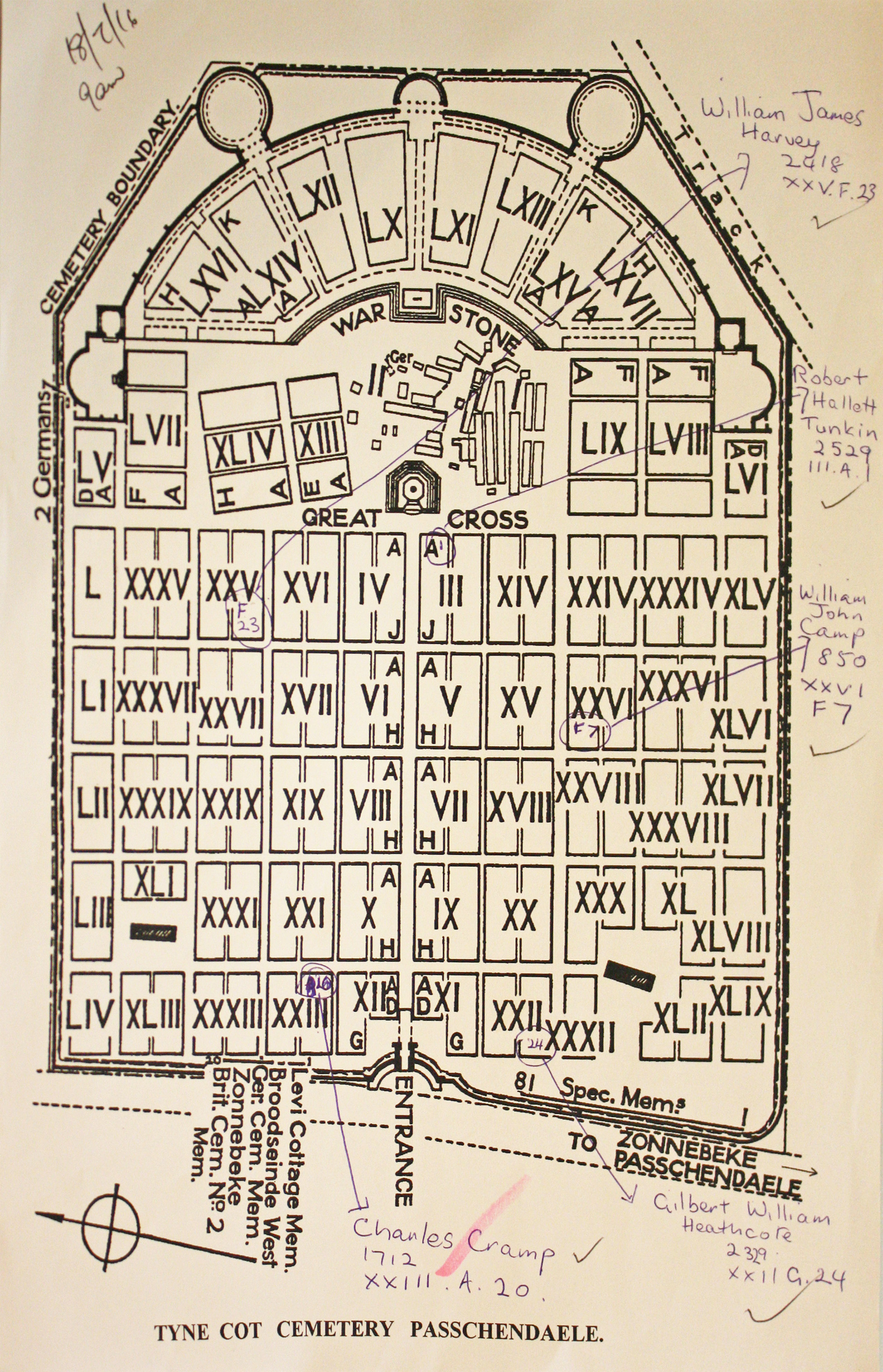
| TYNE COT CEMETERY Annotated plan | 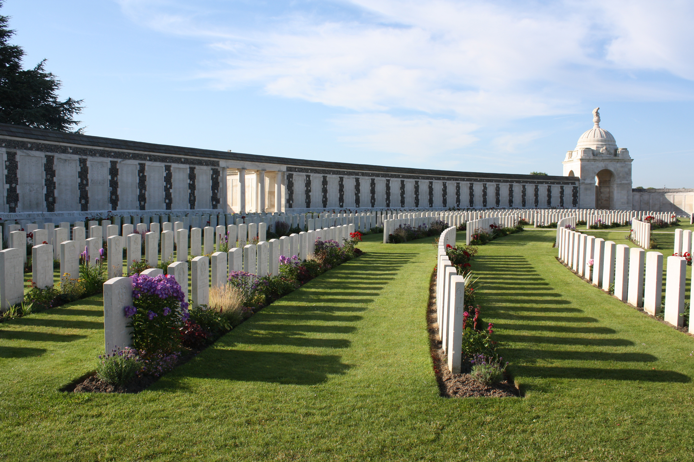 Tyne Cot' or 'Tyne Cottage' was the name given by the Northumberland Fusiliers to a barn which stood near the level crossing on the Passchendaele-Broodseinde road. The barn, which had become the centre of five or six German blockhouses, or pill-boxes, was captured by the 3rd Australian Division on 4 October 1917, in the advance on Passchendaele.One of these pill-boxes was unusually large and was used as an advanced dressing station after its capture. From 6 October to the end of March 1918, 343 graves were made, on two sides of it, by the 50th (Northumbrian) and 33rd Divisions, and by two Canadian units. The cemetery was in German hands again from 13 April to 28 September, when it was finally recaptured, with Passchendaele, by the Belgian Army. Commonwealth War Graves site for TYNE COT CEMETERYGo there on Google maps |
| UNICORN CEMETERY, VENDHUILE Annotated plan | 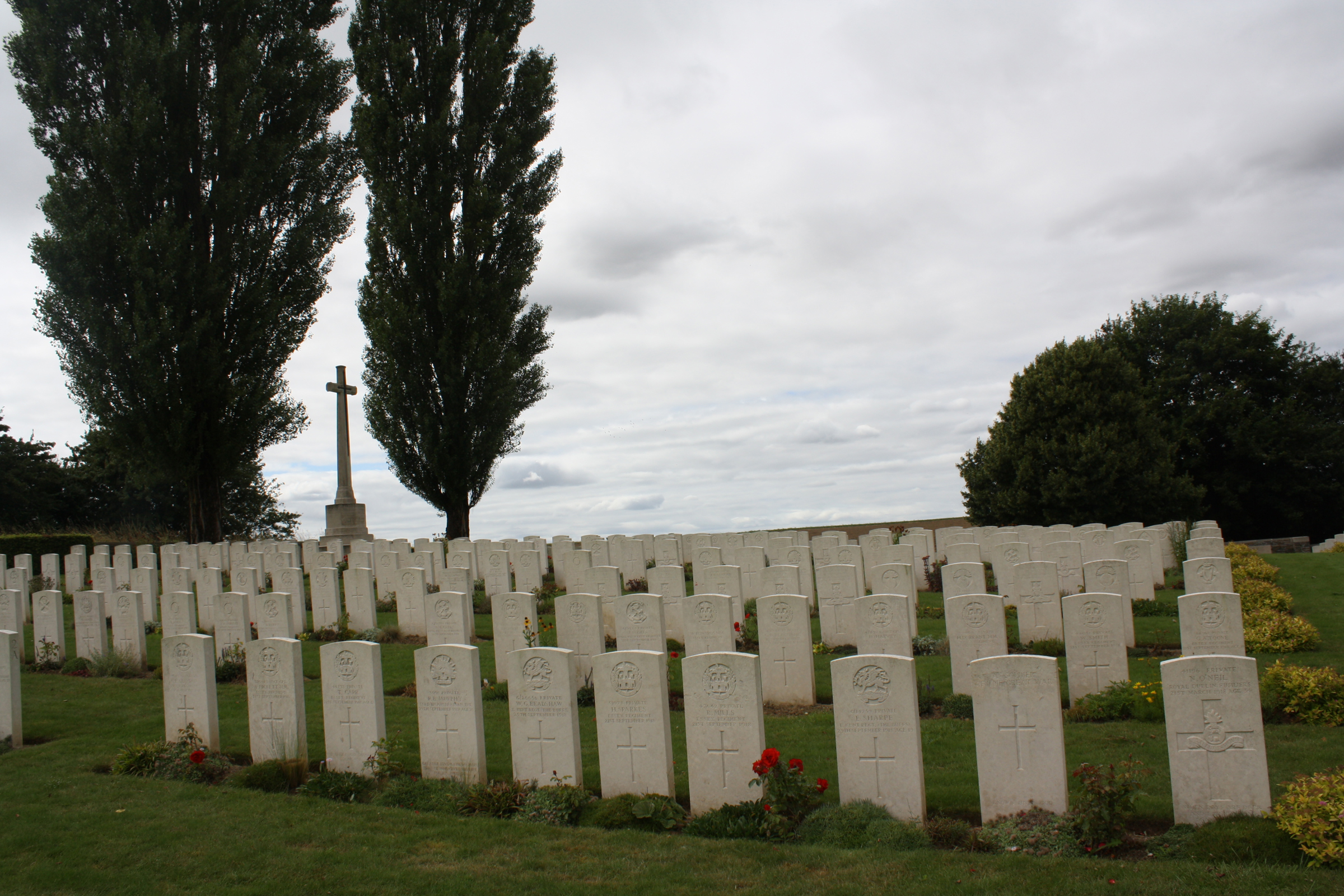 Vendhuile (Vend'huile) was very nearly reached in the Battle of Cambrai 1917. It was taken by the 27th and 30th American Divisions at the end of September 1918, and cleared by the 12th and 18th Divisions on 30 September. After the fight, men of the 18th Division were buried by the 50th (Northumbrian) Division in Plot I, Row A, of Unicorn Cemetery (the name is taken from the Divisional mark of the 50th Division). The rest of the cemetery was formed after the Armistice when graves were brought in from the surrounding battlefields, isolated sites and from the following small cemeteries of 1917 and 1918 Commonwealth War Graves site for UNICORN CEMETERY, VENDHUILEGo there on Google maps |
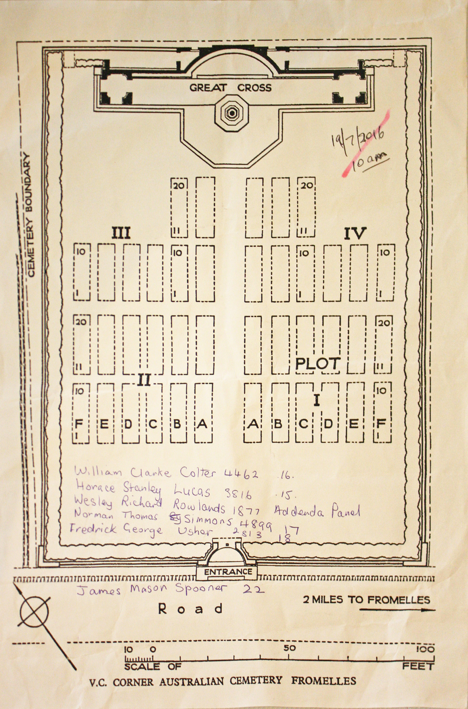
| V.C. CORNER AUSTRALIAN CEMETERY AND MEMORIAL, FROMELLES Annotated plan | 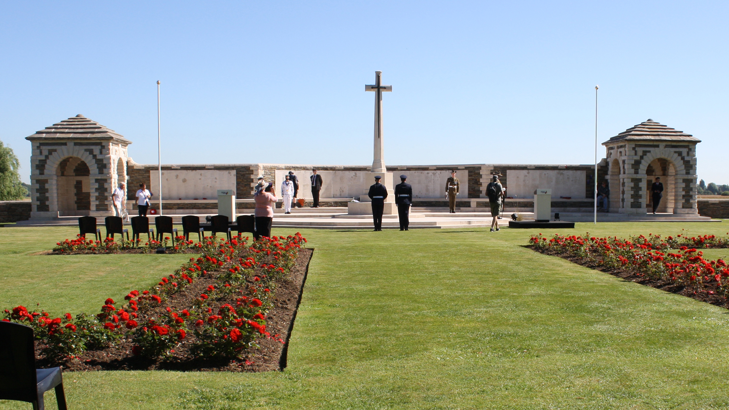 V.C. Corner Cemetery was made after the Armistice. It contains the graves of 410 Australian soldiers who died in the Attack at Fromelles and whose bodies were found on the battlefield, but not a single body could be identified. It was therefore decided not to mark the individual graves, but to record on a memorial the names of all the Australian soldiers who were killed in the engagement and whose graves were not known. The memorial, designed by Sir Herbert Baker, was built to commemorate nearly 1,300 Australian casualties, however since then many have subsequently had graves identified for them (in particular as a result of the excavation of the Pheasant Wood mass grave site in 2009), so today, it is the point of commemoration for 1,100 Australian casualties. Commonwealth War Graves site for V.C. CORNER AUSTRALIAN CEMETERY AND MEMORIAL, FROMELLESGo there on Google maps |
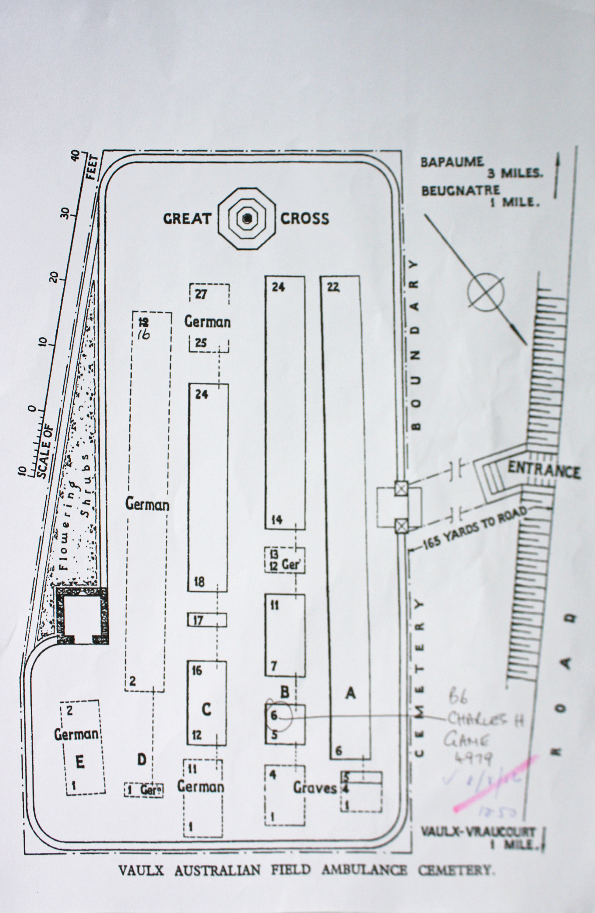
| VAULX AUSTRALIAN FIELD AMBULANCE CEMETERY Annotated plan |  Vaulx Australian Field Ambulance Cemetery was begun in April 1917 and used until February 1918. The Germans then buried in it, and one further Commonwealth burial was made in August.The cemetery contains 52 Commonwealth burials of the First World War, one of which is unidentified, and 61 German war graves. Commonwealth War Graves site for VAULX AUSTRALIAN FIELD AMBULANCE CEMETERYGo there on Google maps |
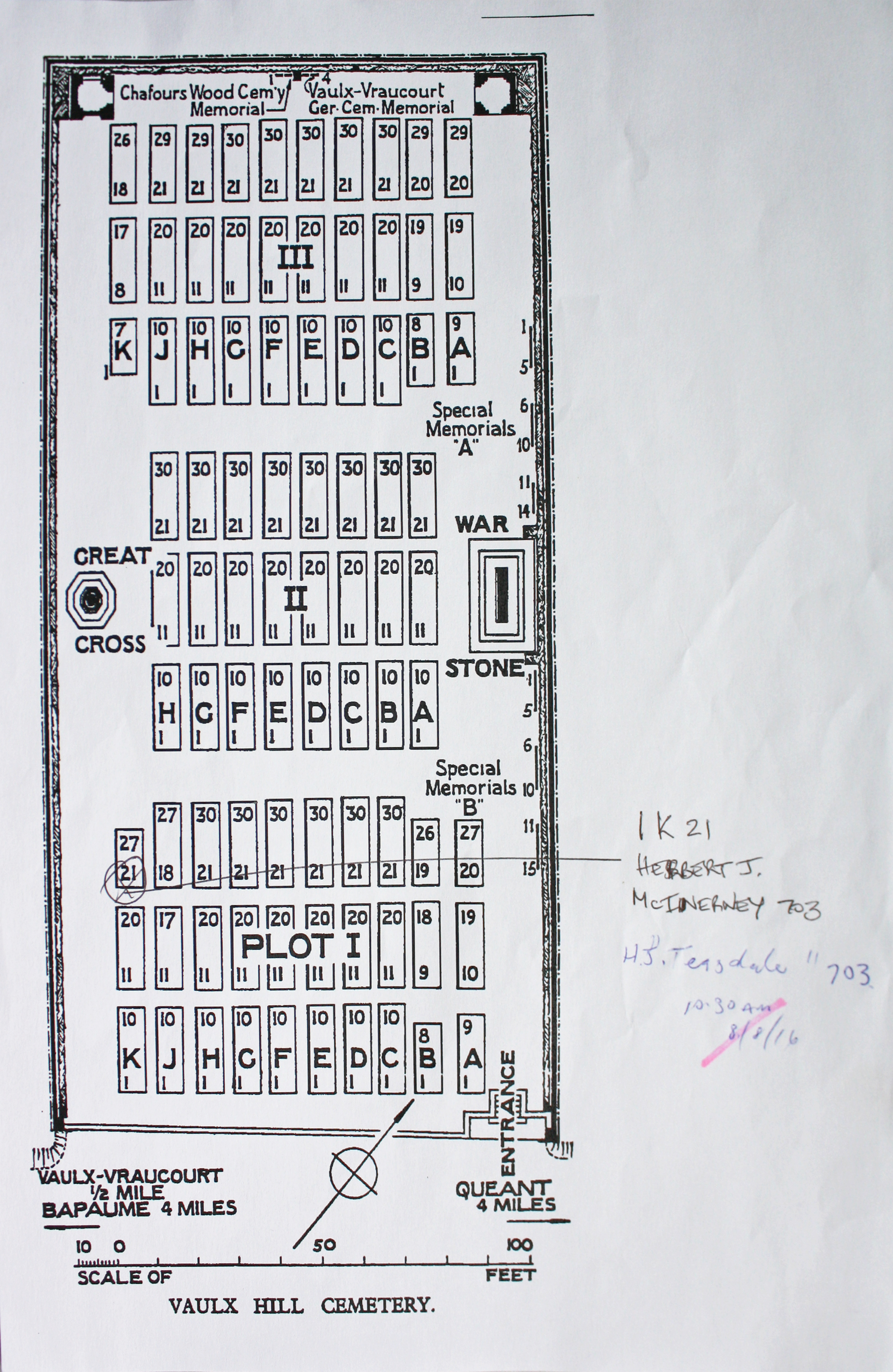
| VAULX HILL CEMETERY Annotated plan | 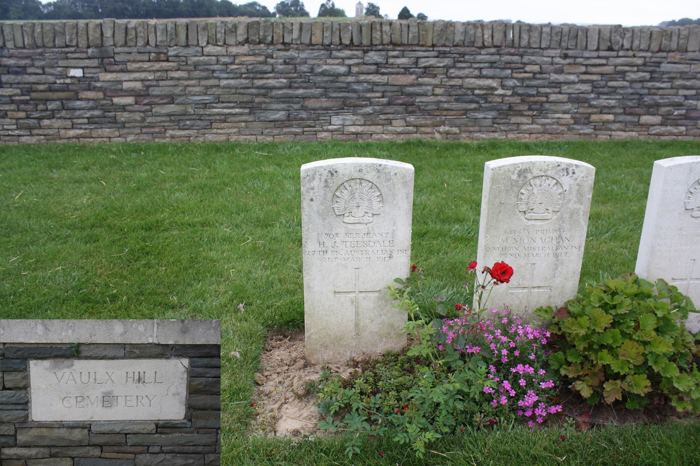 Vaulx Hill Cemetery started with just 17 graves of September 1918 (in Plot I, Rows A and B). The rest of the cemetery was formed after the Armistice when graves were brought in from the battlefields in the immediate neighbourhood. Commonwealth War Graves site for VAULX HILL CEMETERYGo there on Google maps |
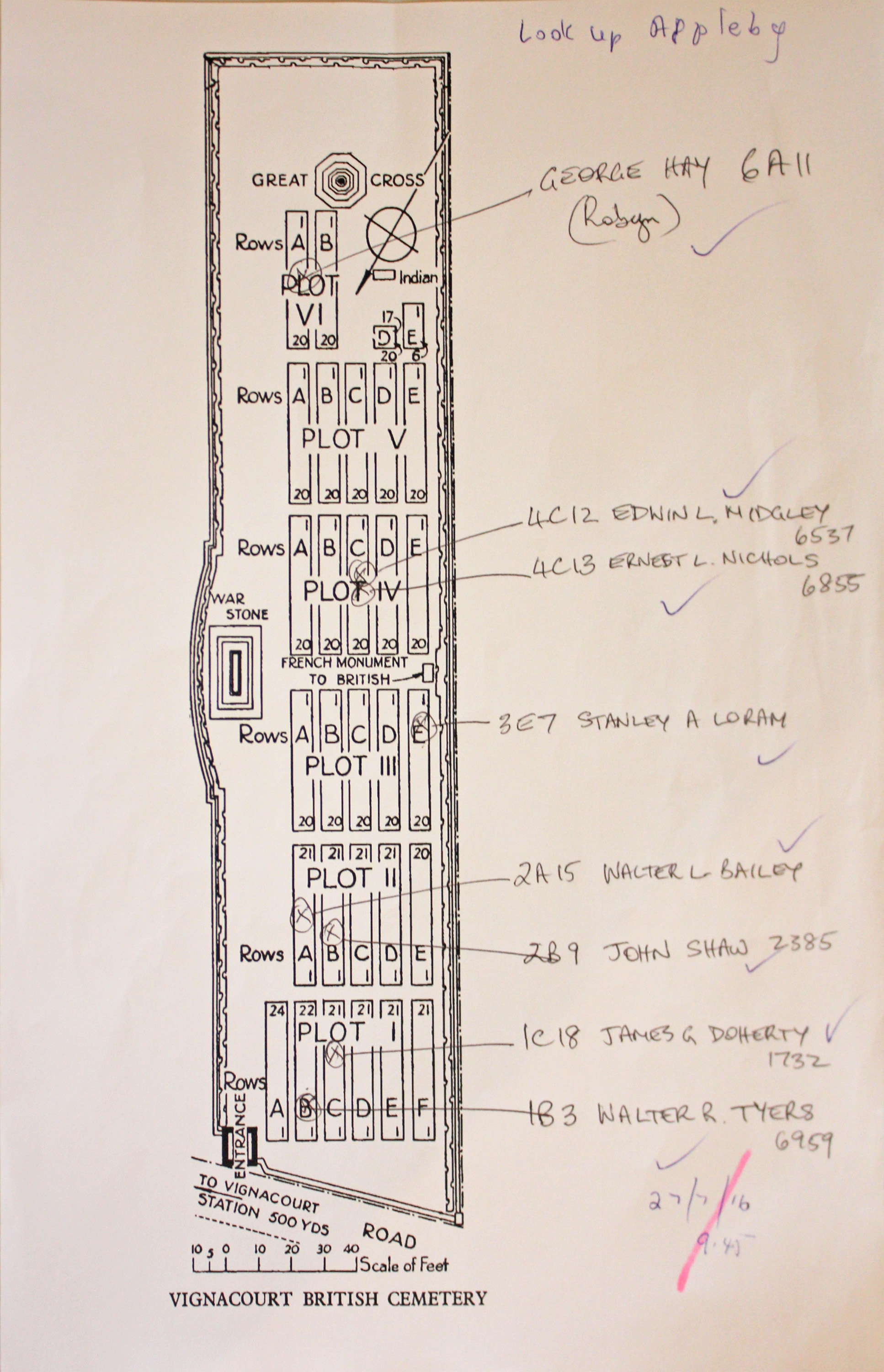
| VIGNACOURT BRITISH CEMETERY Annotated plan | 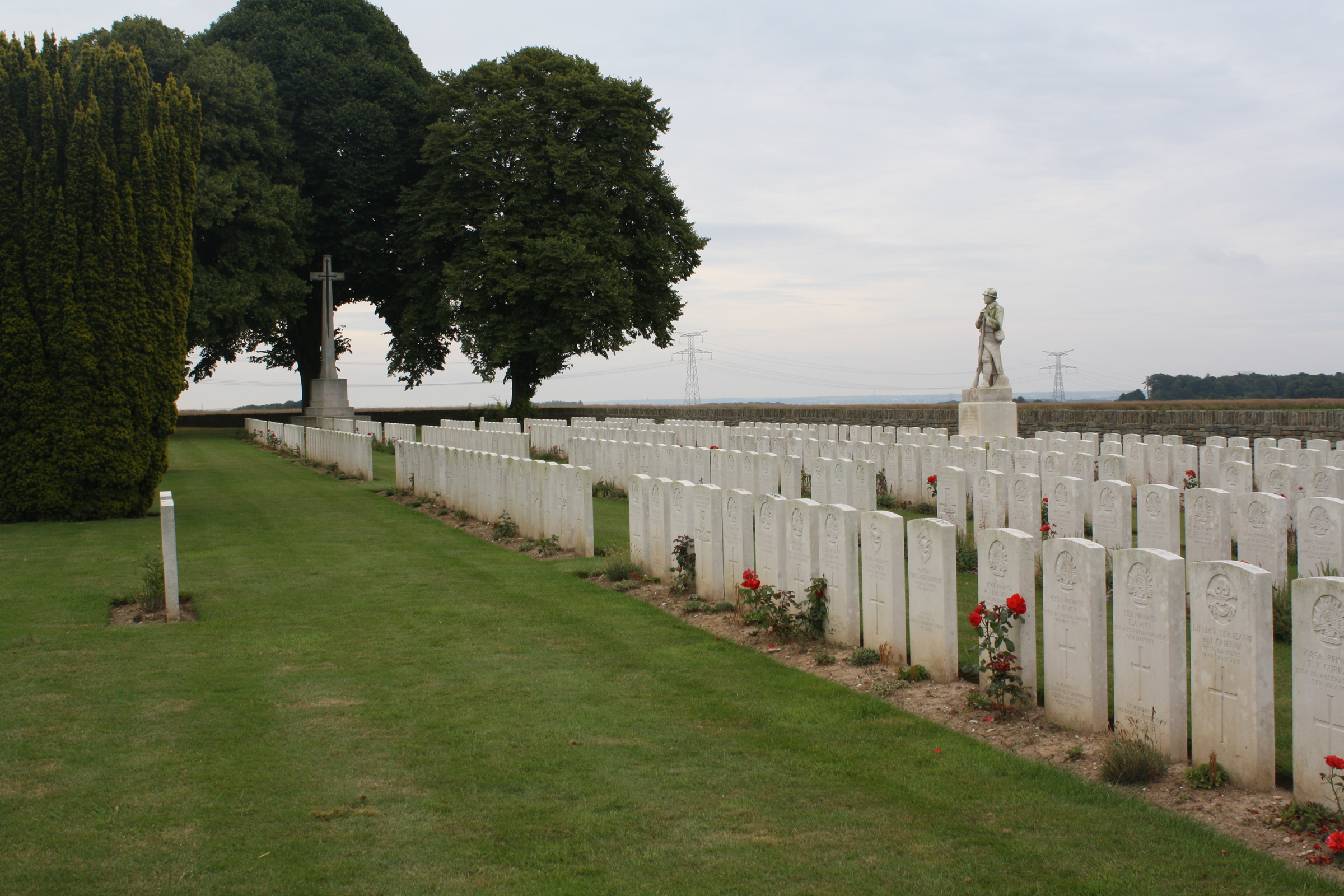 When the German advance began in March 1918, Vignacourt was occupied by the 20th and 61st Casualty Clearing Stations. It also became a headquarters of Royal Air Force squadrons. The cemetery was begun in April and closed in August, and the burials reflect the desperate fighting of the Australian forces on the Amiens front. Six burials made in the communal cemetery between October 1915 and March 1918 were brought into the cemetery after the Armistice. Commonwealth War Graves site for VIGNACOURT BRITISH CEMETERYGo there on Google maps |
| VILLERS-BRETONNEUX MEMORIAL | 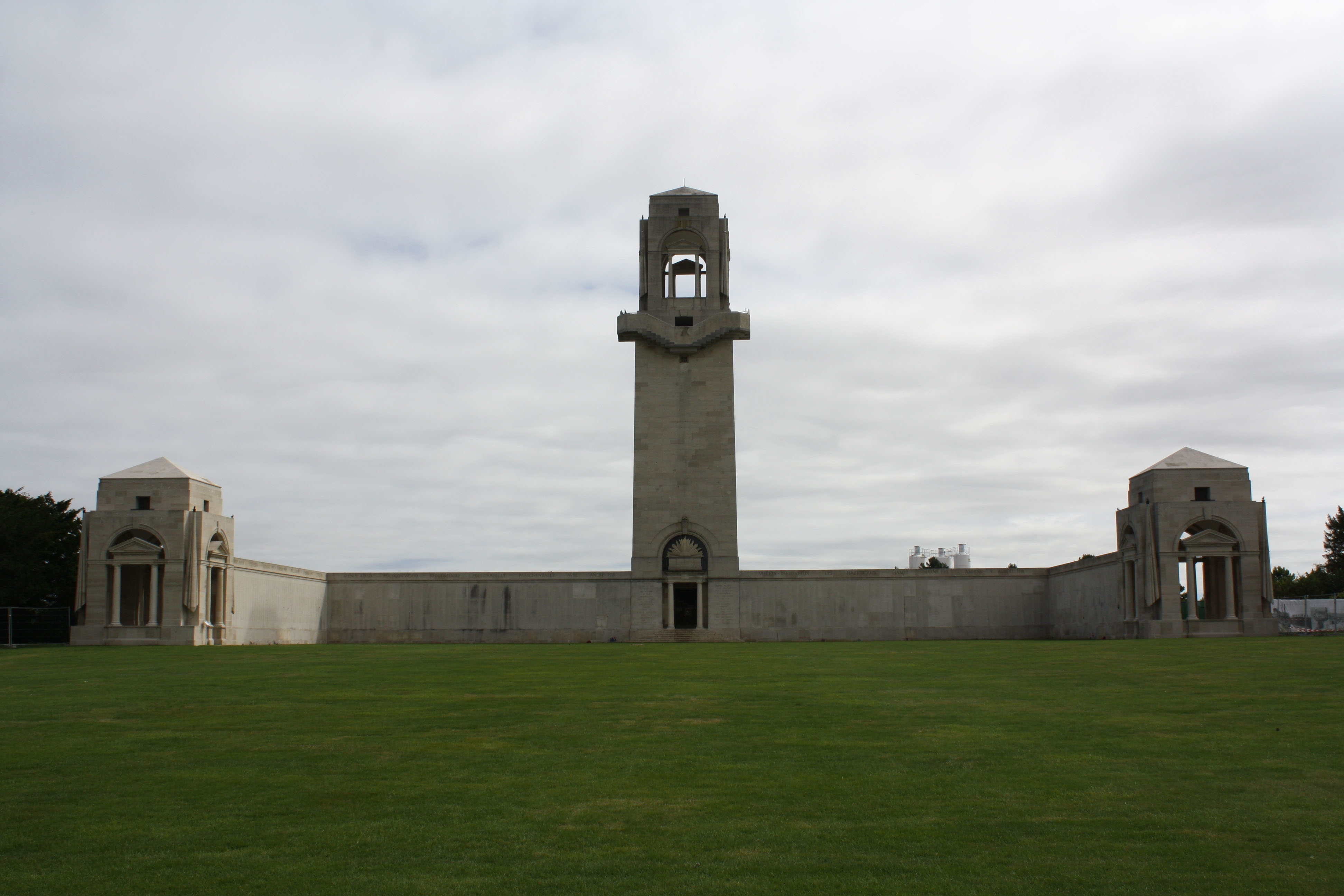 Villers-Bretonneux became famous in 1918, when the German advance on Amiens ended in the capture of the village by their tanks and infantry on 23 April. On the following day, the 4th and 5th Australian Divisions, with units of the 8th and 18th Divisions, recaptured the whole of the village and on 8 August 1918, the 2nd and 5th Australian Divisions advanced from its eastern outskirts in the Battle of Amiens. The memorial is the Australian National Memorial erected to commemorate all Australian soldiers who fought in France and Belgium during the First World War, to their dead, and especially to name those of the dead whose graves are not known. Commonwealth War Graves site for VILLERS-BRETONNEUX MEMORIALGo there on Google maps |
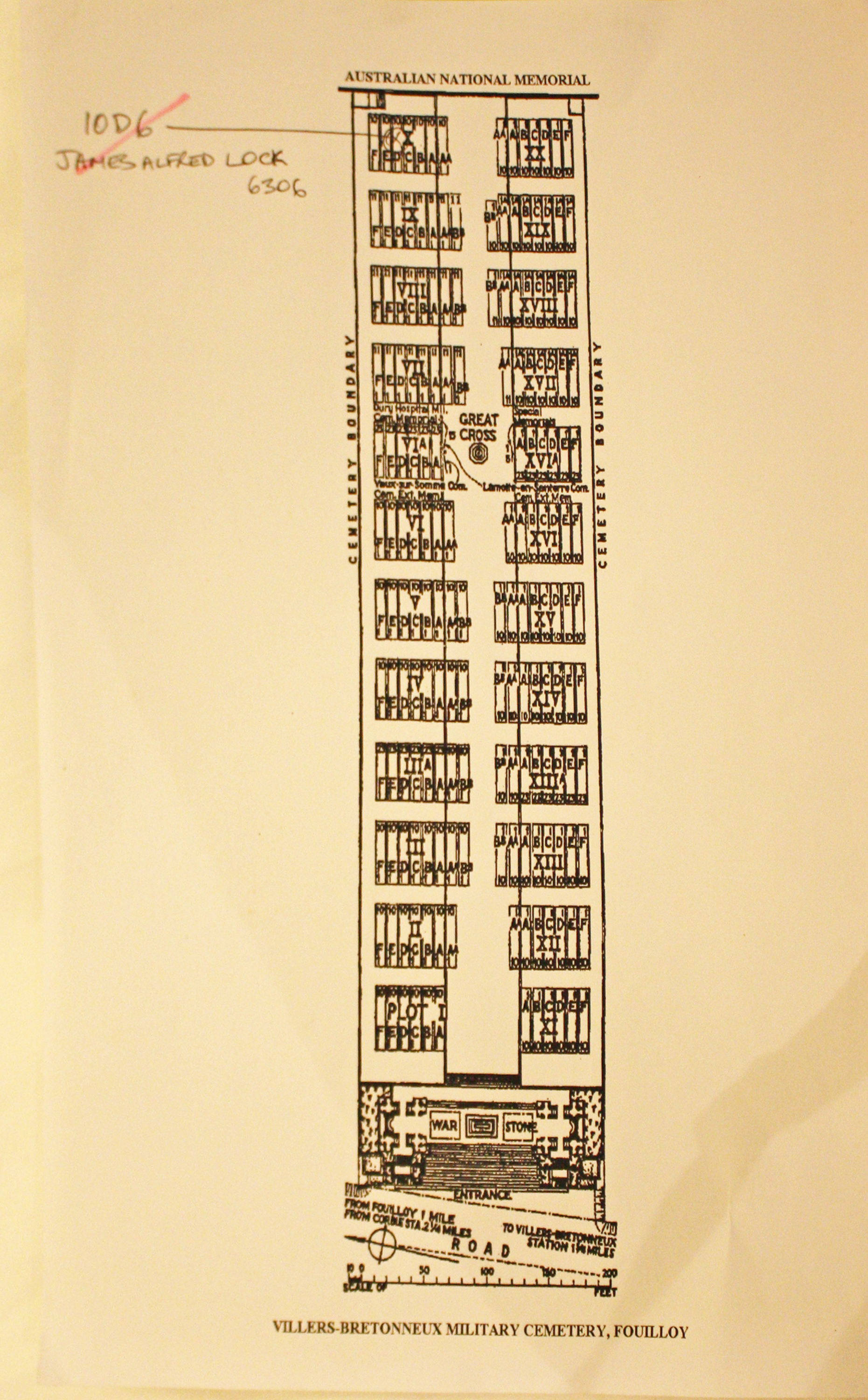
| VILLERS-BRETONNEUX MILITARY CEMETERY Annotated plan | 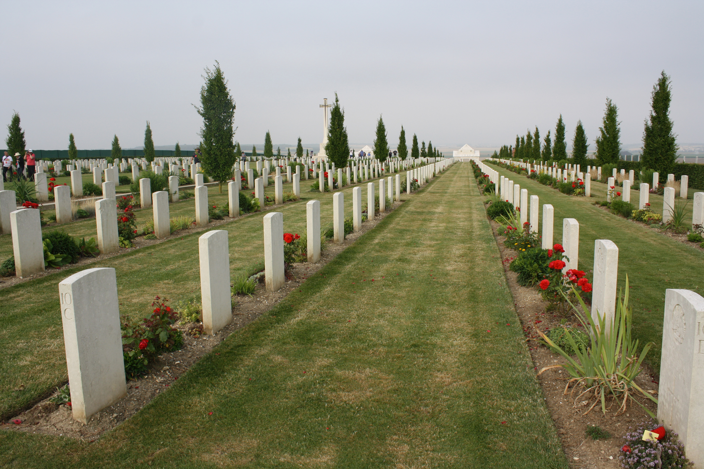 VILLERS-BRETONNEUX MILITARY CEMETERY was made after the Armistice when graves were brought in from other burial grounds in the area and from the battlefields. Plots I to XX were completed by 1920 and contain mostly Australian graves, almost all from the period March to August 1918. Plots IIIA, VIA, XIIIA and XVIA, and Rows in other Plots lettered AA, were completed by 1925, and contain a much larger proportion of unidentified graves brought from a wider area. Later still, 444 graves were brought in from Dury Hospital Military Cemetery. Commonwealth War Graves site for VILLERS-BRETONNEUX MILITARY CEMETERYGo there on Google maps |
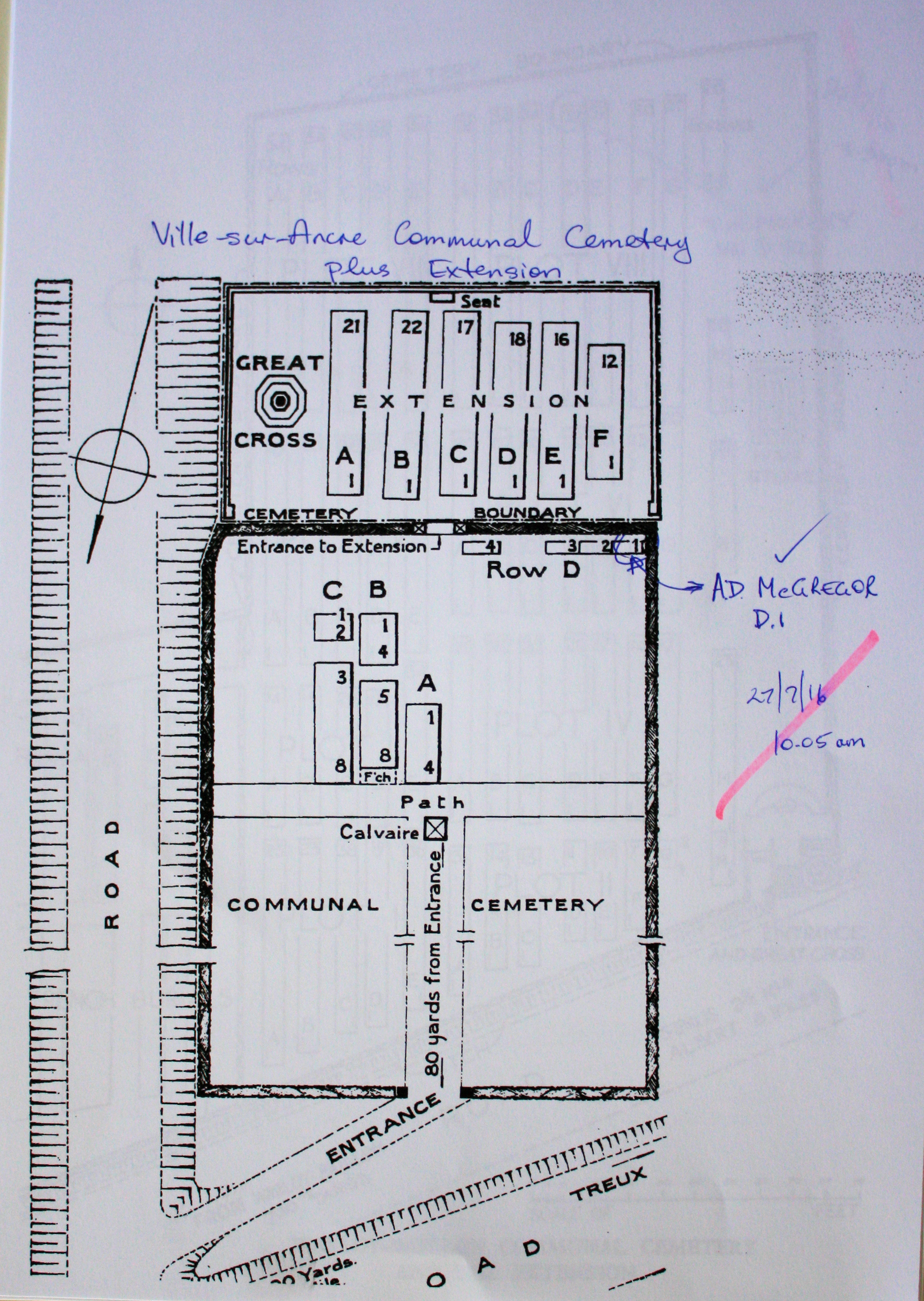
| VILLE-SUR-ANCRE COMMUNAL CEMETERY Annotated plan | 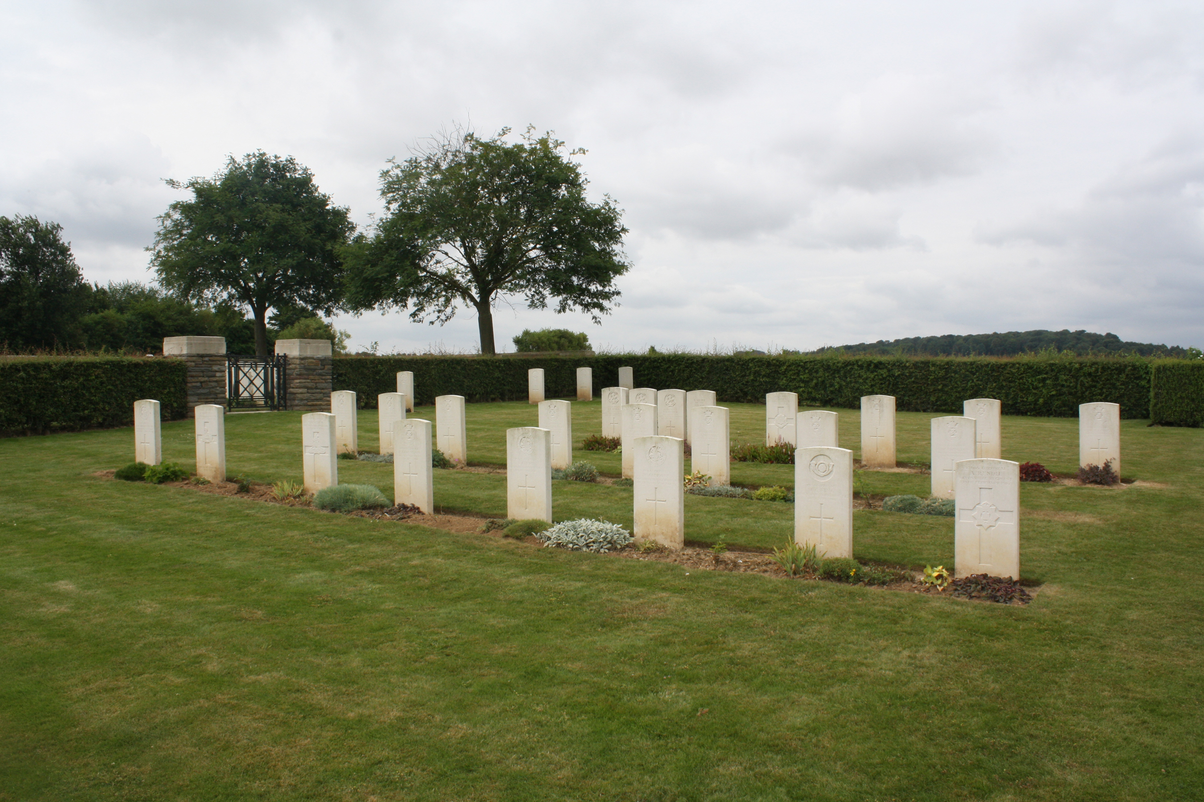 In 1916 the village of Ville-sur-Ancre was used occasionally by field ambulances. It was captured by the Germans at the end of April 1918, and retaken by the 2nd Australian Division on 19 May.The communal cemetery was used for burials during 1916. The extension was begun in August 1918 by the 12th Division Burial Officer, and after the Armistice graves were brought in from the battlefields of the Somme and the Ancre. Commonwealth War Graves site for VILLE-SUR-ANCRE COMMUNAL CEMETERYGo there on Google maps |
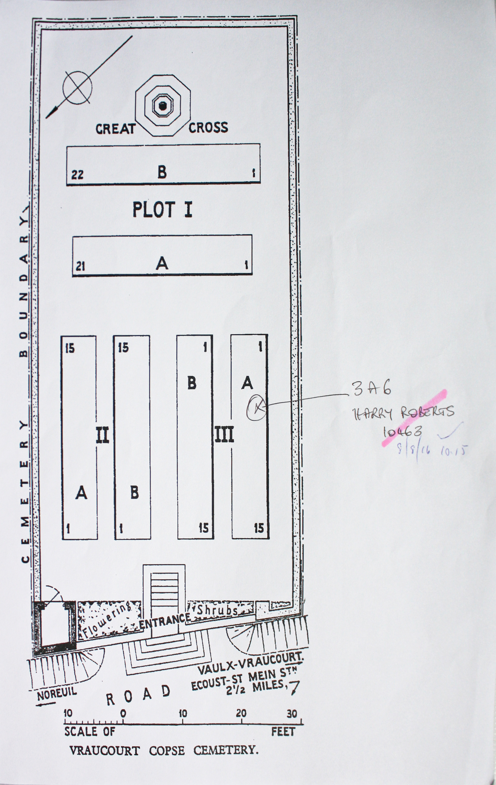
| VRAUCOURT COPSE CEMETERY, VAULX-VRAUCOURT Annotated plan | 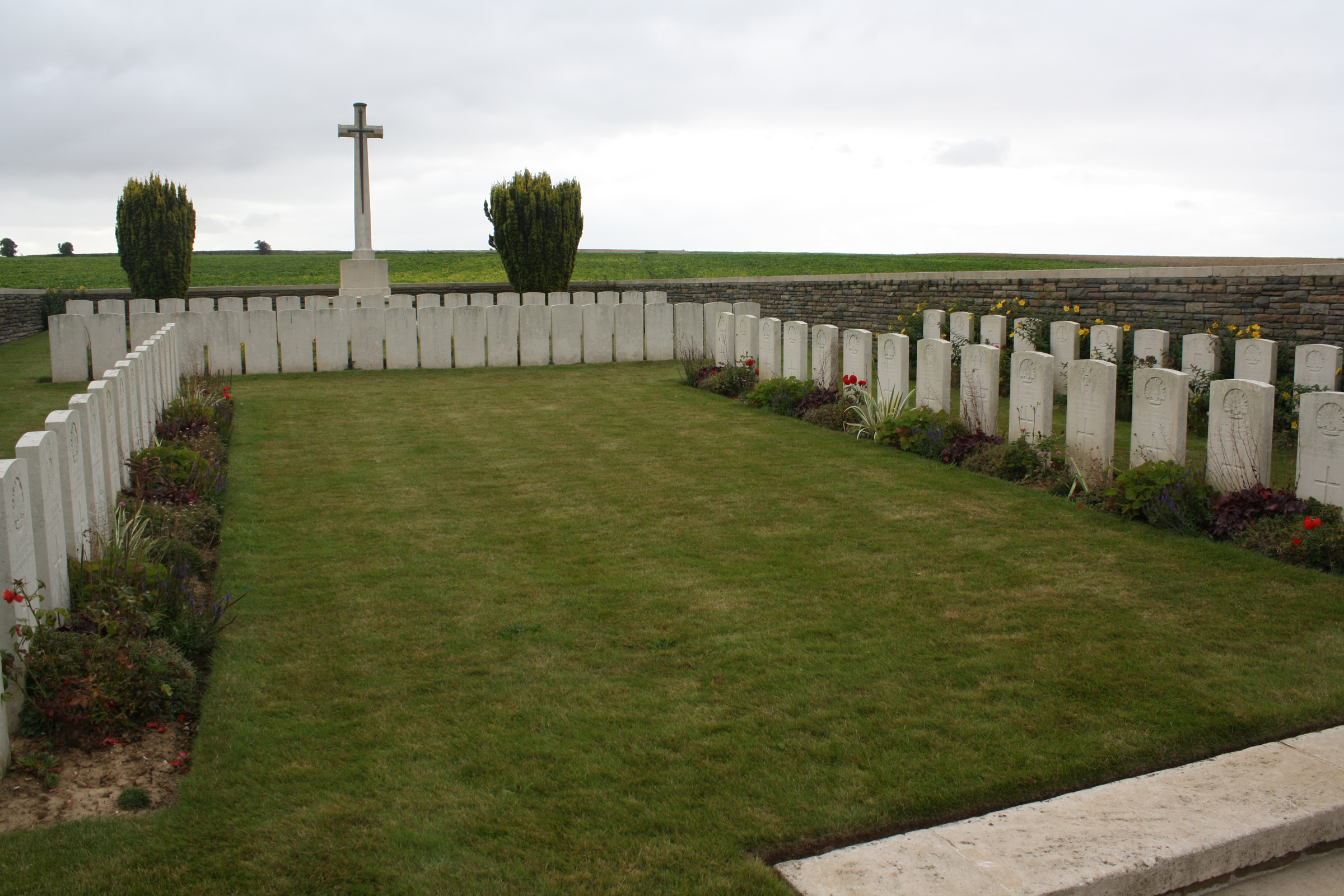 Vaulx-Vraucourt was taken in the spring of 1917, lost (after severe fighting) in March 1918, and retaken in the following September.The copse from which it is named lies to the north. The cemetery originally contained 43 Commonwealth graves of 2 and 3 September 1918 (mainly of the 3rd Division) but in 1928, Plots II and III were made when graves were brought in to the space between Plot I and the road from Vaulx A.D.S. Cemetery. This latter cemetery (named from an Advanced Dressing Station) was on low and swampy ground between Vraucourt Copse Cemetery and the villages. It was begun in April and May 1917, used by the Germans in March 1918, and used again by Commonwealth troops in September 1918. Commonwealth War Graves site for VRAUCOURT COPSE CEMETERY, VAULX-VRAUCOURTGo there on Google maps |
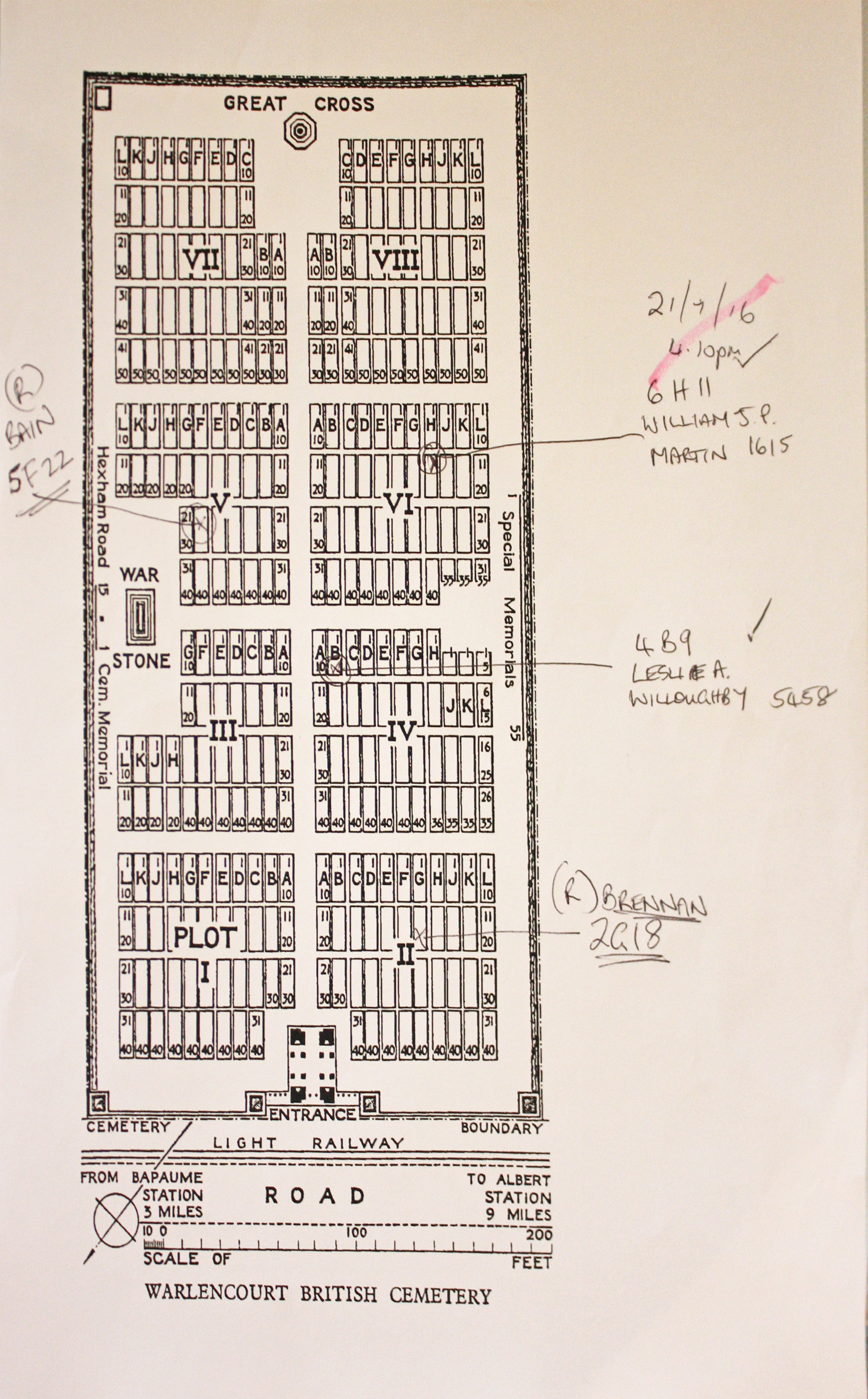
| WARLENCOURT BRITISH CEMETERY Annotated plan |  Warlencourt, the Butte de Warlencourt and Eaucourt-L'Abbaye were the scene of very fierce fighting in 1916. Eaucourt was taken by the 47th (London) Division early in October. The Butte (a Roman mound of excavated chalk, about 17 metres high, once covered with pines) was attacked by that and other divisions, but it was not relinquished by the Germans until the following 26 February, when they withdrew to the Hindenburg Line. The cemetery was made late in 1919 when graves were brought in from small cemeteries and the battlefields of Warlencourt and Le Sars. Commonwealth War Graves site for WARLENCOURT BRITISH CEMETERYGo there on Google maps |
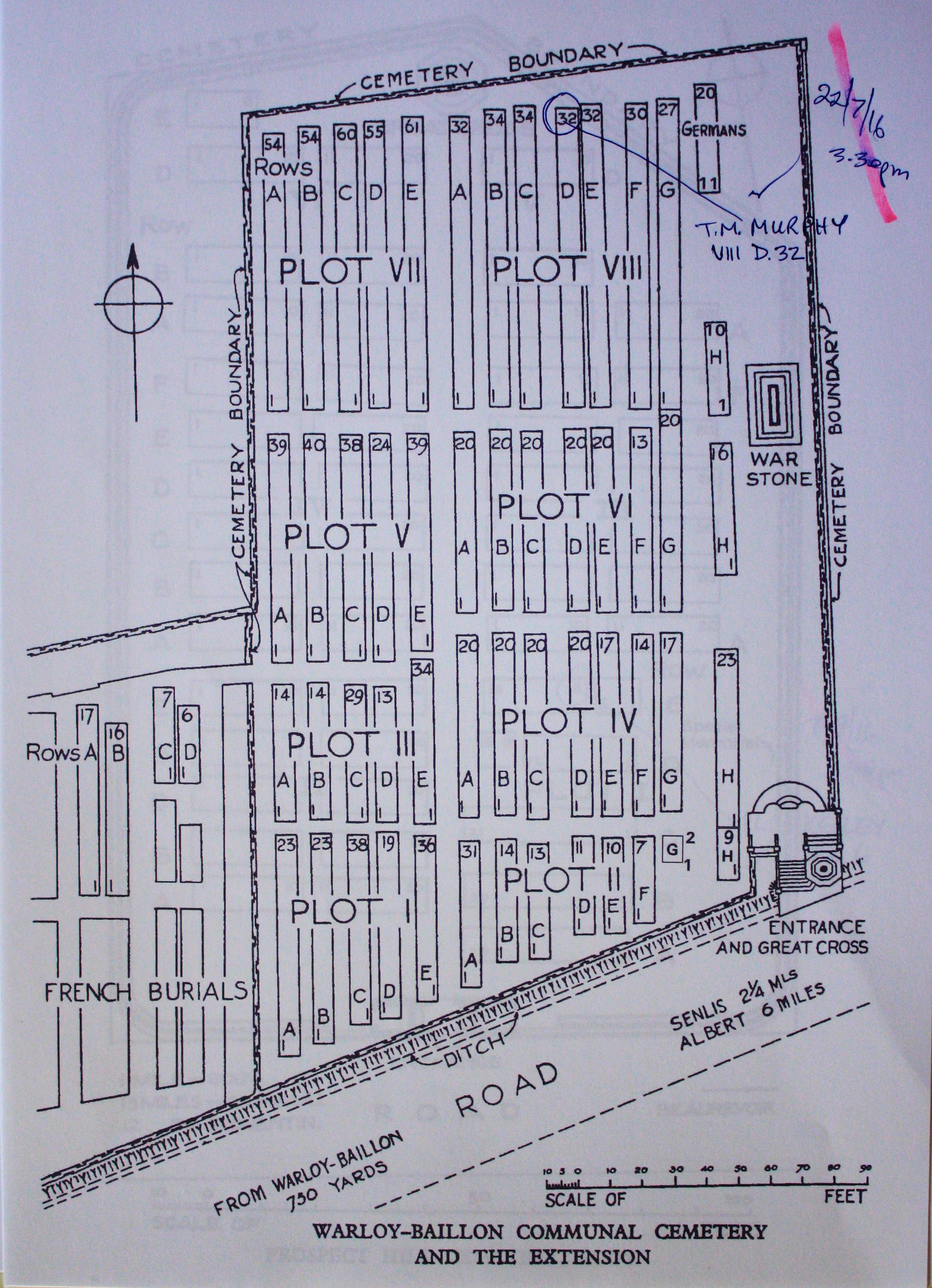
| WARLOY-BAILLON COMMUNAL CEMETERY EXTENSION Annotated plan |  The first Commonwealth burial took place in the communal cemetery in October 1915 and the last on 1 July 1916. By that date, field ambulances had come to the village in readiness for the attack on the German front line eight kilometres away, and the extension was begun on the eastern side of the cemetery. Commonwealth War Graves site for WARLOY-BAILLON COMMUNAL CEMETERY EXTENSIONGo there on Google maps |
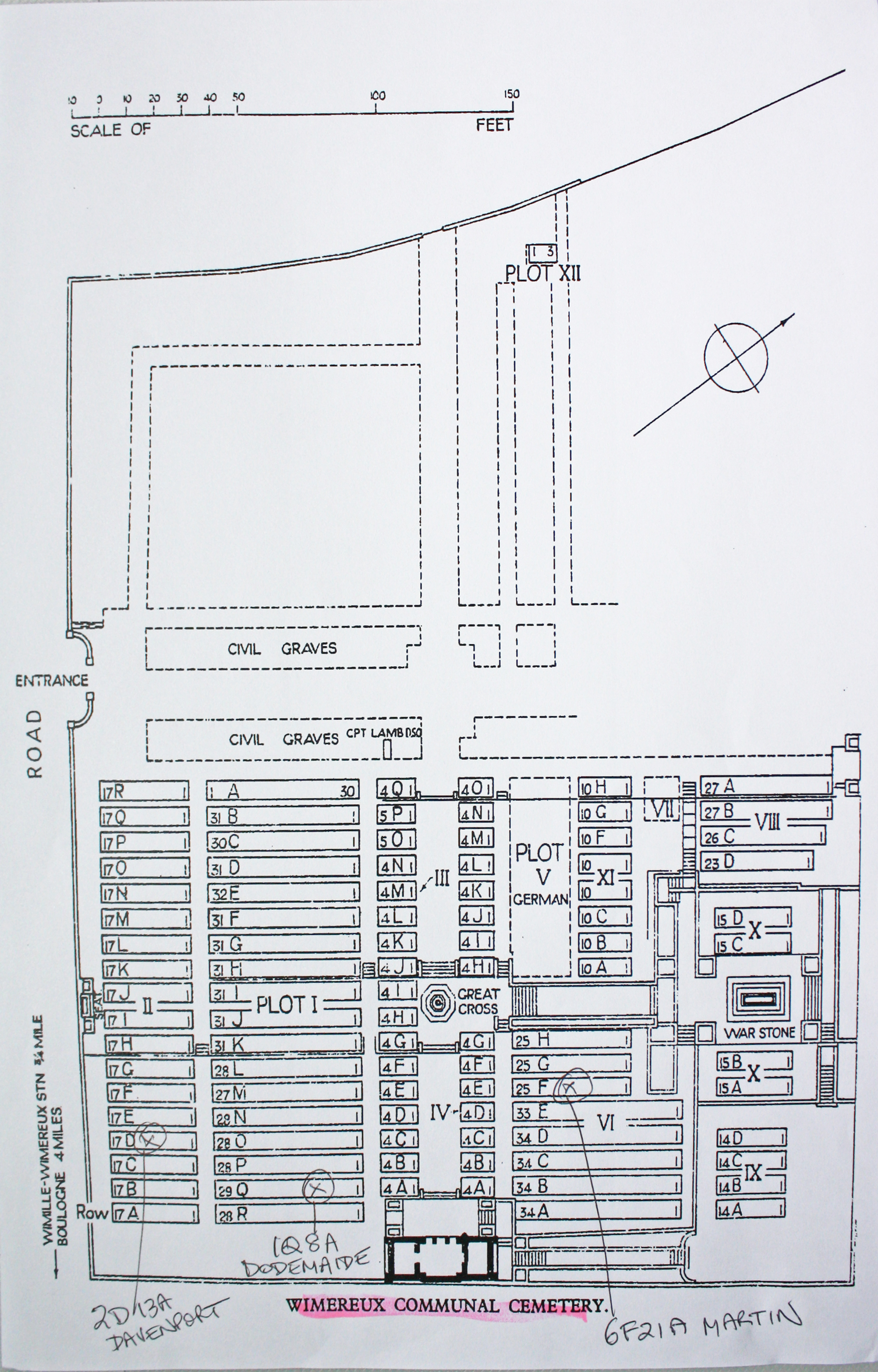
| WIMEREUX COMMUNAL CEMETERY Annotated plan |  Wimereux was the headquarters of the Queen Mary's Army Auxilliary Corps during the First World War and in 1919 it became the General Headquarters of the British Army.From October 1914 onwards, Boulogne and Wimereux formed an important hospital centre and until June 1918, the medical units at Wimereux used the communal cemetery for burials, the south-eastern half having been set aside for Commonwealth graves, although a few burial were also made among the civilian graves. By June 1918, this half of the cemetery was filled, and subsequent burials from the hospitals at Wimereux were made in the new military cemetery at Terlincthun. Commonwealth War Graves site for WIMEREUX COMMUNAL CEMETERYGo there on Google maps |
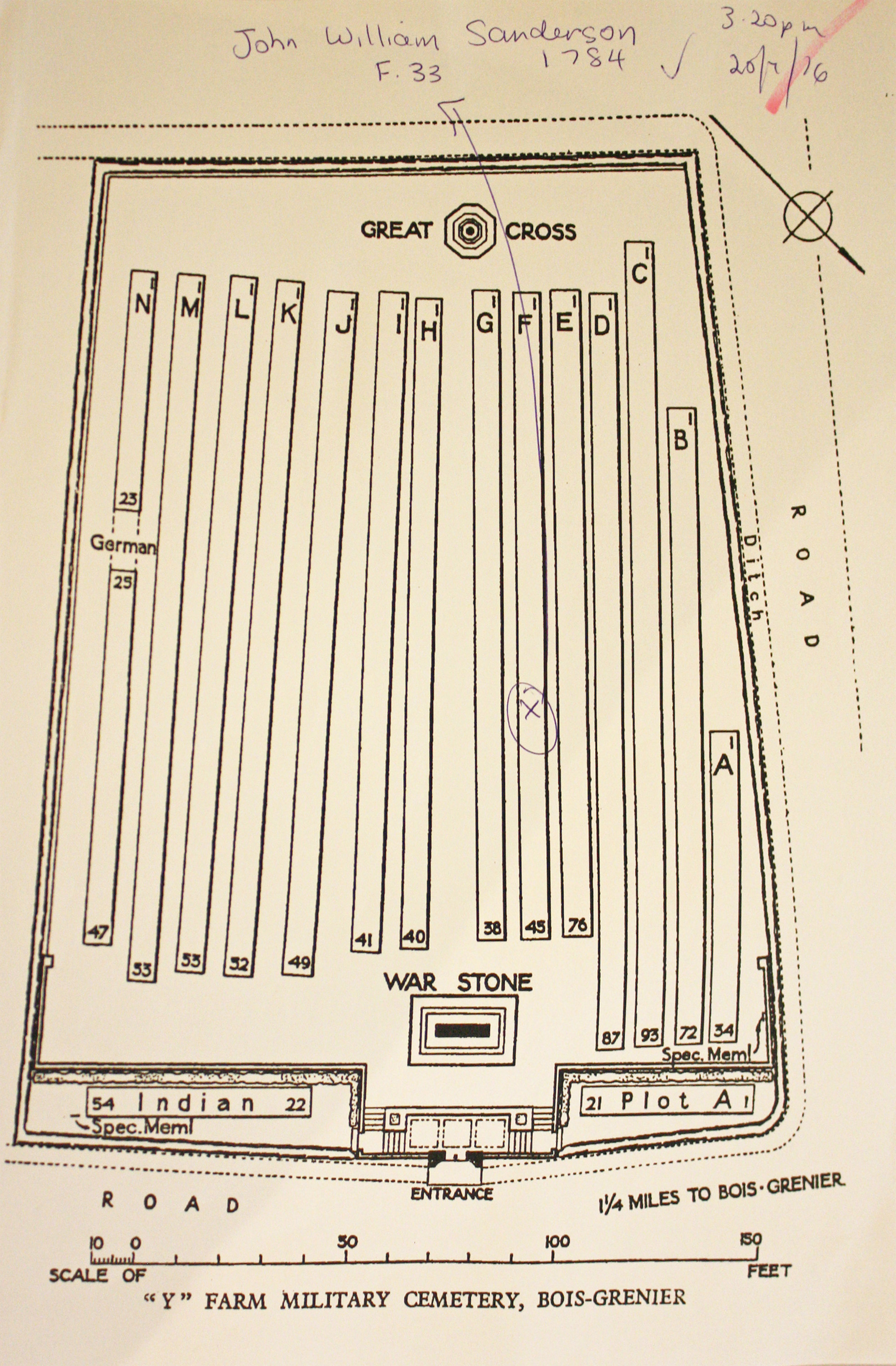
| Y FARM MILITARY CEMETERY, BOIS-GRENIER Annotated plan | 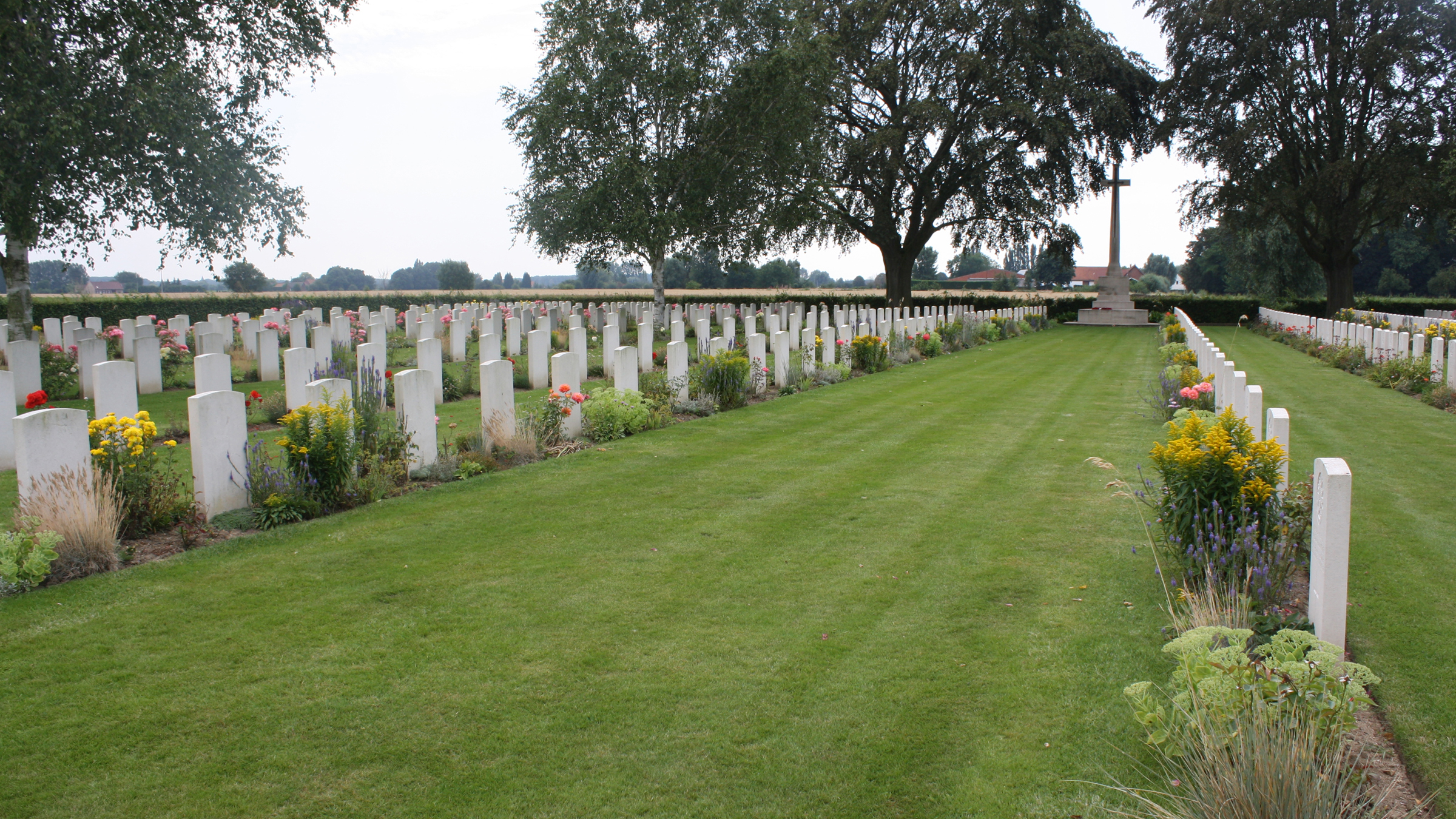 The cemetery was named after a nearby farm, called by the Army "Y" (or Wye) Farm. It was begun in March 1915 and used by units holding this sector until February 1918. At the Armistice it contained 335 burials, but it was then increased when graves were brought in from the battlefields south of Armentieres. Commonwealth War Graves site for Y FARM MILITARY CEMETERY, BOIS-GRENIERGo there on Google maps |
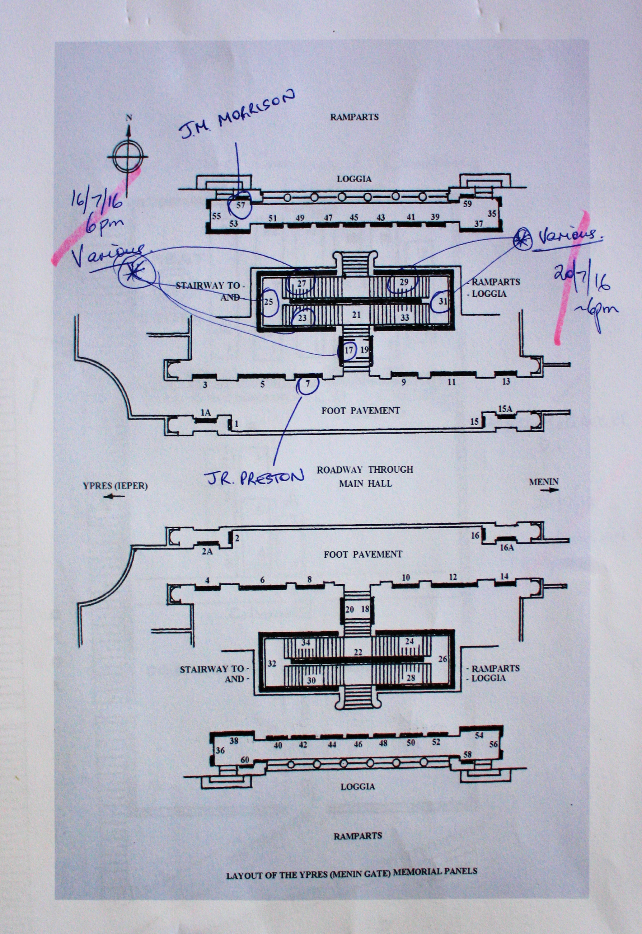
| YPRES (MENIN GATE) MEMORIAL Annotated plan | 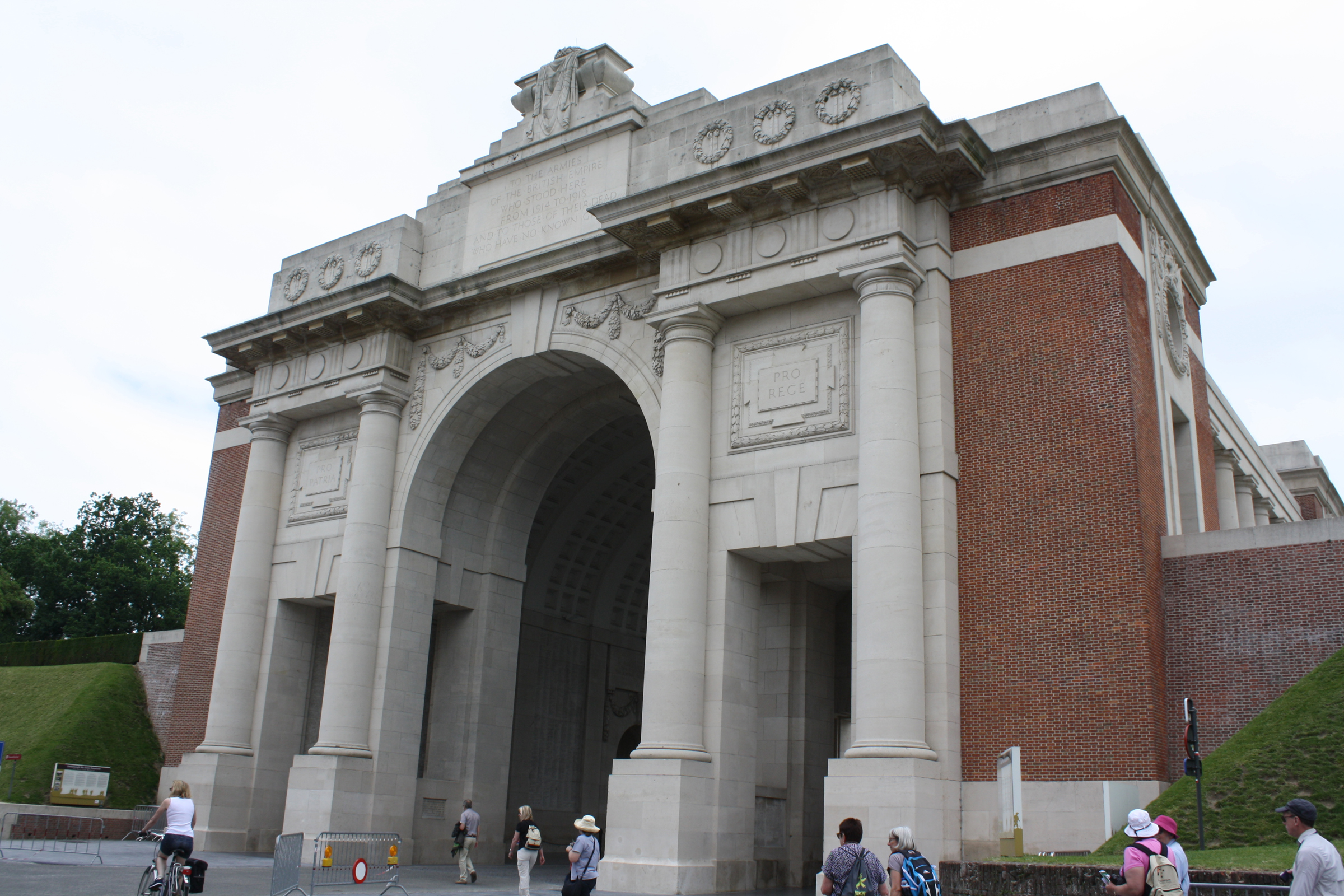 Ypres (now Ieper) is a town in the Province of West Flanders. The Memorial is situated at the eastern side of the town on the road to Menin (Menen) and Courtrai (Kortrijk).The Menin Gate is one of four memorials to the missing in Belgian Flanders which cover the area known as the Ypres Salient. Broadly speaking, the Salient stretched from Langemarck in the north to the northern edge in Ploegsteert Wood in the south, but it varied in area and shape throughout the war. Commonwealth War Graves site for YPRES (MENIN GATE) MEMORIALGo there on Google maps |
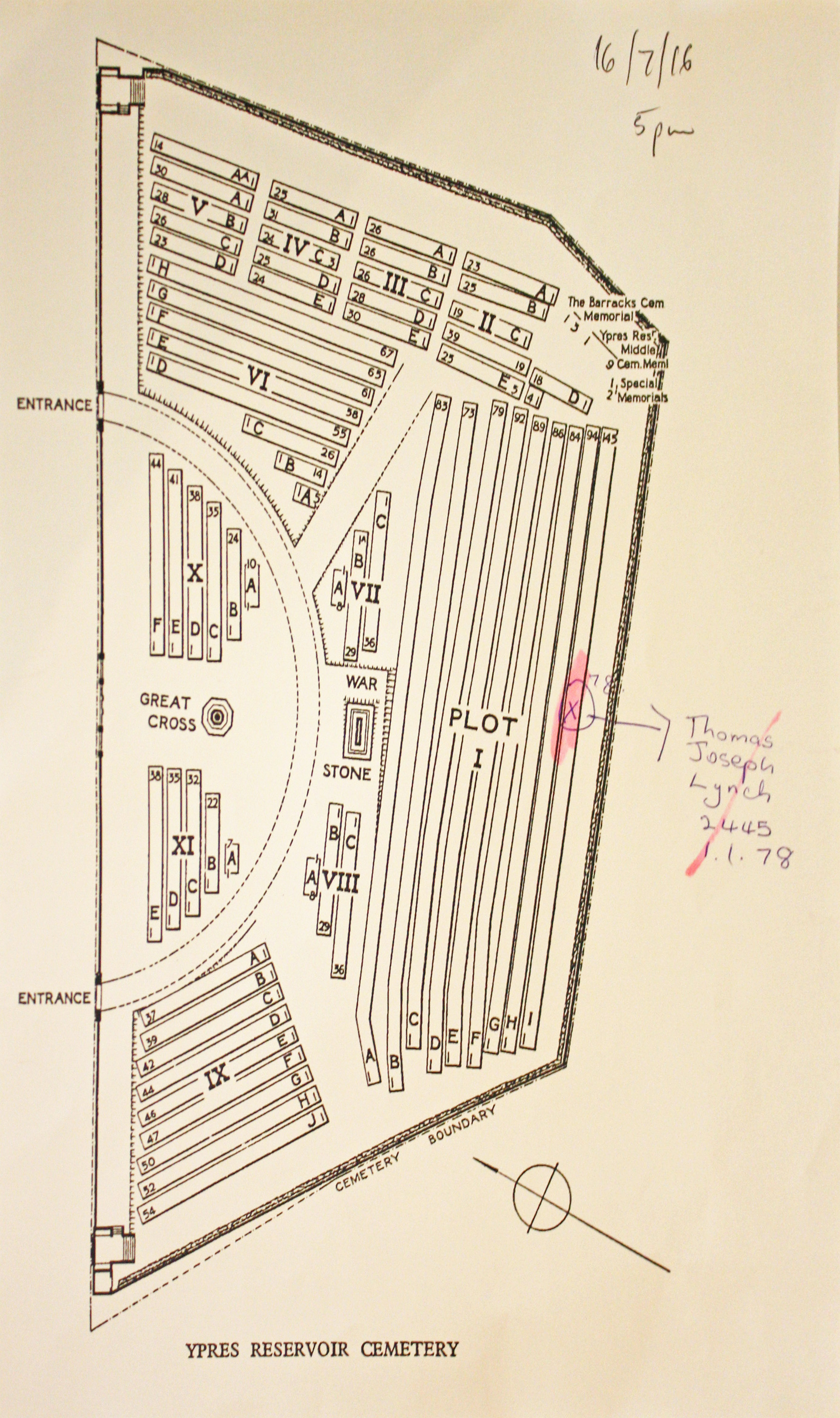
| YPRES RESERVOIR CEMETERY Annotated plan |  This cemetery was begun in October 1915 and used by fighting units and field ambulances until after the Armistice, when it contained 1,099 graves. The cemetery was later enlarged when graves were brought in from the battlefields of the salient and smaller burial grounds. Commonwealth War Graves site for YPRES RESERVOIR CEMETERYGo there on Google maps |
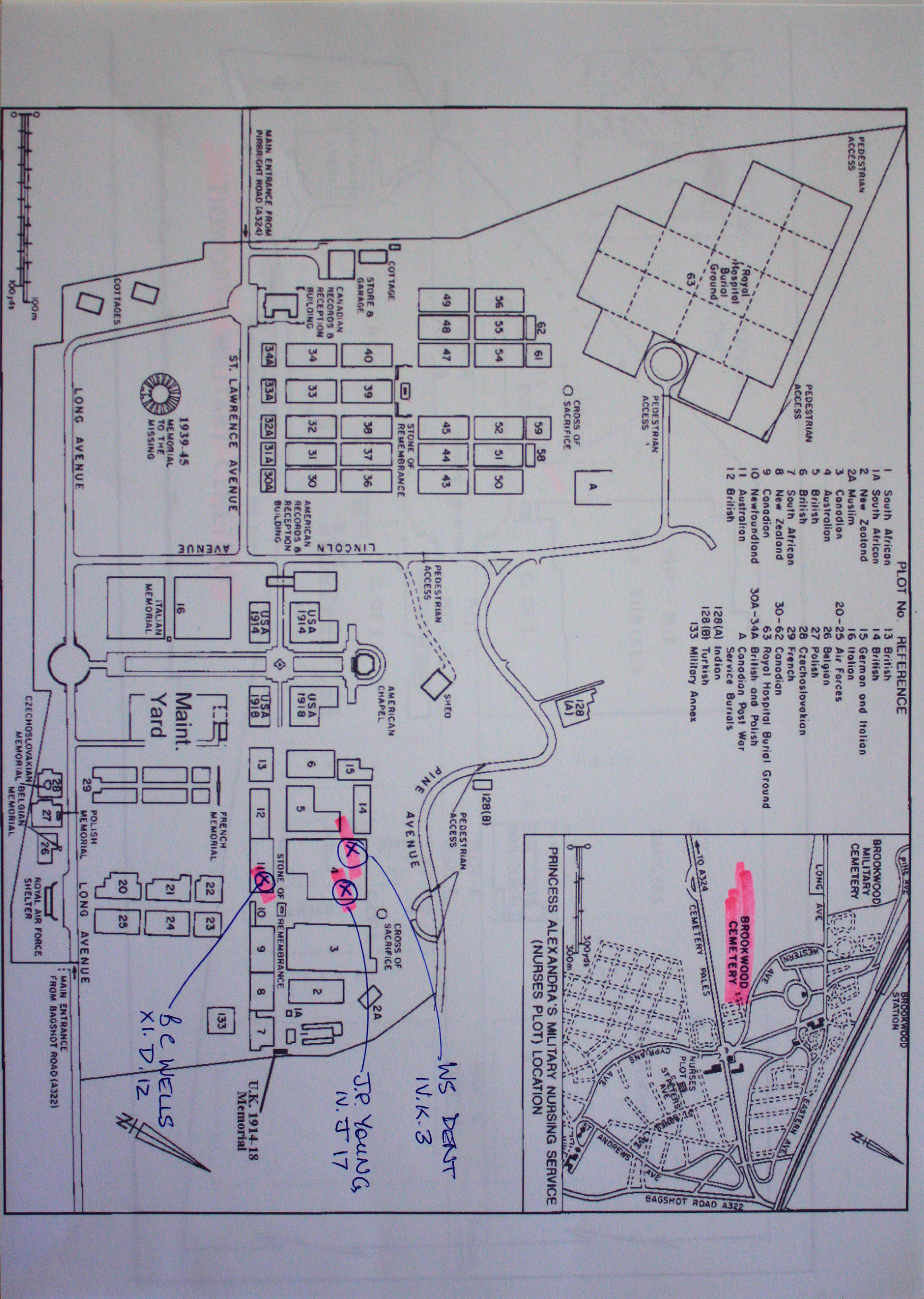
| BROOKWOOD MILITARY CEMETERY Annotated plan |  In 1917, an area of land in Brookwood Cemetery (The London Necropolis) was set aside for the burial of men and women of the forces of the Commonwealth and Americans, who had died, many of battle wounds, in the London district. Commonwealth War Graves site for BROOKWOOD MILITARY CEMETERYGo there on Google maps |
| MILDURA PUBLIC CEMETERY | 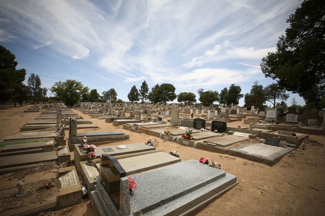 There are 72 War burials in this cemetery, many of them associated with the Air Force training base for WW2. Commonwealth War Graves site for MILDURA PUBLIC CEMETERYGo there on Google maps |
| BOURNEMOUTH (WIMBORNE ROAD) CEMETERY | 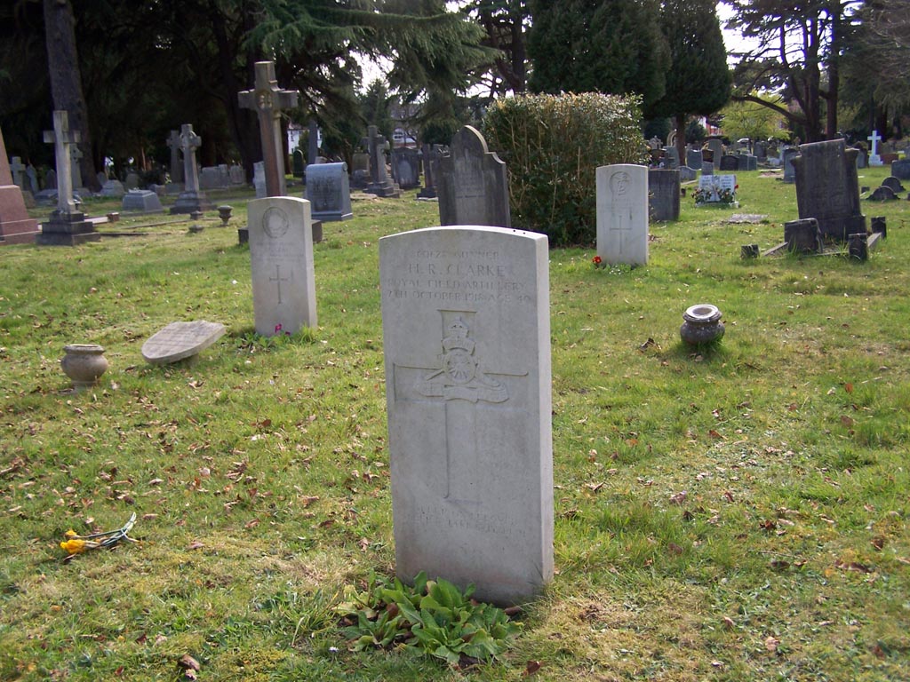 Bournemouth (Wimborne Road) Cemetery contains 48 First World War burials and 38 from the Second World War. Commonwealth War Graves site for BOURNEMOUTH (WIMBORNE ROAD) CEMETERYGo there on Google maps |
| GLOUCESTER OLD CEMETERY | 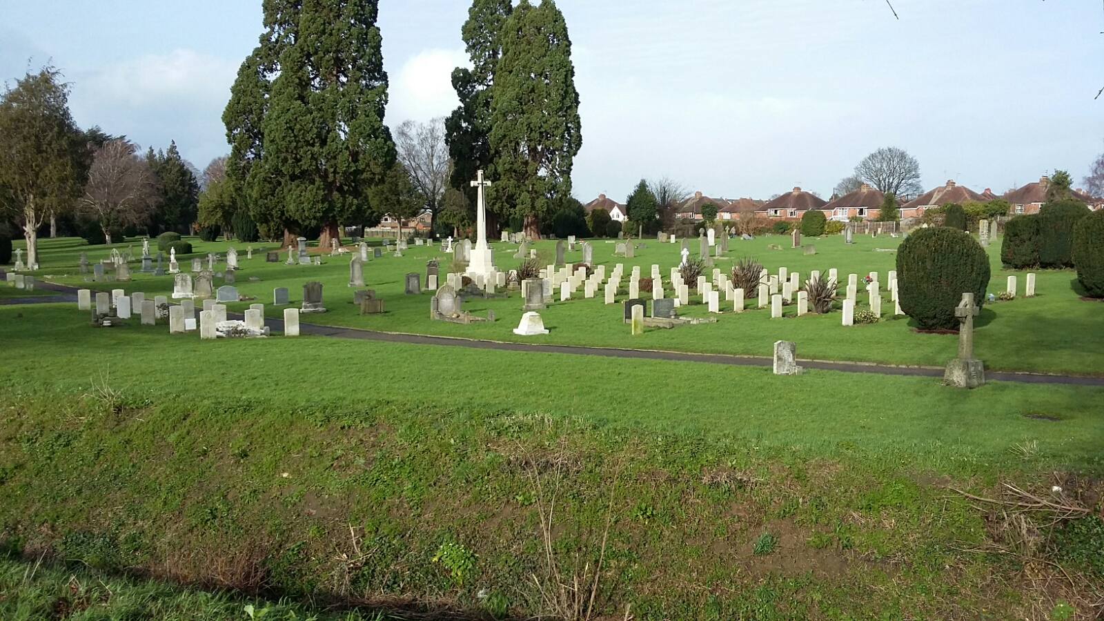 Gloucester Old Cemetery, which is in two distinct parts, contains burials of both wars. All but a few of the 158 First World War graves are in the original ground, 81 of them in a war graves plot. Commonwealth War Graves site for GLOUCESTER OLD CEMETERYGo there on Google maps |
| MERBEIN PUBLIC CEMETERY |  There is only one casualty recorded in this cemetery - Paul Douglas Kalmer Commonwealth War Graves site for MERBEIN PUBLIC CEMETERYGo there on Google maps |
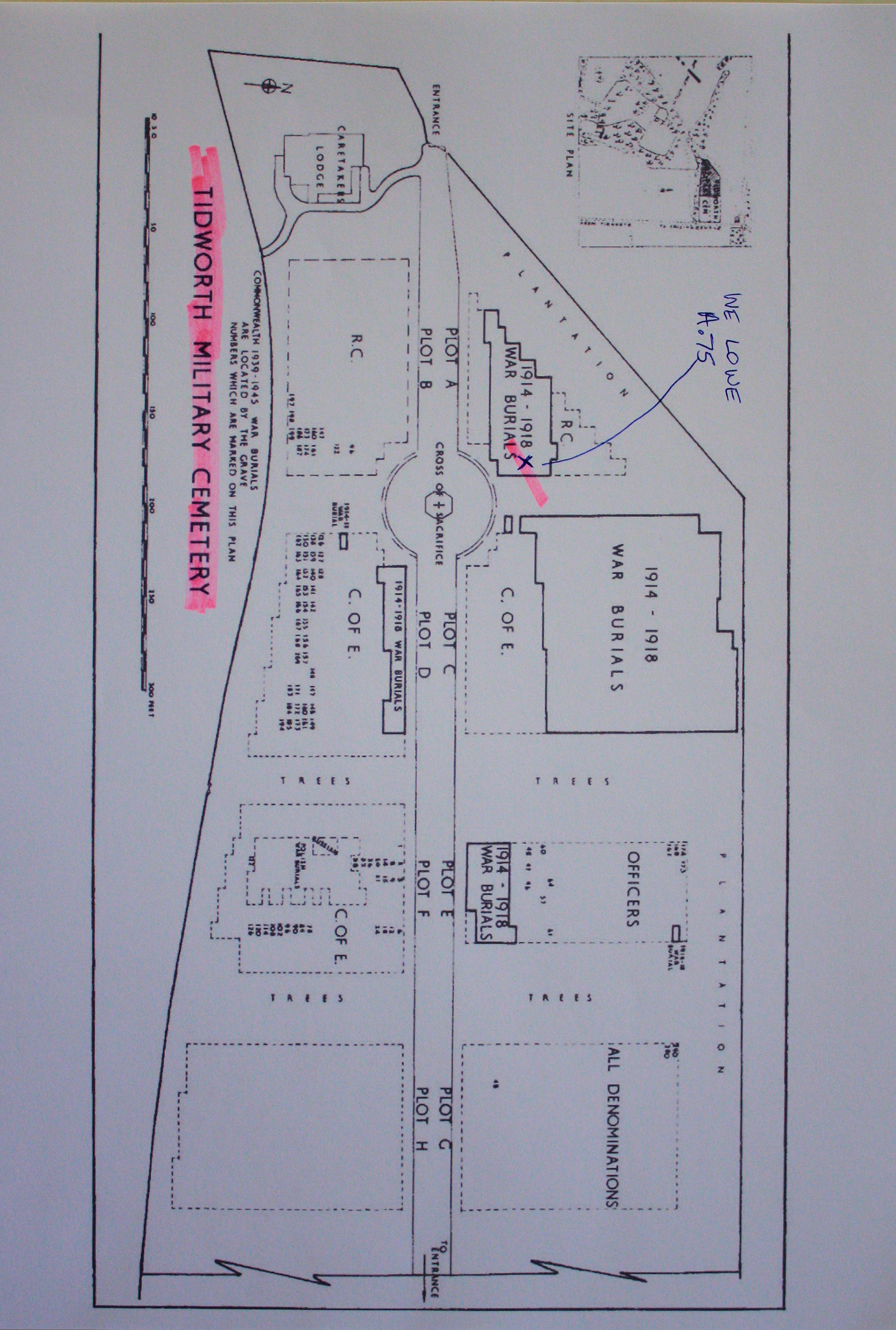
| TIDWORTH MILITARY CEMETERY Annotated plan | 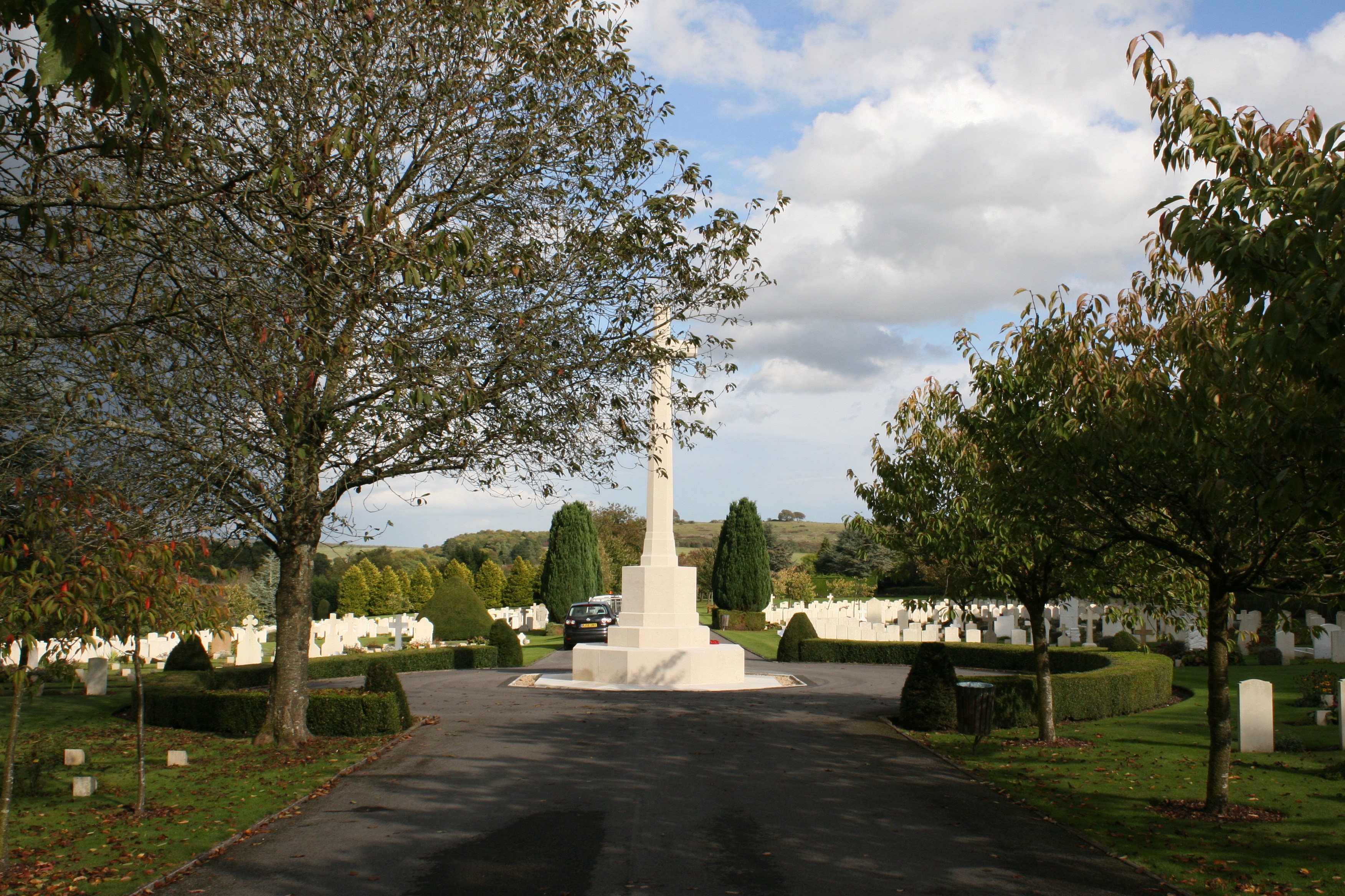 During the First World War, the cemetery was used for burials from Tidworth and Fargo Military Hospitals and the 417 graves, many of them of Australian or New Zealand servicemen, are scattered throughout the cemetery. Commonwealth War Graves site for TIDWORTH MILITARY CEMETERYGo there on Google maps |
| MELCOMBE REGIS CEMETERY |  Weymouth became a depot for Australian forces in 1916 and 83 of the 142 First World War burials in Melcome Regis Cemetery are of Australian servicemen; most of these graves are scattered in the old part. Commonwealth War Graves site for MELCOMBE REGIS CEMETERYGo there on Google maps |
| BRIDPORT CEMETERY |  Located in Dorset, there are 24 casualties buried here. Commonwealth War Graves site for BRIDPORT CEMETERYGo there on Google maps |
| BRISTOL (ARNOS VALE) CEMETERY | _Cemetery.jpg) ARNOS VALE CEMETERY contains burials of both wars. Most of the 356 First World War burials were of men who died at the local hospitals, particularly the 2nd Southern General and the Beaufort, many of whom were landed at Avonmouth from hospital ships from the Mediterranean. Their graves can be found in the 'Soldiers Corner', a plot established by the British Red Cross, near the main entrance. The 238 casualties buried here are commemorated on a memorial at the rear of the plot. Commonwealth War Graves site for BRISTOL (ARNOS VALE) CEMETERYGo there on Google maps |
| WENTWORTH CEMETERY |  The cemetery is in Cadell Street, opposite the junction of the Murray and Darling Rivers. There is only 1 WW1 casualty buried here - Archibald Grieve, who died of illness several months after recruitment. Commonwealth War Graves site for WENTWORTH CEMETERYGo there on Google maps |
_Plan.jpg)